
How to get from Campo Alegre (Minas Gerais) to Teresópolis (Rio de Janeiro)
Calculate route from Campo Alegre (Minas Gerais, Brazil) to Teresópolis (Rio de Janeiro, Brazil).
The flight distance (as the crow flies) between Campo Alegre and Teresópolis is 124.2 km.
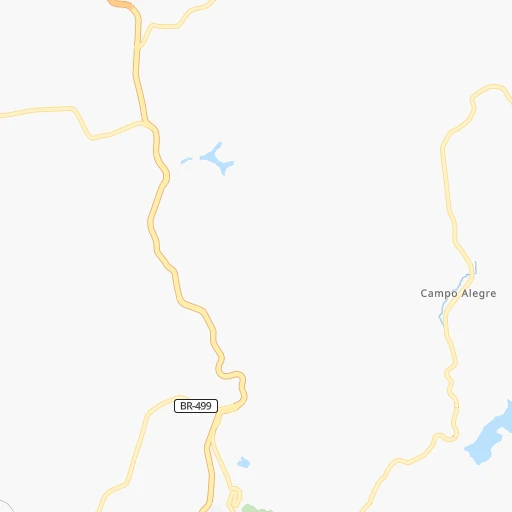
Roadmap (route) to go from Campo Alegre to Teresópolis detailed above, you can also see the course layout on the map.
While doing trip Campo Alegre - Teresópolis by car, the calculated route ends at a distance , or more straight.
Distance and duration of the route between Campo Alegre and Teresópolis
Calculation of distance and route from Teresópolis to Campo Alegre :
124.2172.7 km2h28mn
Continue onto Rua Constantino Horta 0h13mn 7.5 kmTurn right onto Rua Luiz Cunha 0h0mn 101 mTurn left onto Rua Prefeito José Maria Pitela 0h0mn 156 mTurn left onto Avenida Presidente Getúlio Vargas 0h0mn 287 mAt roundabout, take exit 2 onto Avenida Presidente Getúlio Vargas 0h2mn 1.8 kmTurn left onto Rodovia Presidente Juscelino Kubitschek 0h9mn 10.1 kmKeep right onto Avenida Santo Antônio 0h1mn 1.0 kmAt roundabout, take exit 1 0h0mn 55 mTurn slight right onto Rodovia Presidente Juscelino Kubitschek 1h14mn 109.0 kmKeep right onto Estrada União e Indústria and take BR-492, RJ-134 toward Areal, São José do Vale do Rio Preto 0h7mn 7.0 kmAt roundabout, take exit 1 onto Estrada União e Indústria 0h0mn 105 mTurn left onto Rua Sao Joao Batista 0h0mn 83 mTurn right onto Estrada do Brejal 0h3mn 2.2 kmTurn sharp left 0h2mn 1.2 kmTurn left onto Estrada do Brejal 0h15mn 12.5 kmTurn right onto Estrada de Santa Rita 0h2mn 1.5 kmTurn left onto Estrada de Santa Rita 0h2mn 1.3 kmTurn sharp left onto Estrada de Santa Rita 0h2mn 1.9 kmTurn left onto Estrada de Santa Rita 0h8mn 6.4 kmTurn right onto Rodovia Santos Dumont -BR-116 0h3mn 3.1 kmKeep right onto Rua Avelino Machado Bastos 0h0mn 414 mTurn slight right onto Estrada Wenceslau José de Medeiros 0h2mn 2.6 kmTurn right onto Rua Manoel José Lebrão 0h0mn 49 mTurn left onto Avenida Lúcio Meira 0h1mn 1.3 kmKeep right onto Rua Djalma Monteiro 0h1mn 669 mTurn left onto Rua Professora Carmem Gomes 0h1mn 256 mContinue onto Rua Professora Carmem Gomes 0h0mn 55 mArrive at destination 0h0mn 0 m
Travel from Campo Alegre (Rio de Janeiro) to a selection of major cities.
Distances from Campo Alegre to biggest cities in Minas Gerais
- Esmeraldas,103,206 inhabitants.202 km
- Teofilo Otoni,101,170 inhabitants.449 km
- Coronel Fabriciano,100,916 inhabitants.231 km
- Itabira,99,496 inhabitants.202 km
- Passos,98,752 inhabitants.331 km
- Uba,97,828 inhabitants.68 km
- Araguari,96,565 inhabitants.578 km
- Vespasiano,94,749 inhabitants.197 km
- Timoteo,91,722 inhabitants.223 km
- Muriae,91,173 inhabitants.124 km
- Nova Lima,88,399 inhabitants.163 km
- Ituiutaba,85,345 inhabitants.678 km
- Araxa,82,595 inhabitants.411 km
- Itajuba,81,870 inhabitants.229 km
- Lavras,81,472 inhabitants.155 km
- Sao Joao del Rei,78,592 inhabitants.83 km
- Itauna,77,400 inhabitants.186 km
- Para de Minas,75,786 inhabitants.207 km
- Joao Monlevade,72,762 inhabitants.182 km
- Patrocinio,71,963 inhabitants.456 km
Other major cities in country :
- Campo Grande [11], 729,151 inhabitants. 1,162 km
- Jaboatao [30], 702,621 inhabitants. 1,734 km
- Osasco [27], 677,856 inhabitants. 411 km
- Santo Andre [27], 662,373 inhabitants. 399 km
- Joao Pessoa [17], 650,883 inhabitants. 1,844 km
- Jaboatao dos Guararapes [30], 630,008 inhabitants. 1,740 km
- Ribeirao Preto [27], 619,746 inhabitants. 446 km
- Sao Jose dos Campos [27], 613,764 inhabitants. 313 km
- Sorocaba [27], 558,862 inhabitants. 467 km
- Cuiaba [14], 521,934 inhabitants. 1,477 km
- Aparecida de Goiania [29], 510,770 inhabitants. 790 km
- Aracaju [28], 490,175 inhabitants. 1,357 km
- Feira de Santana [05], 481,911 inhabitants. 1,128 km
- Londrina [18], 471,832 inhabitants. 815 km
- Belford Roxo [21], 466,096 inhabitants. 150 km
- Joinville [26], 461,304 inhabitants. 768 km
- Niteroi [21], 456,456 inhabitants. 169 km
- Sao Joao de Meriti [21], 454,849 inhabitants. 155 km
- Ananindeua [16], 433,956 inhabitants. 2,293 km
- Florianopolis [26], 412,724 inhabitants. 856 km
Route from Teresópolis to major cities (Brazil).
- Distance Teresópolis Sao Paulo395 km
- Distance Teresópolis Salvador1,153 km
- Distance Teresópolis Fortaleza2,136 km
- Distance Teresópolis Belo Horizonte295 km
- Distance Teresópolis Brasilia904 km
- Distance Teresópolis Curitiba723 km
- Distance Teresópolis Manaus2,830 km
- Distance Teresópolis Recife1,819 km
- Distance Teresópolis Belem2,409 km
- Distance Teresópolis Porto Alegre1,181 km
- Distance Teresópolis Goiania917 km
- Distance Teresópolis Guarulhos383 km
- Distance Teresópolis Campinas423 km
- Distance Teresópolis Maceio1,616 km
- Distance Teresópolis Sao Luis2,218 km
- Distance Teresópolis Natal2,030 km
- Distance Teresópolis Teresina1,929 km
- Distance Teresópolis Sao Bernardo do Campo394 km
- Distance Teresópolis Campo Grande1,229 km
- Distance Teresópolis Jaboatao1,800 km
Nearest cities to Campo Alegre :
- Rio de Janeiro, 6,023,699 inhabitants. 169 km
- Belo Horizonte, 2,373,224 inhabitants. 172 km
- Nova Iguacu, 1,002,118 inhabitants. 150 km
- Duque de Caxias, 818,329 inhabitants. 154 km
- Contagem, 627,123 inhabitants. 175 km
- Sao Jose dos Campos, 613,764 inhabitants. 313 km
- Juiz de Fora, 470,193 inhabitants. 42 km
- Belford Roxo, 466,096 inhabitants. 150 km
- Niteroi, 456,456 inhabitants. 169 km
- Sao Joao de Meriti, 454,849 inhabitants. 155 km
- Santos, 411,403 inhabitants. 405 km
- Ribeirao das Neves, 406,802 inhabitants. 193 km
- Campos dos Goytacazes, 387,417 inhabitants. 229 km
- Maua, 386,069 inhabitants. 393 km
- Betim, 384,000 inhabitants. 176 km
- Itaquaquecetuba, 336,679 inhabitants. 371 km
- Mogi das Cruzes, 325,746 inhabitants. 361 km
- Sao Vicente, 324,457 inhabitants. 409 km
- Guaruja, 310,424 inhabitants. 402 km
- Suzano, 283,314 inhabitants. 372 km
- Petropolis, 272,691 inhabitants. 126 km
- Taubate, 251,641 inhabitants. 276 km
- Governador Valadares, 250,878 inhabitants. 329 km
- Praia Grande, 250,027 inhabitants. 413 km
- Volta Redonda, 249,580 inhabitants. 137 km
- Santa Luzia, 243,503 inhabitants. 187 km
- Ipatinga, 228,746 inhabitants. 240 km
- Jacarei, 213,110 inhabitants. 328 km
- Sete Lagoas, 201,334 inhabitants. 230 km
- Divinopolis, 193,832 inhabitants. 201 km
- Cachoeiro de Itapemirim, 187,019 inhabitants. 257 km
- Itaborai, 182,498 inhabitants. 163 km
- Ferraz de Vasconcelos, 167,900 inhabitants. 377 km
- Barra Mansa, 164,052 inhabitants. 143 km
- Angra dos Reis, 153,635 inhabitants. 195 km
- Nova Friburgo, 153,361 inhabitants. 140 km
- Nilopolis, 147,281 inhabitants. 155 km
- Macae, 143,029 inhabitants. 209 km
- Ibirite, 141,374 inhabitants. 165 km
- Queimados, 135,741 inhabitants. 145 km
- Pindamonhangaba, 132,218 inhabitants. 261 km
- Teresopolis, 123,979 inhabitants. 124 km
- Barbacena, 122,211 inhabitants. 34 km
- Cubatao, 118,410 inhabitants. 407 km
- Varginha, 116,571 inhabitants. 199 km
- Pouso Alegre, 115,201 inhabitants. 266 km
- Ribeirao Pires, 111,888 inhabitants. 392 km
- Conselheiro Lafaiete, 111,596 inhabitants. 89 km
- Resende, 111,514 inhabitants. 151 km
- Araruama, 109,637 inhabitants. 202 km
Location Campo Alegre (Minas Gerais) :
| Country flag |  |
| Location | Campo Alegre |
| State | Minas Gerais |
| County | Santos Dumont |
| Country | Brazil |
| Country code / ISO 2 | BR |
| Latitude | -21.4166700 |
| Longitude | -43.5166700 |
| Altitude | 0 meters |
| Time zone | America/Sao_Paulo |
Location Teresópolis (Rio de Janeiro) :
| Country flag | |
| Location | Teresópolis |
| State | Rio de Janeiro |
| County | Teresópolis |
| Country | Brazil |
| Country code / ISO 2 | BR |
| Latitude | -22.4167000 |
| Longitude | -42.9782200 |
| Altitude | 0 meters |
| Time zone | America/Sao_Paulo |


