
How to get from Encruzilhada (Rio Grande do Sul) to Marau (Rio Grande do Sul)
Calculate route from Encruzilhada (Rio Grande do Sul, Brazil) to Marau (Rio Grande do Sul, Brazil).
The flight distance (as the crow flies) between Encruzilhada and Marau is 375.0 km.
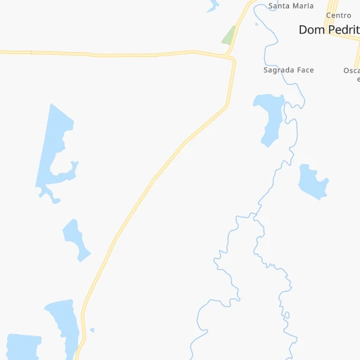
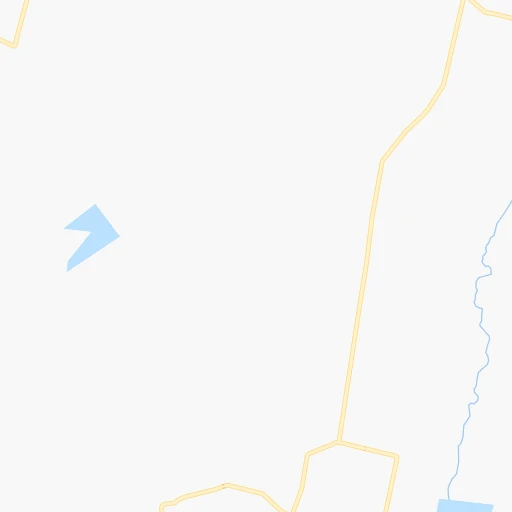
Roadmap (route) to go from Encruzilhada to Marau detailed above, you can also see the course layout on the map.
While doing trip Encruzilhada - Marau by car, the calculated route ends at a distance , or more straight.
Distance and duration of the route between Encruzilhada and Marau
Calculation of distance and route from Marau to Encruzilhada :
375.0544.2 km9h39mn
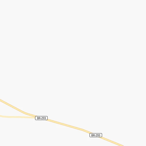
Continue onto ERS-634 0h8mn 4.1 kmTurn right 0h23mn 11.4 kmTurn left onto BR-293 0h25mn 37.7 kmKeep right and drive toward Rosário do Sul, Santa Maria 1h46mn 65.9 kmKeep right and drive toward Rosário do Sul, Santa Maria, Porto Alegre 0h19mn 21.6 kmKeep left onto Rodovia Doutor Mário Ortiz de Vasconcellos 2h39mn 114.3 kmAt roundabout, take exit 2 onto Avenida Governador Walter Jobim 0h1mn 574 mTurn left onto Avenida Maestro Roberto Barbosa Ribas 0h0mn 352 mTurn right onto Rua Zeferino Rodrigues Correa 0h1mn 844 mAt roundabout, take exit 2 onto Avenida Dois de Novembro 0h0mn 415 mAt roundabout, take exit 2 onto Avenida Dois de Novembro 0h0mn 345 mTurn left onto Avenida Borges de Medeiros 0h1mn 533 mTurn sharp right onto Rua Venâncio Aires 0h2mn 1.4 kmTurn left onto Avenida Rio Branco 0h0mn 305 mTurn right onto Rua Silva Jardim 0h0mn 237 mTurn left onto Rua André Marques 0h0mn 113 mContinue onto Rua André Marques 0h0mn 29 mTurn slight right onto Rua José do Patrocínio 0h0mn 212 mTurn left onto Rua Ernesto Beck 0h0mn 78 mKeep right onto Avenida Assis Brasil 0h1mn 651 mAt roundabout, take exit 3 onto Rua Visconde de Ferreira Pinto 0h1mn 635 mTurn right onto Rua Visconde de Ferreira Pinto 0h0mn 32 mTurn sharp left onto Rua Euclides da Cunha 0h9mn 5.5 kmTurn slight right onto Rua Gralha Azul 0h1mn 546 mTurn left 0h0mn 27 mTurn left onto BR-158, BR-392 1h42mn 49.7 kmKeep right onto BR-158, BR-392 and drive toward Cruz Alta 1h58mn 68.9 kmKeep right 1h8mn 74.3 kmKeep left onto ERS-223 0h22mn 24.7 kmTurn right onto TH-08 0h1mn 446 mTurn right 0h0mn 60 mTurn sharp left onto TH-09 0h3mn 1.4 kmTurn right onto TH-10 0h2mn 1.2 kmTurn right onto Rodovia Governador Leonel de Moura Brizola 0h3mn 3.0 kmTurn left onto VRS-810 0h10mn 10.4 kmAt roundabout, take exit 1 onto Rua Cristiano Datsch 0h11mn 10.8 kmAt roundabout, take exit 2 onto Rua 25 de Julho 0h3mn 2.6 kmKeep left 0h10mn 5.1 kmKeep right 0h6mn 2.9 kmKeep left 0h3mn 1.7 kmKeep right 1h33mn 16.5 kmAt roundabout, take exit 3 onto Rua Bento Gonçalves 0h3mn 2.4 kmTurn right onto Avenida Júlio Borella 0h0mn 143 mTurn right onto Rua Irineu Ferlin 0h0mn 60 mArrive at destination 0h0mn 0 m
Travel from Encruzilhada (Rio Grande do Sul) to a selection of major cities.
Distances from Encruzilhada to biggest cities in Rio Grande do Sul
- Alegrete,87,236 inhabitants.166 km
- Esteio,84,902 inhabitants.366 km
- Sapiranga,76,051 inhabitants.391 km
- Cachoeira do Sul,74,694 inhabitants.208 km
- Ijui,71,202 inhabitants.300 km
- Lajeado,65,407 inhabitants.318 km
- Cruz Alta,65,275 inhabitants.284 km
- Santo Angelo,64,606 inhabitants.303 km
- Sao Borja,59,613 inhabitants.285 km
- Carazinho,59,417 inhabitants.356 km
- Santa Rosa,58,957 inhabitants.348 km
- Farroupilha,57,650 inhabitants.383 km
- Vacaria,56,765 inhabitants.461 km
- Sao Gabriel,55,434 inhabitants.84 km
- Montenegro,54,057 inhabitants.349 km
- Camaqua,53,169 inhabitants.283 km
- Parobe,48,559 inhabitants.407 km
- Taquara,48,051 inhabitants.411 km
- Santiago,46,611 inhabitants.200 km
- Venancio Aires,40,627 inhabitants.291 km
Other major cities in country :
- Campo Grande [11], 729,151 inhabitants. 1,173 km
- Jaboatao [30], 702,621 inhabitants. 3,265 km
- Osasco [27], 677,856 inhabitants. 1,144 km
- Santo Andre [27], 662,373 inhabitants. 1,151 km
- Joao Pessoa [17], 650,883 inhabitants. 3,370 km
- Jaboatao dos Guararapes [30], 630,008 inhabitants. 3,270 km
- Contagem [15], 627,123 inhabitants. 1,633 km
- Ribeirao Preto [27], 619,746 inhabitants. 1,294 km
- Sao Jose dos Campos [27], 613,764 inhabitants. 1,236 km
- Uberlandia [15], 563,536 inhabitants. 1,493 km
- Sorocaba [27], 558,862 inhabitants. 1,102 km
- Cuiaba [14], 521,934 inhabitants. 1,718 km
- Aparecida de Goiania [29], 510,770 inhabitants. 1,673 km
- Aracaju [28], 490,175 inhabitants. 2,885 km
- Feira de Santana [05], 481,911 inhabitants. 2,641 km
- Londrina [18], 471,832 inhabitants. 926 km
- Juiz de Fora [15], 470,193 inhabitants. 1,531 km
- Belford Roxo [21], 466,096 inhabitants. 1,451 km
- Joinville [26], 461,304 inhabitants. 778 km
- Niteroi [21], 456,456 inhabitants. 1,466 km
Route from Marau to major cities (Brazil).
- Distance Marau Sao Paulo779 km
- Distance Marau Rio de Janeiro1,094 km
- Distance Marau Salvador2,232 km
- Distance Marau Fortaleza3,110 km
- Distance Marau Belo Horizonte1,266 km
- Distance Marau Brasilia1,477 km
- Distance Marau Curitiba444 km
- Distance Marau Manaus2,941 km
- Distance Marau Recife2,908 km
- Distance Marau Belem3,030 km
- Distance Marau Goiania1,345 km
- Distance Marau Guarulhos793 km
- Distance Marau Campinas804 km
- Distance Marau Nova Iguacu1,082 km
- Distance Marau Maceio2,708 km
- Distance Marau Sao Luis3,005 km
- Distance Marau Duque de Caxias1,092 km
- Distance Marau Natal3,094 km
- Distance Marau Teresina2,783 km
- Distance Marau Sao Bernardo do Campo773 km
Nearest cities to Encruzilhada :
- Pelotas, 320,674 inhabitants. 247 km
- Santa Maria, 249,219 inhabitants. 172 km
- Rio Grande, 187,838 inhabitants. 279 km
- Passo Fundo, 179,529 inhabitants. 379 km
- Uruguaiana, 123,480 inhabitants. 262 km
- Santa Cruz do Sul, 106,113 inhabitants. 265 km
- Bage, 98,940 inhabitants. 74 km
- Santana do Livramento, 89,694 inhabitants. 74 km
- Alegrete, 87,236 inhabitants. 166 km
- Cachoeira do Sul, 74,694 inhabitants. 208 km
- Ijui, 71,202 inhabitants. 300 km
- Lajeado, 65,407 inhabitants. 318 km
- Cruz Alta, 65,275 inhabitants. 284 km
- Santo Angelo, 64,606 inhabitants. 303 km
- Sao Borja, 59,613 inhabitants. 285 km
- Carazinho, 59,417 inhabitants. 356 km
- Sao Gabriel, 55,434 inhabitants. 84 km
- Camaqua, 53,169 inhabitants. 283 km
- Santiago, 46,611 inhabitants. 200 km
- Venancio Aires, 40,627 inhabitants. 291 km
- Dom Pedrito, 36,911 inhabitants. 9 km
- Rosario do Sul, 36,721 inhabitants. 82 km
- Itaqui, 34,631 inhabitants. 269 km
- Sao Luiz Gonzaga, 31,798 inhabitants. 287 km
- Panambi, 30,407 inhabitants. 324 km
- Candelaria, 30,171 inhabitants. 240 km
- Jaguarao, 29,613 inhabitants. 220 km
- Santa Vitoria do Palmar, 27,775 inhabitants. 311 km
- Taquari, 27,107 inhabitants. 308 km
- Rio Pardo, 26,998 inhabitants. 254 km
- Marau, 26,860 inhabitants. 376 km
- Sao Lourenco do Sul, 25,340 inhabitants. 269 km
- Soledade, 24,791 inhabitants. 325 km
- Quarai, 23,229 inhabitants. 174 km
- Teutonia, 21,834 inhabitants. 332 km
- Julio de Castilhos, 20,388 inhabitants. 222 km
- Cangucu, 20,134 inhabitants. 204 km
- Guapore, 20,050 inhabitants. 366 km
- Butia, 19,494 inhabitants. 286 km
- Sao Sepe, 19,181 inhabitants. 147 km
- Herval, 18,063 inhabitants. 174 km
- Cacapava do Sul, 17,522 inhabitants. 133 km
- Tupancireta, 17,488 inhabitants. 230 km
- Encruzilhada do Sul, 17,199 inhabitants. 220 km
- Encantado, 16,637 inhabitants. 340 km
- Arroio do Meio, 16,331 inhabitants. 324 km
- Arroio Grande, 16,117 inhabitants. 212 km
- Sao Francisco de Assis, 14,305 inhabitants. 163 km
- Ibiruba, 14,180 inhabitants. 308 km
- Tapejara, 14,064 inhabitants. 420 km
Location Encruzilhada (Rio Grande do Sul) :
| Country flag |  |
| Location | Encruzilhada |
| State | Rio Grande do Sul |
| County | Dom Pedrito |
| Country | Brazil |
| Country code / ISO 2 | BR |
| Latitude | -30.9833300 |
| Longitude | -54.7666700 |
| Altitude | 0 meters |
| Time zone | America/Sao_Paulo |
Location Marau (Rio Grande do Sul) :
| Country flag | |
| Location | Marau |
| State | Rio Grande do Sul |
| County | Marau |
| Country | Brazil |
| Country code / ISO 2 | BR |
| Latitude | -28.4491700 |
| Longitude | -52.2000000 |
| Altitude | 0 meters |
| Time zone | America/Sao_Paulo |
