
How to get from Itirapuã (Minas Gerais) to Embu (São Paulo)
Calculate route from Itirapuã (Minas Gerais, Brazil) to Embu (São Paulo, Brazil).
The flight distance (as the crow flies) between Itirapuã and Embu is 326.0 km.
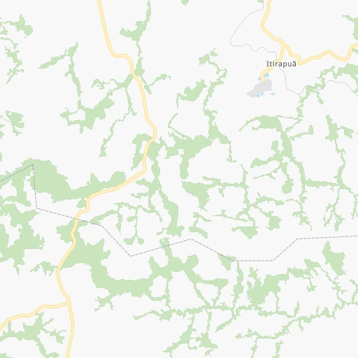
Roadmap (route) to go from Itirapuã to Embu detailed above, you can also see the course layout on the map.
While doing trip Itirapuã - Embu by car, the calculated route ends at a distance , or more straight.
Distance and duration of the route between Itirapuã and Embu
Calculation of distance and route from Embu to Itirapuã :
326.0387.8 km5h23mn
Continue 0h12mn 3.1 kmTurn sharp left onto Rodovia Nagib Francisco Murad 0h6mn 5.8 kmTurn right 0h9mn 4.4 kmKeep left 0h2mn 1.7 kmTurn slight left 0h0mn 35 mTurn right 0h0mn 213 mKeep left 0h5mn 2.4 kmKeep right 0h21mn 10.4 kmTurn right 0h23mn 11.5 kmKeep right 0h0mn 105 mTurn slight left 0h0mn 90 mAt roundabout, take exit 1 0h0mn 94 mAt roundabout, take exit 1 onto Avenida Benedito Alves Costa 0h1mn 742 mAt roundabout, take exit 2 onto Rua Juscelino Kubitschek de Oliveira 3h12mn 289.3 kmKeep right and drive toward Mairiporã, Retorno 0h0mn 271 mKeep right 0h0mn 46 mTurn right onto Avenida Hebrahim Hallak 0h0mn 45 mKeep left 0h0mn 62 mKeep right onto Rua Padre Wairo 0h1mn 513 mKeep left onto Rua Coronel Fagundes 0h0mn 25 mKeep right onto Rua Coronel Fagundes 0h0mn 27 mTurn slight right onto Rua Ipiranga 0h1mn 801 mKeep right onto Rua Ipiranga 0h1mn 732 mKeep right onto Rodovia Prefeito Luiz Salomão Chamma 0h7mn 7.2 kmAt roundabout, take exit 2 onto Estrada Municipal Prefeito Doutor Sarkis Tellian 0h4mn 3.9 kmKeep right onto Avenida Luiz Milano Filho and drive toward Alpes de Caieiras, Laranjeiras, Morro Grande, Caieiras 0h4mn 4.1 kmAt roundabout, take exit 2 onto Avenida Pauliceia 0h0mn 37 mTurn slight right onto Avenida Paulicéia 0h0mn 318 mTurn right onto Estrada do Ajoá 0h1mn 1.0 kmTurn left onto Estrada do Ajoá 0h1mn 661 mTurn right onto Estrada do Ajoá 0h2mn 1.3 kmTurn left onto Rua Gonçalves de Magalhães 0h0mn 228 mTurn right onto Rua Brasílio Del Porto 0h0mn 85 mTurn slight left onto Avenida Paulicéia 0h1mn 301 mTurn left onto Rodovia Presidente Tancredo de Almeida Neves 0h0mn 204 mTurn slight right onto Avenida Raimundo Pereira de Magalhães 0h3mn 3.0 kmKeep right onto Rodoanel Mário Covas toward SP-021 0h17mn 25.1 kmKeep left onto Rodoanel Mário Covas 0h3mn 4.6 kmKeep right and take SP-230, BR-116 toward Rodovia Régis Bittencourt 0h2mn 2.1 kmKeep right 0h0mn 89 mTurn right onto Rua Carmem Miranda 0h0mn 7 mTurn left onto Rua Ghers Stemberg Isidoro 0h1mn 305 mTurn right onto Rua Ghers Stemberg Isidoro 0h0mn 152 mKeep left onto Rua Cândido Portinari 0h0mn 247 mTurn right onto Rua Paulo do Vale 0h1mn 471 mArrive at destination 0h0mn 0 m
Travel from Itirapuã (São Paulo) to a selection of major cities.
Distances from Itirapuã to biggest cities in Minas Gerais
- Esmeraldas,103,206 inhabitants.184 km
- Teofilo Otoni,101,170 inhabitants.527 km
- Coronel Fabriciano,100,916 inhabitants.313 km
- Itabira,99,496 inhabitants.259 km
- Passos,98,752 inhabitants.184 km
- Uba,97,828 inhabitants.209 km
- Araguari,96,565 inhabitants.449 km
- Vespasiano,94,749 inhabitants.209 km
- Timoteo,91,722 inhabitants.307 km
- Muriae,91,173 inhabitants.269 km
- Nova Lima,88,399 inhabitants.186 km
- Ituiutaba,85,345 inhabitants.538 km
- Araxa,82,595 inhabitants.281 km
- Itajuba,81,870 inhabitants.136 km
- Lavras,81,472 inhabitants.8 km
- Sao Joao del Rei,78,592 inhabitants.74 km
- Itauna,77,400 inhabitants.142 km
- Para de Minas,75,786 inhabitants.164 km
- Joao Monlevade,72,762 inhabitants.249 km
- Patrocinio,71,963 inhabitants.338 km
Other major cities in country :
- Campo Grande [11], 729,151 inhabitants. 1,013 km
- Jaboatao [30], 702,621 inhabitants. 1,809 km
- Osasco [27], 677,856 inhabitants. 313 km
- Santo Andre [27], 662,373 inhabitants. 310 km
- Joao Pessoa [17], 650,883 inhabitants. 1,916 km
- Jaboatao dos Guararapes [30], 630,008 inhabitants. 1,815 km
- Ribeirao Preto [27], 619,746 inhabitants. 297 km
- Sao Jose dos Campos [27], 613,764 inhabitants. 230 km
- Sorocaba [27], 558,862 inhabitants. 356 km
- Cuiaba [14], 521,934 inhabitants. 1,337 km
- Aparecida de Goiania [29], 510,770 inhabitants. 673 km
- Aracaju [28], 490,175 inhabitants. 1,430 km
- Feira de Santana [05], 481,911 inhabitants. 1,190 km
- Londrina [18], 471,832 inhabitants. 678 km
- Belford Roxo [21], 466,096 inhabitants. 228 km
- Joinville [26], 461,304 inhabitants. 684 km
- Niteroi [21], 456,456 inhabitants. 259 km
- Sao Joao de Meriti [21], 454,849 inhabitants. 234 km
- Ananindeua [16], 433,956 inhabitants. 2,250 km
- Florianopolis [26], 412,724 inhabitants. 790 km
Route from Embu to major cities (Brazil).
- Distance Embu Rio de Janeiro384 km
- Distance Embu Salvador1,479 km
- Distance Embu Fortaleza2,392 km
- Distance Embu Belo Horizonte513 km
- Distance Embu Brasilia883 km
- Distance Embu Curitiba315 km
- Distance Embu Manaus2,691 km
- Distance Embu Recife2,155 km
- Distance Embu Belem2,477 km
- Distance Embu Porto Alegre833 km
- Distance Embu Goiania815 km
- Distance Embu Nova Iguacu362 km
- Distance Embu Maceio1,954 km
- Distance Embu Sao Luis2,367 km
- Distance Embu Duque de Caxias375 km
- Distance Embu Natal2,346 km
- Distance Embu Teresina2,111 km
- Distance Embu Campo Grande880 km
- Distance Embu Jaboatao2,136 km
- Distance Embu Joao Pessoa2,243 km
Nearest cities to Itirapuã :
- Sao Paulo, 10,021,295 inhabitants. 304 km
- Rio de Janeiro, 6,023,699 inhabitants. 255 km
- Belo Horizonte, 2,373,224 inhabitants. 186 km
- Guarulhos, 1,169,577 inhabitants. 291 km
- Campinas, 1,031,554 inhabitants. 282 km
- Nova Iguacu, 1,002,118 inhabitants. 224 km
- Duque de Caxias, 818,329 inhabitants. 236 km
- Sao Bernardo do Campo, 743,372 inhabitants. 314 km
- Osasco, 677,856 inhabitants. 313 km
- Santo Andre, 662,373 inhabitants. 310 km
- Contagem, 627,123 inhabitants. 179 km
- Ribeirao Preto, 619,746 inhabitants. 297 km
- Sao Jose dos Campos, 613,764 inhabitants. 230 km
- Sorocaba, 558,862 inhabitants. 356 km
- Juiz de Fora, 470,193 inhabitants. 174 km
- Belford Roxo, 466,096 inhabitants. 228 km
- Niteroi, 456,456 inhabitants. 259 km
- Sao Joao de Meriti, 454,849 inhabitants. 234 km
- Santos, 411,403 inhabitants. 329 km
- Ribeirao das Neves, 406,802 inhabitants. 193 km
- Diadema, 390,633 inhabitants. 316 km
- Maua, 386,069 inhabitants. 306 km
- Betim, 384,000 inhabitants. 168 km
- Carapicuiba, 361,112 inhabitants. 314 km
- Piracicaba, 342,209 inhabitants. 321 km
- Itaquaquecetuba, 336,679 inhabitants. 283 km
- Mogi das Cruzes, 325,746 inhabitants. 278 km
- Sao Vicente, 324,457 inhabitants. 331 km
- Jundiai, 321,589 inhabitants. 289 km
- Guaruja, 310,424 inhabitants. 328 km
- Franca, 305,041 inhabitants. 269 km
- Limeira, 289,665 inhabitants. 290 km
- Suzano, 283,314 inhabitants. 286 km
- Petropolis, 272,691 inhabitants. 227 km
- Uberaba, 260,843 inhabitants. 356 km
- Barueri, 251,994 inhabitants. 316 km
- Taubate, 251,641 inhabitants. 202 km
- Praia Grande, 250,027 inhabitants. 336 km
- Volta Redonda, 249,580 inhabitants. 162 km
- Santa Luzia, 243,503 inhabitants. 205 km
- Ipatinga, 228,746 inhabitants. 324 km
- Sumare, 227,977 inhabitants. 293 km
- Embu, 221,733 inhabitants. 327 km
- Taboao da Serra, 214,523 inhabitants. 321 km
- Jacarei, 213,110 inhabitants. 247 km
- Sao Carlos, 205,035 inhabitants. 315 km
- Hortolandia, 203,533 inhabitants. 291 km
- Itapevi, 201,748 inhabitants. 323 km
- Sete Lagoas, 201,334 inhabitants. 217 km
- Americana, 196,022 inhabitants. 293 km
Location Itirapuã (Minas Gerais) :
| Country flag |  |
| Location | Itirapuã |
| State | Minas Gerais |
| County | Lavras |
| Country | Brazil |
| Country code / ISO 2 | BR |
| Latitude | -21.3000000 |
| Longitude | -44.9500000 |
| Altitude | 0 meters |
| Time zone | America/Sao_Paulo |
Location Embu (São Paulo) :
| Country flag | |
| Location | Embu |
| State | São Paulo |
| County | Embu |
| Country | Brazil |
| Country code / ISO 2 | BR |
| Latitude | -23.6488900 |
| Longitude | -46.8522200 |
| Altitude | 0 meters |
| Time zone | America/Sao_Paulo |


