

How to get from Janaúba (Minas Gerais) to Itambacuri (Minas Gerais)
Calculate route from Janaúba (Minas Gerais, Brazil) to Itambacuri (Minas Gerais, Brazil).
The flight distance (as the crow flies) between Janaúba and Itambacuri is 301.9 km.
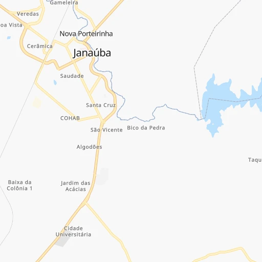
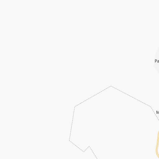
Roadmap (route) to go from Janaúba to Itambacuri detailed above, you can also see the course layout on the map.
While doing trip Janaúba - Itambacuri by car, the calculated route ends at a distance , or more straight.
Distance and duration of the route between Janaúba and Itambacuri
Calculation of distance and route from Itambacuri to Janaúba :
301.9456.4 km10h60mn
Continue onto Avenida do Comércio 0h0mn 55 mTurn right onto Rua Pio XII 0h0mn 39 mTurn right onto Rua Américo Soares 0h1mn 490 mTurn left onto Avenida Marechal Deodoro da Fonseca 0h0mn 150 mTurn right onto Avenida Prefeito Edilson Brandão Guimarães 0h0mn 408 mTurn left onto BR-122, MGC-122 1h31mn 33.8 kmKeep right 0h0mn 61 mTurn right onto Rodovia MG-120 1h48mn 32.8 kmTurn left 0h15mn 7.7 kmTurn left 0h18mn 9.0 kmKeep right 0h9mn 4.6 kmKeep left 0h14mn 7.1 kmTurn slight right 0h0mn 87 mTurn sharp left onto Rodovia Júlio Garcia 0h19mn 22.0 kmTurn right onto Estrada para Grão-Mogol 0h27mn 13.7 kmKeep left 1h30mn 15.2 kmContinue onto Estrada da Usina de Irapé 0h2mn 1.2 kmContinue onto Estrada da Usina de Irapé 1h2mn 30.9 kmTurn left onto Estrada da Usina de Irapé 0h12mn 5.8 kmKeep right 0h5mn 2.3 kmTurn slight left onto LMG-677 0h20mn 23.3 kmKeep right onto MG-114 0h2mn 2.6 kmTurn left 0h8mn 4.0 kmContinue onto Rua Bélgica 0h1mn 404 mTurn left onto Rua Nossa Senhora da Lapa 0h0mn 97 mTurn right onto Rua Sete de Setembro 0h0mn 72 mTurn left onto Rua Presidente Vargas 0h0mn 10 mTurn right onto Avenida Capitão Mor Antônio Pereira 0h0mn 65 mContinue onto Praça Valdomiro Silva 0h1mn 427 mTurn right 0h0mn 36 mTurn sharp left onto MGC-367, BR-367 1h39mn 43.8 kmTurn right onto BR-342 1h56mn 28.0 kmKeep left 0h5mn 2.4 kmTurn right 0h0mn 21 mTurn right 0h0mn 193 mTurn slight right 0h3mn 1.7 kmKeep left 0h0mn 55 mTurn slight left onto BR-342 0h20mn 9.9 kmTurn slight left onto BR-342 0h13mn 6.6 kmTurn sharp left 0h3mn 1.4 kmTurn right 0h0mn 197 mTurn left 0h6mn 2.8 kmTurn sharp left onto BR-342 0h18mn 9.4 kmTurn right onto Praça Dom José de Haas 0h0mn 15 mKeep left onto Rua Miguel Couto 0h0mn 190 mTurn left onto Rua João Martins 0h0mn 70 mContinue onto Rua João Martins 0h0mn 31 mKeep left onto Rua João Martins 0h28mn 28.4 kmTurn right onto Rodovia Santos Dumont 1h49mn 69.2 kmContinue onto Avenida Alfredo Sá 0h1mn 1.0 kmKeep right onto Rodovia Santos Dumont 0h1mn 701 mTurn right onto Avenida Agnaldo Neiva 0h0mn 30 mTurn sharp left onto Avenida Agnaldo Neiva 0h0mn 99 mTurn slight right onto Rodovia Santos Dumont 0h25mn 28.3 kmKeep right 0h0mn 199 mTurn slight right onto Avenida Farmacêutico Joviano 0h2mn 2.2 kmAt roundabout, take exit 3 onto Avenida Farmacêutico Joviano 0h0mn 381 mTurn right onto Rua Barão do Rio Branco 0h0mn 21 mContinue onto Rua Barão do Rio Branco 0h0mn 192 mContinue onto Rua Barão do Rio Branco 0h0mn 52 mTurn right onto Travessa São José 0h0mn 155 mArrive at destination 0h0mn 0 m
Travel from Janaúba (Minas Gerais) to a selection of major cities.
Distances from Janaúba to biggest cities in Minas Gerais
- Esmeraldas,103,206 inhabitants.454 km
- Teofilo Otoni,101,170 inhabitants.299 km
- Coronel Fabriciano,100,916 inhabitants.420 km
- Itabira,99,496 inhabitants.425 km
- Passos,98,752 inhabitants.649 km
- Uba,97,828 inhabitants.593 km
- Araguari,96,565 inhabitants.608 km
- Vespasiano,94,749 inhabitants.438 km
- Timoteo,91,722 inhabitants.426 km
- Muriae,91,173 inhabitants.601 km
- Nova Lima,88,399 inhabitants.469 km
- Ituiutaba,85,345 inhabitants.743 km
- Araxa,82,595 inhabitants.571 km
- Itajuba,81,870 inhabitants.771 km
- Lavras,81,472 inhabitants.632 km
- Sao Joao del Rei,78,592 inhabitants.602 km
- Itauna,77,400 inhabitants.494 km
- Para de Minas,75,786 inhabitants.472 km
- Joao Monlevade,72,762 inhabitants.446 km
- Patrocinio,71,963 inhabitants.525 km
Other major cities in country :
- Campo Grande [11], 729,151 inhabitants. 1,305 km
- Jaboatao [30], 702,621 inhabitants. 1,240 km
- Osasco [27], 677,856 inhabitants. 935 km
- Santo Andre [27], 662,373 inhabitants. 938 km
- Joao Pessoa [17], 650,883 inhabitants. 1,335 km
- Jaboatao dos Guararapes [30], 630,008 inhabitants. 1,244 km
- Ribeirao Preto [27], 619,746 inhabitants. 764 km
- Sao Jose dos Campos [27], 613,764 inhabitants. 865 km
- Sorocaba [27], 558,862 inhabitants. 961 km
- Cuiaba [14], 521,934 inhabitants. 1,370 km
- Aparecida de Goiania [29], 510,770 inhabitants. 644 km
- Aracaju [28], 490,175 inhabitants. 867 km
- Feira de Santana [05], 481,911 inhabitants. 612 km
- Londrina [18], 471,832 inhabitants. 1,173 km
- Belford Roxo [21], 466,096 inhabitants. 775 km
- Joinville [26], 461,304 inhabitants. 1,302 km
- Niteroi [21], 456,456 inhabitants. 789 km
- Sao Joao de Meriti [21], 454,849 inhabitants. 779 km
- Ananindeua [16], 433,956 inhabitants. 1,700 km
- Florianopolis [26], 412,724 inhabitants. 1,420 km
Route from Itambacuri to major cities (Brazil).
- Distance Itambacuri Sao Paulo801 km
- Distance Itambacuri Rio de Janeiro565 km
- Distance Itambacuri Salvador658 km
- Distance Itambacuri Fortaleza1,630 km
- Distance Itambacuri Brasilia711 km
- Distance Itambacuri Curitiba1,137 km
- Distance Itambacuri Manaus2,601 km
- Distance Itambacuri Recife1,333 km
- Distance Itambacuri Belem1,990 km
- Distance Itambacuri Porto Alegre1,650 km
- Distance Itambacuri Goiania818 km
- Distance Itambacuri Guarulhos787 km
- Distance Itambacuri Campinas780 km
- Distance Itambacuri Nova Iguacu558 km
- Distance Itambacuri Maceio1,131 km
- Distance Itambacuri Sao Luis1,749 km
- Distance Itambacuri Duque de Caxias556 km
- Distance Itambacuri Natal1,533 km
- Distance Itambacuri Teresina1,446 km
- Distance Itambacuri Sao Bernardo do Campo809 km
Nearest cities to Janaúba :
- Montes Claros, 332,379 inhabitants. 119 km
- Vitoria da Conquista, 253,137 inhabitants. 285 km
- Teofilo Otoni, 101,170 inhabitants. 299 km
- Curvelo, 63,954 inhabitants. 350 km
- Guanambi, 58,877 inhabitants. 185 km
- Janauba, 56,572 inhabitants. 0 km
- Pirapora, 51,656 inhabitants. 245 km
- Brumado, 41,989 inhabitants. 251 km
- Bom Jesus da Lapa, 40,691 inhabitants. 284 km
- Nanuque, 37,824 inhabitants. 388 km
- Diamantina, 37,343 inhabitants. 274 km
- Pocoes, 35,254 inhabitants. 347 km
- Januaria, 34,811 inhabitants. 118 km
- Sao Francisco, 33,033 inhabitants. 167 km
- Bocaiuva, 32,114 inhabitants. 155 km
- Almenara, 29,333 inhabitants. 283 km
- Varzea da Palma, 28,706 inhabitants. 251 km
- Nova Venecia, 28,362 inhabitants. 448 km
- Joao Pinheiro, 28,080 inhabitants. 374 km
- Caetite, 27,187 inhabitants. 213 km
- Salinas, 25,746 inhabitants. 116 km
- Buritizeiro, 25,103 inhabitants. 247 km
- Taiobeiras, 24,351 inhabitants. 115 km
- Guanhaes, 23,727 inhabitants. 333 km
- Itambe, 23,558 inhabitants. 295 km
- Santa Maria da Vitoria, 23,488 inhabitants. 285 km
- Corinto, 22,121 inhabitants. 312 km
- Maracas, 22,049 inhabitants. 406 km
- Aracuai, 22,005 inhabitants. 176 km
- Pedra Azul, 20,899 inhabitants. 217 km
- Barra de Sao Francisco, 20,743 inhabitants. 417 km
- Capelinha, 20,073 inhabitants. 227 km
- Livramento do Brumado, 19,914 inhabitants. 287 km
- Barreiro do Jaiba, 18,167 inhabitants. 37 km
- Itamarandiba, 18,063 inhabitants. 234 km
- Espinosa, 17,548 inhabitants. 111 km
- Aguas Vermelhas, 16,409 inhabitants. 198 km
- Jequitinhonha, 15,463 inhabitants. 256 km
- Brasilia de Minas, 14,728 inhabitants. 128 km
- Medina, 14,686 inhabitants. 202 km
- Itambacuri, 14,652 inhabitants. 302 km
- Macaubas, 14,597 inhabitants. 317 km
- Porteirinha, 14,144 inhabitants. 31 km
- Francisco Sa, 13,997 inhabitants. 77 km
- Ecoporanga, 13,774 inhabitants. 389 km
- Itanhem, 13,517 inhabitants. 352 km
- Carlos Chagas, 13,206 inhabitants. 344 km
- Correntina, 13,186 inhabitants. 309 km
- Itacarambi, 13,084 inhabitants. 115 km
- Riacho de Santana, 12,657 inhabitants. 247 km
Location Janaúba (Minas Gerais) :
| Country flag |  |
| Location | Janaúba |
| State | Minas Gerais |
| County | Janaúba |
| Country | Brazil |
| Country code / ISO 2 | BR |
| Latitude | -15.8025000 |
| Longitude | -43.3088900 |
| Altitude | 0 meters |
| Time zone | America/Sao_Paulo |
Location Itambacuri (Minas Gerais) :
| Country flag | |
| Location | Itambacuri |
| State | Minas Gerais |
| County | Itambacuri |
| Country | Brazil |
| Country code / ISO 2 | BR |
| Latitude | -18.0311100 |
| Longitude | -41.6850000 |
| Altitude | 0 meters |
| Time zone | America/Sao_Paulo |