

How to get from Pomba (Minas Gerais) to Ubá (Minas Gerais)
Calculate route from Pomba (Minas Gerais, Brazil) to Ubá (Minas Gerais, Brazil).
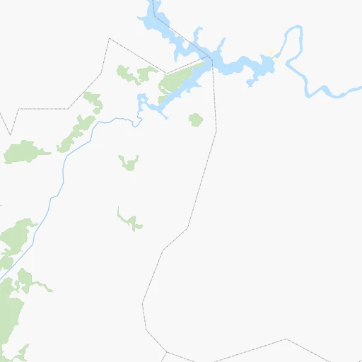
The flight distance (as the crow flies) between Pomba and Ubá is 33.1 km.
Roadmap (route) to go from Pomba to Ubá detailed above, you can also see the course layout on the map.
While doing trip Pomba - Ubá by car, the calculated route ends at a distance , or more straight.
Distance and duration of the route between Pomba and Ubá
Calculation of distance and route from Ubá to Pomba :
33.143.5 km1h47mn
Continue 0h4mn 1.9 kmTurn slight left onto Rua Vereador Agildo José dos Reis 0h0mn 13 mTurn right onto Rodovia MG-133 0h6mn 5.6 kmKeep right 0h0mn 53 mAt roundabout, take exit 1 0h8mn 9.6 kmKeep left onto BR-265, MGC-265 0h24mn 23.7 kmKeep right onto Rua Alberto Rodrigues Baião 0h1mn 824 mTurn sharp left onto Rua do Divino 0h0mn 65 mTurn right onto Travessa Oswaldo Bressani 0h0mn 131 mTurn right onto Travessa Oswaldo Bressani 0h0mn 17 mTurn right onto Avenida Padre Arnaldo Jansen 0h1mn 964 mTurn right onto Rua José Campomizzi 0h1mn 459 mTurn right onto Praça São Januário 0h0mn 39 mArrive at destination 0h0mn 0 m
Travel from Pomba (Minas Gerais) to a selection of major cities.
Distances from Pomba to biggest cities in Minas Gerais
- Esmeraldas,103,206 inhabitants.209 km
- Teofilo Otoni,101,170 inhabitants.423 km
- Coronel Fabriciano,100,916 inhabitants.208 km
- Itabira,99,496 inhabitants.189 km
- Passos,98,752 inhabitants.362 km
- Uba,97,828 inhabitants.33 km
- Araguari,96,565 inhabitants.602 km
- Vespasiano,94,749 inhabitants.197 km
- Timoteo,91,722 inhabitants.201 km
- Muriae,91,173 inhabitants.87 km
- Nova Lima,88,399 inhabitants.163 km
- Ituiutaba,85,345 inhabitants.706 km
- Araxa,82,595 inhabitants.436 km
- Itajuba,81,870 inhabitants.265 km
- Lavras,81,472 inhabitants.189 km
- Sao Joao del Rei,78,592 inhabitants.114 km
- Itauna,77,400 inhabitants.200 km
- Para de Minas,75,786 inhabitants.220 km
- Joao Monlevade,72,762 inhabitants.168 km
- Patrocinio,71,963 inhabitants.478 km
Other major cities in country :
- Campo Grande [11], 729,151 inhabitants. 1,196 km
- Jaboatao [30], 702,621 inhabitants. 1,706 km
- Osasco [27], 677,856 inhabitants. 446 km
- Santo Andre [27], 662,373 inhabitants. 433 km
- Joao Pessoa [17], 650,883 inhabitants. 1,817 km
- Jaboatao dos Guararapes [30], 630,008 inhabitants. 1,712 km
- Ribeirao Preto [27], 619,746 inhabitants. 480 km
- Sao Jose dos Campos [27], 613,764 inhabitants. 347 km
- Sorocaba [27], 558,862 inhabitants. 503 km
- Cuiaba [14], 521,934 inhabitants. 1,504 km
- Aparecida de Goiania [29], 510,770 inhabitants. 810 km
- Aracaju [28], 490,175 inhabitants. 1,329 km
- Feira de Santana [05], 481,911 inhabitants. 1,103 km
- Londrina [18], 471,832 inhabitants. 851 km
- Belford Roxo [21], 466,096 inhabitants. 163 km
- Joinville [26], 461,304 inhabitants. 800 km
- Niteroi [21], 456,456 inhabitants. 175 km
- Sao Joao de Meriti [21], 454,849 inhabitants. 167 km
- Ananindeua [16], 433,956 inhabitants. 2,291 km
- Florianopolis [26], 412,724 inhabitants. 885 km
Route from Ubá to major cities (Brazil).
- Distance Ubá Sao Paulo466 km
- Distance Ubá Rio de Janeiro200 km
- Distance Ubá Salvador1,022 km
- Distance Ubá Fortaleza1,995 km
- Distance Ubá Brasilia794 km
- Distance Ubá Curitiba805 km
- Distance Ubá Manaus2,729 km
- Distance Ubá Recife1,693 km
- Distance Ubá Belem2,271 km
- Distance Ubá Porto Alegre1,294 km
- Distance Ubá Goiania828 km
- Distance Ubá Guarulhos452 km
- Distance Ubá Campinas469 km
- Distance Ubá Nova Iguacu190 km
- Distance Ubá Maceio1,491 km
- Distance Ubá Sao Luis2,075 km
- Distance Ubá Duque de Caxias189 km
- Distance Ubá Natal1,899 km
- Distance Ubá Teresina1,785 km
- Distance Ubá Sao Bernardo do Campo470 km
Nearest cities to Pomba :
- Rio de Janeiro, 6,023,699 inhabitants. 177 km
- Belo Horizonte, 2,373,224 inhabitants. 174 km
- Nova Iguacu, 1,002,118 inhabitants. 163 km
- Duque de Caxias, 818,329 inhabitants. 164 km
- Contagem, 627,123 inhabitants. 179 km
- Sao Jose dos Campos, 613,764 inhabitants. 347 km
- Juiz de Fora, 470,193 inhabitants. 53 km
- Belford Roxo, 466,096 inhabitants. 163 km
- Niteroi, 456,456 inhabitants. 175 km
- Sao Joao de Meriti, 454,849 inhabitants. 167 km
- Ribeirao das Neves, 406,802 inhabitants. 197 km
- Vila Velha, 394,930 inhabitants. 320 km
- Serra, 394,153 inhabitants. 327 km
- Campos dos Goytacazes, 387,417 inhabitants. 198 km
- Betim, 384,000 inhabitants. 184 km
- Vitoria, 312,656 inhabitants. 316 km
- Petropolis, 272,691 inhabitants. 132 km
- Taubate, 251,641 inhabitants. 310 km
- Governador Valadares, 250,878 inhabitants. 303 km
- Volta Redonda, 249,580 inhabitants. 165 km
- Santa Luzia, 243,503 inhabitants. 186 km
- Ipatinga, 228,746 inhabitants. 217 km
- Jacarei, 213,110 inhabitants. 362 km
- Sete Lagoas, 201,334 inhabitants. 234 km
- Divinopolis, 193,832 inhabitants. 221 km
- Cachoeiro de Itapemirim, 187,019 inhabitants. 221 km
- Itaborai, 182,498 inhabitants. 162 km
- Barra Mansa, 164,052 inhabitants. 171 km
- Angra dos Reis, 153,635 inhabitants. 222 km
- Nova Friburgo, 153,361 inhabitants. 127 km
- Nilopolis, 147,281 inhabitants. 168 km
- Macae, 143,029 inhabitants. 187 km
- Ibirite, 141,374 inhabitants. 171 km
- Queimados, 135,741 inhabitants. 160 km
- Pindamonhangaba, 132,218 inhabitants. 295 km
- Teresopolis, 123,979 inhabitants. 124 km
- Barbacena, 122,211 inhabitants. 62 km
- Varginha, 116,571 inhabitants. 234 km
- Pouso Alegre, 115,201 inhabitants. 302 km
- Conselheiro Lafaiete, 111,596 inhabitants. 96 km
- Resende, 111,514 inhabitants. 183 km
- Araruama, 109,637 inhabitants. 194 km
- Cabo Frio, 108,239 inhabitants. 212 km
- Guaratingueta, 105,880 inhabitants. 266 km
- Esmeraldas, 103,206 inhabitants. 209 km
- Colatina, 101,190 inhabitants. 332 km
- Guarapari, 100,925 inhabitants. 288 km
- Coronel Fabriciano, 100,916 inhabitants. 208 km
- Itaguai, 100,752 inhabitants. 182 km
- Rio das Ostras, 100,000 inhabitants. 186 km
Location Pomba (Minas Gerais) :
| Country flag |  |
| Location | Pomba |
| State | Minas Gerais |
| County | Rio Pomba |
| Country | Brazil |
| Country code / ISO 2 | BR |
| Latitude | -21.3166700 |
| Longitude | -43.1833300 |
| Altitude | 0 meters |
| Time zone | America/Sao_Paulo |
Location Ubá (Minas Gerais) :
| Country flag | |
| Location | Ubá |
| State | Minas Gerais |
| County | Ubá |
| Country | Brazil |
| Country code / ISO 2 | BR |
| Latitude | -21.1200000 |
| Longitude | -42.9427800 |
| Altitude | 0 meters |
| Time zone | America/Sao_Paulo |