


How to get from Estación Bellaco (Río Negro) to Cardona (Soriano)
Calculate route from Estación Bellaco (Río Negro, Uruguay) to Cardona (Soriano, Uruguay).
The flight distance (as the crow flies) between Estación Bellaco and Cardona is 131.6 km.
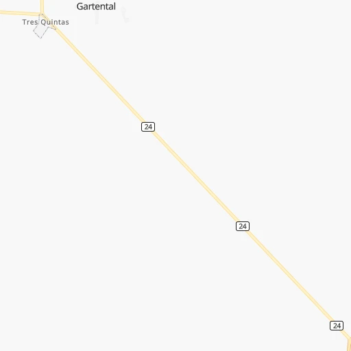
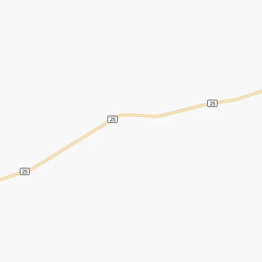
Roadmap (route) to go from Estación Bellaco to Cardona detailed above, you can also see the course layout on the map.
While doing trip Estación Bellaco - Cardona by car, the calculated route ends at a distance , or more straight.
Distance and duration of the route between Estación Bellaco and Cardona
Calculation of distance and route from Cardona to Estación Bellaco :
131.6163.4 km3h42mn
Continue 0h1mn 325 mTurn left onto Ruta 25 0h2mn 3.3 kmAt roundabout, take exit 2 onto Ruta 25 0h0mn 129 mContinue onto Ruta 24 Guyunusa 1h46mn 44.9 kmKeep left 0h18mn 8.9 kmTurn left onto Ruta 2 Grito de Asencio 0h9mn 10.1 kmAt roundabout, take exit 2 onto Ruta 2 Grito de Asencio 1h24mn 94.2 kmAt roundabout, take exit 3 onto Bulevar José C. Cardona - Florencio Sánchez 0h1mn 1.2 kmTurn left onto General Fructuoso Rivera 0h1mn 375 mTurn right onto Joaquín Suárez 0h0mn 55 mArrive at destination 0h0mn 0 m
Travel from Estación Bellaco (Soriano) to a selection of major cities.
Distances from Estación Bellaco to biggest cities in Río Negro
Other major cities in country :
Route from Cardona to major cities (Uruguay).
Nearest cities to Estación Bellaco :
- Montevideo, 1,270,737 inhabitants. 285 km
- Salto, 99,823 inhabitants. 154 km
- Paysandu, 73,249 inhabitants. 53 km
- Las Piedras, 69,682 inhabitants. 267 km
- Rivera, 64,631 inhabitants. 303 km
- Maldonado, 55,478 inhabitants. 360 km
- Tacuarembo, 51,854 inhabitants. 214 km
- Mercedes, 42,359 inhabitants. 56 km
- Artigas, 41,909 inhabitants. 296 km
- Minas, 38,025 inhabitants. 304 km
- San Jose de Mayo, 36,529 inhabitants. 206 km
- Durazno, 33,926 inhabitants. 144 km
- Florida, 32,234 inhabitants. 214 km
- Barros Blancos, 31,650 inhabitants. 281 km
- San Carlos, 24,938 inhabitants. 355 km
- Pando, 24,047 inhabitants. 281 km
- Fray Bentos, 23,279 inhabitants. 56 km
- Colonia del Sacramento, 21,714 inhabitants. 189 km
- Trinidad, 21,429 inhabitants. 124 km
- La Paz, 19,913 inhabitants. 270 km
- Canelones, 19,698 inhabitants. 246 km
- Delta del Tigre, 17,973 inhabitants. 263 km
- Carmelo, 16,921 inhabitants. 142 km
- Santa Lucia, 16,438 inhabitants. 233 km
- Progreso, 15,973 inhabitants. 262 km
- Young, 15,924 inhabitants. 25 km
- Dolores, 15,880 inhabitants. 90 km
- Paso de Carrasco, 15,393 inhabitants. 288 km
- Juan L. Lacaze, 13,223 inhabitants. 188 km
- Paso de los Toros, 13,221 inhabitants. 128 km
- Bella Union, 13,171 inhabitants. 280 km
- Nueva Helvecia, 10,054 inhabitants. 181 km
- Nueva Palmira, 9,335 inhabitants. 132 km
- Libertad, 9,311 inhabitants. 239 km
- Rosario, 9,308 inhabitants. 179 km
- Colonia Nicolich, 8,902 inhabitants. 286 km
- Piriapolis, 7,968 inhabitants. 336 km
- Tranqueras, 7,474 inhabitants. 266 km
- Sarandi del Yi, 7,367 inhabitants. 220 km
- Punta del Este, 7,234 inhabitants. 365 km
- Pan de Azucar, 7,180 inhabitants. 332 km
- San Ramon, 7,008 inhabitants. 247 km
- Sarandi Grande, 6,441 inhabitants. 180 km
- Joaquin Suarez, 6,257 inhabitants. 278 km
- Tarariras, 6,069 inhabitants. 169 km
- Sauce, 5,910 inhabitants. 269 km
- Guichon, 5,051 inhabitants. 79 km
- Tala, 4,949 inhabitants. 264 km
- Barra de Carrasco, 4,824 inhabitants. 291 km
- Cardona, 4,712 inhabitants. 132 km
Location Estación Bellaco (Río Negro) :
| Country flag |  |
| Location | Estación Bellaco |
| State | Río Negro |
| County | |
| Country | Uruguay |
| Country code / ISO 2 | UY |
| Latitude | -32.7666700 |
| Longitude | -57.8833300 |
| Altitude | 0 meters |
| Time zone | America/Montevideo |
Location Cardona (Soriano) :
| Country flag | |
| Location | Cardona |
| State | Soriano |
| County | Cardona |
| Country | Uruguay |
| Country code / ISO 2 | UY |
| Latitude | -33.8704900 |
| Longitude | -57.3695400 |
| Altitude | 0 meters |
| Time zone | America/Montevideo |