

How to get from Estación Egaña (Soriano) to Dolores (Soriano)
Calculate route from Estación Egaña (Soriano, Uruguay) to Dolores (Soriano, Uruguay).
The flight distance (as the crow flies) between Estación Egaña and Dolores is 54.6 km.
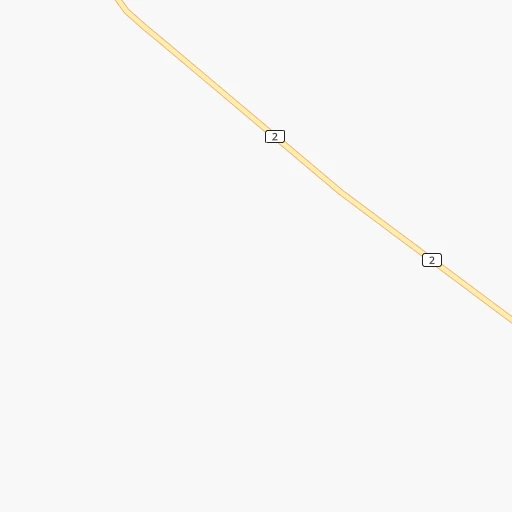
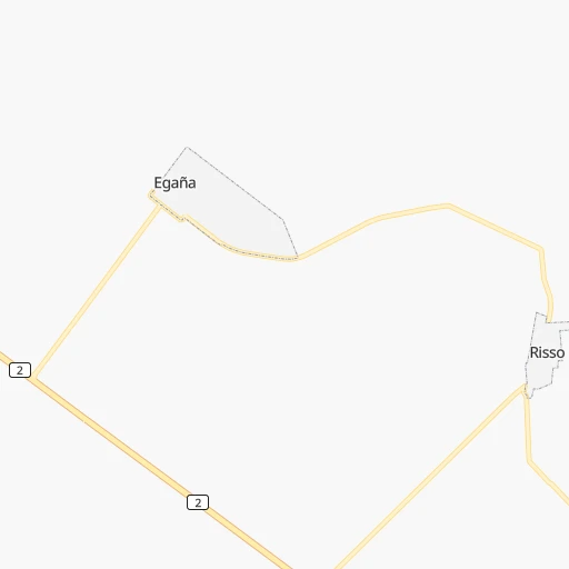
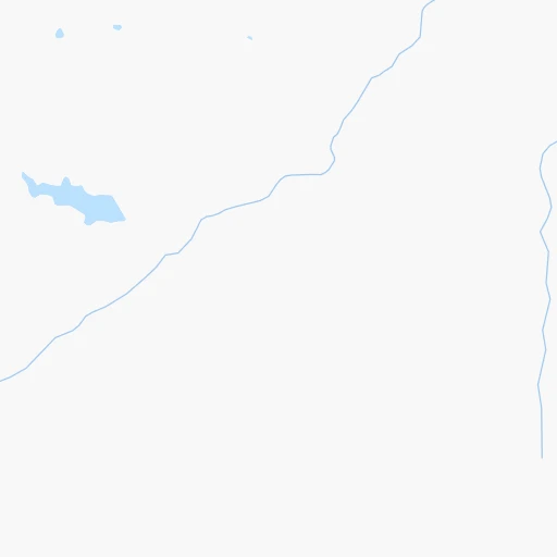
Roadmap (route) to go from Estación Egaña to Dolores detailed above, you can also see the course layout on the map.
While doing trip Estación Egaña - Dolores by car, the calculated route ends at a distance , or more straight.
Distance and duration of the route between Estación Egaña and Dolores
Calculation of distance and route from Dolores to Estación Egaña :
54.660.6 km1h4mn
Continue 0h0mn 89 mTurn sharp right 0h0mn 61 mTurn right 0h10mn 5.0 kmTurn right onto Ruta 2 Grito de Asencio 0h14mn 16.5 kmTurn left 0h0mn 40 mTurn slight right onto Ruta 105 1h36mn 35.7 kmContinue onto Ruta 105 and drive toward Dolores 0h0mn 63 mTurn left onto Ruta 21 0h3mn 2.9 kmTurn left onto Grito de Asencio 0h0mn 102 mTurn left onto General José Artigas 0h0mn 101 mTurn left onto Carlos P. Puig 0h0mn 50 mArrive at destination 0h0mn 0 m
Travel from Estación Egaña (Soriano) to a selection of major cities.
Distances from Estación Egaña to biggest cities in Soriano
Other major cities in country :
Route from Dolores to major cities (Uruguay).
Nearest cities to Estación Egaña :
- Montevideo, 1,270,737 inhabitants. 197 km
- Salto, 99,823 inhabitants. 249 km
- Paysandu, 73,249 inhabitants. 148 km
- Las Piedras, 69,682 inhabitants. 181 km
- Rivera, 64,631 inhabitants. 359 km
- Maldonado, 55,478 inhabitants. 286 km
- Tacuarembo, 51,854 inhabitants. 261 km
- Mercedes, 42,359 inhabitants. 54 km
- Minas, 38,025 inhabitants. 237 km
- San Jose de Mayo, 36,529 inhabitants. 118 km
- Durazno, 33,926 inhabitants. 106 km
- Florida, 32,234 inhabitants. 142 km
- Barros Blancos, 31,650 inhabitants. 197 km
- San Carlos, 24,938 inhabitants. 283 km
- Pando, 24,047 inhabitants. 198 km
- Fray Bentos, 23,279 inhabitants. 83 km
- Colonia del Sacramento, 21,714 inhabitants. 98 km
- Trinidad, 21,429 inhabitants. 69 km
- La Paz, 19,913 inhabitants. 183 km
- Canelones, 19,698 inhabitants. 162 km
- Delta del Tigre, 17,973 inhabitants. 174 km
- Carmelo, 16,921 inhabitants. 75 km
- Santa Lucia, 16,438 inhabitants. 149 km
- Progreso, 15,973 inhabitants. 176 km
- Young, 15,924 inhabitants. 101 km
- Dolores, 15,880 inhabitants. 55 km
- Paso de Carrasco, 15,393 inhabitants. 202 km
- Juan L. Lacaze, 13,223 inhabitants. 92 km
- Paso de los Toros, 13,221 inhabitants. 136 km
- Nueva Helvecia, 10,054 inhabitants. 86 km
- Nueva Palmira, 9,335 inhabitants. 78 km
- Libertad, 9,311 inhabitants. 148 km
- Rosario, 9,308 inhabitants. 84 km
- Colonia Nicolich, 8,902 inhabitants. 200 km
- Piriapolis, 7,968 inhabitants. 258 km
- Tranqueras, 7,474 inhabitants. 321 km
- Sarandi del Yi, 7,367 inhabitants. 188 km
- Punta del Este, 7,234 inhabitants. 290 km
- Pan de Azucar, 7,180 inhabitants. 257 km
- San Ramon, 7,008 inhabitants. 173 km
- Sarandi Grande, 6,441 inhabitants. 121 km
- Joaquin Suarez, 6,257 inhabitants. 194 km
- Tarariras, 6,069 inhabitants. 74 km
- Sauce, 5,910 inhabitants. 186 km
- Guichon, 5,051 inhabitants. 144 km
- Tala, 4,949 inhabitants. 191 km
- Barra de Carrasco, 4,824 inhabitants. 205 km
- Cardona, 4,712 inhabitants. 39 km
- Atlantida, 4,669 inhabitants. 216 km
- Vichadero, 4,170 inhabitants. 342 km
Location Estación Egaña (Soriano) :
| Country flag |  |
| Location | Estación Egaña |
| State | Soriano |
| County | |
| Country | Uruguay |
| Country code / ISO 2 | UY |
| Latitude | -33.6021200 |
| Longitude | -57.6333300 |
| Altitude | 0 meters |
| Time zone | America/Montevideo |
Location Dolores (Soriano) :
| Country flag | |
| Location | Dolores |
| State | Soriano |
| County | Dolores |
| Country | Uruguay |
| Country code / ISO 2 | UY |
| Latitude | -33.5300900 |
| Longitude | -58.2170100 |
| Altitude | 0 meters |
| Time zone | America/Montevideo |
