
How to get from Estación Estanzuela (Colonia) to Libertad (San José)
Calculate route from Estación Estanzuela (Colonia, Uruguay) to Libertad (San José, Uruguay).
The flight distance (as the crow flies) between Estación Estanzuela and Libertad is 107.2 km.
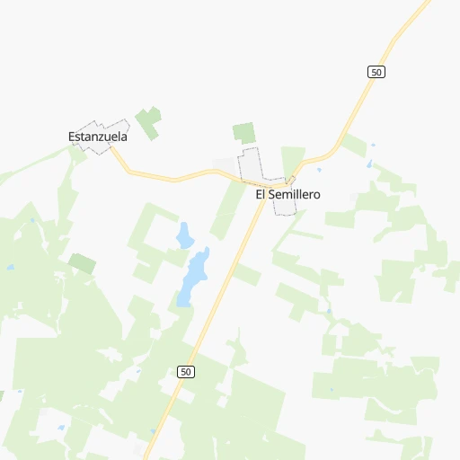
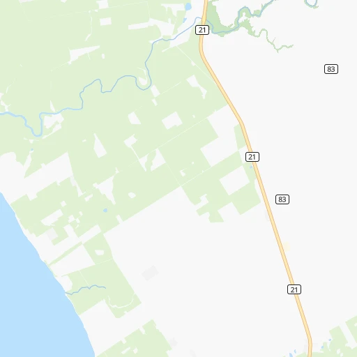
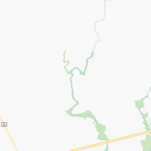
Roadmap (route) to go from Estación Estanzuela to Libertad detailed above, you can also see the course layout on the map.
While doing trip Estación Estanzuela - Libertad by car, the calculated route ends at a distance , or more straight.
Distance and duration of the route between Estación Estanzuela and Libertad
Calculation of distance and route from Libertad to Estación Estanzuela :
107.2128.9 km2h54mn
Continue 0h0mn 212 mTurn right 0h5mn 3.5 kmTurn right onto Ruta 50 0h14mn 11.5 kmTurn left onto Ruta 1 Brigadier General Manuel Oribe 2h32mn 111.4 kmTurn left 0h0mn 48 mKeep right and drive toward Libertad 0h0mn 249 mTurn slight right onto Camino Departamental 0h2mn 1.6 kmTurn left onto Agraciada 0h1mn 430 mTurn left onto Doctor Ernesto G. Ciganda 0h0mn 76 mArrive at destination 0h0mn 0 m
Travel from Estación Estanzuela (San José) to a selection of major cities.
Distances from Estación Estanzuela to biggest cities in Colonia
Other major cities in country :
Route from Libertad to major cities (Uruguay).
Nearest cities to Estación Estanzuela :
- Montevideo, 1,270,737 inhabitants. 155 km
- Salto, 99,823 inhabitants. 329 km
- Paysandu, 73,249 inhabitants. 226 km
- Las Piedras, 69,682 inhabitants. 145 km
- Maldonado, 55,478 inhabitants. 262 km
- Tacuarembo, 51,854 inhabitants. 333 km
- Mercedes, 42,359 inhabitants. 123 km
- Minas, 38,025 inhabitants. 229 km
- San Jose de Mayo, 36,529 inhabitants. 93 km
- Durazno, 33,926 inhabitants. 153 km
- Florida, 32,234 inhabitants. 142 km
- Barros Blancos, 31,650 inhabitants. 165 km
- San Carlos, 24,938 inhabitants. 263 km
- Pando, 24,047 inhabitants. 168 km
- Fray Bentos, 23,279 inhabitants. 145 km
- Colonia del Sacramento, 21,714 inhabitants. 18 km
- Trinidad, 21,429 inhabitants. 118 km
- La Paz, 19,913 inhabitants. 146 km
- Canelones, 19,698 inhabitants. 135 km
- Delta del Tigre, 17,973 inhabitants. 134 km
- Carmelo, 16,921 inhabitants. 63 km
- Santa Lucia, 16,438 inhabitants. 124 km
- Progreso, 15,973 inhabitants. 144 km
- Young, 15,924 inhabitants. 182 km
- Dolores, 15,880 inhabitants. 100 km
- Paso de Carrasco, 15,393 inhabitants. 165 km
- Juan L. Lacaze, 13,223 inhabitants. 27 km
- Paso de los Toros, 13,221 inhabitants. 202 km
- Nueva Helvecia, 10,054 inhabitants. 46 km
- Nueva Palmira, 9,335 inhabitants. 81 km
- Libertad, 9,311 inhabitants. 107 km
- Rosario, 9,308 inhabitants. 35 km
- Colonia Nicolich, 8,902 inhabitants. 165 km
- Piriapolis, 7,968 inhabitants. 232 km
- Sarandi del Yi, 7,367 inhabitants. 222 km
- Punta del Este, 7,234 inhabitants. 265 km
- Pan de Azucar, 7,180 inhabitants. 234 km
- San Ramon, 7,008 inhabitants. 163 km
- Sarandi Grande, 6,441 inhabitants. 145 km
- Joaquin Suarez, 6,257 inhabitants. 162 km
- Tarariras, 6,069 inhabitants. 12 km
- Sauce, 5,910 inhabitants. 157 km
- Guichon, 5,051 inhabitants. 225 km
- Tala, 4,949 inhabitants. 180 km
- Barra de Carrasco, 4,824 inhabitants. 167 km
- Cardona, 4,712 inhabitants. 61 km
- Atlantida, 4,669 inhabitants. 187 km
- Toledo, 4,056 inhabitants. 156 km
- Empalme Olmos, 4,007 inhabitants. 173 km
- San Jacinto, 3,954 inhabitants. 172 km
Location Estación Estanzuela (Colonia) :
| Country flag |  |
| Location | Estación Estanzuela |
| State | Colonia |
| County | |
| Country | Uruguay |
| Country code / ISO 2 | UY |
| Latitude | -34.3286200 |
| Longitude | -57.7272400 |
| Altitude | 0 meters |
| Time zone | America/Montevideo |
Location Libertad (San José) :
| Country flag | |
| Location | Libertad |
| State | San José |
| County | Libertad |
| Country | Uruguay |
| Country code / ISO 2 | UY |
| Latitude | -34.6345900 |
| Longitude | -56.6173900 |
| Altitude | 0 meters |
| Time zone | America/Montevideo |