
How to get from Nemby (Central) to San Pedro de Ycuamandiyú (San Pedro)
Calculate route from Nemby (Central, Paraguay) to San Pedro de Ycuamandiyú (San Pedro, Paraguay).
The flight distance (as the crow flies) between Nemby and San Pedro de Ycuamandiyú is 152.4 km.
Roadmap (route) to go from Nemby to San Pedro de Ycuamandiyú detailed above, you can also see the course layout on the map.
While doing trip Nemby - San Pedro de Ycuamandiyú by car, the calculated route ends at a distance , or more straight.
Distance and duration of the route between Nemby and San Pedro de Ycuamandiyú
Calculation of distance and route from San Pedro de Ycuamandiyú to Nemby :
152.4337.5 km5h14mn
Continue 0h0mn 32 mTurn right onto Profesor Doctor Victorio Curiel 0h6mn 4.8 kmTurn right 0h0mn 68 mTurn left 0h1mn 330 mTurn right onto Padres Jesuitas 0h0mn 135 mTurn slight right onto Fernando de Pinedo 0h1mn 352 mTurn sharp right onto Teniente Maschio 0h0mn 20 mKeep left onto Juan León Mallorquín 0h1mn 517 mTurn left onto Hernandarias 0h0mn 570 mTurn right onto Cerro Cora 0h1mn 815 mTurn left onto Saturio Ríos 0h1mn 337 mContinue onto General Eugenio Alejandrino Garay 0h10mn 7.2 kmKeep right onto Eugenio A. Garay 0h1mn 799 mTurn right onto Avenida General Elizardo Aquino 0h1mn 321 mTurn left onto Fulgencio Yegros 0h2mn 1.2 kmTurn left onto Karandayty 0h0mn 144 mTurn right onto Calle Rosario 0h1mn 732 mKeep left onto Ykua Karanday 0h7mn 4.9 kmTurn left onto Profesora Rita Etelvina G. de Aveiro 0h7mn 4.2 kmTurn right onto Avenida Doctor José Gaspar Rodríguez de Francia 0h0mn 195 mTurn sharp left onto Calle Rosario 0h1mn 669 mTurn right onto Ruta Nacional General Aquino 1h14mn 77.4 kmContinue onto Ruta Nacional General Aquino 1h0mn 70.6 kmAt roundabout, take exit 3 onto Ruta Nacional Blás Garay 1h12mn 86.3 kmTurn left onto Ruta Nacional Juana de Lara 0h23mn 26.9 kmTurn right 0h3mn 1.3 kmTurn slight right onto Ruta Nacional Juana de Lara 1h38mn 44.6 kmAt roundabout, take exit 1 onto Ruta Nacional Juana de Lara 0h1mn 386 mTurn right 0h0mn 146 mTurn left 0h1mn 344 mTurn left 0h0mn 27 mKeep right 0h0mn 119 mTurn right 0h0mn 77 mTurn left 0h1mn 741 mTurn right onto Teniente Rojas Silva 0h1mn 304 mArrive at destination 0h0mn 0 m
Travel from Nemby (San Pedro) to a selection of major cities.
Distances from Nemby to biggest cities in Central
Other major cities in country :
Route from San Pedro de Ycuamandiyú to major cities (Paraguay).
- Distance San Pedro de Ycuamandiyú Asuncion146 km
- Distance San Pedro de Ycuamandiyú Ciudad del Este296 km
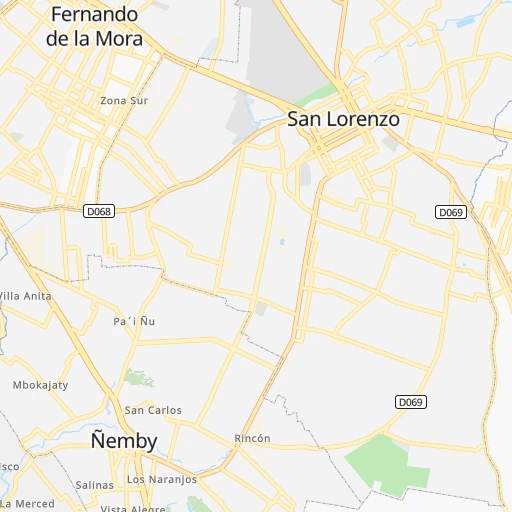
- Distance San Pedro de Ycuamandiyú San Lorenzo146 km
- Distance San Pedro de Ycuamandiyú Capiata146 km
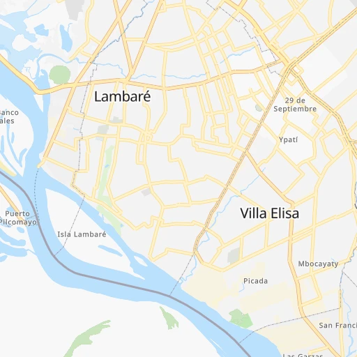
- Distance San Pedro de Ycuamandiyú Lambare150 km
- Distance San Pedro de Ycuamandiyú Fernando de la Mora146 km
- Distance San Pedro de Ycuamandiyú Limpio127 km
- Distance San Pedro de Ycuamandiyú Nemby153 km
- Distance San Pedro de Ycuamandiyú Pedro Juan Caballero220 km
- Distance San Pedro de Ycuamandiyú Encarnacion381 km
- Distance San Pedro de Ycuamandiyú Mariano Roque Alonso133 km
- Distance San Pedro de Ycuamandiyú Itaugua148 km
- Distance San Pedro de Ycuamandiyú Villa Elisa152 km
- Distance San Pedro de Ycuamandiyú Villa Hayes121 km
- Distance San Pedro de Ycuamandiyú San Antonio156 km
- Distance San Pedro de Ycuamandiyú Caaguazu188 km
- Distance San Pedro de Ycuamandiyú Presidente Franco299 km
- Distance San Pedro de Ycuamandiyú Coronel Oviedo165 km
Nearest cities to Nemby :
- Asuncion, 1,482,200 inhabitants. 15 km
- Ciudad del Este, 320,782 inhabitants. 294 km
- San Lorenzo, 227,876 inhabitants. 7 km
- Capiata, 198,553 inhabitants. 10 km
- Lambare, 126,377 inhabitants. 9 km
- Fernando de la Mora, 120,167 inhabitants. 6 km
- Limpio, 96,143 inhabitants. 26 km
- Nemby, 94,641 inhabitants. 0 km
- Pedro Juan Caballero, 75,109 inhabitants. 366 km
- Encarnacion, 74,983 inhabitants. 272 km
- Mariano Roque Alonso, 72,008 inhabitants. 21 km
- Itaugua, 64,997 inhabitants. 18 km
- Villa Elisa, 64,099 inhabitants. 6 km
- Villa Hayes, 57,217 inhabitants. 34 km
- San Antonio, 55,754 inhabitants. 3 km
- Caaguazu, 54,808 inhabitants. 153 km
- Presidente Franco, 54,292 inhabitants. 295 km
- Coronel Oviedo, 51,286 inhabitants. 110 km
- Concepcion, 48,123 inhabitants. 222 km
- Villarrica, 41,157 inhabitants. 117 km
- Pilar, 28,716 inhabitants. 181 km
- Caazapa, 23,996 inhabitants. 147 km
- Caacupe, 21,696 inhabitants. 40 km
- Ita, 18,459 inhabitants. 21 km
- San Juan Bautista, 16,593 inhabitants. 147 km
- Nueva Esperanza, 12,717 inhabitants. 288 km
- Juan de Ayolas, 12,061 inhabitants. 232 km
- Santa Rita, 11,823 inhabitants. 252 km
- Colonia General Alfredo Stroessner, 11,558 inhabitants. 184 km
- Aregua, 11,222 inhabitants. 18 km
- San Isidro de Curuguaty, 11,095 inhabitants. 213 km
- Horqueta, 10,531 inhabitants. 233 km
- Lima, 10,367 inhabitants. 199 km
- Piribebuy, 10,337 inhabitants. 50 km
- Paraguari, 10,079 inhabitants. 46 km
- Tobati, 9,952 inhabitants. 48 km
- Ypacarai, 9,655 inhabitants. 25 km
- San Pedro de Ycuamandiyu, 9,360 inhabitants. 153 km
- Capitan Bado, 9,114 inhabitants. 312 km
- Guarambare, 9,065 inhabitants. 13 km
- Eusebio Ayala, 8,253 inhabitants. 58 km
- San Juan Nepomuceno, 7,893 inhabitants. 179 km
- Benjamin Aceval, 7,751 inhabitants. 48 km
- Doctor Juan Leon Mallorquin, 7,481 inhabitants. 229 km
- Santa Rosa Misiones, 7,257 inhabitants. 180 km
- Yaguaron, 7,181 inhabitants. 31 km
- Repatriacion, 7,085 inhabitants. 160 km
- Obligado, 6,350 inhabitants. 263 km
- Emboscada, 5,911 inhabitants. 33 km
- Carapegua, 5,784 inhabitants. 54 km
Location Nemby (Central) :
| Country flag |  |
| Location | Nemby |
| State | Central |
| County | Ñemby |
| Country | Paraguay |
| Country code / ISO 2 | PY |
| Latitude | -25.3949000 |
| Longitude | -57.5357400 |
| Altitude | 0 meters |
| Time zone | America/Asuncion |
Location San Pedro de Ycuamandiyú (San Pedro) :
| Country flag | |
| Location | San Pedro de Ycuamandiyú |
| State | San Pedro |
| County | San Pedro Del Ykuamandiyu |
| Country | Paraguay |
| Country code / ISO 2 | PY |
| Latitude | -24.0853400 |
| Longitude | -57.0874500 |
| Altitude | 0 meters |
| Time zone | America/Asuncion |