
How to get from Acará (Pará) to Santa Helena (Maranhão)
Calculate route from Acará (Pará, Brazil) to Santa Helena (Maranhão, Brazil).
The flight distance (as the crow flies) between Acará and Santa Helena is 323.1 km.
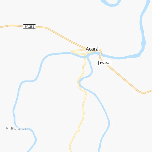
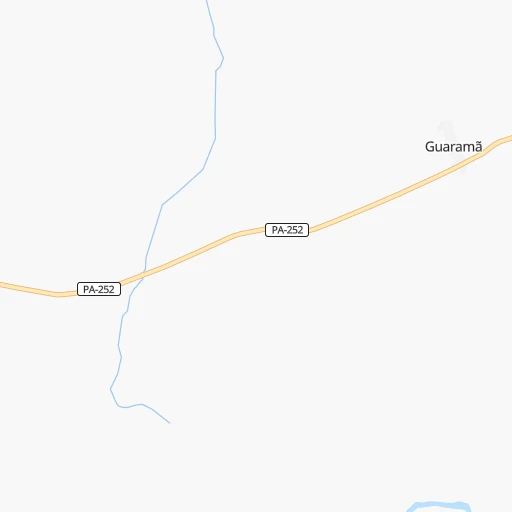
Roadmap (route) to go from Acará to Santa Helena detailed above, you can also see the course layout on the map.
While doing trip Acará - Santa Helena by car, the calculated route ends at a distance , or more straight.
Distance and duration of the route between Acará and Santa Helena
Calculation of distance and route from Santa Helena to Acará :
323.1404.0 km6h25mn
Continue onto Rua Marechal Deodoro da Fonseca 0h0mn 70 mTurn right onto Travessa Martinho Vaz 0h0mn 241 mTurn left onto Avenida Comandante Pedro Vinagre 0h0mn 186 mTurn right onto Travessa Severino 0h18mn 18.8 kmAt roundabout, take exit 1 onto PA-252, PA-140 0h11mn 11.3 kmKeep left 0h0mn 20 mTurn left onto Avenida Marechal Deodoro da Fonseca 0h0mn 90 mTurn slight right onto Avenida Presidente Vargas 1h42mn 46.5 kmAt roundabout, take exit 1 onto Rodovia Belém-Brasília 0h24mn 31.1 kmTurn sharp right 0h4mn 3.6 kmKeep right 0h7mn 5.4 kmTurn sharp right onto Travessa Coronel João Câncio 0h0mn 100 mTurn left onto Avenida José Leônidas de Oliveira 0h0mn 254 mTurn slight left onto Travessa Júlio Ribeiro Taváres 0h0mn 8 mAt roundabout, take exit 1 onto Rua Bom Sucesso 0h0mn 125 mAt roundabout, take exit 1 onto Rua Bom Sucesso 0h0mn 137 mContinue onto Avenida José de Vieira Cordeiro 1h42mn 45.7 kmKeep right 0h0mn 26 mTurn slight right onto Avenida Moura Carvalho 0h1mn 846 mTurn left onto Avenida Fernando Guilhon 0h1mn 691 mTurn right onto Rua Inácio Coutinho 0h0mn 211 mTurn left onto Travessa Nazareno Nonato Ferreira 0h2mn 1.2 kmContinue 0h15mn 7.5 kmKeep right 0h2mn 988 mKeep right 0h26mn 13.0 kmTurn slight left 0h20mn 9.9 kmTurn left onto Rua Emílio Alexandre 0h3mn 1.7 kmKeep left 0h18mn 9.1 kmKeep right 0h0mn 84 mTurn slight right onto BR-316 1h28mn 127.7 kmAt roundabout, take exit 2 onto MA-106 1h57mn 67.1 kmTurn left onto Travessa Pedro II 0h1mn 258 mTurn right onto Rua Gonçalves Dias 0h0mn 62 mArrive at destination 0h0mn 0 m
Travel from Acará (Maranhão) to a selection of major cities.
Distances from Acará to biggest cities in Pará
- Vigia,29,229 inhabitants.123 km
- Sao Miguel do Guama,28,265 inhabitants.88 km
- Conceicao do Araguaia,27,115 inhabitants.712 km
- Igarape Miri,26,837 inhabitants.85 km
- Alenquer,26,290 inhabitants.728 km
- Obidos,24,970 inhabitants.815 km
- Igarape Acu,24,136 inhabitants.113 km
- Monte Alegre,22,840 inhabitants.655 km
- Moju,21,510 inhabitants.64 km
- Portel,21,315 inhabitants.292 km
- Itupiranga,21,301 inhabitants.375 km
- Almeirim,20,464 inhabitants.490 km
Other major cities in country :
- Campo Grande [11], 729,151 inhabitants. 2,173 km
- Jaboatao [30], 702,621 inhabitants. 1,618 km
- Osasco [27], 677,856 inhabitants. 2,406 km
- Santo Andre [27], 662,373 inhabitants. 2,423 km
- Joao Pessoa [17], 650,883 inhabitants. 1,586 km
- Jaboatao dos Guararapes [30], 630,008 inhabitants. 1,614 km
- Contagem [15], 627,123 inhabitants. 2,051 km
- Ribeirao Preto [27], 619,746 inhabitants. 2,140 km
- Sao Jose dos Campos [27], 613,764 inhabitants. 2,375 km
- Uberlandia [15], 563,536 inhabitants. 1,888 km
- Sorocaba [27], 558,862 inhabitants. 2,399 km
- Cuiaba [14], 521,934 inhabitants. 1,748 km
- Aparecida de Goiania [29], 510,770 inhabitants. 1,658 km
- Aracaju [28], 490,175 inhabitants. 1,582 km
- Feira de Santana [05], 481,911 inhabitants. 1,534 km
- Londrina [18], 471,832 inhabitants. 2,398 km
- Juiz de Fora [15], 470,193 inhabitants. 2,266 km
- Belford Roxo [21], 466,096 inhabitants. 2,373 km
- Joinville [26], 461,304 inhabitants. 2,711 km
- Niteroi [21], 456,456 inhabitants. 2,393 km
Route from Santa Helena to major cities (Brazil).
- Distance Santa Helena Sao Paulo2,377 km
- Distance Santa Helena Rio de Janeiro2,313 km
- Distance Santa Helena Salvador1,410 km
- Distance Santa Helena Fortaleza769 km
- Distance Santa Helena Belo Horizonte1,975 km
- Distance Santa Helena Brasilia1,536 km
- Distance Santa Helena Curitiba2,617 km
- Distance Santa Helena Manaus1,640 km
- Distance Santa Helena Recife1,324 km
- Distance Santa Helena Belem367 km
- Distance Santa Helena Porto Alegre3,158 km
- Distance Santa Helena Goiania1,666 km
- Distance Santa Helena Guarulhos2,367 km
- Distance Santa Helena Campinas2,309 km
- Distance Santa Helena Nova Iguacu2,294 km
- Distance Santa Helena Maceio1,343 km
- Distance Santa Helena Duque de Caxias2,298 km
- Distance Santa Helena Natal1,189 km
- Distance Santa Helena Teresina422 km
- Distance Santa Helena Sao Bernardo do Campo2,393 km
Nearest cities to Acará :
- Belem, 1,407,737 inhabitants. 66 km
- Ananindeua, 433,956 inhabitants. 69 km
- Macapa, 338,936 inhabitants. 389 km
- Castanhal, 137,406 inhabitants. 80 km
- Santana, 83,927 inhabitants. 394 km
- Abaetetuba, 78,050 inhabitants. 81 km
- Tucurui, 76,337 inhabitants. 260 km
- Paragominas, 69,613 inhabitants. 137 km
- Santa Ines, 67,424 inhabitants. 366 km
- Braganca, 57,163 inhabitants. 189 km
- Benevides, 49,794 inhabitants. 67 km
- Capanema, 47,766 inhabitants. 142 km
- Breves, 46,473 inhabitants. 256 km
- Cameta, 45,200 inhabitants. 148 km
- Salinopolis, 40,998 inhabitants. 177 km
- Tome Acu, 34,053 inhabitants. 51 km
- Capitao Poco, 32,704 inhabitants. 129 km
- Barcarena, 29,871 inhabitants. 70 km
- Vigia, 29,229 inhabitants. 123 km
- Sao Miguel do Guama, 28,265 inhabitants. 88 km
- Igarape Miri, 26,837 inhabitants. 85 km
- Lago da Pedra, 25,996 inhabitants. 419 km
- Igarape Acu, 24,136 inhabitants. 113 km
- Pindare Mirim, 22,933 inhabitants. 366 km
- Moju, 21,510 inhabitants. 64 km
- Portel, 21,315 inhabitants. 292 km
- Viseu, 18,958 inhabitants. 244 km
- Soure, 18,212 inhabitants. 143 km
- Mocajuba, 16,567 inhabitants. 161 km
- Augusto Correa, 16,279 inhabitants. 203 km
- Santa Helena, 16,045 inhabitants. 324 km
- Tucuma, 15,030 inhabitants. 286 km
- Maracacume, 14,164 inhabitants. 249 km
- Vitorino Freire, 13,267 inhabitants. 402 km
- Santa Maria do Para, 12,915 inhabitants. 97 km
- Carutapera, 12,819 inhabitants. 257 km
- Acara, 12,802 inhabitants. 0 km
- Maracana, 12,682 inhabitants. 157 km
- Baiao, 12,316 inhabitants. 188 km
- Moncao, 11,050 inhabitants. 369 km
- Curuca, 10,843 inhabitants. 143 km
- Turiacu, 10,471 inhabitants. 316 km
- Marapanim, 10,236 inhabitants. 149 km
- Oeiras do Para, 10,162 inhabitants. 184 km
- Sao Joao de Pirabas, 10,065 inhabitants. 174 km
- Santo Antonio do Taua, 8,921 inhabitants. 90 km
- Sao Caetano de Odivelas, 8,862 inhabitants. 136 km
- Candido Mendes, 8,613 inhabitants. 282 km
- Ourem, 8,145 inhabitants. 129 km
- Muana, 7,464 inhabitants. 123 km
Location Acará (Pará) :
| Country flag |  |
| Location | Acará |
| State | Pará |
| County | Acará |
| Country | Brazil |
| Country code / ISO 2 | BR |
| Latitude | -1.9608300 |
| Longitude | -48.1966700 |
| Altitude | 0 meters |
| Time zone | America/Belem |
Location Santa Helena (Maranhão) :
| Country flag | |
| Location | Santa Helena |
| State | Maranhão |
| County | Santa Helena |
| Country | Brazil |
| Country code / ISO 2 | BR |
| Latitude | -2.2311100 |
| Longitude | -45.3000000 |
| Altitude | 0 meters |
| Time zone | America/Fortaleza |