
How to get from Anum (Alagoas) to Goiana (Pernambuco)
Calculate route from Anum (Alagoas, Brazil) to Goiana (Pernambuco, Brazil).
The flight distance (as the crow flies) between Anum and Goiana is 273.9 km.
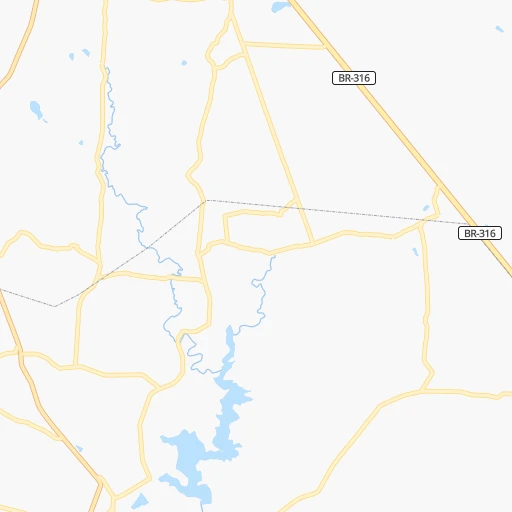
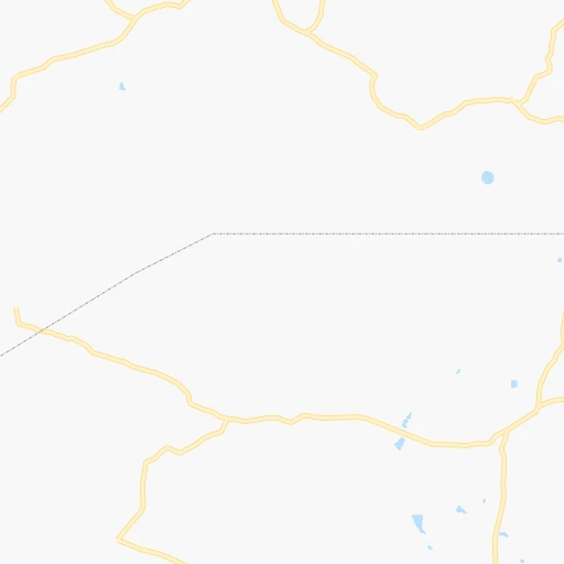
Roadmap (route) to go from Anum to Goiana detailed above, you can also see the course layout on the map.
While doing trip Anum - Goiana by car, the calculated route ends at a distance , or more straight.
Distance and duration of the route between Anum and Goiana
Calculation of distance and route from Goiana to Anum :
273.9345.3 km5h29mn
Continue onto BR-316 0h6mn 6.7 kmAt roundabout, take exit 1 onto Avenida Governador Muniz Falcão 0h1mn 1.4 kmTurn sharp left onto Travessa São Cristóvão 0h0mn 103 mTurn right onto Lago São Cristóvão 0h0mn 72 mTurn left onto Avenida Vieira de Brito 0h0mn 12 mTurn right onto Avenida Deputado Medeiros Neto 0h1mn 776 mTurn left onto Rua Major Cicero de Goes Monteiro 0h3mn 2.8 kmKeep right onto Rua Santo Antônio 0h5mn 4.2 kmTurn left 0h1mn 1.1 kmTurn right onto AL-115 and drive toward Bom Conselho 1h1mn 68.4 kmAt roundabout, take exit 1 0h0mn 313 mAt roundabout, take exit 2 onto Rua São Miguel 0h0mn 362 mTurn right onto Rua Venezuela 0h0mn 88 mTurn left onto Rua Bolívia 0h2mn 1.6 kmTurn right 0h0mn 41 mTurn sharp left onto Avenida Getúlio Vargas 0h0mn 173 mTurn right onto Avenida Júlio Brasileiro 0h1mn 1.3 kmTurn left onto Praça Tavares Correia 0h1mn 950 mKeep left onto Rodovia Mestre Domiguinhos 1h9mn 75.3 kmKeep right 0h0mn 415 mKeep left 0h1mn 1.5 kmKeep right 0h11mn 16.5 kmKeep right 0h1mn 710 mKeep right onto Avenida José Pinheiro dos Santos 0h1mn 618 mContinue 0h1mn 1.2 kmTurn right onto Rua Professora Maria Emília 0h1mn 490 mTurn left onto Rua Professor Vicente Monteiro 0h1mn 319 mTurn right onto Avenida Rui Barbosa 0h0mn 97 mTurn left 0h0mn 136 mTurn right onto Rua Visconde de Inhaúma 0h0mn 86 mTurn left onto Avenida Doutor Osvaldo Cruz 0h0mn 415 mTurn left onto Rua Silvino Macedo 0h0mn 336 mKeep right onto Rua Cônego Júlio Cabral 0h0mn 251 mTurn left onto Rua Tupý 0h0mn 302 mTurn slight right onto Rua Cônego Júlio Cabral 0h0mn 228 mContinue onto Avenida Brasil 0h3mn 2.1 kmKeep right 1h56mn 54.6 kmTurn right onto Rua Primeiro de Maio 0h2mn 1.1 kmTurn slight right onto Rua Doutor Barbosa Lima 0h0mn 150 mTurn left onto Rua da Saudade 0h0mn 120 mTurn right onto Rua da Alegria 0h1mn 754 mTurn slight right onto Estrada para Limoeiro 0h16mn 17.5 kmTurn left onto Rua Francisco Heraclio do Rego 0h1mn 537 mTurn right onto Avenida Capibaribe 0h2mn 1.4 kmTurn left onto Rua Coronel Manoel de Aquino 0h0mn 204 mTurn right onto Rua Vigário Joaquim Pinto 0h2mn 2.5 kmKeep right 0h0mn 110 mContinue onto Rodovia Coronel francisco do heraclio 0h19mn 19.7 kmContinue onto Rodovia Coronel Francisco do Heraclio 0h3mn 1.8 kmTurn left onto Avenida Professora Amélia Lemos 0h3mn 1.2 kmTurn left 0h0mn 41 mTurn slight left onto Rodovia BR-408 0h6mn 6.3 kmKeep right 0h20mn 20.1 kmTurn left onto PE-004 0h9mn 10.1 kmKeep right onto PE-004 0h0mn 127 mTurn slight right onto Rodovia PE-062 0h13mn 13.9 kmContinue onto Rua Augusto Gondin 0h1mn 441 mTurn right onto Rua José Maria Alburquerque Melo 0h1mn 530 mTurn slight right onto Avenida Desembargador Edmundo Jordão 0h1mn 421 mTurn right onto Avenida do Povo 0h0mn 84 mTurn left onto 1ª Travessa do Povo 0h0mn 35 mArrive at destination 0h0mn 0 m
Travel from Anum (Pernambuco) to a selection of major cities.
Distances from Anum to biggest cities in Alagoas
Other major cities in country :
- Campo Grande [11], 729,151 inhabitants. 2,291 km
- Jaboatao [30], 702,621 inhabitants. 225 km
- Osasco [27], 677,856 inhabitants. 1,906 km
- Santo Andre [27], 662,373 inhabitants. 1,902 km
- Joao Pessoa [17], 650,883 inhabitants. 323 km
- Jaboatao dos Guararapes [30], 630,008 inhabitants. 229 km
- Contagem [15], 627,123 inhabitants. 1,415 km
- Ribeirao Preto [27], 619,746 inhabitants. 1,774 km
- Sao Jose dos Campos [27], 613,764 inhabitants. 1,820 km
- Uberlandia [15], 563,536 inhabitants. 1,642 km
- Sorocaba [27], 558,862 inhabitants. 1,944 km
- Cuiaba [14], 521,934 inhabitants. 2,226 km
- Aparecida de Goiania [29], 510,770 inhabitants. 1,597 km
- Aracaju [28], 490,175 inhabitants. 169 km
- Feira de Santana [05], 481,911 inhabitants. 406 km
- Londrina [18], 471,832 inhabitants. 2,187 km
- Juiz de Fora [15], 470,193 inhabitants. 1,548 km
- Belford Roxo [21], 466,096 inhabitants. 1,649 km
- Joinville [26], 461,304 inhabitants. 2,277 km
- Niteroi [21], 456,456 inhabitants. 1,647 km
Route from Goiana to major cities (Brazil).
- Distance Goiana Sao Paulo2,170 km
- Distance Goiana Rio de Janeiro1,919 km
- Distance Goiana Salvador714 km
- Distance Goiana Fortaleza580 km
- Distance Goiana Belo Horizonte1,680 km
- Distance Goiana Brasilia1,679 km
- Distance Goiana Curitiba2,500 km
- Distance Goiana Manaus2,817 km
- Distance Goiana Belem1,645 km
- Distance Goiana Porto Alegre3,022 km
- Distance Goiana Goiania1,852 km
- Distance Goiana Guarulhos2,157 km
- Distance Goiana Campinas2,141 km
- Distance Goiana Nova Iguacu1,918 km
- Distance Goiana Maceio248 km
- Distance Goiana Sao Luis1,173 km
- Distance Goiana Duque de Caxias1,914 km
- Distance Goiana Natal198 km
- Distance Goiana Teresina906 km
- Distance Goiana Sao Bernardo do Campo2,179 km
Nearest cities to Anum :
- Recife, 1,478,098 inhabitants. 245 km
- Maceio, 954,991 inhabitants. 96 km
- Jaboatao, 702,621 inhabitants. 225 km
- Joao Pessoa, 650,883 inhabitants. 323 km
- Jaboatao dos Guararapes, 630,008 inhabitants. 229 km
- Aracaju, 490,175 inhabitants. 169 km
- Feira de Santana, 481,911 inhabitants. 406 km
- Olinda, 366,754 inhabitants. 250 km
- Campina Grande, 348,936 inhabitants. 261 km
- Paulista, 289,971 inhabitants. 254 km
- Caruaru, 235,371 inhabitants. 148 km
- Juazeiro do Norte, 225,230 inhabitants. 392 km
- Arapiraca, 166,562 inhabitants. 33 km
- Nossa Senhora do Socorro, 163,993 inhabitants. 166 km
- Cabo, 143,105 inhabitants. 215 km
- Alagoinhas, 122,688 inhabitants. 359 km
- Santa Rita, 119,893 inhabitants. 316 km
- Garanhuns, 110,085 inhabitants. 66 km
- Vitoria de Santo Antao, 107,383 inhabitants. 207 km
- Patos, 92,575 inhabitants. 282 km
- Bayeux, 91,056 inhabitants. 318 km
- Crato, 88,786 inhabitants. 398 km
- Sao Lourenco da Mata, 88,416 inhabitants. 237 km
- Igarassu, 86,457 inhabitants. 259 km
- Paulo Afonso, 85,350 inhabitants. 179 km
- Abreu e Lima, 81,959 inhabitants. 253 km
- Santa Cruz do Capibaribe, 76,450 inhabitants. 173 km
- Sao Cristovao, 71,539 inhabitants. 185 km
- Carpina, 70,689 inhabitants. 232 km
- Itabaiana, 63,888 inhabitants. 164 km
- Rio Largo, 63,387 inhabitants. 80 km
- Gravata, 61,249 inhabitants. 180 km
- Arcoverde, 57,163 inhabitants. 128 km
- Estancia, 55,654 inhabitants. 221 km
- Cabedelo, 54,839 inhabitants. 337 km
- Ipojuca, 53,364 inhabitants. 205 km
- Bezerros, 51,436 inhabitants. 162 km
- Serra Talhada, 51,203 inhabitants. 250 km
- Marechal Deodoro, 50,571 inhabitants. 80 km
- Belo Jardim, 49,922 inhabitants. 127 km
- Serrinha, 49,078 inhabitants. 361 km
- Escada, 48,083 inhabitants. 194 km
- Sousa, 47,927 inhabitants. 352 km
- Lagarto, 45,445 inhabitants. 199 km
- Moreno, 45,237 inhabitants. 222 km
- Timbauba, 45,121 inhabitants. 259 km
- Goiana, 43,980 inhabitants. 274 km
- Cajazeiras, 43,913 inhabitants. 360 km
- Guarabira, 43,749 inhabitants. 315 km
- Limoeiro, 42,328 inhabitants. 217 km
Location Anum (Alagoas) :
| Country flag |  |
| Location | Anum |
| State | Alagoas |
| County | Palmeira dos Índios |
| Country | Brazil |
| Country code / ISO 2 | BR |
| Latitude | -9.4666700 |
| Longitude | -36.5833300 |
| Altitude | 0 meters |
| Time zone | America/Maceio |
Location Goiana (Pernambuco) :
| Country flag | |
| Location | Goiana |
| State | Pernambuco |
| County | Goiana |
| Country | Brazil |
| Country code / ISO 2 | BR |
| Latitude | -7.5605600 |
| Longitude | -35.0025000 |
| Altitude | 0 meters |
| Time zone | America/Recife |