
How to get from Florestal (Pernambuco) to Estância (Sergipe)
Calculate route from Florestal (Pernambuco, Brazil) to Estância (Sergipe, Brazil).
The flight distance (as the crow flies) between Florestal and Estância is 322.2 km.
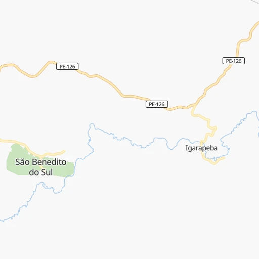
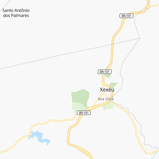
Roadmap (route) to go from Florestal to Estância detailed above, you can also see the course layout on the map.
While doing trip Florestal - Estância by car, the calculated route ends at a distance , or more straight.
Distance and duration of the route between Florestal and Estância
Calculation of distance and route from Estância to Florestal :
322.2411.6 km6h16mn
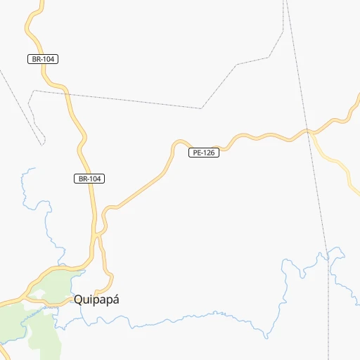
Continue 0h0mn 131 mTurn left 0h4mn 1.8 kmTurn sharp left 0h1mn 1.1 kmTurn right onto Rua Coronel Cavalcante 0h0mn 261 mTurn sharp right onto Estrada para Igarapeba 0h3mn 2.7 kmTurn left onto PE-126 0h16mn 17.9 kmTurn left onto BR-104 1h51mn 58.8 kmKeep right onto Rua Prado Omena 0h1mn 918 mTurn left onto Rua Marechal Castelo Branco 0h0mn 68 mTurn right 0h0mn 120 mTurn right 0h0mn 115 mTurn sharp left 0h0mn 80 mTurn sharp right 0h1mn 551 mKeep left 0h2mn 797 mTurn left 0h12mn 5.8 kmTurn right 0h25mn 12.7 kmTurn left onto AL-440 0h10mn 5.1 kmTurn left onto AL-440, AL-210 0h9mn 11.3 kmKeep right onto AL-440 0h0mn 87 mContinue onto BR-316 0h29mn 34.0 kmAt roundabout, take exit 2 onto AL-110 0h26mn 30.4 kmAt roundabout, take exit 2 onto Rodovia Geraldo Cavalcante Cajueiro 0h25mn 26.8 kmTurn right 0h0mn 259 mContinue 1h20mn 99.5 kmTurn slight right onto Rodovia Governador Mário Covas 0h21mn 24.7 kmContinue onto Rodovia Governador Mário Covas 0h13mn 15.2 kmKeep right onto Rodovia Governador Mário Covas and take BR-101 toward São Cristóvão, Estância, Salvador 1h41mn 58.0 kmTurn left 0h0mn 35 mTurn right onto Avenida Raimundo Silveira Souza 0h2mn 1.4 kmTurn left onto Rua A 0h0mn 8 mTurn right onto Avenida Raimundo Silveira Souza 0h1mn 924 mTurn right 0h0mn 6 mContinue onto Rua Joaquim Calazans 0h0mn 57 mArrive at destination 0h0mn 0 m
Travel from Florestal (Sergipe) to a selection of major cities.
Distances from Florestal to biggest cities in Pernambuco
- Belo Jardim,49,922 inhabitants.81 km
- Escada,48,083 inhabitants.87 km
- Moreno,45,237 inhabitants.115 km
- Timbauba,45,121 inhabitants.158 km
- Goiana,43,980 inhabitants.169 km
- Limoeiro,42,328 inhabitants.114 km
- Salgueiro,42,152 inhabitants.368 km
- Pesqueira,41,896 inhabitants.105 km
- Palmares,41,679 inhabitants.34 km
- Sirinhaem,40,852 inhabitants.86 km
- Araripina,38,569 inhabitants.529 km
- Barreiros,35,565 inhabitants.75 km
- Surubim,34,580 inhabitants.110 km
- Ribeirao,29,818 inhabitants.63 km
- Ouricuri,29,317 inhabitants.476 km
- Bom Conselho,27,800 inhabitants.98 km
- Brejo da Madre de Deus,27,369 inhabitants.93 km
- Nazare da Mata,26,485 inhabitants.139 km
- Lajedo,25,261 inhabitants.53 km
- Afogados da Ingazeira,25,060 inhabitants.228 km
Other major cities in country :
- Campo Grande [11], 729,151 inhabitants. 2,397 km
- Osasco [27], 677,856 inhabitants. 2,010 km
- Santo Andre [27], 662,373 inhabitants. 2,006 km
- Joao Pessoa [17], 650,883 inhabitants. 219 km
- Contagem [15], 627,123 inhabitants. 1,519 km
- Ribeirao Preto [27], 619,746 inhabitants. 1,880 km
- Sao Jose dos Campos [27], 613,764 inhabitants. 1,923 km
- Uberlandia [15], 563,536 inhabitants. 1,749 km
- Sorocaba [27], 558,862 inhabitants. 2,049 km
- Cuiaba [14], 521,934 inhabitants. 2,325 km
- Aparecida de Goiania [29], 510,770 inhabitants. 1,702 km
- Aracaju [28], 490,175 inhabitants. 268 km
- Feira de Santana [05], 481,911 inhabitants. 512 km
- Londrina [18], 471,832 inhabitants. 2,294 km
- Juiz de Fora [15], 470,193 inhabitants. 1,649 km
- Belford Roxo [21], 466,096 inhabitants. 1,749 km
- Joinville [26], 461,304 inhabitants. 2,381 km
- Niteroi [21], 456,456 inhabitants. 1,746 km
- Sao Joao de Meriti [21], 454,849 inhabitants. 1,751 km
- Ananindeua [16], 433,956 inhabitants. 1,615 km
Route from Estância to major cities (Brazil).
- Distance Estância Sao Paulo1,679 km
- Distance Estância Rio de Janeiro1,432 km
- Distance Estância Salvador223 km
- Distance Estância Fortaleza849 km
- Distance Estância Belo Horizonte1,188 km
- Distance Estância Brasilia1,241 km
- Distance Estância Curitiba2,009 km
- Distance Estância Manaus2,653 km
- Distance Estância Recife455 km
- Distance Estância Belem1,640 km
- Distance Estância Porto Alegre2,530 km
- Distance Estância Goiania1,411 km
- Distance Estância Guarulhos1,665 km
- Distance Estância Campinas1,650 km
- Distance Estância Nova Iguacu1,430 km
- Distance Estância Maceio258 km
- Distance Estância Sao Luis1,233 km
- Distance Estância Duque de Caxias1,426 km
- Distance Estância Natal657 km
- Distance Estância Teresina907 km
Nearest cities to Florestal :
- Recife, 1,478,098 inhabitants. 138 km
- Maceio, 954,991 inhabitants. 96 km
- Jaboatao, 702,621 inhabitants. 119 km
- Joao Pessoa, 650,883 inhabitants. 219 km
- Jaboatao dos Guararapes, 630,008 inhabitants. 122 km
- Aracaju, 490,175 inhabitants. 268 km
- Olinda, 366,754 inhabitants. 143 km
- Campina Grande, 348,936 inhabitants. 177 km
- Paulista, 289,971 inhabitants. 147 km
- Caruaru, 235,371 inhabitants. 61 km
- Arapiraca, 166,562 inhabitants. 136 km
- Nossa Senhora do Socorro, 163,993 inhabitants. 266 km
- Parnamirim, 150,343 inhabitants. 330 km
- Cabo, 143,105 inhabitants. 109 km
- Santa Rita, 119,893 inhabitants. 213 km
- Garanhuns, 110,085 inhabitants. 70 km
- Vitoria de Santo Antao, 107,383 inhabitants. 100 km
- Patos, 92,575 inhabitants. 253 km
- Bayeux, 91,056 inhabitants. 215 km
- Sao Lourenco da Mata, 88,416 inhabitants. 130 km
- Igarassu, 86,457 inhabitants. 152 km
- Paulo Afonso, 85,350 inhabitants. 266 km
- Abreu e Lima, 81,959 inhabitants. 146 km
- Santa Cruz do Capibaribe, 76,450 inhabitants. 103 km
- Sao Cristovao, 71,539 inhabitants. 285 km
- Carpina, 70,689 inhabitants. 127 km
- Itabaiana, 63,888 inhabitants. 269 km
- Rio Largo, 63,387 inhabitants. 74 km
- Gravata, 61,249 inhabitants. 76 km
- Arcoverde, 57,163 inhabitants. 138 km
- Estancia, 55,654 inhabitants. 323 km
- Caico, 54,934 inhabitants. 296 km
- Cabedelo, 54,839 inhabitants. 234 km
- Ipojuca, 53,364 inhabitants. 100 km
- Bezerros, 51,436 inhabitants. 65 km
- Serra Talhada, 51,203 inhabitants. 283 km
- Marechal Deodoro, 50,571 inhabitants. 100 km
- Belo Jardim, 49,922 inhabitants. 81 km
- Escada, 48,083 inhabitants. 87 km
- Sousa, 47,927 inhabitants. 347 km
- Lagarto, 45,445 inhabitants. 305 km
- Moreno, 45,237 inhabitants. 115 km
- Timbauba, 45,121 inhabitants. 158 km
- Goiana, 43,980 inhabitants. 169 km
- Cajazeiras, 43,913 inhabitants. 366 km
- Guarabira, 43,749 inhabitants. 222 km
- Limoeiro, 42,328 inhabitants. 114 km
- Penedo, 42,097 inhabitants. 182 km
- Pesqueira, 41,896 inhabitants. 105 km
- Palmares, 41,679 inhabitants. 34 km
Location Florestal (Pernambuco) :
| Country flag |  |
| Location | Florestal |
| State | Pernambuco |
| County | São Benedito do Sul |
| Country | Brazil |
| Country code / ISO 2 | BR |
| Latitude | -8.8166700 |
| Longitude | -35.8666700 |
| Altitude | 0 meters |
| Time zone | America/Maceio |
Location Estância (Sergipe) :
| Country flag | |
| Location | Estância |
| State | Sergipe |
| County | Estância |
| Country | Brazil |
| Country code / ISO 2 | BR |
| Latitude | -11.2683300 |
| Longitude | -37.4383300 |
| Altitude | 0 meters |
| Time zone | America/Maceio |