


How to get from Santa Teresinha (Ceará) to São Gonçalo do Amarante (Ceará)
Calculate route from Santa Teresinha (Ceará, Brazil) to São Gonçalo do Amarante (Ceará, Brazil).
The flight distance (as the crow flies) between Santa Teresinha and São Gonçalo do Amarante is 242.9 km.
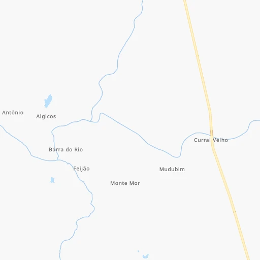
Roadmap (route) to go from Santa Teresinha to São Gonçalo do Amarante detailed above, you can also see the course layout on the map.
While doing trip Santa Teresinha - São Gonçalo do Amarante by car, the calculated route ends at a distance , or more straight.
Distance and duration of the route between Santa Teresinha and São Gonçalo do Amarante
Calculation of distance and route from São Gonçalo do Amarante to Santa Teresinha :
242.9295.0 km5h12mn
Continue 0h7mn 2.1 kmKeep left 0h1mn 425 mTurn slight left 0h0mn 136 mKeep right 0h1mn 555 mKeep left 0h8mn 4.2 kmKeep left 0h0mn 23 mTurn left 0h3mn 1.6 kmTurn slight left onto Rodovia Governador César Cals de Oliveira Filho 0h9mn 10.1 kmKeep right 0h23mn 27.7 kmTurn sharp left onto Rua Germano Farias Sales 0h0mn 346 mContinue onto CE-176 1h53mn 63.7 kmTurn left onto Rua Francisco Martins Filho 0h0mn 426 mAt roundabout, take exit 1 onto Avenida Coronel Manoel Alves 0h1mn 1.1 kmAt roundabout, take exit 1 onto Rua Professor Otávio Terceiro de Farias 1h48mn 56.9 kmTurn left 0h6mn 3.0 kmTurn right 0h10mn 5.1 kmTurn right 0h0mn 51 mTurn left 0h6mn 3.0 kmKeep left 0h3mn 1.4 kmTurn left onto Estrada José Hugo Câmara Monteiro Coêlho 0h9mn 4.4 kmContinue onto Estrada José Hugo Câmara Monteiro Coêlho 0h0mn 224 mContinue onto Estrada José Hugo Câmara Monteiro Coêlho 0h3mn 1.6 kmKeep right 0h13mn 6.5 kmKeep right 0h2mn 1.2 kmTurn right 0h0mn 13 mKeep left 0h0mn 36 mTurn left 0h10mn 5.0 kmKeep left 0h0mn 47 mTurn left 0h0mn 12 mKeep left 0h3mn 1.3 kmKeep right 0h1mn 360 mTurn slight right onto CE-168 0h8mn 7.9 kmAt roundabout, take exit 3 onto Rodovia Deputado José Firmo de Aguiar 0h12mn 12.2 kmTurn left onto Rua Vicente Alves 0h0mn 17 mTurn right onto Rua Frederico Ferreira Pontes 0h1mn 626 mTurn right onto Rua Julião Pinto de Mesquita 0h1mn 511 mTurn left onto Rodovia Deputado José Firmo de Aguiar 0h29mn 28.3 kmContinue onto Rodovia Deputado Jackson Pereira 0h18mn 20.0 kmKeep right 0h13mn 15.7 kmKeep left 0h1mn 292 mTurn left onto Rua Tália Liberdade 0h5mn 5.5 kmTurn left onto Avenida Coronel Neco Martins 0h2mn 1.5 kmArrive at destination 0h0mn 0 m
Travel from Santa Teresinha (Ceará) to a selection of major cities.
Distances from Santa Teresinha to biggest cities in Ceará
- Morada Nova,37,389 inhabitants.247 km
- Eusebio,37,289 inhabitants.272 km
- Beberibe,37,025 inhabitants.291 km
- Quixeramobim,34,321 inhabitants.146 km
- Barbalha,33,943 inhabitants.288 km
- Itapage,32,043 inhabitants.190 km
- Itaitinga,30,938 inhabitants.260 km
- Limoeiro do Norte,29,449 inhabitants.278 km
- Sao Joao dos Inhamuns,29,188 inhabitants.110 km
- Acarau,28,389 inhabitants.249 km
- Ico,28,323 inhabitants.243 km
- Brejo Santo,27,384 inhabitants.324 km
- Ipu,26,678 inhabitants.84 km
- Granja,25,879 inhabitants.218 km
- Boa Viagem,24,671 inhabitants.96 km
- Acopiara,24,561 inhabitants.171 km
- Santa Quiteria,24,391 inhabitants.95 km
- Sao Goncalo do Amarante,23,583 inhabitants.243 km
- Trairi,23,126 inhabitants.248 km
- Jaguaribe,23,065 inhabitants.238 km
Other major cities in country :
- Campo Grande [11], 729,151 inhabitants. 2,289 km
- Jaboatao [30], 702,621 inhabitants. 709 km
- Osasco [27], 677,856 inhabitants. 2,160 km
- Santo Andre [27], 662,373 inhabitants. 2,166 km
- Joao Pessoa [17], 650,883 inhabitants. 675 km
- Jaboatao dos Guararapes [30], 630,008 inhabitants. 705 km
- Contagem [15], 627,123 inhabitants. 1,697 km
- Ribeirao Preto [27], 619,746 inhabitants. 1,955 km
- Sao Jose dos Campos [27], 613,764 inhabitants. 2,095 km
- Uberlandia [15], 563,536 inhabitants. 1,753 km
- Sorocaba [27], 558,862 inhabitants. 2,180 km
- Cuiaba [14], 521,934 inhabitants. 2,060 km
- Aparecida de Goiania [29], 510,770 inhabitants. 1,613 km
- Aracaju [28], 490,175 inhabitants. 758 km
- Feira de Santana [05], 481,911 inhabitants. 821 km
- Londrina [18], 471,832 inhabitants. 2,326 km
- Juiz de Fora [15], 470,193 inhabitants. 1,882 km
- Belford Roxo [21], 466,096 inhabitants. 1,993 km
- Joinville [26], 461,304 inhabitants. 2,522 km
- Niteroi [21], 456,456 inhabitants. 2,002 km
Route from São Gonçalo do Amarante to major cities (Brazil).
- Distance São Gonçalo do Amarante Sao Paulo2,368 km
- Distance São Gonçalo do Amarante Rio de Janeiro2,196 km
- Distance São Gonçalo do Amarante Salvador1,044 km
- Distance São Gonçalo do Amarante Belo Horizonte1,894 km
- Distance São Gonçalo do Amarante Brasilia1,673 km
- Distance São Gonçalo do Amarante Curitiba2,667 km
- Distance São Gonçalo do Amarante Manaus2,341 km
- Distance São Gonçalo do Amarante Recife671 km
- Distance São Gonçalo do Amarante Belem1,087 km
- Distance São Gonçalo do Amarante Porto Alegre3,213 km
- Distance São Gonçalo do Amarante Goiania1,839 km
- Distance São Gonçalo do Amarante Guarulhos2,355 km
- Distance São Gonçalo do Amarante Campinas2,318 km
- Distance São Gonçalo do Amarante Nova Iguacu2,186 km
- Distance São Gonçalo do Amarante Maceio763 km
- Distance São Gonçalo do Amarante Sao Luis605 km
- Distance São Gonçalo do Amarante Duque de Caxias2,186 km
- Distance São Gonçalo do Amarante Natal483 km
- Distance São Gonçalo do Amarante Teresina456 km
- Distance São Gonçalo do Amarante Sao Bernardo do Campo2,381 km
Nearest cities to Santa Teresinha :
- Fortaleza, 2,400,000 inhabitants. 273 km
- Teresina, 744,512 inhabitants. 244 km
- Caucaia, 275,019 inhabitants. 262 km
- Juazeiro do Norte, 225,230 inhabitants. 278 km
- Maracanau, 193,529 inhabitants. 256 km
- Sobral, 157,996 inhabitants. 156 km
- Caxias, 148,072 inhabitants. 307 km
- Parnaiba, 138,008 inhabitants. 274 km
- Timon, 124,427 inhabitants. 248 km
- Crato, 88,786 inhabitants. 275 km
- Iguatu, 70,380 inhabitants. 204 km
- Aquiraz, 65,116 inhabitants. 277 km
- Picos, 57,495 inhabitants. 243 km
- Itapipoca, 55,784 inhabitants. 209 km
- Pacatuba, 55,291 inhabitants. 251 km
- Crateus, 52,933 inhabitants. 15 km
- Cascavel, 52,357 inhabitants. 282 km
- Serra Talhada, 51,203 inhabitants. 413 km
- Horizonte, 51,171 inhabitants. 258 km
- Quixada, 49,328 inhabitants. 176 km
- Floriano, 48,587 inhabitants. 328 km
- Sousa, 47,927 inhabitants. 323 km
- Tiangua, 45,696 inhabitants. 155 km
- Piripiri, 44,864 inhabitants. 158 km
- Camocim, 44,481 inhabitants. 242 km
- Aracati, 44,293 inhabitants. 319 km
- Cajazeiras, 43,913 inhabitants. 304 km
- Caninde, 42,720 inhabitants. 163 km
- Pacajus, 41,558 inhabitants. 257 km
- Chapadinha, 40,804 inhabitants. 340 km
- Russas, 39,465 inhabitants. 291 km
- Araripina, 38,569 inhabitants. 280 km
- Morada Nova, 37,389 inhabitants. 247 km
- Eusebio, 37,289 inhabitants. 272 km
- Beberibe, 37,025 inhabitants. 291 km
- Coelho Neto, 36,184 inhabitants. 282 km
- Quixeramobim, 34,321 inhabitants. 146 km
- Barbalha, 33,943 inhabitants. 288 km
- Itapage, 32,043 inhabitants. 190 km
- Campo Maior, 31,739 inhabitants. 176 km
- Itaitinga, 30,938 inhabitants. 260 km
- Limoeiro do Norte, 29,449 inhabitants. 278 km
- Ouricuri, 29,317 inhabitants. 319 km
- Sao Joao dos Inhamuns, 29,188 inhabitants. 110 km
- Altos, 28,768 inhabitants. 206 km
- Acarau, 28,389 inhabitants. 249 km
- Ico, 28,323 inhabitants. 243 km
- Brejo Santo, 27,384 inhabitants. 324 km
- Ipu, 26,678 inhabitants. 84 km
- Granja, 25,879 inhabitants. 218 km
Location Santa Teresinha (Ceará) :
| Country flag |  |
| Location | Santa Teresinha |
| State | Ceará |
| County | Crateús |
| Country | Brazil |
| Country code / ISO 2 | BR |
| Latitude | -5.0666700 |
| Longitude | -40.6000000 |
| Altitude | 0 meters |
| Time zone | America/Fortaleza |
Location São Gonçalo do Amarante (Ceará) :
| Country flag | |
| Location | São Gonçalo do Amarante |
| State | Ceará |
| County | São Gonçalo do Amarante |
| Country | Brazil |
| Country code / ISO 2 | BR |
| Latitude | -3.6072200 |
| Longitude | -38.9683300 |
| Altitude | 0 meters |
| Time zone | America/Fortaleza |
