


How to get from Araplı İstasyonu (Kayseri) to İskenderun (Hatay)
Calculate route from Araplı İstasyonu (Kayseri, Turkey) to İskenderun (Hatay, Turkey).
The flight distance (as the crow flies) between Araplı İstasyonu and İskenderun is 208.7 km.
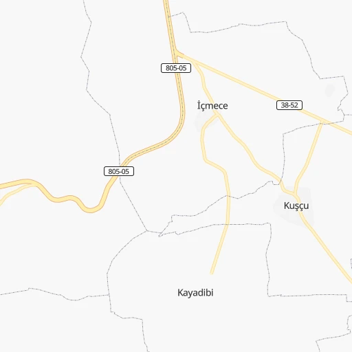
Roadmap (route) to go from Araplı İstasyonu to İskenderun detailed above, you can also see the course layout on the map.
While doing trip Araplı İstasyonu - İskenderun by car, the calculated route ends at a distance , or more straight.
Distance and duration of the route between Araplı İstasyonu and İskenderun
Calculation of distance and route from İskenderun to Araplı İstasyonu :
208.7344.2 km3h23mn
Continue 0h2mn 490 mTurn right 0h2mn 459 mTurn right onto 805-05 0h24mn 27.8 kmKeep right onto D805 0h5mn 6.1 kmAt roundabout, take exit 2 onto Kayseri-Niğde yolu 0h0mn 565 mKeep right 0h1mn 967 mKeep left 1h18mn 146.1 kmKeep left onto Tarsus Doğu Kavşağı toward O-51 0h8mn 14.2 kmKeep left onto Adana-Erdemli Otoyolu 1h30mn 59.3 kmKeep left onto O-52 0h10mn 18.9 kmKeep right onto Ceyhan-İskenderun Otoyolu 1h38mn 64.1 kmKeep right 0h1mn 1.1 kmTurn left 0h3mn 3.4 kmKeep right 0h0mn 347 mKeep right 0h0mn 285 mTurn sharp left 0h0mn 140 mTurn right 0h0mn 34 mTurn left 0h0mn 28 mArrive at destination 0h0mn 0 m
Travel from Araplı İstasyonu (Hatay) to a selection of major cities.
Distances from Araplı İstasyonu to biggest cities in Kayseri
Other major cities in country :
- Malatya [44], 441,805 inhabitants. 286 km
- Sultangazi [34], 436,935 inhabitants. 618 km
- Maltepe [34], 427,040 inhabitants. 588 km
- Erzurum [25], 420,691 inhabitants. 569 km
- Samsun [55], 394,050 inhabitants. 356 km
- Batman [76], 381,990 inhabitants. 535 km
- Kahramanmaras [46], 376,045 inhabitants. 180 km
- Van [65], 371,713 inhabitants. 728 km
- Atasehir [34], 361,615 inhabitants. 593 km
- Sisli [34], 314,684 inhabitants. 607 km
- Denizli [20], 313,238 inhabitants. 525 km
- Batikent [68], 300,000 inhabitants. 278 km
- Elazig [23], 298,004 inhabitants. 367 km
- Zeytinburnu [34], 288,743 inhabitants. 609 km
- Adapazari [54], 286,787 inhabitants. 489 km
- Sultanbeyli [34], 286,622 inhabitants. 581 km
- Gebze [41], 281,436 inhabitants. 560 km
- Merkezefendi [20], 280,341 inhabitants. 529 km
- Sivas [58], 264,022 inhabitants. 239 km
- Tarsus [32], 256,482 inhabitants. 148 km
Route from İskenderun to major cities (Turkey).
- Distance İskenderun Istanbul797 km
- Distance İskenderun Ankara471 km
- Distance İskenderun Izmir823 km
- Distance İskenderun Bursa739 km
- Distance İskenderun Adana88 km
- Distance İskenderun Gaziantep120 km
- Distance İskenderun Konya357 km
- Distance İskenderun Cankaya470 km
- Distance İskenderun Antalya490 km
- Distance İskenderun Bagcilar805 km
- Distance İskenderun Diyarbakir388 km
- Distance İskenderun Kayseri246 km
- Distance İskenderun UEskuedar792 km
- Distance İskenderun Bahcelievler802 km
- Distance İskenderun Umraniye785 km
- Distance İskenderun Mersin139 km
- Distance İskenderun Esenler804 km
- Distance İskenderun Eskisehir609 km
- Distance İskenderun Karabaglar822 km
- Distance İskenderun Muratpasa484 km
Nearest cities to Araplı İstasyonu :
- Ankara, 3,517,182 inhabitants. 266 km
- Adana, 1,248,988 inhabitants. 140 km
- Gaziantep, 1,065,975 inhabitants. 244 km
- Konya, 875,530 inhabitants. 228 km
- Cankaya, 792,189 inhabitants. 266 km
- Kayseri, 592,840 inhabitants. 67 km
- Mersin, 537,842 inhabitants. 163 km
- Kahramanmaras, 376,045 inhabitants. 180 km
- Batikent, 300,000 inhabitants. 278 km
- Sivas, 264,022 inhabitants. 239 km
- Tarsus, 256,482 inhabitants. 148 km
- Kirikkale, 211,138 inhabitants. 223 km
- Antakya, 210,000 inhabitants. 247 km
- Osmaniye, 202,837 inhabitants. 167 km
- Corum, 183,418 inhabitants. 257 km
- Iskenderun, 159,965 inhabitants. 209 km
- Aksaray, 152,201 inhabitants. 91 km
- Tokat, 129,702 inhabitants. 265 km
- Karaman, 120,399 inhabitants. 200 km
- Ordu, 116,788 inhabitants. 390 km
- Turhal, 110,884 inhabitants. 255 km
- Karabuk, 97,481 inhabitants. 390 km
- Ceyhan, 96,303 inhabitants. 151 km
- Kirsehir, 94,336 inhabitants. 127 km
- Polatli, 93,262 inhabitants. 292 km
- Eregli, 92,117 inhabitants. 119 km
- Nigde, 91,039 inhabitants. 44 km
- Kozan, 88,115 inhabitants. 110 km
- Yozgat, 87,881 inhabitants. 177 km
- Amasya, 82,896 inhabitants. 277 km
- Nizip, 82,308 inhabitants. 278 km
- Kilis, 82,301 inhabitants. 249 km
- Fatsa, 82,160 inhabitants. 375 km
- Elbistan, 80,456 inhabitants. 188 km
- UEnye, 77,585 inhabitants. 375 km
- Nevsehir, 75,527 inhabitants. 52 km
- Silifke, 75,315 inhabitants. 229 km
- Khanjarah, 71,379 inhabitants. 290 km
- Kadirli, 70,248 inhabitants. 133 km
- Sorgun, 62,862 inhabitants. 175 km
- Cubuk, 62,602 inhabitants. 282 km
- Kirikhan, 60,916 inhabitants. 226 km
- Anamur, 57,128 inhabitants. 311 km
- Reyhanli, 56,995 inhabitants. 257 km
- Dortyol, 56,513 inhabitants. 188 km
- Zile, 55,680 inhabitants. 241 km
- Erbaa, 52,185 inhabitants. 300 km
- Merzifon, 50,658 inhabitants. 295 km
- Carsamba, 50,459 inhabitants. 359 km
- Niksar, 49,865 inhabitants. 309 km
Location Araplı İstasyonu (Kayseri) :
| Country flag |  |
| Location | Araplı İstasyonu |
| State | Kayseri |
| County | |
| Country | Turkey |
| Country code / ISO 2 | TR |
| Latitude | 38.2391300 |
| Longitude | 35.0476400 |
| Altitude | 0 meters |
| Time zone | Europe/Istanbul |
Location İskenderun (Hatay) :
| Country flag | |
| Location | İskenderun |
| State | Hatay |
| County | |
| Country | Turkey |
| Country code / ISO 2 | TR |
| Latitude | 36.5871800 |
| Longitude | 36.1734700 |
| Altitude | 0 meters |
| Time zone | Europe/Istanbul |


