


How to get from Bağıştaş İstasyonu (Erzincan) to Erbaa (Tokat)
Calculate route from Bağıştaş İstasyonu (Erzincan, Turkey) to Erbaa (Tokat, Turkey).
The flight distance (as the crow flies) between Bağıştaş İstasyonu and Erbaa is 211.1 km.
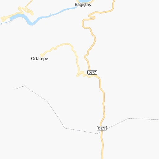
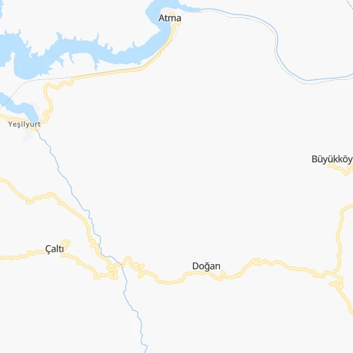
Roadmap (route) to go from Bağıştaş İstasyonu to Erbaa detailed above, you can also see the course layout on the map.
While doing trip Bağıştaş İstasyonu - Erbaa by car, the calculated route ends at a distance , or more straight.
Distance and duration of the route between Bağıştaş İstasyonu and Erbaa
Calculation of distance and route from Erbaa to Bağıştaş İstasyonu :
211.1300.0 km5h34mn
Continue 0h2mn 1.8 kmTurn right 0h1mn 336 mTurn sharp left onto Kemaliye - İliç yolu 0h1mn 1.2 kmAt roundabout, take exit 1 0h6mn 6.3 kmAt roundabout, take exit 2 0h2mn 2.9 kmAt roundabout, take exit 2 0h1mn 1.6 kmAt roundabout, take exit 2 0h4mn 4.9 kmAt roundabout, take exit 1 onto İliç - Refahiye yolu 0h2mn 1.9 kmAt roundabout, take exit 3 onto D877 0h3mn 3.4 kmAt roundabout, take exit 1 onto D877 0h2mn 2.2 kmAt roundabout, take exit 2 onto D877 0h4mn 4.7 kmAt roundabout, take exit 2 onto D877 0h5mn 5.4 kmAt roundabout, take exit 3 0h2mn 1.7 kmKeep right 0h6mn 4.7 kmKeep right 0h2mn 1.9 kmKeep right 0h1mn 520 mKeep left 0h4mn 3.1 kmKeep left 0h8mn 6.8 kmTurn right 0h16mn 13.1 kmKeep left 0h16mn 13.2 kmTurn left onto Sivas-Erzincan yolu 0h6mn 10.7 kmTurn right 0h0mn 388 mTurn right 0h0mn 11 mTurn left 0h0mn 174 mKeep right 0h0mn 13 mKeep right 0h0mn 17 mKeep right 0h0mn 55 mTurn slight right onto İmranlı - Suşehri yolu 0h22mn 22.5 kmKeep left onto 58-11 0h0mn 73 mContinue onto İmranlı - Suşehri yolu 0h19mn 18.7 kmTurn right onto Samsun-Erzincan yolu 0h1mn 827 mAt roundabout, take exit 2 onto Samsun-Erzincan yolu 0h5mn 5.6 kmAt roundabout, take exit 2 onto Samsun-Erzincan yolu 0h4mn 4.5 kmAt roundabout, take exit 1 onto Samsun-Erzincan yolu 0h15mn 18.8 kmAt roundabout, take exit 1 onto Tokat-Ercincan yolu 0h14mn 17.4 kmAt roundabout, take exit 1 onto Tokat-Ercincan yolu 0h6mn 6.5 kmAt roundabout, take exit 1 onto Amasya-Erzincan Yolu 0h10mn 11.2 kmAt roundabout, take exit 1 onto Amasya-Erzincan Yolu 0h7mn 7.9 kmAt roundabout, take exit 1 onto D100 0h4mn 5.1 kmAt roundabout, take exit 2 onto D100 0h4mn 4.3 kmKeep right onto D100 0h2mn 2.9 kmKeep right onto D100 0h5mn 5.6 kmContinue onto Amasya-Erzincan Yolu 0h1mn 1.1 kmContinue onto Amasya-Erzincan Yolu 0h9mn 10.4 kmContinue onto Amasya-Erzincan Yolu 0h6mn 6.7 kmContinue onto Ercincan - Amasya yolu 0h2mn 2.4 kmAt roundabout, take exit 2 onto Ercincan - Amasya yolu 0h10mn 11.3 kmAt roundabout, take exit 1 onto Amasya-Erzincan Yolu 0h29mn 37.8 kmAt roundabout, take exit 1 onto Amasya-Erzincan Yolu 0h1mn 1.5 kmKeep right onto Amasya-Erzincan Yolu 0h1mn 1.3 kmAt roundabout, take exit 2 0h2mn 1.5 kmTurn right onto Alişan Diktaş Caddesi 0h0mn 331 mTurn slight right onto Gazi Bulvarı 0h0mn 34 mKeep right onto Gazi Bulvarı 0h0mn 260 mKeep right onto Gazi Bulvarı 0h1mn 467 mTurn right 0h0mn 84 mTurn left 0h0mn 105 mArrive at destination 0h0mn 0 m
Travel from Bağıştaş İstasyonu (Tokat) to a selection of major cities.
Distances from Bağıştaş İstasyonu to biggest cities in Erzincan
Other major cities in country :
- Sanliurfa [63], 449,549 inhabitants. 254 km
- Malatya [44], 441,805 inhabitants. 121 km
- Sultangazi [34], 436,935 inhabitants. 835 km
- Maltepe [34], 427,040 inhabitants. 808 km
- Erzurum [25], 420,691 inhabitants. 248 km
- Samsun [55], 394,050 inhabitants. 273 km
- Batman [76], 381,990 inhabitants. 290 km
- Kahramanmaras [46], 376,045 inhabitants. 245 km
- Van [65], 371,713 inhabitants. 439 km
- Atasehir [34], 361,615 inhabitants. 812 km
- Sisli [34], 314,684 inhabitants. 824 km
- Denizli [20], 313,238 inhabitants. 835 km
- Batikent [68], 300,000 inhabitants. 494 km
- Elazig [23], 298,004 inhabitants. 108 km
- Zeytinburnu [34], 288,743 inhabitants. 830 km
- Adapazari [54], 286,787 inhabitants. 701 km
- Sultanbeyli [34], 286,622 inhabitants. 799 km
- Gebze [41], 281,436 inhabitants. 783 km
- Merkezefendi [20], 280,341 inhabitants. 838 km
- Sivas [58], 264,022 inhabitants. 128 km
Route from Erbaa to major cities (Turkey).
- Distance Erbaa Istanbul642 km
- Distance Erbaa Ankara326 km
- Distance Erbaa Izmir847 km
- Distance Erbaa Bursa638 km
- Distance Erbaa Adana422 km
- Distance Erbaa Gaziantep408 km
- Distance Erbaa Konya470 km
- Distance Erbaa Cankaya325 km
- Distance Erbaa Antalya659 km
- Distance Erbaa Bagcilar650 km
- Distance Erbaa Diyarbakir439 km
- Distance Erbaa Kayseri235 km
- Distance Erbaa UEskuedar636 km
- Distance Erbaa Bahcelievler650 km
- Distance Erbaa Umraniye628 km
- Distance Erbaa Mersin461 km
- Distance Erbaa Esenler649 km
- Distance Erbaa Eskisehir523 km
- Distance Erbaa Karabaglar849 km
- Distance Erbaa Muratpasa656 km
Nearest cities to Bağıştaş İstasyonu :
- Gaziantep, 1,065,975 inhabitants. 280 km
- Diyarbakir, 644,763 inhabitants. 228 km
- Kayseri, 592,840 inhabitants. 268 km
- Sanliurfa, 449,549 inhabitants. 254 km
- Malatya, 441,805 inhabitants. 121 km
- Erzurum, 420,691 inhabitants. 248 km
- Samsun, 394,050 inhabitants. 273 km
- Batman, 381,990 inhabitants. 290 km
- Kahramanmaras, 376,045 inhabitants. 245 km
- Elazig, 298,004 inhabitants. 108 km
- Sivas, 264,022 inhabitants. 128 km
- Trabzon, 244,083 inhabitants. 206 km
- Adiyaman, 223,744 inhabitants. 187 km
- Osmaniye, 202,837 inhabitants. 326 km
- Siverek, 175,341 inhabitants. 201 km
- Iskenderun, 159,965 inhabitants. 375 km
- Viransehir, 154,163 inhabitants. 271 km
- Kiziltepe, 150,174 inhabitants. 311 km
- Tokat, 129,702 inhabitants. 189 km
- Ordu, 116,788 inhabitants. 178 km
- Erzincan, 114,027 inhabitants. 95 km
- Turhal, 110,884 inhabitants. 229 km
- Giresun, 98,864 inhabitants. 165 km
- Ceyhan, 96,303 inhabitants. 354 km
- Bafra, 92,944 inhabitants. 321 km
- Rize, 92,772 inhabitants. 249 km
- Nusaybin, 88,977 inhabitants. 357 km
- Kozan, 88,115 inhabitants. 318 km
- Amasya, 82,896 inhabitants. 261 km
- Nizip, 82,308 inhabitants. 276 km
- Kilis, 82,301 inhabitants. 325 km
- Fatsa, 82,160 inhabitants. 195 km
- Bingol, 80,568 inhabitants. 186 km
- Elbistan, 80,456 inhabitants. 175 km
- UEnye, 77,585 inhabitants. 213 km
- Midyat, 76,268 inhabitants. 337 km
- Bismil, 74,493 inhabitants. 261 km
- Kahta, 73,105 inhabitants. 184 km
- Mardin, 71,373 inhabitants. 309 km
- Kadirli, 70,248 inhabitants. 308 km
- Ardesen, 67,965 inhabitants. 291 km
- Silvan, 65,956 inhabitants. 265 km
- Kirikhan, 60,916 inhabitants. 375 km
- Dortyol, 56,513 inhabitants. 348 km
- Zile, 55,680 inhabitants. 240 km
- Ergani, 52,684 inhabitants. 172 km
- Erbaa, 52,185 inhabitants. 211 km
- Merzifon, 50,658 inhabitants. 301 km
- Carsamba, 50,459 inhabitants. 245 km
- Niksar, 49,865 inhabitants. 182 km
Location Bağıştaş İstasyonu (Erzincan) :
| Country flag |  |
| Location | Bağıştaş İstasyonu |
| State | Erzincan |
| County | |
| Country | Turkey |
| Country code / ISO 2 | TR |
| Latitude | 39.4343100 |
| Longitude | 38.4531800 |
| Altitude | 0 meters |
| Time zone | Europe/Istanbul |
Location Erbaa (Tokat) :
| Country flag | |
| Location | Erbaa |
| State | Tokat |
| County | |
| Country | Turkey |
| Country code / ISO 2 | TR |
| Latitude | 40.6688900 |
| Longitude | 36.5675000 |
| Altitude | 0 meters |
| Time zone | Europe/Istanbul |

