
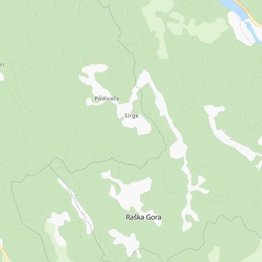

How to get from Željeznička Stanica Raška Gora (Federation of B&H) to Goražde (Federation of B&H)
Calculate route from Željeznička Stanica Raška Gora (Federation of B&H, Bosnia and Herzegovina) to Goražde (Federation of B&H, Bosnia and Herzegovina).
The flight distance (as the crow flies) between Željeznička Stanica Raška Gora and Goražde is 94.0 km.
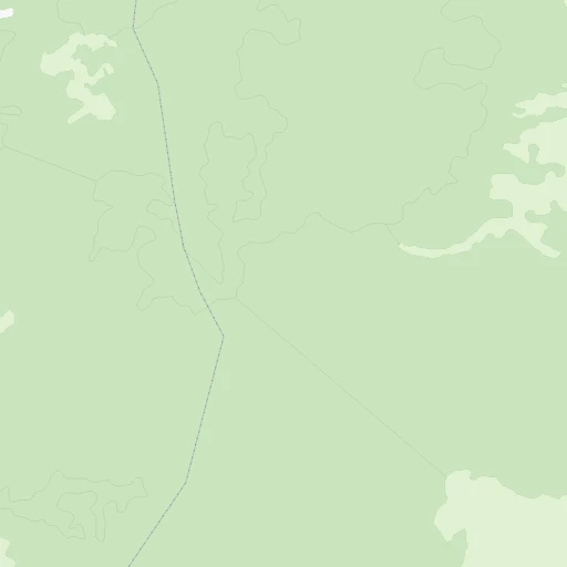
Roadmap (route) to go from Željeznička Stanica Raška Gora to Goražde detailed above, you can also see the course layout on the map.
While doing trip Željeznička Stanica Raška Gora - Goražde by car, the calculated route ends at a distance , or more straight.
Distance and duration of the route between Željeznička Stanica Raška Gora and Goražde
Calculation of distance and route from Goražde to Željeznička Stanica Raška Gora :
94.0184.9 km3h4mn
Continue 0h0mn 185 mTurn left 0h3mn 1.4 kmKeep left onto Narentabahn 0h5mn 1.2 kmTurn left 0h1mn 284 mTurn right 0h1mn 402 mTurn slight left onto M 115, M17 1h8mn 65.7 kmAt roundabout, take exit 2 0h17mn 31.2 kmKeep right and drive toward Foša, Sarajevo 0h4mn 5.1 kmAt roundabout, take exit 1 onto Safeta Zajke 0h3mn 2.2 kmAt roundabout, take exit 1 onto Alije Kučukalića 0h0mn 334 mAt roundabout, take exit 2 onto Alije Kučukalića 0h0mn 219 mTurn left onto Bulevar Meše Selimovića 0h6mn 5.5 kmKeep right onto Bentbaša 1h40mn 43.3 kmKeep right onto R-448 0h19mn 19.4 kmKeep right 0h0mn 183 mKeep right 0h0mn 232 mTurn right 0h2mn 889 mTurn sharp left 0h0mn 128 mTurn right 0h1mn 337 mTurn left 0h3mn 1.3 kmKeep right 0h1mn 268 mTurn sharp right 0h1mn 641 mTurn left 0h5mn 2.5 kmContinue onto Višegradska 0h2mn 899 mContinue onto 1. Slavne višegradske brigade 0h1mn 930 mKeep left 0h0mn 71 mTurn right onto Sinan-paše Sijerčića 0h0mn 67 mTurn right 0h0mn 40 mArrive at destination 0h0mn 0 m
Travel from Željeznička Stanica Raška Gora (Federation of B&H) to a selection of major cities.
Distances from Željeznička Stanica Raška Gora to biggest cities in Federation of B&H
Other major cities in country :
Route from Goražde to major cities (Bosnia and Herzegovina).
Nearest cities to Željeznička Stanica Raška Gora :
- Sarajevo, 696,731 inhabitants. 61 km
- Banja Luka, 221,106 inhabitants. 159 km
- Zenica, 164,423 inhabitants. 85 km
- Tuzla, 142,486 inhabitants. 139 km
- Mostar, 104,518 inhabitants. 11 km
- Bihac, 75,641 inhabitants. 221 km
- Bugojno, 41,378 inhabitants. 76 km
- Brcko, 38,968 inhabitants. 177 km
- Bijeljina, 37,692 inhabitants. 183 km
- Prijedor, 36,347 inhabitants. 195 km
- Trebinje, 33,178 inhabitants. 90 km
- Travnik, 31,127 inhabitants. 89 km
- Doboj, 27,235 inhabitants. 146 km
- Cazin, 21,741 inhabitants. 229 km
- Velika Kladusa, 19,330 inhabitants. 254 km
- Visoko, 17,890 inhabitants. 67 km
- Gorazde, 17,650 inhabitants. 94 km
- Konjic, 15,950 inhabitants. 26 km
- Gracanica, 15,758 inhabitants. 146 km
- Gradacac, 15,659 inhabitants. 167 km
- Bosanska Krupa, 15,193 inhabitants. 211 km
- Mrkonjic Grad, 14,737 inhabitants. 126 km
- Foca, 14,615 inhabitants. 75 km
- Zavidovici, 14,380 inhabitants. 115 km
- Zivinice, 13,641 inhabitants. 130 km
- Sanski Most, 13,551 inhabitants. 176 km
- Gradiska, 13,346 inhabitants. 196 km
- Bileca, 13,257 inhabitants. 78 km
- Kakanj, 12,406 inhabitants. 81 km
- Livno, 11,748 inhabitants. 81 km
- Odzak, 11,621 inhabitants. 181 km
- Stijena, 10,844 inhabitants. 222 km
- Sipovo, 10,738 inhabitants. 113 km
- Prozor, 10,349 inhabitants. 47 km
- Novi Travnik, 10,006 inhabitants. 83 km
- Ljubuski, 9,987 inhabitants. 36 km
- Kozarska Dubica, 9,959 inhabitants. 211 km
- Derventa, 9,773 inhabitants. 172 km
- Jajce, 9,763 inhabitants. 111 km
- Todorovo, 9,560 inhabitants. 240 km
- Siroki Brijeg, 9,370 inhabitants. 22 km
- Brod, 9,249 inhabitants. 190 km
- Novi Grad, 8,920 inhabitants. 215 km
- Sokolac, 8,842 inhabitants. 95 km
- Mionica, 8,701 inhabitants. 167 km
- Zepce, 8,502 inhabitants. 111 km
- Kiseljak, 8,475 inhabitants. 59 km
- Potoci, 8,312 inhabitants. 3 km
- Fojnica, 8,244 inhabitants. 59 km
- Milici, 8,210 inhabitants. 129 km
Location Željeznička Stanica Raška Gora (Federation of B&H) :
| Country flag |  |
| Location | Željeznička Stanica Raška Gora |
| State | Federation of B&H |
| County | |
| Country | Bosnia and Herzegovina |
| Country code / ISO 2 | BA |
| Latitude | 43.4347200 |
| Longitude | 17.8536100 |
| Altitude | 0 meters |
| Time zone | Europe/Sarajevo |
Location Goražde (Federation of B&H) :
| Country flag | |
| Location | Goražde |
| State | Federation of B&H |
| County | |
| Country | Bosnia and Herzegovina |
| Country code / ISO 2 | BA |
| Latitude | 43.6679500 |
| Longitude | 18.9756400 |
| Altitude | 0 meters |
| Time zone | Europe/Sarajevo |