


How to get from Azory (Łódź Voivodeship) to Jastrzębie Zdrój (Silesia)
Calculate route from Azory (Łódź Voivodeship, Poland) to Jastrzębie Zdrój (Silesia, Poland).
The flight distance (as the crow flies) between Azory and Jastrzębie Zdrój is 258.1 km.
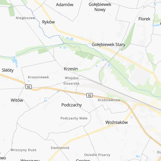
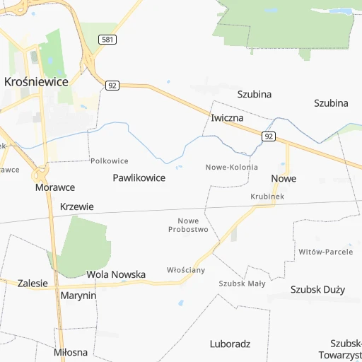
Roadmap (route) to go from Azory to Jastrzębie Zdrój detailed above, you can also see the course layout on the map.
While doing trip Azory - Jastrzębie Zdrój by car, the calculated route ends at a distance , or more straight.
Distance and duration of the route between Azory and Jastrzębie Zdrój
Calculation of distance and route from Jastrzębie Zdrój to Azory :
258.1317.0 km3h54mn
Continue 0h0mn 103 mTurn right 0h0mn 36 mTurn left 0h2mn 847 mTurn left 0h1mn 789 mTurn right 0h0mn 102 mKeep left 0h1mn 629 mTurn right onto Objazdowa 0h3mn 4.4 kmTurn right onto Łąkoszyńska 0h18mn 18.8 kmTurn left onto Rynek 0h1mn 547 mAt roundabout, take exit 3 onto Łowicka 0h3mn 3.3 kmTurn right and take A1 toward Gdańsk, Łódź 0h1mn 491 mKeep right and drive toward Łódź 2h18mn 282.1 kmKeep right and take 933 toward Wodzisław Śląski, Jastrzębie-Zdrój 0h1mn 752 mKeep left and take 933 toward Pszczyna, Jastrzębie-Zdrój 0h2mn 1.3 kmAt roundabout, take exit 3 onto Wodzisławska 0h1mn 488 mKeep right 0h0mn 127 mTurn slight right onto Wodzisławska 0h2mn 2.0 kmAt roundabout, take exit 3 onto Rondo Dolne 0h0mn 143 mTurn right 0h0mn 20 mTurn right 0h0mn 114 mArrive at destination 0h0mn 0 m
Travel from Azory (Silesia) to a selection of major cities.
Distances from Azory to biggest cities in Łódź Voivodeship
Other major cities in country :
- Praga Poludnie [78], 187,845 inhabitants. 122 km
- Bielsko-Biala [83], 176,515 inhabitants. 269 km
- Olsztyn [85], 171,803 inhabitants. 190 km
- Rzeszow [80], 158,382 inhabitants. 308 km
- Ursynow [78], 147,676 inhabitants. 120 km
- Ruda Slaska [83], 146,189 inhabitants. 222 km
- Wola [78], 143,996 inhabitants. 115 km
- Rybnik [83], 142,510 inhabitants. 244 km
- Bielany [78], 134,854 inhabitants. 112 km
- Srodmiescie [78], 134,306 inhabitants. 117 km
- Dabrowa Gornicza [83], 130,601 inhabitants. 213 km
- Tychy [83], 130,000 inhabitants. 235 km
- Opole [79], 127,676 inhabitants. 198 km
- Elblag [85], 127,558 inhabitants. 214 km
- Plock [78], 127,474 inhabitants. 44 km
- Walbrzych [72], 127,431 inhabitants. 265 km
- Gorzow Wielkopolski [76], 124,430 inhabitants. 282 km
- Targowek [78], 124,316 inhabitants. 119 km
- Wloclawek [73], 120,339 inhabitants. 49 km
- Zielona Gora [76], 118,433 inhabitants. 262 km
Route from Jastrzębie Zdrój to major cities (Poland).
- Distance Jastrzębie Zdrój Warsaw305 km
- Distance Jastrzębie Zdrój Lodz212 km
- Distance Jastrzębie Zdrój Krakow98 km
- Distance Jastrzębie Zdrój Wroclaw168 km
- Distance Jastrzębie Zdrój Poznan296 km
- Distance Jastrzębie Zdrój Gdansk489 km
- Distance Jastrzębie Zdrój Szczecin476 km
- Distance Jastrzębie Zdrój Bydgoszcz355 km
- Distance Jastrzębie Zdrój Lublin317 km
- Distance Jastrzębie Zdrój Bialystok475 km
- Distance Jastrzębie Zdrój Gdynia508 km
- Distance Jastrzębie Zdrój Radom243 km
- Distance Jastrzębie Zdrój Mokotow303 km
- Distance Jastrzębie Zdrój Torun340 km
- Distance Jastrzębie Zdrój Kielce178 km
- Distance Jastrzębie Zdrój Praga Poludnie309 km
- Distance Jastrzębie Zdrój Olsztyn446 km
- Distance Jastrzębie Zdrój Rzeszow245 km
- Distance Jastrzębie Zdrój Ursynow299 km
- Distance Jastrzębie Zdrój Wola305 km
Nearest cities to Azory :
- Warsaw, 1,702,139 inhabitants. 117 km
- Lodz, 768,755 inhabitants. 53 km
- Krakow, 755,050 inhabitants. 246 km
- Wroclaw, 634,893 inhabitants. 201 km
- Poznan, 570,352 inhabitants. 162 km
- Gdansk, 461,865 inhabitants. 240 km
- Bydgoszcz, 366,452 inhabitants. 132 km
- Katowice, 317,316 inhabitants. 221 km
- Gdynia, 253,730 inhabitants. 259 km
- Czestochowa, 248,125 inhabitants. 160 km
- Sosnowiec, 227,295 inhabitants. 217 km
- Radom, 226,794 inhabitants. 157 km
- Mokotow, 212,670 inhabitants. 118 km
- Torun, 208,717 inhabitants. 99 km
- Kielce, 208,598 inhabitants. 177 km
- Gliwice, 198,835 inhabitants. 220 km
- Zabrze, 192,177 inhabitants. 215 km
- Bytom, 189,186 inhabitants. 211 km
- Praga Poludnie, 187,845 inhabitants. 122 km
- Bielsko-Biala, 176,515 inhabitants. 269 km
- Olsztyn, 171,803 inhabitants. 190 km
- Rzeszow, 158,382 inhabitants. 308 km
- Ursynow, 147,676 inhabitants. 120 km
- Ruda Slaska, 146,189 inhabitants. 222 km
- Wola, 143,996 inhabitants. 115 km
- Rybnik, 142,510 inhabitants. 244 km
- Bielany, 134,854 inhabitants. 112 km
- Srodmiescie, 134,306 inhabitants. 117 km
- Dabrowa Gornicza, 130,601 inhabitants. 213 km
- Tychy, 130,000 inhabitants. 235 km
- Opole, 127,676 inhabitants. 198 km
- Elblag, 127,558 inhabitants. 214 km
- Plock, 127,474 inhabitants. 44 km
- Targowek, 124,316 inhabitants. 119 km
- Wloclawek, 120,339 inhabitants. 49 km
- Tarnow, 117,799 inhabitants. 274 km
- Chorzow, 113,430 inhabitants. 216 km
- Kalisz, 108,759 inhabitants. 98 km
- Bemowo, 102,393 inhabitants. 110 km
- Grudziadz, 99,486 inhabitants. 144 km
- Slupsk, 98,608 inhabitants. 291 km
- Jaworzno, 96,541 inhabitants. 226 km
- Jastrzebie Zdroj, 95,813 inhabitants. 259 km
- Praga Polnoc, 93,192 inhabitants. 118 km
- Ochota, 93,192 inhabitants. 115 km
- Bialoleka, 89,324 inhabitants. 114 km
- Nowy Sacz, 84,376 inhabitants. 307 km
- Konin, 81,258 inhabitants. 72 km
- Piotrkow Trybunalski, 80,128 inhabitants. 96 km
- Inowroclaw, 77,597 inhabitants. 94 km
Location Azory (Łódź Voivodeship) :
| Country flag |  |
| Location | Azory |
| State | Łódź Voivodeship |
| County | Powiat kutnowski |
| Country | Poland |
| Country code / ISO 2 | PL |
| Latitude | 52.2333300 |
| Longitude | 19.3000000 |
| Altitude | 0 meters |
| Time zone | Europe/Warsaw |
Location Jastrzębie Zdrój (Silesia) :
| Country flag | |
| Location | Jastrzębie Zdrój |
| State | Silesia |
| County | Jastrzębie-Zdrój |
| Country | Poland |
| Country code / ISO 2 | PL |
| Latitude | 49.9554200 |
| Longitude | 18.5747900 |
| Altitude | 260 meters |
| Time zone | Europe/Warsaw |


