


How to get from Tura Vasútállomás (Pest) to Monor (Pest)
Calculate route from Tura Vasútállomás (Pest, Hungary) to Monor (Pest, Hungary).
The flight distance (as the crow flies) between Tura Vasútállomás and Monor is 32.6 km.
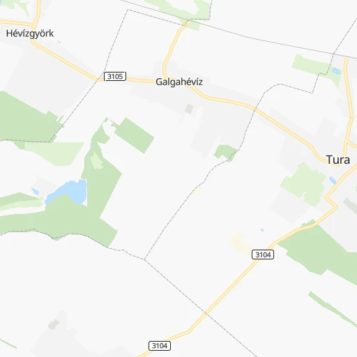
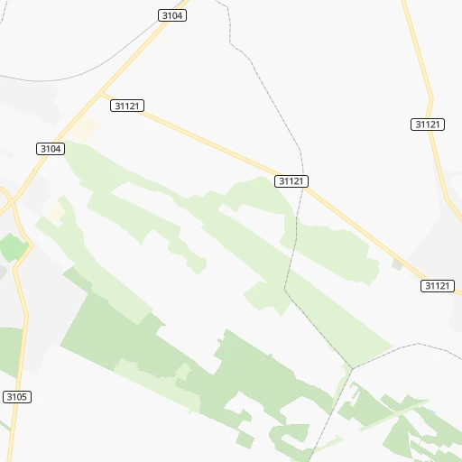
Roadmap (route) to go from Tura Vasútállomás to Monor detailed above, you can also see the course layout on the map.
While doing trip Tura Vasútállomás - Monor by car, the calculated route ends at a distance , or more straight.
Distance and duration of the route between Tura Vasútállomás and Monor
Calculation of distance and route from Monor to Tura Vasútállomás :
32.643.8 km1h47mn
Continue 0h1mn 274 mTurn left onto Szent István út 0h2mn 1.5 kmTurn left onto 3105 0h1mn 476 mAt roundabout, take exit 2 onto Kossuth Lajos út 0h1mn 717 mTurn slight right onto Park utca 0h7mn 6.6 kmTurn slight left onto József Attila utca 0h0mn 383 mTurn right onto Szent Erzsébet tér 0h1mn 649 mTurn left onto 3105 0h6mn 6.2 kmTurn slight right onto Nagykátai út 0h6mn 5.9 kmTurn left onto Szent István tér 0h0mn 475 mAt roundabout, take exit 1 onto Fő út 0h9mn 9.5 kmTurn left onto 3124 0h3mn 2.4 kmKeep left onto Kossuth Lajos utca 0h0mn 154 mKeep right onto Kossuth Lajos utca 0h0mn 142 mTurn left onto Bajcsy-Zsilinszky utca 0h9mn 8.1 kmAt roundabout, take exit 2 onto Kossuth Lajos utca 0h0mn 125 mTurn left onto Bajcsy-Zsilinszky utca 0h0mn 76 mTurn right onto Forrás köz 0h0mn 73 mArrive at destination 0h0mn 0 m
Travel from Tura Vasútállomás (Pest) to a selection of major cities.
Distances from Tura Vasútállomás to biggest cities in Pest
Other major cities in country :
- Budapest XVII. keruelet [05], 78,250 inhabitants. 31 km
- Jozsefvaros [05], 76,957 inhabitants. 42 km
- Budapest XXI. keruelet [05], 76,339 inhabitants. 45 km
- Paradsasvar [11], 76,000 inhabitants. 43 km
- Szolnok [20], 75,474 inhabitants. 67 km
- Tatabanya [12], 70,541 inhabitants. 91 km
- Budapest XVI. keruelet [05], 68,484 inhabitants. 35 km
- Kaposvar [17], 67,746 inhabitants. 196 km
- Bekescsaba [03], 65,206 inhabitants. 155 km
- Budapest XX. keruelet [05], 63,371 inhabitants. 43 km
- Veszprem [23], 62,023 inhabitants. 140 km
- Erzsebetvaros [05], 62,000 inhabitants. 42 km
- Zalaegerszeg [24], 61,898 inhabitants. 226 km
- Budapest XIX. keruelet [05], 61,610 inhabitants. 39 km
- Kispest [05], 61,453 inhabitants. 40 km
- Sopron [09], 57,210 inhabitants. 226 km
- Eger [11], 56,647 inhabitants. 66 km
- Budapest XII. keruelet [05], 56,544 inhabitants. 46 km
- Nagykanizsa [24], 50,823 inhabitants. 237 km
- Budapest XXII. keruelet [05], 50,499 inhabitants. 48 km
Route from Monor to major cities (Hungary).
- Distance Monor Budapest35 km
- Distance Monor Debrecen166 km
- Distance Monor Miskolc130 km
- Distance Monor Szeged133 km
- Distance Monor Pecs169 km
- Distance Monor Budapest XI. keruelet34 km
- Distance Monor Zuglo32 km
- Distance Monor Gyor141 km
- Distance Monor Budapest III. keruelet37 km
- Distance Monor Nyiregyhaza183 km
- Distance Monor Budapest XIII. keruelet34 km
- Distance Monor Kecskemet53 km
- Distance Monor Szekesfehervar80 km
- Distance Monor Budapest IV. keruelet36 km
- Distance Monor Budapest XVIII. keruelet23 km
- Distance Monor Budapest II. keruelet37 km
- Distance Monor Budapest VIII. keruelet32 km
- Distance Monor Budapest XV. keruelet34 km
- Distance Monor Szombathely214 km
- Distance Monor Budapest X. keruelet26 km
Nearest cities to Tura Vasútállomás :
- Budapest, 1,741,041 inhabitants. 44 km
- Debrecen, 204,124 inhabitants. 153 km
- Miskolc, 172,637 inhabitants. 103 km
- Szeged, 164,883 inhabitants. 158 km
- Pecs, 156,649 inhabitants. 201 km
- Budapest XI. keruelet, 139,049 inhabitants. 46 km
- Zuglo, 130,000 inhabitants. 39 km
- Gyor, 128,265 inhabitants. 148 km
- Budapest III. keruelet, 123,723 inhabitants. 43 km
- Nyiregyhaza, 116,298 inhabitants. 162 km
- Budapest XIII. keruelet, 113,531 inhabitants. 40 km
- Kecskemet, 109,847 inhabitants. 80 km
- Szekesfehervar, 101,600 inhabitants. 102 km
- Budapest IV. keruelet, 98,374 inhabitants. 39 km
- Budapest XVIII. keruelet, 93,225 inhabitants. 38 km
- Budapest II. keruelet, 88,729 inhabitants. 45 km
- Budapest VIII. keruelet, 82,222 inhabitants. 43 km
- Budapest XV. keruelet, 80,218 inhabitants. 37 km
- Szombathely, 79,534 inhabitants. 229 km
- Budapest X. keruelet, 79,270 inhabitants. 37 km
- Budapest XVII. keruelet, 78,250 inhabitants. 31 km
- Jozsefvaros, 76,957 inhabitants. 42 km
- Budapest XXI. keruelet, 76,339 inhabitants. 45 km
- Paradsasvar, 76,000 inhabitants. 43 km
- Szolnok, 75,474 inhabitants. 67 km
- Tatabanya, 70,541 inhabitants. 91 km
- Budapest XVI. keruelet, 68,484 inhabitants. 35 km
- Kaposvar, 67,746 inhabitants. 196 km
- Bekescsaba, 65,206 inhabitants. 155 km
- Budapest XX. keruelet, 63,371 inhabitants. 43 km
- Erd, 62,408 inhabitants. 58 km
- Veszprem, 62,023 inhabitants. 140 km
- Erzsebetvaros, 62,000 inhabitants. 42 km
- Zalaegerszeg, 61,898 inhabitants. 226 km
- Budapest XIX. keruelet, 61,610 inhabitants. 39 km
- Kispest, 61,453 inhabitants. 40 km
- Eger, 56,647 inhabitants. 66 km
- Budapest XII. keruelet, 56,544 inhabitants. 46 km
- Nagykanizsa, 50,823 inhabitants. 237 km
- Budapest XXII. keruelet, 50,499 inhabitants. 48 km
- Dunaujvaros, 50,084 inhabitants. 89 km
- Hodmezovasarhely, 47,485 inhabitants. 146 km
- Budapest VI. keruelet, 42,120 inhabitants. 42 km
- Salgotarjan, 39,640 inhabitants. 55 km
- Cegled, 39,287 inhabitants. 53 km
- Ozd, 38,476 inhabitants. 84 km
- Baja, 37,714 inhabitants. 169 km
- Vac, 35,108 inhabitants. 39 km
- Szekszard, 34,174 inhabitants. 157 km
- Papa, 32,990 inhabitants. 164 km
Location Tura Vasútállomás (Pest) :
| Country flag |  |
| Location | Tura Vasútállomás |
| State | Pest |
| County | |
| Country | Hungary |
| Country code / ISO 2 | HU |
| Latitude | 47.6257200 |
| Longitude | 19.6006700 |
| Altitude | 0 meters |
| Time zone | Europe/Budapest |
Location Monor (Pest) :
| Country flag | |
| Location | Monor |
| State | Pest |
| County | |
| Country | Hungary |
| Country code / ISO 2 | HU |
| Latitude | 47.3513300 |
| Longitude | 19.4473300 |
| Altitude | 0 meters |
| Time zone | Europe/Budapest |

