
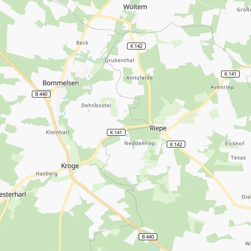
How to get from Bahnhof Amtsfelde (Lower Saxony) to Nienburg (Lower Saxony)
Calculate route from Bahnhof Amtsfelde (Lower Saxony, Germany) to Nienburg (Lower Saxony, Germany).
The flight distance (as the crow flies) between Bahnhof Amtsfelde and Nienburg is 47.4 km.
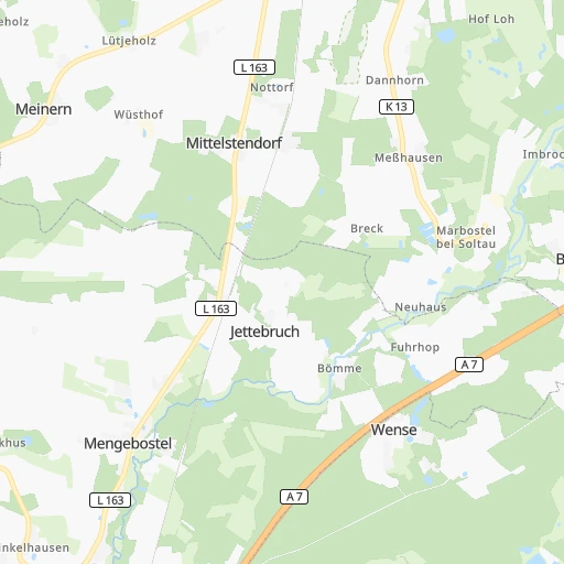
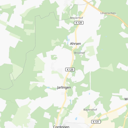
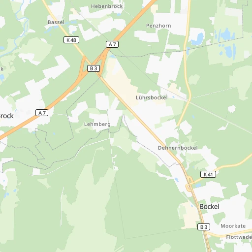
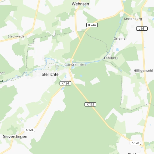
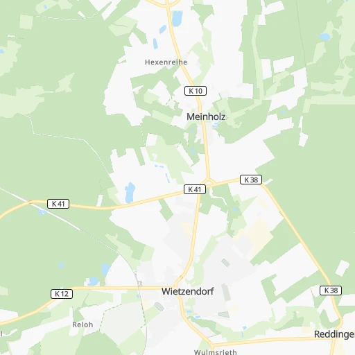
Roadmap (route) to go from Bahnhof Amtsfelde to Nienburg detailed above, you can also see the course layout on the map.
While doing trip Bahnhof Amtsfelde - Nienburg by car, the calculated route ends at a distance , or more straight.
Distance and duration of the route between Bahnhof Amtsfelde and Nienburg
Calculation of distance and route from Nienburg to Bahnhof Amtsfelde :
47.453.6 km1h50mn
Continue onto K 142 0h1mn 1.7 kmTurn right onto K 141 0h5mn 6.3 kmTurn right onto Cordinger Straße 0h2mn 2.0 kmAt roundabout, take exit 3 onto Ahrsener Straße 0h3mn 3.8 kmTurn left onto Cordinger Straße 0h1mn 838 mTurn left onto Bergstraße 0h4mn 3.6 kmAt roundabout, take exit 2 onto B 209 0h11mn 14.1 kmContinue onto Bahnhofstraße 0h0mn 201 mTurn slight left onto Rodewalder Straße 0h0mn 15 mTurn right onto Bahnhofstraße 0h0mn 68 mTurn right onto Kükerstraße 0h0mn 247 mTurn left onto Alter Stöckener Weg 0h0mn 90 mTurn slight left onto Stöckener Straße 0h0mn 12 mTurn right onto Stöckener Straße 0h1mn 878 mTurn right onto Nienburger Straße 0h11mn 13.3 kmTurn left onto B 215 0h3mn 2.6 kmAt roundabout, take exit 3 onto Verdener Landstraße 0h3mn 2.4 kmAt roundabout, take exit 2 onto Verdener Landstraße 0h1mn 489 mAt roundabout, take exit 2 onto Verdener Landstraße 0h0mn 204 mTurn left onto Sedanstraße 0h1mn 401 mTurn right onto Am Ahornbusch 0h1mn 270 mTurn left onto Amselhof 0h0mn 124 mArrive at destination 0h0mn 0 m
Travel from Bahnhof Amtsfelde (Lower Saxony) to a selection of major cities.
Distances from Bahnhof Amtsfelde to biggest cities in Lower Saxony
- Peine,49,953 inhabitants.78 km
- Melle,46,514 inhabitants.125 km
- Neustadt am Ruebenberge,45,942 inhabitants.53 km
- Stade,45,634 inhabitants.73 km
- Lehrte,43,920 inhabitants.67 km
- Goslar,43,560 inhabitants.126 km
- Gifhorn,43,000 inhabitants.77 km
- Wunstorf,42,080 inhabitants.62 km
- Seevetal,41,266 inhabitants.53 km
- Aurich,40,319 inhabitants.160 km
- Laatzen,40,038 inhabitants.71 km
- Buxtehude,38,192 inhabitants.58 km
- Buchholz in der Nordheide,37,404 inhabitants.43 km
- Uelzen,34,996 inhabitants.57 km
- Meppen,34,198 inhabitants.166 km
- Papenburg,34,117 inhabitants.155 km
- Leer,33,886 inhabitants.154 km
- Seelze,32,899 inhabitants.62 km
- Winsen,32,662 inhabitants.56 km
- Nienburg,32,629 inhabitants.48 km
Other major cities in country :
- Mannheim [01], 307,960 inhabitants. 395 km
- Marienthal [04], 287,101 inhabitants. 73 km
- Karlsruhe [01], 283,799 inhabitants. 448 km
- Hamburg-Nord [04], 280,000 inhabitants. 73 km
- Wiesbaden [05], 272,432 inhabitants. 335 km
- Muenster [07], 270,184 inhabitants. 179 km
- Gelsenkirchen [07], 270,028 inhabitants. 240 km
- Aachen [07], 265,208 inhabitants. 348 km
- Moenchengladbach [07], 261,742 inhabitants. 298 km
- Augsburg [02], 259,196 inhabitants. 516 km
- Eimsbuettel [04], 251,907 inhabitants. 71 km
- Altona [04], 250,192 inhabitants. 68 km
- Chemnitz [13], 247,220 inhabitants. 323 km
- Krefeld [07], 237,984 inhabitants. 281 km
- Halle (Saale) [14], 234,107 inhabitants. 225 km
- Hamburg-Mitte [04], 233,144 inhabitants. 70 km
- Kiel [10], 232,758 inhabitants. 155 km
- Magdeburg [14], 229,826 inhabitants. 159 km
- Neue Neustadt [14], 226,851 inhabitants. 157 km
- Oberhausen [07], 219,176 inhabitants. 254 km
Route from Nienburg to major cities (Germany).
- Distance Nienburg Berlin284 km
- Distance Nienburg Hamburg116 km
- Distance Nienburg Munich529 km
- Distance Nienburg Koeln247 km
- Distance Nienburg Frankfurt am Main284 km
- Distance Nienburg Essen201 km
- Distance Nienburg Stuttgart430 km
- Distance Nienburg Dortmund174 km
- Distance Nienburg Duesseldorf231 km
- Distance Nienburg Bremen55 km
- Distance Nienburg Leipzig260 km
- Distance Nienburg Duisburg216 km
- Distance Nienburg Nuernberg378 km
- Distance Nienburg Dresden358 km
- Distance Nienburg Wandsbek119 km
- Distance Nienburg Bochum189 km
- Distance Nienburg Bochum-Hordel189 km
- Distance Nienburg Wuppertal210 km
- Distance Nienburg Bielefeld83 km
- Distance Nienburg Bonn258 km
Nearest cities to Bahnhof Amtsfelde :
- Hamburg, 1,739,117 inhabitants. 72 km
- Koeln, 963,395 inhabitants. 294 km
- Frankfurt am Main, 650,000 inhabitants. 324 km
- Essen, 593,085 inhabitants. 248 km
- Dortmund, 588,462 inhabitants. 221 km
- Duesseldorf, 573,057 inhabitants. 278 km
- Bremen, 546,501 inhabitants. 62 km
- Hannover, 515,140 inhabitants. 65 km
- Leipzig, 504,971 inhabitants. 255 km
- Duisburg, 504,358 inhabitants. 263 km
- Wandsbek, 411,422 inhabitants. 75 km
- Bochum, 385,729 inhabitants. 236 km
- Bochum-Hordel, 380,000 inhabitants. 237 km
- Wuppertal, 360,797 inhabitants. 258 km
- Bielefeld, 331,906 inhabitants. 130 km
- Bonn, 313,125 inhabitants. 305 km
- Marienthal, 287,101 inhabitants. 73 km
- Hamburg-Nord, 280,000 inhabitants. 73 km
- Wiesbaden, 272,432 inhabitants. 335 km
- Muenster, 270,184 inhabitants. 179 km
- Gelsenkirchen, 270,028 inhabitants. 240 km
- Eimsbuettel, 251,907 inhabitants. 71 km
- Altona, 250,192 inhabitants. 68 km
- Braunschweig, 244,715 inhabitants. 94 km
- Halle (Saale), 234,107 inhabitants. 225 km
- Hamburg-Mitte, 233,144 inhabitants. 70 km
- Kiel, 232,758 inhabitants. 155 km
- Magdeburg, 229,826 inhabitants. 159 km
- Neue Neustadt, 226,851 inhabitants. 157 km
- Oberhausen, 219,176 inhabitants. 254 km
- Luebeck, 212,207 inhabitants. 121 km
- Erfurt, 203,254 inhabitants. 237 km
- Harburg, 202,571 inhabitants. 60 km
- Hagen, 198,972 inhabitants. 234 km
- Rostock, 198,293 inhabitants. 204 km
- Kassel, 194,501 inhabitants. 182 km
- Hamm, 185,327 inhabitants. 191 km
- Mainz, 184,997 inhabitants. 345 km
- Herne, 172,108 inhabitants. 231 km
- Muelheim, 171,000 inhabitants. 257 km
- Osnabrueck, 166,462 inhabitants. 136 km
- Solingen, 164,359 inhabitants. 267 km
- Leverkusen, 162,738 inhabitants. 284 km
- Oldenburg, 159,218 inhabitants. 103 km
- Paderborn, 142,161 inhabitants. 152 km
- Wolfsburg, 123,064 inhabitants. 93 km
- Recklinghausen, 122,438 inhabitants. 227 km
- Goettingen, 122,149 inhabitants. 158 km
- Bottrop, 119,909 inhabitants. 248 km
- Bergedorf, 119,665 inhabitants. 69 km
Location Bahnhof Amtsfelde (Lower Saxony) :
| Country flag |  |
| Location | Bahnhof Amtsfelde |
| State | Lower Saxony |
| County | |
| Country | Germany |
| Country code / ISO 2 | DE |
| Latitude | 52.9500000 |
| Longitude | 9.7166700 |
| Altitude | 0 meters |
| Time zone | Europe/Berlin |
Location Nienburg (Lower Saxony) :
| Country flag | |
| Location | Nienburg |
| State | Lower Saxony |
| County | |
| Country | Germany |
| Country code / ISO 2 | DE |
| Latitude | 52.6461000 |
| Longitude | 9.2208600 |
| Altitude | 0 meters |
| Time zone | Europe/Berlin |
