


How to get from Netanya (Central District) to Ashdod (Southern District)
Calculate route from Netanya (Central District, Israel) to Ashdod (Southern District, Israel).
The flight distance (as the crow flies) between Netanya and Ashdod is 63.3 km.
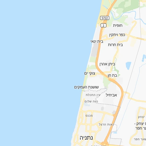
Roadmap (route) to go from Netanya to Ashdod detailed above, you can also see the course layout on the map.
While doing trip Netanya - Ashdod by car, the calculated route ends at a distance , or more straight.
Distance and duration of the route between Netanya and Ashdod
Calculation of distance and route from Ashdod to Netanya :
63.370.1 km1h51mn
Continue onto בארי 0h0mn 64 mTurn right onto נפתלי הרץ אימבר 0h0mn 96 mTurn sharp right onto ישראל זנגוויל 0h0mn 207 mTurn left onto ששת הימים 0h0mn 126 mKeep right 0h0mn 33 mTurn right onto רזיאל 0h1mn 463 mTurn left onto הרצל 0h0mn 488 mKeep right and take 2 toward תל אביב 0h9mn 11.9 kmKeep left onto איילון דרום 0h14mn 20.3 kmKeep left onto איילון דרום 0h19mn 28.2 kmKeep right and take 41 toward אשדוד 0h3mn 3.6 kmTurn left onto שדרות בני ברית 0h4mn 4.6 kmArrive at destination 0h0mn 0 m
Travel from Netanya (Southern District) to a selection of major cities.
Distances from Netanya to biggest cities in Central District
Other major cities in country :
Route from Ashdod to major cities (Israel).
- Distance Ashdod Jerusalem54 km
- Distance Ashdod Tel Aviv34 km
- Distance Ashdod West Jerusalem54 km
- Distance Ashdod Haifa119 km
- Distance Ashdod Rishon LeZiyyon24 km
- Distance Ashdod Petah Tiqwa40 km
- Distance Ashdod Netanya63 km
- Distance Ashdod Holon27 km
- Distance Ashdod Bnei Brak37 km
- Distance Ashdod Rehovot19 km
- Distance Ashdod Bat Yam28 km
- Distance Ashdod Ramat Gan36 km
- Distance Ashdod Jaffa30 km
- Distance Ashdod Modi'in Makkabbim Re'ut36 km
- Distance Ashdod Herzliya45 km
- Distance Ashdod Kfar Saba49 km
- Distance Ashdod Ra'anana48 km
- Distance Ashdod Hadera76 km
- Distance Ashdod Bet Shemesh33 km
- Distance Ashdod Lod29 km
Nearest cities to Netanya :
- Jerusalem, 801,000 inhabitants. 71 km
- Tel Aviv, 432,892 inhabitants. 29 km
- West Jerusalem, 400,000 inhabitants. 70 km
- Haifa, 267,300 inhabitants. 55 km
- Ashdod, 224,656 inhabitants. 63 km
- Rishon LeZiyyon, 220,492 inhabitants. 41 km
- Petah Tiqwa, 200,000 inhabitants. 27 km
- Beersheba, 186,600 inhabitants. 121 km
- Netanya, 171,676 inhabitants. 0 km
- Holon, 165,787 inhabitants. 37 km
- Bnei Brak, 154,400 inhabitants. 28 km
- Rehovot, 132,671 inhabitants. 49 km
- Bat Yam, 128,979 inhabitants. 36 km
- Ramat Gan, 128,095 inhabitants. 28 km
- Ashkelon, 105,995 inhabitants. 79 km
- Jaffa, 100,000 inhabitants. 33 km
- Modi'in Makkabbim Re'ut, 88,749 inhabitants. 51 km
- Herzliya, 83,600 inhabitants. 19 km
- Kfar Saba, 80,773 inhabitants. 18 km
- Ra'anana, 80,000 inhabitants. 17 km
- Hadera, 75,854 inhabitants. 13 km
- Bet Shemesh, 67,100 inhabitants. 68 km
- Lod, 66,589 inhabitants. 43 km
- Nazareth, 64,800 inhabitants. 58 km
- Modiin Ilit, 64,179 inhabitants. 48 km
- Ramla, 63,860 inhabitants. 45 km
- Nahariyya, 51,200 inhabitants. 78 km
- Qiryat Ata, 48,966 inhabitants. 58 km
- Givatayim, 48,000 inhabitants. 29 km
- Qiryat Gat, 47,450 inhabitants. 81 km
- Acre, 45,603 inhabitants. 69 km
- Eilat, 45,588 inhabitants. 309 km
- Afula, 44,930 inhabitants. 51 km
- Karmi'el, 44,382 inhabitants. 77 km
- Hod HaSharon, 43,185 inhabitants. 20 km
- Umm el Fahm, 41,030 inhabitants. 34 km
- Tiberias, 39,790 inhabitants. 81 km
- Qiryat Mozqin, 39,404 inhabitants. 60 km
- Qiryat Yam, 39,273 inhabitants. 61 km
- Rosh Ha'Ayin, 39,215 inhabitants. 28 km
- Ness Ziona, 38,700 inhabitants. 45 km
- Kiryat Ono, 37,791 inhabitants. 31 km
- Qiryat Bialik, 36,551 inhabitants. 59 km
- Ramat HaSharon, 36,137 inhabitants. 21 km
- Dimona, 33,558 inhabitants. 141 km
- Et Taiyiba, 32,978 inhabitants. 16 km
- Yavne, 31,774 inhabitants. 52 km
- Or Yehuda, 30,802 inhabitants. 34 km
- Yehud-Monosson, 29,312 inhabitants. 34 km
- Safed, 27,816 inhabitants. 92 km
Location Netanya (Central District) :
| Country flag |  |
| Location | Netanya |
| State | Central District |
| County | |
| Country | Israel |
| Country code / ISO 2 | IL |
| Latitude | 32.3329100 |
| Longitude | 34.8599200 |
| Altitude | 0 meters |
| Time zone | Asia/Jerusalem |
Location Ashdod (Southern District) :
| Country flag | |
| Location | Ashdod |
| State | Southern District |
| County | |
| Country | Israel |
| Country code / ISO 2 | IL |
| Latitude | 31.7921300 |
| Longitude | 34.6496600 |
| Altitude | 0 meters |
| Time zone | Asia/Jerusalem |
