


How to get from Tulkarm (West Bank) to Ţūbās (West Bank)
Calculate route from Tulkarm (West Bank, Palestinian Territory) to Ţūbās (West Bank, Palestinian Territory).
The flight distance (as the crow flies) between Tulkarm and Ţūbās is 32.1 km.
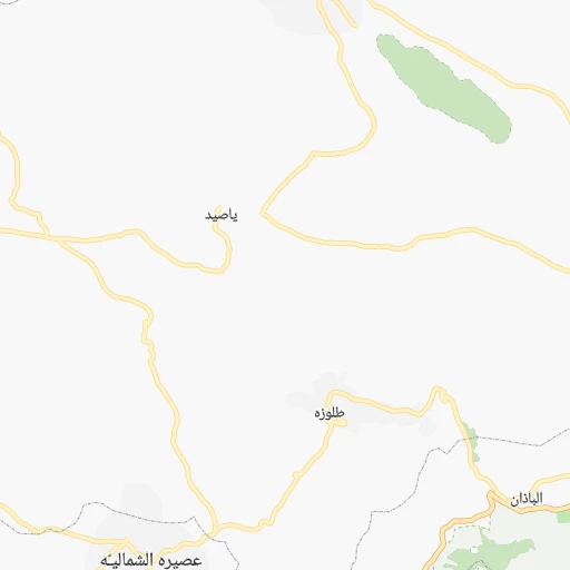
Roadmap (route) to go from Tulkarm to Ţūbās detailed above, you can also see the course layout on the map.
While doing trip Tulkarm - Ţūbās by car, the calculated route ends at a distance , or more straight.
Distance and duration of the route between Tulkarm and Ţūbās
Calculation of distance and route from Ţūbās to Tulkarm :
32.140.1 km1h46mn
Continue 0h0mn 2 mKeep right 0h0mn 49 mTurn left onto The Hospital 0h0mn 180 mTurn left onto شارع النزهة 0h0mn 223 mTurn right onto King Husein 0h0mn 281 mTurn left onto شارع نابلس 0h2mn 1.6 kmAt roundabout, take exit 1 onto شارع نابلس 0h5mn 4.7 kmAt roundabout, take exit 1 onto Nablus-Tulkarm Road 0h3mn 2.4 kmContinue onto Al-Sha'rawiyyah (Nablus-Tulkarm Road) 0h1mn 1.2 kmAt roundabout, take exit 2 onto Nablus-Tulkarm Road 0h1mn 768 mTurn left onto Bazzariya-Kafr Rumman 0h6mn 5.1 kmContinue onto 60 0h3mn 2.9 kmTurn right onto Silet Aldaher 0h0mn 26 mKeep left 0h0mn 184 mTurn slight right onto 60 0h1mn 602 mAt roundabout, take exit 2 onto 60 0h1mn 629 mTurn sharp left 0h1mn 559 mTurn slight left onto 60 0h0mn 91 mTurn sharp right 0h5mn 5.0 kmAt roundabout, take exit 1 0h2mn 1.7 kmKeep left onto Qattit Hardan 0h1mn 550 mTurn sharp right onto عمر بن الخطاب 0h0mn 77 mTurn left onto عمر بن الخطاب 0h0mn 124 mTurn left onto Az Zawyeh 0h0mn 33 mTurn right 0h0mn 135 mTurn slight left 0h0mn 102 mTurn slight right onto Methalon 0h1mn 667 mTurn slight right 0h1mn 1.1 kmTurn slight left onto شارع المطروحة - البلدية المتحدة 0h2mn 973 mAt roundabout, take exit 2 onto شارع المطروحة - طوباس 0h1mn 1.1 kmTurn right onto شارع الجديدة - طوباس 0h5mn 4.6 kmContinue onto طريق مستشفى طوباس التركي 0h1mn 812 mAt roundabout, take exit 1 onto Tubas Main 0h2mn 1.1 kmAt roundabout, take exit 1 onto البلده القديمة 0h0mn 112 mKeep right onto البلده القديمة 0h0mn 73 mContinue 0h0mn 146 mTurn left 0h0mn 87 mKeep left 0h0mn 64 mTurn right 0h0mn 36 mArrive at destination 0h0mn 0 m
Travel from Tulkarm (West Bank) to a selection of major cities.
Distances from Tulkarm to biggest cities in West Bank
Other major cities in country :
Route from Ţūbās to major cities (Palestinian Territory).
- Distance Ţūbās Gaza125 km
- Distance Ţūbās Khan Yunis148 km
- Distance Ţūbās Jabalya122 km
- Distance Ţūbās Rafah156 km
- Distance Ţūbās Dayr al Balah139 km
- Distance Ţūbās Bayt Lahya119 km
Nearest cities to Tulkarm :
- East Jerusalem, 428,304 inhabitants. 62 km
- Gaza, 410,000 inhabitants. 105 km
- Khan Yunis, 173,183 inhabitants. 128 km
- Jabalya, 168,568 inhabitants. 101 km
- Hebron, 160,470 inhabitants. 87 km
- Nablus, 130,326 inhabitants. 23 km
- Rafah, 126,305 inhabitants. 135 km
- Dayr al Balah, 59,504 inhabitants. 118 km
- Bayt Lahya, 56,919 inhabitants. 99 km
- Tulkarm, 44,169 inhabitants. 0 km
- Qalqilyah, 43,212 inhabitants. 15 km
- Yuta, 41,425 inhabitants. 96 km
- Al Birah, 38,192 inhabitants. 48 km
- Bayt Hanun, 37,392 inhabitants. 98 km
- An Nusayrat, 36,123 inhabitants. 113 km
- Old City, 36,000 inhabitants. 62 km
- Al Burayj, 34,951 inhabitants. 114 km
- Janin, 34,730 inhabitants. 30 km
- Bani Suhayla, 31,272 inhabitants. 127 km
- Bethlehem, 29,019 inhabitants. 69 km
- Az Zahiriyah, 27,616 inhabitants. 100 km
- Kalandia, 25,595 inhabitants. 52 km
- Ar Ram wa Dahiyat al Barid, 24,838 inhabitants. 55 km
- Ramallah, 24,599 inhabitants. 49 km
- Halhul, 21,076 inhabitants. 82 km
- Dura, 20,835 inhabitants. 89 km
- Jericho, 19,783 inhabitants. 63 km
- Bani Na`im, 19,783 inhabitants. 89 km
- Al Qararah, 19,500 inhabitants. 123 km
- As Samu`, 19,355 inhabitants. 102 km
- Qabatiyah, 19,127 inhabitants. 26 km
- Idhna, 18,727 inhabitants. 84 km
- `Abasan al Kabirah, 18,163 inhabitants. 128 km
- Sa`ir, 17,775 inhabitants. 82 km
- Al `Ayzariyah, 17,455 inhabitants. 64 km
- Balatah, 17,146 inhabitants. 27 km
- Az Zuwaydah, 16,688 inhabitants. 115 km
- Bayt Jala, 16,183 inhabitants. 68 km
- Al Yamun, 16,164 inhabitants. 27 km
- Tubas, 15,591 inhabitants. 32 km
- Bayt Sahur, 14,921 inhabitants. 70 km
- Tarqumya, 14,202 inhabitants. 82 km
- Ya`bad, 13,477 inhabitants. 20 km
- Surif, 12,992 inhabitants. 74 km
- Baytunya, 12,822 inhabitants. 48 km
- Bayt Ummar, 12,238 inhabitants. 77 km
- `Anata, 11,946 inhabitants. 60 km
- Givat Zeev, 11,764 inhabitants. 52 km
- Abu Dis, 11,753 inhabitants. 65 km
- Salfit, 11,000 inhabitants. 29 km
Location Tulkarm (West Bank) :
| Country flag |  |
| Location | Tulkarm |
| State | West Bank |
| County | Tulkarm |
| Country | Palestinian Territory |
| Country code / ISO 2 | PS |
| Latitude | 32.3103700 |
| Longitude | 35.0286300 |
| Altitude | 0 meters |
| Time zone | Asia/Hebron |
Location Ţūbās (West Bank) :
| Country flag | |
| Location | Ţūbās |
| State | West Bank |
| County | Tubas |
| Country | Palestinian Territory |
| Country code / ISO 2 | PS |
| Latitude | 32.3209100 |
| Longitude | 35.3698900 |
| Altitude | 0 meters |
| Time zone | Asia/Hebron |