

How to get from Station de Stile (El Oued) to Oum el Bouaghi (Oum el Bouaghi)
Calculate route from Station de Stile (El Oued, Algeria) to Oum el Bouaghi (Oum el Bouaghi, Algeria).
The flight distance (as the crow flies) between Station de Stile and Oum el Bouaghi is 210.9 km.
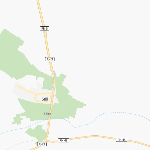
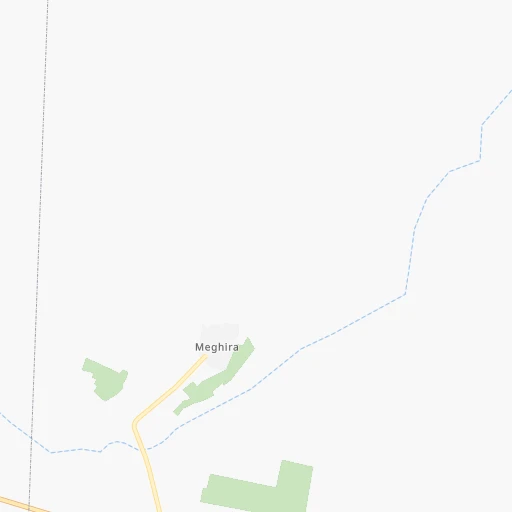
Roadmap (route) to go from Station de Stile to Oum el Bouaghi detailed above, you can also see the course layout on the map.
While doing trip Station de Stile - Oum el Bouaghi by car, the calculated route ends at a distance , or more straight.
Distance and duration of the route between Station de Stile and Oum el Bouaghi
Calculation of distance and route from Oum el Bouaghi to Station de Stile :
210.9280.2 km4h9mn
Continue onto RN 3 0h18mn 20.8 kmKeep right 0h21mn 21.0 kmKeep right 0h0mn 30 mTurn slight right onto CW 36 0h26mn 26.5 kmTurn right onto RN 83 0h21mn 28.1 kmAt roundabout, take exit 1 onto RN 83 0h18mn 24.3 kmKeep right onto RN 83 0h1mn 870 mAt roundabout, take exit 1 onto RN 83 1h46mn 51.6 kmAt roundabout, take exit 2 onto RN 83 0h16mn 17.8 kmTurn left 0h0mn 74 mContinue onto RN 80 0h2mn 1.6 kmTurn right 0h1mn 967 mTurn left 0h0mn 138 mKeep right 0h4mn 4.0 kmAt roundabout, take exit 2 0h15mn 15.6 kmAt roundabout, take exit 3 onto RN 80 0h3mn 4.2 kmAt roundabout, take exit 2 onto RN 80 0h4mn 3.4 kmAt roundabout, take exit 2 onto طريق بابار 0h2mn 1.5 kmAt roundabout, take exit 3 onto تجنب حفاتري أحمد 0h2mn 1.5 kmAt roundabout, take exit 2 onto تجنب حفاتري أحمد 0h0mn 321 mAt roundabout, take exit 2 onto نهج 20 أوت 1956 0h3mn 2.2 kmKeep left 0h1mn 1.2 kmAt roundabout, take exit 2 onto الطريق السريع خنشلة - قايس 0h1mn 1.2 kmKeep right onto RN 32 0h1mn 838 mAt roundabout, take exit 2 onto RN 32 0h1mn 1.4 kmAt roundabout, take exit 2 onto RN 32 0h4mn 4.1 kmAt roundabout, take exit 2 onto RN 32 0h3mn 3.6 kmAt roundabout, take exit 2 onto RN 32 0h1mn 1.1 kmAt roundabout, take exit 1 onto RN 32 0h2mn 2.4 kmAt roundabout, take exit 2 onto RN 32 0h3mn 4.2 kmAt roundabout, take exit 1 onto RN 32 0h4mn 6.5 kmAt roundabout, take exit 1 onto طريق أم البواقي 0h4mn 6.4 kmAt roundabout, take exit 2 onto طريق أم البواقي 0h2mn 2.3 kmAt roundabout, take exit 2 onto طريق أم البواقي 0h3mn 4.2 kmAt roundabout, take exit 2 onto طريق أم البواقي 0h3mn 4.8 kmAt roundabout, take exit 2 onto طريق أم البواقي 0h3mn 4.7 kmAt roundabout, take exit 2 onto RN 32 0h2mn 2.4 kmAt roundabout, take exit 2 onto RN 32 0h2mn 1.2 kmAt roundabout, take exit 2 0h2mn 788 mTurn left 0h0mn 17 mTurn right 0h0mn 129 mTurn right 0h0mn 47 mTurn right onto نهج 20 أوت 1955 0h0mn 110 mArrive at destination 0h0mn 0 m
Travel from Station de Stile (Oum el Bouaghi) to a selection of major cities.
Distances from Station de Stile to biggest cities in El Oued
Other major cities in country :
- Djelfa [22], 154,265 inhabitants. 248 km
- Mascara [26], 150,000 inhabitants. 543 km
- Jijel [24], 148,000 inhabitants. 286 km
- Medea [06], 147,707 inhabitants. 365 km
- Tizi Ouzou [14], 144,000 inhabitants. 322 km
- Bechar [38], 143,382 inhabitants. 814 km
- Tlemcen [15], 132,341 inhabitants. 666 km
- Relizane [51], 130,094 inhabitants. 516 km
- Mostaganem [07], 130,000 inhabitants. 563 km
- Ouargla [50], 129,402 inhabitants. 262 km
- El Eulma [12], 128,351 inhabitants. 213 km
- Saida [10], 127,497 inhabitants. 532 km
- Guelma [23], 123,590 inhabitants. 282 km
- Bordj el Kiffan [01], 123,246 inhabitants. 372 km
- Ain Oussera [22], 118,687 inhabitants. 306 km
- Khenchela [47], 117,000 inhabitants. 173 km
- Laghouat [25], 113,872 inhabitants. 286 km
- Ain Beida [29], 105,765 inhabitants. 218 km
- Baraki [55], 105,402 inhabitants. 371 km
- Oum el Bouaghi [29], 100,821 inhabitants. 211 km
Route from Oum el Bouaghi to major cities (Algeria).
- Distance Oum el Bouaghi Algiers374 km
- Distance Oum el Bouaghi Boumerdas341 km
- Distance Oum el Bouaghi Oran700 km
- Distance Oum el Bouaghi Tebessa105 km
- Distance Oum el Bouaghi Constantine71 km
- Distance Oum el Bouaghi Biskra170 km
- Distance Oum el Bouaghi Setif157 km
- Distance Oum el Bouaghi Batna92 km
- Distance Oum el Bouaghi Bab Ezzouar365 km
- Distance Oum el Bouaghi Annaba128 km
- Distance Oum el Bouaghi Sidi Bel Abbes706 km
- Distance Oum el Bouaghi Blida391 km
- Distance Oum el Bouaghi Tiaret527 km
- Distance Oum el Bouaghi Chlef521 km
- Distance Oum el Bouaghi Bordj Bou Arreridj213 km
- Distance Oum el Bouaghi Ech Chettia528 km
- Distance Oum el Bouaghi Bejaia207 km
- Distance Oum el Bouaghi Skikda113 km
- Distance Oum el Bouaghi El Achir225 km
- Distance Oum el Bouaghi Souk Ahras88 km
Nearest cities to Station de Stile :
- Algiers, 1,977,663 inhabitants. 377 km
- Boumerdas, 786,499 inhabitants. 357 km
- Tebessa, 634,332 inhabitants. 239 km
- Constantine, 450,097 inhabitants. 244 km
- Biskra, 307,987 inhabitants. 69 km
- Setif, 288,461 inhabitants. 221 km
- Batna, 280,798 inhabitants. 147 km
- Bab Ezzouar, 275,630 inhabitants. 371 km
- Annaba, 206,570 inhabitants. 339 km
- Bordj Bou Arreridj, 168,346 inhabitants. 229 km
- Bejaia, 164,103 inhabitants. 289 km
- Skikda, 162,702 inhabitants. 306 km
- El Achir, 158,333 inhabitants. 234 km
- Souk Ahras, 156,745 inhabitants. 293 km
- Djelfa, 154,265 inhabitants. 248 km
- Jijel, 148,000 inhabitants. 286 km
- Tizi Ouzou, 144,000 inhabitants. 322 km
- El Oued, 134,699 inhabitants. 133 km
- Ouargla, 129,402 inhabitants. 262 km
- El Eulma, 128,351 inhabitants. 213 km
- Guelma, 123,590 inhabitants. 282 km
- Bordj el Kiffan, 123,246 inhabitants. 372 km
- Khenchela, 117,000 inhabitants. 173 km
- Ain Beida, 105,765 inhabitants. 218 km
- Baraki, 105,402 inhabitants. 371 km
- Oum el Bouaghi, 100,821 inhabitants. 211 km
- M'Sila, 100,000 inhabitants. 205 km
- Messaad, 99,485 inhabitants. 222 km
- Barika, 98,846 inhabitants. 136 km
- Ghardaia, 93,423 inhabitants. 286 km
- El Khroub, 83,746 inhabitants. 235 km
- Rouissat, 80,784 inhabitants. 264 km
- Azzaba, 75,317 inhabitants. 297 km
- Ain Touta, 72,280 inhabitants. 125 km
- Cheria, 72,095 inhabitants. 203 km
- Birkhadem, 71,722 inhabitants. 378 km
- Chelghoum el Aid, 71,660 inhabitants. 214 km
- Sidi Aissa, 69,740 inhabitants. 267 km
- Larbaa, 69,298 inhabitants. 359 km
- Mila, 68,831 inhabitants. 247 km
- Bir el Ater, 68,703 inhabitants. 204 km
- Ain Fakroun, 68,433 inhabitants. 210 km
- Tolga, 68,246 inhabitants. 72 km
- Akbou, 66,654 inhabitants. 276 km
- Besbes, 66,287 inhabitants. 324 km
- Sidi Khaled, 64,476 inhabitants. 87 km
- Bougara, 63,155 inhabitants. 362 km
- Hamma Bouziane, 63,012 inhabitants. 248 km
- Reguiba, 62,185 inhabitants. 105 km
- Meftah, 59,990 inhabitants. 360 km
Location Station de Stile (El Oued) :
| Country flag |  |
| Location | Station de Stile |
| State | El Oued |
| County | |
| Country | Algeria |
| Country code / ISO 2 | DZ |
| Latitude | 34.2500000 |
| Longitude | 5.9166700 |
| Altitude | 0 meters |
| Time zone | Africa/Algiers |
Location Oum el Bouaghi (Oum el Bouaghi) :
| Country flag | |
| Location | Oum el Bouaghi |
| State | Oum el Bouaghi |
| County | |
| Country | Algeria |
| Country code / ISO 2 | DZ |
| Latitude | 35.8754100 |
| Longitude | 7.1135300 |
| Altitude | 0 meters |
| Time zone | Africa/Algiers |