

How to get from Kuta (Niger) to Igboho (Oyo)
Calculate route from Kuta (Niger, Nigeria) to Igboho (Oyo, Nigeria).
The flight distance (as the crow flies) between Kuta and Igboho is 343.6 km.
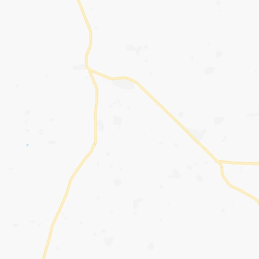
Roadmap (route) to go from Kuta to Igboho detailed above, you can also see the course layout on the map.
While doing trip Kuta - Igboho by car, the calculated route ends at a distance , or more straight.
Distance and duration of the route between Kuta and Igboho
Calculation of distance and route from Igboho to Kuta :
343.6462.6 km7h12mn
Continue 0h1mn 836 mTurn right 0h4mn 2.1 kmKeep right 0h11mn 5.5 kmKeep left 0h11mn 5.7 kmTurn left 0h7mn 3.7 kmKeep left 0h9mn 4.3 kmContinue 0h10mn 8.3 kmTurn left 0h0mn 223 mTurn right 0h4mn 3.2 kmTurn right 0h3mn 2.5 kmAt roundabout, take exit 2 0h1mn 1.5 kmAt roundabout, take exit 2 0h1mn 767 mAt roundabout, take exit 2 onto Western Bypass 0h1mn 816 mAt roundabout, take exit 1 0h29mn 32.1 kmTurn left 1h45mn 49.8 kmTurn right onto A124 3h43mn 190.4 kmKeep right onto Jebba Road 1h49mn 57.0 kmTurn right onto Kaiama Road 1h43mn 50.1 kmKeep left 1h40mn 43.6 kmTurn sharp left onto F200 0h0mn 125 mArrive at destination 0h0mn 0 m
Travel from Kuta (Oyo) to a selection of major cities.
Distances from Kuta to biggest cities in Niger
Other major cities in country :
- Calabar [22], 461,796 inhabitants. 575 km
- Uyo [21], 436,606 inhabitants. 553 km
- Katsina [24], 432,149 inhabitants. 361 km
- Ado-Ekiti [54], 424,340 inhabitants. 299 km
- Akure [48], 420,594 inhabitants. 336 km
- Bauchi [46], 316,149 inhabitants. 347 km
- Ikeja [05], 313,196 inhabitants. 520 km
- Makurdi [26], 292,645 inhabitants. 310 km
- Efon-Alaaye [54], 279,319 inhabitants. 315 km
- Ilesa [42], 277,904 inhabitants. 330 km
- Owo [48], 276,574 inhabitants. 322 km
- Umuahia [45], 264,662 inhabitants. 491 km
- Ondo [48], 257,005 inhabitants. 372 km
- Ikot Ekpene [21], 254,806 inhabitants. 533 km
- Iwo [42], 250,443 inhabitants. 373 km
- Gombe [55], 250,258 inhabitants. 491 km
- Jimeta [35], 248,148 inhabitants. 634 km
- Atani [25], 230,000 inhabitants. 429 km
- Gusau [57], 226,857 inhabitants. 256 km
- Mubi [35], 225,705 inhabitants. 720 km
Route from Igboho to major cities (Nigeria).
- Distance Igboho Lagos268 km
- Distance Igboho Kano629 km
- Distance Igboho Kaduna446 km
- Distance Igboho Port Harcourt578 km
- Distance Igboho Benin City346 km
- Distance Igboho Maiduguri1,082 km
- Distance Igboho Zaria503 km
- Distance Igboho Aba576 km
- Distance Igboho Jos577 km
- Distance Igboho Ilorin94 km
- Distance Igboho Enugu492 km
- Distance Igboho Abeokuta193 km
- Distance Igboho Abuja412 km
- Distance Igboho Sokoto498 km
- Distance Igboho Onitsha449 km
- Distance Igboho Warri430 km
- Distance Igboho Ebute Ikorodu251 km
- Distance Igboho Okene308 km
- Distance Igboho Calabar664 km
- Distance Igboho Uyo625 km
Nearest cities to Kuta :
- Kano, 3,626,068 inhabitants. 309 km
- Ibadan, 3,565,108 inhabitants. 415 km
- Kaduna, 1,582,102 inhabitants. 108 km
- Zaria, 975,153 inhabitants. 177 km
- Jos, 816,824 inhabitants. 239 km
- Ilorin, 814,192 inhabitants. 283 km
- Oyo, 736,072 inhabitants. 379 km
- Abuja, 590,400 inhabitants. 125 km
- Okene, 479,178 inhabitants. 263 km
- Ado-Ekiti, 424,340 inhabitants. 299 km
- Akure, 420,594 inhabitants. 336 km
- Makurdi, 292,645 inhabitants. 310 km
- Minna, 291,905 inhabitants. 33 km
- Efon-Alaaye, 279,319 inhabitants. 315 km
- Ilesa, 277,904 inhabitants. 330 km
- Owo, 276,574 inhabitants. 322 km
- Ondo, 257,005 inhabitants. 372 km
- Iwo, 250,443 inhabitants. 373 km
- Gusau, 226,857 inhabitants. 256 km
- Ikire, 222,160 inhabitants. 393 km
- Ise-Ekiti, 190,063 inhabitants. 303 km
- Ila Orangun, 179,192 inhabitants. 286 km
- Bida, 171,656 inhabitants. 117 km
- Ijero-Ekiti, 167,632 inhabitants. 291 km
- Inisa, 164,161 inhabitants. 345 km
- Suleja, 162,135 inhabitants. 92 km
- Osogbo, 156,694 inhabitants. 333 km
- Kisi, 155,510 inhabitants. 326 km
- Gbongan, 139,485 inhabitants. 372 km
- Ejigbo, 138,357 inhabitants. 343 km
- Funtua, 136,811 inhabitants. 196 km
- Igboho, 136,764 inhabitants. 344 km
- Ikirun, 134,240 inhabitants. 313 km
- Lafia, 127,236 inhabitants. 251 km
- Modakeke, 119,529 inhabitants. 386 km
- Ilobu, 118,089 inhabitants. 333 km
- Offa, 113,830 inhabitants. 291 km
- Ijebu-Igbo, 109,261 inhabitants. 439 km
- Birnin Kebbi, 108,164 inhabitants. 398 km
- Ikere-Ekiti, 103,054 inhabitants. 310 km
- Lafiagi, 102,779 inhabitants. 182 km
- Kontagora, 98,754 inhabitants. 148 km
- Kuje, 97,367 inhabitants. 124 km
- Olupona, 95,002 inhabitants. 376 km
- Lere, 93,290 inhabitants. 212 km
- Emure-Ekiti, 90,645 inhabitants. 304 km
- Igede-Ekiti, 87,282 inhabitants. 301 km
- Idanre, 86,468 inhabitants. 353 km
- Keffi, 85,911 inhabitants. 171 km
- Ogaminana, 84,373 inhabitants. 259 km
Location Kuta (Niger) :
| Country flag |  |
| Location | Kuta |
| State | Niger |
| County | Shiroro |
| Country | Nigeria |
| Country code / ISO 2 | NG |
| Latitude | 9.8686400 |
| Longitude | 6.7104200 |
| Altitude | 0 meters |
| Time zone | Africa/Lagos |
Location Igboho (Oyo) :
| Country flag | |
| Location | Igboho |
| State | Oyo |
| County | Orelope |
| Country | Nigeria |
| Country code / ISO 2 | NG |
| Latitude | 8.8378400 |
| Longitude | 3.7562800 |
| Altitude | 0 meters |
| Time zone | Africa/Lagos |