
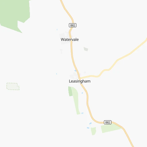

How to get from Watervale (South Australia) to Nairne (South Australia)
Calculate route from Watervale (South Australia, Australia) to Nairne (South Australia, Australia).
The flight distance (as the crow flies) between Watervale and Nairne is 123.2 km.
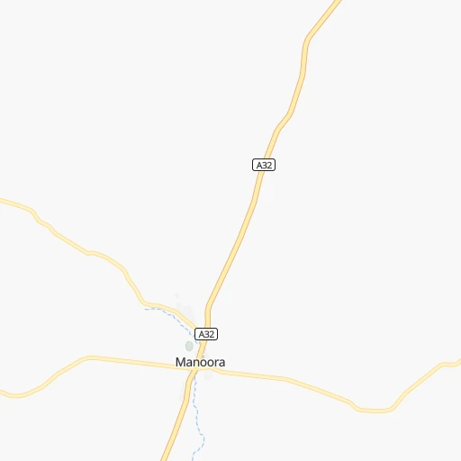
Roadmap (route) to go from Watervale to Nairne detailed above, you can also see the course layout on the map.
While doing trip Watervale - Nairne by car, the calculated route ends at a distance , or more straight.
Distance and duration of the route between Watervale and Nairne
Calculation of distance and route from Nairne to Watervale :
123.2140.1 km2h56mn
Continue onto Sollys Hill Road 0h0mn 70 mTurn left onto Mount Horrocks Road 0h1mn 649 mTurn right onto Horrocks Highway 1h31mn 41.8 kmTurn right onto Stockport - Tarlee Road 0h2mn 4.1 kmKeep left onto Rohde Road 0h3mn 4.0 kmTurn right onto Horrocks Highway 0h19mn 26.6 kmTurn left onto High Street 0h0mn 240 mAt roundabout, take exit 3 onto Murray Road 0h1mn 1.1 kmTurn left onto Murray Street 0h1mn 994 mTurn left onto Murray Street 0h1mn 653 mTurn left onto Seventh Street 0h1mn 1.4 kmAt roundabout, take exit 2 onto Gawler-One Tree Hill Road 0h10mn 12.2 kmAt roundabout, take exit 2 onto Kersbrook Road 0h10mn 10.9 kmTurn right onto Scott Street 0h4mn 4.9 kmTurn right onto Torrens Valley Scenic Drive and take B10 toward Houghton, Adelaide 0h0mn 396 mTurn left onto Tippett Road 0h2mn 2.1 kmTurn left onto Gorge Road 0h1mn 1.3 kmTurn right onto Cudlee Creek Road 0h7mn 8.0 kmTurn right onto Mill Road 0h1mn 722 mTurn left onto Post Office Road 0h0mn 213 mTurn right onto Main Street 0h1mn 428 mTurn left onto Woodside Road 0h3mn 2.9 kmAt roundabout, take exit 3 onto Onkaparinga Valley Scenic Drive 0h3mn 3.1 kmTurn left onto Nairne Road 0h1mn 421 mTurn right onto Nairne Road 0h7mn 8.6 kmTurn left onto North Road 0h3mn 2.1 kmTurn right onto Junction Street 0h0mn 81 mArrive at destination 0h0mn 0 m
Travel from Watervale (South Australia) to a selection of major cities.
Distances from Watervale to biggest cities in South Australia
Other major cities in country :
- Mackay [04], 74,219 inhabitants. 1,761 km
- Bundaberg [04], 70,826 inhabitants. 1,668 km
- Bunbury [08], 68,248 inhabitants. 2,128 km
- Maitland [02], 67,132 inhabitants. 1,209 km
- Armadale [08], 62,296 inhabitants. 2,116 km
- Rockhampton [04], 61,724 inhabitants. 1,650 km
- South Brisbane [04], 60,000 inhabitants. 1,552 km
Route from Nairne to major cities (Australia).
- Distance Nairne Sydney1,135 km
- Distance Nairne Melbourne624 km
- Distance Nairne Brisbane1,583 km
- Distance Nairne Perth2,162 km
- Distance Nairne Gold Coast1,582 km
- Distance Nairne Canberra930 km
- Distance Nairne Newcastle1,210 km
- Distance Nairne Wollongong1,098 km
- Distance Nairne Logan City1,579 km
- Distance Nairne Geelong598 km
- Distance Nairne Hobart1,136 km
- Distance Nairne Townsville1,920 km
- Distance Nairne Cairns2,128 km
- Distance Nairne Toowoomba1,492 km
- Distance Nairne Darwin2,641 km
- Distance Nairne Rockingham2,165 km
- Distance Nairne Launceston1,012 km
- Distance Nairne Bendigo521 km
- Distance Nairne Ballarat525 km
- Distance Nairne Mandurah2,159 km
Nearest cities to Watervale :
- Adelaide, 1,225,235 inhabitants. 109 km
- Adelaide Hills, 60,394 inhabitants. 107 km
- Morphett Vale, 22,602 inhabitants. 132 km
- Prospect, 20,217 inhabitants. 104 km
- Gawler, 20,006 inhabitants. 73 km
- Whyalla, 19,645 inhabitants. 142 km
- Murray Bridge, 19,577 inhabitants. 143 km
- Broken Hill, 18,430 inhabitants. 344 km
- Paralowie, 15,872 inhabitants. 90 km
- Parafield Gardens, 15,317 inhabitants. 93 km
- Port Augusta, 13,257 inhabitants. 181 km
- Port Pirie, 13,206 inhabitants. 102 km
- Port Lincoln, 13,044 inhabitants. 268 km
- Port Augusta West, 12,133 inhabitants. 182 km
- Happy Valley, 11,531 inhabitants. 126 km
- Seaton, 9,704 inhabitants. 106 km
- Athelstone, 9,290 inhabitants. 103 km
- Golden Grove, 8,976 inhabitants. 93 km
- Ingle Farm, 8,474 inhabitants. 98 km
- Mount Barker, 8,357 inhabitants. 126 km
- Hope Valley, 8,223 inhabitants. 99 km
- Victor Harbor, 7,760 inhabitants. 178 km
- Campbelltown, 7,005 inhabitants. 104 km
- North Adelaide, 6,678 inhabitants. 107 km
- Salisbury, 6,648 inhabitants. 91 km
- Paradise, 6,327 inhabitants. 103 km
- Aldinga, 5,984 inhabitants. 149 km
- Modbury, 5,570 inhabitants. 98 km
- Findon, 5,451 inhabitants. 106 km
- Henley Beach, 5,405 inhabitants. 109 km
- Grange, 5,238 inhabitants. 107 km
- Klemzig, 5,087 inhabitants. 103 km
- Nuriootpa, 5,031 inhabitants. 67 km
- Strathalbyn, 4,731 inhabitants. 148 km
- Tanunda, 4,684 inhabitants. 71 km
- Seaford, 4,654 inhabitants. 139 km
- Enfield, 4,389 inhabitants. 101 km
- Belair, 4,382 inhabitants. 117 km
- Berri, 4,330 inhabitants. 185 km
- Fullarton, 4,083 inhabitants. 111 km
- Blair Athol, 3,969 inhabitants. 101 km
- McLaren Vale, 3,853 inhabitants. 141 km
- South Plympton, 3,805 inhabitants. 115 km
- Blackwood, 3,799 inhabitants. 119 km
- Coromandel Valley, 3,779 inhabitants. 122 km
- Hackham, 3,765 inhabitants. 134 km
- Glenelg East, 3,701 inhabitants. 115 km
- Elizabeth, 3,668 inhabitants. 86 km
- Encounter Bay, 3,665 inhabitants. 181 km
- Nairne, 3,648 inhabitants. 123 km
Location Watervale (South Australia) :
| Country flag |  |
| Location | Watervale |
| State | South Australia |
| County | Clare and Gilbert Valleys |
| Country | Australia |
| Country code / ISO 2 | AU |
| Latitude | -33.9500000 |
| Longitude | 138.6333300 |
| Altitude | 0 meters |
| Time zone | Australia/Adelaide |
Location Nairne (South Australia) :
| Country flag | |
| Location | Nairne |
| State | South Australia |
| County | Mount Barker |
| Country | Australia |
| Country code / ISO 2 | AU |
| Latitude | -35.0345000 |
| Longitude | 138.9115400 |
| Altitude | 0 meters |
| Time zone | Australia/Adelaide |

