
How to get from Stantsiya Rassypnaya Pad’ (Primorskiy (Maritime) Kray) to Spassk-Dal’niy (Primorskiy (Maritime) Kray)
Calculate route from Stantsiya Rassypnaya Pad’ (Primorskiy (Maritime) Kray, Russia) to Spassk-Dal’niy (Primorskiy (Maritime) Kray, Russia).
The flight distance (as the crow flies) between Stantsiya Rassypnaya Pad’ and Spassk-Dal’niy is 130.6 km.
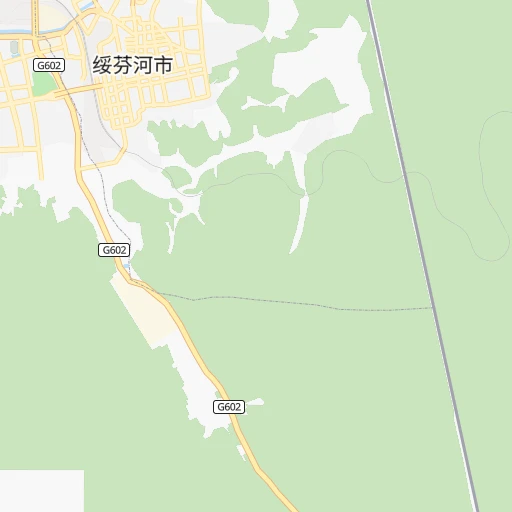
Roadmap (route) to go from Stantsiya Rassypnaya Pad’ to Spassk-Dal’niy detailed above, you can also see the course layout on the map.
While doing trip Stantsiya Rassypnaya Pad’ - Spassk-Dal’niy by car, the calculated route ends at a distance , or more straight.
Distance and duration of the route between Stantsiya Rassypnaya Pad’ and Spassk-Dal’niy
Calculation of distance and route from Spassk-Dal’niy to Stantsiya Rassypnaya Pad’ :
130.6273.1 km4h18mn
Continue 0h12mn 3.1 kmTurn sharp left onto Уссурийск — Пограничный 0h10mn 11.7 kmAt roundabout, take exit 1 onto 绥满线 0h5mn 5.5 kmKeep left 1h31mn 35.8 kmKeep left 0h7mn 6.8 kmAt roundabout, take exit 4 onto 三岔口-石岩 0h10mn 11.2 kmTurn right onto 虎东线 0h0mn 101 mTurn left onto 虎东线 0h0mn 459 mTurn right 0h0mn 154 mTurn slight right onto Галёнки — Полтавка 0h16mn 15.6 kmKeep right onto Покровка — Новогеоргиевка 0h21mn 20.6 kmContinue onto улица Советов 0h2mn 1.5 kmKeep left onto улица Советов 0h0mn 67 mTurn slight left onto Пионерская улица 0h1mn 771 mTurn right onto Комсомольская улица 0h13mn 13.4 kmContinue onto Уссурийск — Пограничный 0h15mn 14.9 kmTurn left onto улица Новосёлова 0h4mn 3.9 kmTurn left onto улица Некрасова 0h14mn 15.7 kmKeep right 2h32mn 107.4 kmTurn left onto Красногвардейская улица 0h2mn 2.5 kmTurn right onto Краснознамённая улица 0h2mn 1.7 kmTurn left 0h0mn 101 mTurn left 0h0mn 43 mTurn right 0h0mn 47 mArrive at destination 0h0mn 0 m
Travel from Stantsiya Rassypnaya Pad’ (Primorskiy (Maritime) Kray) to a selection of major cities.
Distances from Stantsiya Rassypnaya Pad’ to biggest cities in Primorskiy (Maritime) Kray
Other major cities in country :
- Yaroslavl [88], 606,730 inhabitants. 6,059 km
- Barnaul [04], 599,579 inhabitants. 3,543 km
- Irkutsk [20], 586,695 inhabitants. 2,162 km
- Khabarovsk [30], 579,000 inhabitants. 545 km
- Khabarovsk Vtoroy [30], 578,303 inhabitants. 543 km
- Orenburg [55], 550,204 inhabitants. 5,459 km
- Novokuznetsk [29], 539,616 inhabitants. 3,321 km
- Ryazan' [62], 520,173 inhabitants. 6,233 km
- Tyumen [78], 519,119 inhabitants. 4,637 km
- Lipetsk [43], 515,655 inhabitants. 6,356 km
- Penza [57], 512,602 inhabitants. 6,007 km
- Naberezhnyye Chelny [73], 509,870 inhabitants. 5,454 km
- Kalininskiy [42], 504,641 inhabitants. 6,392 km
- Astrakhan [07], 502,533 inhabitants. 6,191 km
- Makhachkala [17], 497,959 inhabitants. 6,425 km
- Tomsk [75], 485,519 inhabitants. 3,465 km
- Kemerovo [29], 477,090 inhabitants. 3,390 km
- Tula [76], 468,825 inhabitants. 6,373 km
- Kirov [33], 457,383 inhabitants. 5,492 km
- Cheboksary [16], 446,781 inhabitants. 5,732 km
Route from Spassk-Dal’niy to major cities (Russia).
- Distance Spassk-Dal’niy Moscow6,350 km
- Distance Spassk-Dal’niy Saint Petersburg6,453 km
- Distance Spassk-Dal’niy Novosibirsk3,678 km
- Distance Spassk-Dal’niy Yekaterinburg5,012 km
- Distance Spassk-Dal’niy Nizhniy Novgorod5,974 km
- Distance Spassk-Dal’niy Samara5,781 km
- Distance Spassk-Dal’niy Omsk4,285 km
- Distance Spassk-Dal’niy Kazan5,716 km
- Distance Spassk-Dal’niy Rostov-na-Donu6,758 km
- Distance Spassk-Dal’niy Chelyabinsk5,019 km
- Distance Spassk-Dal’niy Ufa5,363 km
- Distance Spassk-Dal’niy Volgograd6,370 km
- Distance Spassk-Dal’niy Perm5,222 km
- Distance Spassk-Dal’niy Krasnoyarsk3,058 km
- Distance Spassk-Dal’niy Saratov6,116 km
- Distance Spassk-Dal’niy Voronezh6,510 km
- Distance Spassk-Dal’niy Tol'yatti5,813 km
- Distance Spassk-Dal’niy Krasnodar6,948 km
- Distance Spassk-Dal’niy Ulyanovsk5,829 km
- Distance Spassk-Dal’niy Izhevsk5,438 km
Nearest cities to Stantsiya Rassypnaya Pad’ :
- Vladivostok, 587,022 inhabitants. 151 km
- Ussuriysk, 157,068 inhabitants. 87 km
- Nakhodka, 146,920 inhabitants. 219 km
- Artem, 102,300 inhabitants. 138 km
- Arsen'yev, 58,700 inhabitants. 167 km
- Spassk-Dal'niy, 45,265 inhabitants. 131 km
- Partizansk, 42,489 inhabitants. 208 km
- Lesozavodsk, 41,778 inhabitants. 214 km
- Bol'shoy Kamen', 38,100 inhabitants. 168 km
- Dalnerechensk, 28,300 inhabitants. 264 km
- Fokino, 25,827 inhabitants. 183 km
- Luchegorsk, 21,833 inhabitants. 330 km
- Vrangel', 20,000 inhabitants. 237 km
- Trudovoye, 18,484 inhabitants. 138 km
- Zavodskoy, 14,865 inhabitants. 133 km
- Slavyanka, 14,687 inhabitants. 169 km
- Chernigovka, 13,969 inhabitants. 108 km
- Chuguyevka, 13,354 inhabitants. 213 km
- Livadiya, 12,652 inhabitants. 205 km
- Uglovoye, 12,429 inhabitants. 136 km
- Pogranichnyy, 11,930 inhabitants. 14 km
- Kamen'-Rybolov, 11,489 inhabitants. 78 km
- Khorol', 11,245 inhabitants. 69 km
- Pokrovka, 10,614 inhabitants. 58 km
- Yaroslavskiy, 10,010 inhabitants. 84 km
- Kirovskiy, 9,467 inhabitants. 198 km
- Mikhaylovka, 9,300 inhabitants. 81 km
- Preobrazheniye, 9,113 inhabitants. 272 km
- Dunay, 8,394 inhabitants. 190 km
- Tavrichanka, 8,352 inhabitants. 128 km
- Novoshakhtinskiy, 8,091 inhabitants. 86 km
- Razdol'noye, 7,567 inhabitants. 108 km
- Vozdvizhenka, 7,102 inhabitants. 79 km
- Lipovtsy, 6,581 inhabitants. 45 km
- Vol'no-Nadezhdinskoye, 6,577 inhabitants. 128 km
- Uglekamensk, 6,461 inhabitants. 207 km
- Smolyaninovo, 6,294 inhabitants. 157 km
- Spasskoye, 6,038 inhabitants. 129 km
- Novyy, 5,970 inhabitants. 130 km
- Vladimiro-Aleksandrovskoye, 5,444 inhabitants. 223 km
- Shkotovo, 5,221 inhabitants. 149 km
- Gornyye Klyuchi, 5,146 inhabitants. 206 km
- Sergeyevka, 5,081 inhabitants. 207 km
- Russkiy, 5,080 inhabitants. 159 km
- Yakovlevka, 4,996 inhabitants. 180 km
- Novosysoyevka, 4,903 inhabitants. 172 km
- Anuchino, 4,658 inhabitants. 154 km
- Knevichi, 4,605 inhabitants. 134 km
- Novonikol'sk, 4,449 inhabitants. 78 km
- Monastyrishche, 4,192 inhabitants. 105 km
Location Stantsiya Rassypnaya Pad’ (Primorskiy (Maritime) Kray) :
| Country flag |  |
| Location | Stantsiya Rassypnaya Pad’ |
| State | Primorskiy (Maritime) Kray |
| County | |
| Country | Russia |
| Country code / ISO 2 | RU |
| Latitude | 44.3740000 |
| Longitude | 131.2094000 |
| Altitude | 0 meters |
| Time zone | Asia/Vladivostok |
Location Spassk-Dal’niy (Primorskiy (Maritime) Kray) :
| Country flag | |
| Location | Spassk-Dal’niy |
| State | Primorskiy (Maritime) Kray |
| County | |
| Country | Russia |
| Country code / ISO 2 | RU |
| Latitude | 44.5988400 |
| Longitude | 132.8259300 |
| Altitude | 0 meters |
| Time zone | Asia/Vladivostok |