

How to get from Hŭngnam (Hamgyŏng-namdo) to Chaeryŏng-ŭp (Hwanghae-namdo)
Calculate route from Hŭngnam (Hamgyŏng-namdo, North Korea) to Chaeryŏng-ŭp (Hwanghae-namdo, North Korea).
The flight distance (as the crow flies) between Hŭngnam and Chaeryŏng-ŭp is 234.9 km.
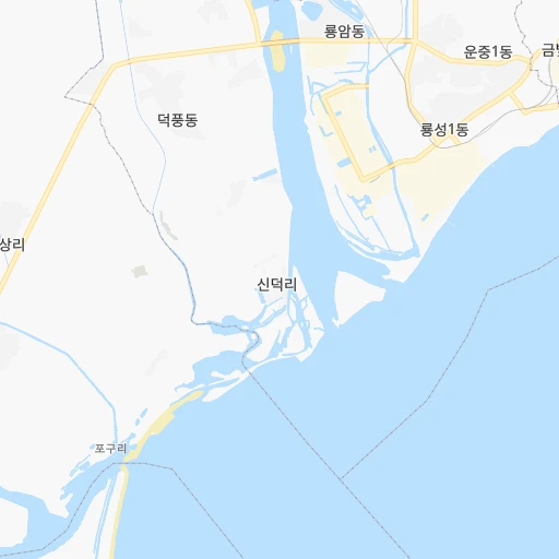
Roadmap (route) to go from Hŭngnam to Chaeryŏng-ŭp detailed above, you can also see the course layout on the map.
While doing trip Hŭngnam - Chaeryŏng-ŭp by car, the calculated route ends at a distance , or more straight.
Distance and duration of the route between Hŭngnam and Chaeryŏng-ŭp
Calculation of distance and route from Chaeryŏng-ŭp to Hŭngnam :
234.9324.4 km5h35mn
Continue 0h1mn 276 mTurn right 0h1mn 850 mTurn right 0h0mn 25 mTurn left 0h1mn 456 mTurn left 0h1mn 1.1 kmTurn slight left 0h10mn 10.3 kmKeep left 0h5mn 4.7 kmTurn right 0h1mn 1.1 kmKeep left 0h3mn 2.6 kmKeep right 0h6mn 4.7 kmTurn left 0h1mn 1.2 kmTurn right 0h7mn 5.6 kmTurn left onto AH6 0h7mn 7.7 kmKeep left 0h1mn 1.0 kmContinue onto AH6 0h15mn 17.1 kmTurn left onto AH6 0h15mn 17.5 kmTurn left onto AH6 0h7mn 8.5 kmTurn right 0h3mn 1.3 kmTurn sharp left 0h1mn 545 mKeep right 1h33mn 36.2 kmKeep right 0h0mn 219 mTurn slight right onto 평양원산관광도로 1h45mn 67.5 kmTurn sharp left 0h0mn 289 mContinue 0h10mn 10.9 kmTurn left 0h4mn 4.0 kmTurn left 0h29mn 32.2 kmKeep left 0h17mn 18.6 kmTurn right 0h0mn 334 mTurn right 0h1mn 646 mTurn left 0h3mn 3.4 kmTurn sharp left 0h24mn 39.3 kmKeep right 0h0mn 103 mTurn left 0h2mn 2.0 kmTurn right 0h0mn 10 mTurn left 0h1mn 317 mTurn left 0h0mn 228 mTurn right 0h1mn 999 mTurn left 0h18mn 20.3 kmTurn right 0h0mn 166 mArrive at destination 0h0mn 0 m
Travel from Hŭngnam (Hwanghae-namdo) to a selection of major cities.
Distances from Hŭngnam to biggest cities in Hamgyŏng-namdo
Other major cities in country :
Route from Chaeryŏng-ŭp to major cities (North Korea).
- Distance Chaeryŏng-ŭp Pyongyang72 km
- Distance Chaeryŏng-ŭp Hamhung237 km
- Distance Chaeryŏng-ŭp Namp'o42 km
- Distance Chaeryŏng-ŭp Sunch'on118 km
- Distance Chaeryŏng-ŭp Hungnam235 km
- Distance Chaeryŏng-ŭp Wonsan179 km
- Distance Chaeryŏng-ŭp Chongjin518 km
- Distance Chaeryŏng-ŭp Sariwon17 km
- Distance Chaeryŏng-ŭp Sinuiju217 km
- Distance Chaeryŏng-ŭp Kanggye298 km
- Distance Chaeryŏng-ŭp Hyesan399 km
- Distance Chaeryŏng-ŭp Songnim40 km
- Distance Chaeryŏng-ŭp Manp'o312 km
- Distance Chaeryŏng-ŭp P'yongsong97 km
- Distance Chaeryŏng-ŭp Hyesan-dong399 km
- Distance Chaeryŏng-ŭp Yuktae-dong284 km
- Distance Chaeryŏng-ŭp Hongwon271 km
- Distance Chaeryŏng-ŭp Rajin584 km
- Distance Chaeryŏng-ŭp Kilju427 km
- Distance Chaeryŏng-ŭp Anju136 km
Nearest cities to Hŭngnam :
- Pyongyang, 3,222,000 inhabitants. 183 km
- Hamhung, 559,056 inhabitants. 12 km
- Namp'o, 455,000 inhabitants. 226 km
- Sunch'on, 437,000 inhabitants. 151 km
- Hungnam, 346,082 inhabitants. 0 km
- Kaesong, 338,155 inhabitants. 227 km
- Wonsan, 329,207 inhabitants. 77 km
- Chongjin, 327,000 inhabitants. 284 km
- Sariwon, 310,100 inhabitants. 218 km
- Haeju, 222,396 inhabitants. 259 km
- Kanggye, 209,530 inhabitants. 154 km
- Hyesan, 192,680 inhabitants. 181 km
- Songnim, 152,425 inhabitants. 208 km
- Manp'o, 116,760 inhabitants. 185 km
- P'yongsong, 100,000 inhabitants. 163 km
- Hyesan-dong, 97,794 inhabitants. 181 km
- Yuktae-dong, 76,427 inhabitants. 51 km
- Hongwon, 70,923 inhabitants. 36 km
- Rajin, 66,224 inhabitants. 351 km
- Ongjin, 64,247 inhabitants. 288 km
- Kilju, 63,652 inhabitants. 192 km
- Chaeryong-up, 53,330 inhabitants. 235 km
- Anju, 50,196 inhabitants. 169 km
- Hoeryong, 43,831 inhabitants. 341 km
- Sungho 1-tong, 39,841 inhabitants. 169 km
- Changyon, 39,368 inhabitants. 280 km
- Sunan, 36,671 inhabitants. 180 km
- Hwangju-up, 35,641 inhabitants. 205 km
- Kyongsong, 35,604 inhabitants. 258 km
- Aoji-ri, 34,248 inhabitants. 379 km
- Nanam, 34,055 inhabitants. 272 km
- Anbyon-up, 31,845 inhabitants. 88 km
- Kusong, 30,902 inhabitants. 203 km
- Chongju, 29,065 inhabitants. 207 km
- Kangdong-up, 28,922 inhabitants. 152 km
- Sonbong, 27,331 inhabitants. 364 km
- Iwon-up, 26,364 inhabitants. 104 km
- Hukkyo-ri, 25,437 inhabitants. 195 km
- Kosan, 24,822 inhabitants. 110 km
- Yonan-up, 22,665 inhabitants. 249 km
- Yonggwang-up, 21,882 inhabitants. 25 km
- Musan-up, 21,739 inhabitants. 298 km
- Kowon-up, 21,490 inhabitants. 54 km
- Hoeyang, 21,111 inhabitants. 125 km
- T'ongch'on-up, 20,575 inhabitants. 100 km
- Kapsan-up, 20,406 inhabitants. 151 km
- Anak, 19,995 inhabitants. 235 km
- Kujang-up, 19,522 inhabitants. 136 km
- Sil-li, 19,463 inhabitants. 188 km
- Chunghwa, 19,346 inhabitants. 190 km
Location Hŭngnam (Hamgyŏng-namdo) :
| Country flag |  |
| Location | Hŭngnam |
| State | Hamgyŏng-namdo |
| County | |
| Country | North Korea |
| Country code / ISO 2 | KP |
| Latitude | 39.8316700 |
| Longitude | 127.6186100 |
| Altitude | 0 meters |
| Time zone | Asia/Pyongyang |
Location Chaeryŏng-ŭp (Hwanghae-namdo) :
| Country flag | |
| Location | Chaeryŏng-ŭp |
| State | Hwanghae-namdo |
| County | |
| Country | North Korea |
| Country code / ISO 2 | KP |
| Latitude | 38.3991700 |
| Longitude | 125.6155600 |
| Altitude | 0 meters |
| Time zone | Asia/Pyongyang |