
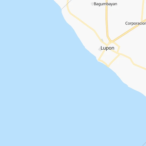

How to get from Lupon (Davao) to Bais City (Central Visayas)
Calculate route from Lupon (Davao, Philippines) to Bais City (Central Visayas, Philippines).
The flight distance (as the crow flies) between Lupon and Bais City is 436.3 km.
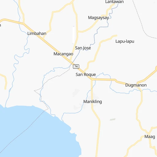
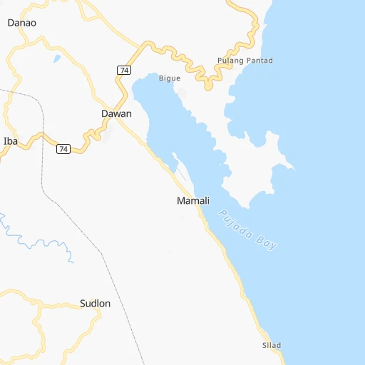
Roadmap (route) to go from Lupon to Bais City detailed above, you can also see the course layout on the map.
While doing trip Lupon - Bais City by car, the calculated route ends at a distance , or more straight.
Distance and duration of the route between Lupon and Bais City
Calculation of distance and route from Bais City to Lupon :
436.3677.0 km16h52mn
Continue 0h0mn 160 mTurn right onto Manuel Roxas Street 0h0mn 222 mKeep left onto Manuel Roxas Street 0h0mn 21 mTurn left onto Emilio Aguinaldo Street 0h0mn 73 mContinue onto Emilio Aguinaldo Street 0h0mn 275 mTurn left onto Surigao — Davao Coastal Road 1h55mn 64.5 kmKeep left onto Tagum City Bypass Road 0h7mn 7.9 kmTurn right 0h1mn 299 mTurn left 0h0mn 45 mTurn left onto Davao-Agusan National Highway 0h0mn 11 mTurn right onto Tagum City Bypass Road 0h4mn 5.1 kmTurn left onto Tagum-Santo Tomas Road 0h12mn 14.2 kmTurn right onto Tagum-Santo Tomas Road 0h6mn 6.6 kmTurn right onto Tagum-Panabo Circumferential Road 0h0mn 513 mTurn left onto Santo Tomas - Magwawa Road 1h37mn 26.5 kmTurn right onto Paquibato-Bukidnon Road 0h18mn 19.6 kmContinue onto Sinuda-Kalagangan Road 0h6mn 6.8 kmContinue 0h0mn 206 mTurn left onto Kalagangan Road 0h2mn 1.6 kmTurn left onto Kapalong-Talaingod-Valencia Road 0h28mn 33.0 kmTurn left onto Kapalong-Talaingod-Valencia Road 0h18mn 20.6 kmTurn right 0h0mn 19 mTurn left 0h7mn 7.0 kmTurn left onto Sayre Highway 0h0mn 148 mTurn right onto Valencia-Lantapan Road 0h7mn 6.9 kmTurn right onto Valencia-Lantapan Road 0h9mn 8.8 kmTurn left onto Aglayan-Alanib-Ticalaan Road 0h21mn 25.0 kmTurn left 0h0mn 89 mTurn right 0h0mn 242 mTurn left onto Aglayan-Alanib-Ticalaan Road 1h32mn 37.9 kmContinue onto Cagayan de Oro - Dominorog - Camp Kibaritan Road 0h9mn 9.8 kmTurn sharp left onto Mamaon - Rogongon Road 0h8mn 6.8 kmKeep left onto Tagoloan-Talakag Road 1h37mn 40.1 kmTurn right onto Marawi-Marcos Boulevard Road 0h2mn 1.8 kmTurn sharp right onto Iligan-Marawi Road 0h0mn 41 mKeep right onto Iligan-Marawi Road 0h3mn 3.9 kmTurn left 0h5mn 5.3 kmTurn left 0h2mn 2.2 kmTurn right 0h3mn 2.6 kmTurn sharp left 0h4mn 2.0 kmTurn left 0h2mn 1.1 kmKeep left 0h29mn 14.6 kmTurn right 0h1mn 429 mTurn sharp left 0h11mn 11.5 kmTurn left 0h4mn 4.0 kmTurn left 0h1mn 698 mTurn left 0h12mn 11.6 kmTurn sharp left onto Linamon-Zamboanga Road 0h6mn 5.4 kmKeep right 0h0mn 40 mTurn slight right 1h40mn 4.5 kmContinue 0h0mn 35 mKeep right 0h0mn 162 mContinue onto Port Road 0h1mn 550 mTurn right onto Don Anselmo Bernad Avenue 0h2mn 1.2 kmTurn slight right onto Don Anselmo Bernad Avenue 1h45mn 40.0 kmTurn left onto Barrientos Street 0h0mn 193 mTurn right onto Oroquieta-Langcangan Road 0h0mn 137 mTurn left onto Independence Street 0h6mn 3.3 kmTurn slight right onto Oroquieta-Calamba Mountain Road 1h34mn 30.4 kmTurn left 0h1mn 657 mKeep left 0h0mn 135 mTurn left onto Oroquieta-Dipolog Road 1h36mn 32.2 kmTurn sharp left onto Ilaya-Isis-Polanco Road 0h8mn 8.4 kmTurn right onto Polanco - Piñan Road 0h3mn 3.0 kmTurn left 0h2mn 1.4 kmTurn right 0h2mn 2.0 kmTurn left onto Dipolog-Oroquieta Road 0h0mn 285 mTurn right 0h2mn 883 mContinue 0h0mn 115 mTurn right 0h0mn 11 mKeep left onto Dumaguete – Dipolog 5h14mn 83.8 kmTurn slight right 0h0mn 6 mTurn left 0h0mn 63 mTurn right onto Dumaguete Port Road 0h0mn 108 mTurn left 0h0mn 140 mTurn right onto Flores Avenue 0h0mn 8 mTurn left onto Don Carlos A. Gothong, Sr. Avenue 0h1mn 1.0 kmTurn right onto Veterans Avenue 0h6mn 4.9 kmTurn left onto Divinagracia Street 0h1mn 832 mTurn right onto Calingacion Street 0h0mn 159 mTurn left onto Dumaguete North Road 0h22mn 24.2 kmTurn left onto Magallanes Street 0h12mn 14.1 kmTurn right onto Burgos Street 0h0mn 216 mArrive at destination 0h0mn 0 m
Travel from Lupon (Central Visayas) to a selection of major cities.
Distances from Lupon to biggest cities in Davao
Other major cities in country :
- Bacoor [40], 356,974 inhabitants. 1,008 km
- Lapu-Lapu City [07], 350,467 inhabitants. 442 km
- Iligan [10], 342,618 inhabitants. 245 km
- Mandaue City [07], 331,320 inhabitants. 445 km
- Calamba [40], 316,612 inhabitants. 971 km
- Iligan City [12], 312,323 inhabitants. 233 km
- Butuan [13], 309,709 inhabitants. 234 km
- Cabuyao [40], 308,745 inhabitants. 979 km
- Mandaluyong City [NCR], 305,576 inhabitants. 1,013 km
- Binan [40], 300,000 inhabitants. 989 km
- Angeles City [03], 299,391 inhabitants. 1,093 km
- Santol [03], 298,976 inhabitants. 1,095 km
- Cainta [40], 283,172 inhabitants. 1,008 km
- Baguio [15], 272,714 inhabitants. 1,213 km
- San Pedro [40], 270,216 inhabitants. 992 km
- Mantampay [10], 265,032 inhabitants. 243 km
- San Fernando [03], 251,248 inhabitants. 1,076 km
- Libertad [13], 250,353 inhabitants. 235 km
- Navotas [NCR], 249,463 inhabitants. 1,026 km
- Tacloban [08], 242,089 inhabitants. 496 km
Route from Bais City to major cities (Philippines).
- Distance Bais City Quezon City606 km
- Distance Bais City Manila605 km
- Distance Bais City Caloocan City610 km
- Distance Bais City Budta303 km
- Distance Bais City Davao392 km
- Distance Bais City Malingao309 km
- Distance Bais City General Santos448 km
- Distance Bais City Taguig592 km
- Distance Bais City Pasig City600 km
- Distance Bais City Las Pinas589 km
- Distance Bais City Antipolo601 km
- Distance Bais City Makati City597 km
- Distance Bais City Zamboanga320 km
- Distance Bais City Bacolod City121 km
- Distance Bais City Mansilingan117 km
- Distance Bais City Cagayan de Oro208 km
- Distance Bais City Dasmarinas579 km
- Distance Bais City Pasay597 km
- Distance Bais City Iloilo137 km
- Distance Bais City San Jose del Monte624 km
Nearest cities to Lupon :
- Budta, 1,273,715 inhabitants. 177 km
- Davao, 1,212,504 inhabitants. 48 km
- Malingao, 1,121,974 inhabitants. 172 km
- General Santos, 679,588 inhabitants. 127 km
- Cagayan de Oro, 445,103 inhabitants. 232 km
- Iligan, 342,618 inhabitants. 245 km
- Iligan City, 312,323 inhabitants. 233 km
- Butuan, 309,709 inhabitants. 234 km
- Mantampay, 265,032 inhabitants. 243 km
- Libertad, 250,353 inhabitants. 235 km
- Magugpo Poblacion, 233,254 inhabitants. 65 km
- Pagadian, 186,852 inhabitants. 302 km
- Cotabato, 179,433 inhabitants. 198 km
- Marawi City, 143,627 inhabitants. 227 km
- Muricay, 132,094 inhabitants. 298 km
- Koronadal, 125,502 inhabitants. 136 km
- Digos, 116,122 inhabitants. 74 km
- Dumaguete, 113,541 inhabitants. 401 km
- Mati, 105,908 inhabitants. 24 km
- Dipolog, 93,549 inhabitants. 349 km
- Ozamiz City, 93,082 inhabitants. 277 km
- Surigao, 87,832 inhabitants. 327 km
- Tagbilaran City, 86,411 inhabitants. 388 km
- Panabo, 84,749 inhabitants. 58 km
- NIA Valencia, 83,591 inhabitants. 151 km
- Kidapawan, 79,652 inhabitants. 102 km
- Mariano, 70,516 inhabitants. 237 km
- Bislig, 67,567 inhabitants. 150 km
- Bais, 65,594 inhabitants. 437 km
- Polomolok, 63,987 inhabitants. 129 km
- Malaybalay, 61,524 inhabitants. 171 km
- Banga, 58,855 inhabitants. 146 km
- Tacurong, 54,648 inhabitants. 149 km
- Malungun, 52,248 inhabitants. 106 km
- Monkayo, 51,393 inhabitants. 102 km
- Dapitan, 50,514 inhabitants. 346 km
- Bugo, 45,787 inhabitants. 226 km
- Parang, 44,930 inhabitants. 199 km
- Samal, 43,526 inhabitants. 39 km
- Alabel, 43,312 inhabitants. 119 km
- Compostela, 42,563 inhabitants. 87 km
- Malita, 41,114 inhabitants. 69 km
- Bayugan, 40,561 inhabitants. 209 km
- Oroquieta, 39,279 inhabitants. 301 km
- Tanjay, 39,151 inhabitants. 429 km
- Maramag, 33,844 inhabitants. 147 km
- Midsayap, 32,932 inhabitants. 167 km
- Jagna, 32,566 inhabitants. 356 km
- Kabacan, 31,769 inhabitants. 132 km
- Isulan, 31,717 inhabitants. 158 km
Location Lupon (Davao) :
| Country flag |  |
| Location | Lupon |
| State | Davao |
| County | Province of Davao Oriental |
| Country | Philippines |
| Country code / ISO 2 | PH |
| Latitude | 6.8981400 |
| Longitude | 126.0096100 |
| Altitude | 0 meters |
| Time zone | Asia/Manila |
Location Bais City (Central Visayas) :
| Country flag | |
| Location | Bais City |
| State | Central Visayas |
| County | Province of Negros Oriental |
| Country | Philippines |
| Country code / ISO 2 | PH |
| Latitude | 9.5911100 |
| Longitude | 123.1227800 |
| Altitude | 0 meters |
| Time zone | Asia/Manila |
