


How to get from San Miguel (Western Visayas) to Sagay (Western Visayas)
Calculate route from San Miguel (Western Visayas, Philippines) to Sagay (Western Visayas, Philippines).
The flight distance (as the crow flies) between San Miguel and Sagay is 106.2 km.
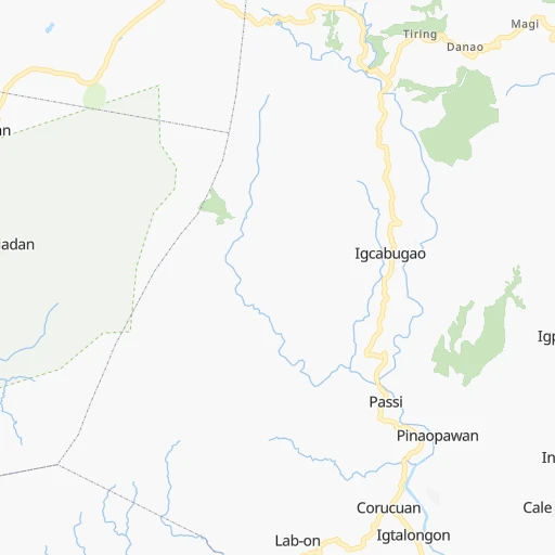
Roadmap (route) to go from San Miguel to Sagay detailed above, you can also see the course layout on the map.
While doing trip San Miguel - Sagay by car, the calculated route ends at a distance , or more straight.
Distance and duration of the route between San Miguel and Sagay
Calculation of distance and route from Sagay to San Miguel :
106.2164.3 km6h31mn
Continue 0h0mn 75 mTurn left 0h0mn 75 mTurn right onto Iloilo R-2 Road 0h15mn 13.1 kmContinue onto Lopez Jaena Street 0h0mn 186 mTurn left onto Marcelo H. del Pilar Street 0h1mn 994 mKeep right onto Marcelo H. del Pilar Street 0h1mn 806 mContinue onto General Luna Street 0h1mn 908 mKeep right 0h0mn 95 mAt roundabout, take exit 2 onto Jocson Street 0h0mn 275 mKeep right onto Jocson Street and drive toward Obrero, Port Terminal 0h0mn 23 mTurn slight right onto Rizal Street and drive toward Obrero, Port Terminal 0h1mn 694 mTurn sharp right 0h0mn 19 mKeep left onto Iloilo-Jordan RORO 1h46mn 4.6 kmTurn right 0h0mn 29 mTurn left 0h1mn 706 mTurn right onto Jordan – Rizal Wharf Road 0h1mn 789 mTurn slight left onto Guimaras Circumferential Road 0h4mn 4.9 kmContinue 0h10mn 10.4 kmKeep left 0h0mn 500 mTurn sharp left onto Guimaras Circumferential Road 0h0mn 12 mTurn right 2h9mn 13.7 kmContinue 0h1mn 717 mContinue onto Riego Street 0h0mn 225 mTurn left onto 713 0h3mn 2.4 kmTurn right onto 713 0h3mn 2.2 kmTurn left onto Bacolod South Road 0h1mn 821 mContinue onto R.M. Salas Drive 0h9mn 8.8 kmContinue onto Araneta Street 0h6mn 5.7 kmTurn right onto Bacolod Circumferential Road 0h28mn 25.5 kmTurn left onto Bacolod Airport Access Road 0h0mn 4 mTurn sharp right onto Bacolod-Negros Economic Highway 0h18mn 15.9 kmTurn right onto Osmeña Avenue 0h25mn 24.1 kmKeep right 0h19mn 19.7 kmTurn left onto Old Sagay Port 0h0mn 41 mTurn right onto Old Sagay Port 0h6mn 5.4 kmTurn left 0h0mn 86 mArrive at destination 0h0mn 0 m
Travel from San Miguel (Western Visayas) to a selection of major cities.
Distances from San Miguel to biggest cities in Western Visayas
- Paraiso,30,494 inhabitants.99 km
- Pulupandan,27,363 inhabitants.47 km
- Maao,25,837 inhabitants.66 km
- Himamaylan,25,089 inhabitants.88 km
- La Castellana,24,407 inhabitants.79 km
- Sipalay,24,029 inhabitants.115 km
- Asia,23,546 inhabitants.137 km
- Taloc,20,409 inhabitants.52 km
Other major cities in country :
- Iligan [10], 342,618 inhabitants. 345 km
- Mandaue City [07], 331,320 inhabitants. 167 km
- Calamba [40], 316,612 inhabitants. 407 km
- Iligan City [12], 312,323 inhabitants. 353 km
- Butuan [13], 309,709 inhabitants. 394 km
- Cabuyao [40], 308,745 inhabitants. 415 km
- Mandaluyong City [NCR], 305,576 inhabitants. 451 km
- Binan [40], 300,000 inhabitants. 424 km
- Angeles City [03], 299,391 inhabitants. 528 km
- Santol [03], 298,976 inhabitants. 529 km
- Cainta [40], 283,172 inhabitants. 447 km
- Baguio [15], 272,714 inhabitants. 659 km
- San Pedro [40], 270,216 inhabitants. 427 km
- Mantampay [10], 265,032 inhabitants. 349 km
- San Fernando [03], 251,248 inhabitants. 511 km
- Libertad [13], 250,353 inhabitants. 391 km
- Navotas [NCR], 249,463 inhabitants. 463 km
- Tacloban [08], 242,089 inhabitants. 282 km
- Batangas [40], 237,370 inhabitants. 365 km
- Magugpo Poblacion [11], 233,254 inhabitants. 522 km
Route from Sagay to major cities (Philippines).
- Distance Sagay Quezon City486 km
- Distance Sagay Manila486 km
- Distance Sagay Caloocan City491 km
- Distance Sagay Budta431 km
- Distance Sagay Davao494 km
- Distance Sagay Malingao437 km
- Distance Sagay Cebu City87 km
- Distance Sagay General Santos571 km
- Distance Sagay Taguig473 km
- Distance Sagay Pasig City480 km
- Distance Sagay Las Pinas472 km
- Distance Sagay Antipolo480 km
- Distance Sagay Makati City478 km
- Distance Sagay Zamboanga473 km
- Distance Sagay Cagayan de Oro305 km
- Distance Sagay Dasmarinas464 km
- Distance Sagay Pasay479 km
- Distance Sagay San Jose del Monte502 km
- Distance Sagay Bacoor476 km
- Distance Sagay Lapu-Lapu City91 km
Nearest cities to San Miguel :
- Cebu City, 798,634 inhabitants. 164 km
- Bacolod City, 454,898 inhabitants. 54 km
- Mansilingan, 454,150 inhabitants. 59 km
- Cagayan de Oro, 445,103 inhabitants. 350 km
- Iloilo, 387,681 inhabitants. 14 km
- Lapu-Lapu City, 350,467 inhabitants. 171 km
- Iligan, 342,618 inhabitants. 345 km
- Mandaue City, 331,320 inhabitants. 167 km
- Iligan City, 312,323 inhabitants. 353 km
- Mantampay, 265,032 inhabitants. 349 km
- Tacloban, 242,089 inhabitants. 282 km
- Batangas, 237,370 inhabitants. 365 km
- Ormoc, 191,200 inhabitants. 235 km
- Panalanoy, 189,090 inhabitants. 283 km
- Pagadian, 186,852 inhabitants. 346 km
- Legaspi, 179,481 inhabitants. 297 km
- Naga, 174,931 inhabitants. 326 km
- Toledo, 156,916 inhabitants. 136 km
- Bago City, 150,250 inhabitants. 49 km
- Marawi City, 143,627 inhabitants. 368 km
- Kabankalan, 136,483 inhabitants. 96 km
- Talisay, 133,148 inhabitants. 163 km
- Muricay, 132,094 inhabitants. 347 km
- Cadiz, 129,053 inhabitants. 92 km
- San Jose, 118,807 inhabitants. 232 km
- Dumaguete, 113,541 inhabitants. 188 km
- Roxas City, 102,688 inhabitants. 95 km
- Iriga City, 94,846 inhabitants. 313 km
- Dipolog, 93,549 inhabitants. 264 km
- Ozamiz City, 93,082 inhabitants. 330 km
- Victorias, 86,510 inhabitants. 68 km
- Tagbilaran City, 86,411 inhabitants. 197 km
- Binonga, 83,980 inhabitants. 56 km
- NIA Valencia, 83,591 inhabitants. 431 km
- Sorsogon, 82,730 inhabitants. 296 km
- Polangui, 77,122 inhabitants. 301 km
- Sagay, 72,153 inhabitants. 106 km
- Mariano, 70,516 inhabitants. 363 km
- Danao, 70,270 inhabitants. 173 km
- Libon, 68,846 inhabitants. 300 km
- Catbalogan, 68,081 inhabitants. 287 km
- Calbayog City, 67,921 inhabitants. 273 km
- Calapan, 66,008 inhabitants. 325 km
- Bais, 65,594 inhabitants. 151 km
- Talisay, 65,265 inhabitants. 55 km
- Minglanilla, 62,058 inhabitants. 157 km
- Malaybalay, 61,524 inhabitants. 413 km
- Ualog, 60,548 inhabitants. 104 km
- Tabaco, 57,860 inhabitants. 319 km
- Kalibo (poblacion), 56,845 inhabitants. 104 km
Location San Miguel (Western Visayas) :
| Country flag |  |
| Location | San Miguel |
| State | Western Visayas |
| County | Province of Iloilo |
| Country | Philippines |
| Country code / ISO 2 | PH |
| Latitude | 10.7800000 |
| Longitude | 122.4655600 |
| Altitude | 0 meters |
| Time zone | Asia/Manila |
Location Sagay (Western Visayas) :
| Country flag | |
| Location | Sagay |
| State | Western Visayas |
| County | Province of Negros Occidental |
| Country | Philippines |
| Country code / ISO 2 | PH |
| Latitude | 10.9447200 |
| Longitude | 123.4241700 |
| Altitude | 0 meters |
| Time zone | Asia/Manila |