
How to get from Talacogon (Caraga) to Polomolok (Soccsksargen)
Calculate route from Talacogon (Caraga, Philippines) to Polomolok (Soccsksargen, Philippines).
The flight distance (as the crow flies) between Talacogon and Polomolok is 260.7 km.
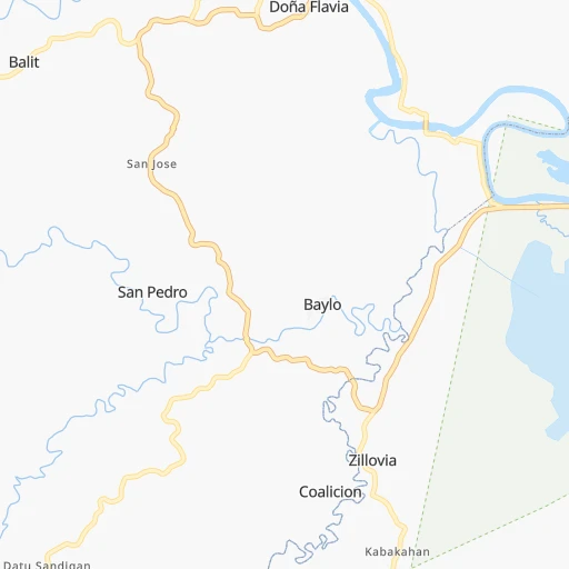
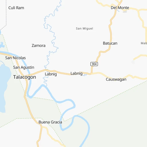
Roadmap (route) to go from Talacogon to Polomolok detailed above, you can also see the course layout on the map.
While doing trip Talacogon - Polomolok by car, the calculated route ends at a distance , or more straight.
Distance and duration of the route between Talacogon and Polomolok
Calculation of distance and route from Polomolok to Talacogon :
260.7356.7 km6h38mn
Continue 0h0mn 23 mTurn left 0h2mn 841 mContinue 0h0mn 112 mTurn slight left onto Talacogon-La Paz Road 1h46mn 50.1 kmKeep right 0h23mn 22.7 kmTurn right onto Sampaguita-Makilos Road 0h3mn 3.1 kmTurn right onto Sampaguita-Makilos Road 0h13mn 13.0 kmTurn left onto Laak-Melale Road 0h14mn 13.6 kmTurn right 0h3mn 1.4 kmTurn left onto Bukidnon-Laak Road 0h3mn 3.2 kmContinue 0h9mn 7.7 kmTurn sharp left 0h8mn 8.4 kmTurn slight right onto Asuncion-San Isidro-Laak-Veruela Road 0h14mn 16.3 kmTurn slight left onto Tagum-Panabo Circumferential Road 0h9mn 10.0 kmTurn right onto Tagum City Bypass Road 0h6mn 7.2 kmKeep right onto Canocotan-Bincungan Road 0h1mn 1.3 kmTurn left 0h1mn 742 mTurn right onto Davao-Agusan National Highway 0h12mn 14.2 kmContinue onto Davao-Agusan National Highway 1h41mn 38.3 kmContinue onto MacArthur Highway 0h2mn 1.4 kmContinue onto MacArthur Highway 1h39mn 42.0 kmKeep left onto Diversion Road 0h4mn 4.9 kmTurn left onto Davao-GenSan Highway 0h29mn 33.6 kmContinue onto Davao-GenSan Highway 0h15mn 17.0 kmTurn slight right onto Davao-GenSan Highway 0h14mn 15.4 kmTurn right 0h4mn 3.5 kmTurn left 0h0mn 246 mTurn left 0h2mn 1.9 kmTurn left 0h2mn 1.5 kmContinue onto Silway 8-Upper Labay Road 0h11mn 13.1 kmTurn right onto Silway 8-Upper Labay Road 0h0mn 253 mTurn left onto Silway 8-Upper Labay Road 0h2mn 1.9 kmTurn right onto Silway 8-Upper Labay Road 0h3mn 3.8 kmTurn right onto General Santos-Polomolok Highway 0h3mn 3.2 kmTurn right onto B.L. French Street 0h1mn 436 mTurn left onto B. Bayan, Sr. Street 0h0mn 224 mTurn right onto Pioneer Avenue 0h0mn 86 mArrive at destination 0h0mn 0 m
Travel from Talacogon (Soccsksargen) to a selection of major cities.
Distances from Talacogon to biggest cities in Caraga
Other major cities in country :
- San Jose del Monte [03], 357,828 inhabitants. 876 km
- Bacoor [40], 356,974 inhabitants. 853 km
- Lapu-Lapu City [07], 350,467 inhabitants. 288 km
- Iligan [10], 342,618 inhabitants. 172 km
- Mandaue City [07], 331,320 inhabitants. 292 km
- Calamba [40], 316,612 inhabitants. 815 km
- Iligan City [12], 312,323 inhabitants. 154 km
- Cabuyao [40], 308,745 inhabitants. 823 km
- Mandaluyong City [NCR], 305,576 inhabitants. 856 km
- Binan [40], 300,000 inhabitants. 832 km
- Angeles City [03], 299,391 inhabitants. 936 km
- Santol [03], 298,976 inhabitants. 938 km
- Cainta [40], 283,172 inhabitants. 850 km
- Baguio [15], 272,714 inhabitants. 1,050 km
- San Pedro [40], 270,216 inhabitants. 836 km
- Mantampay [10], 265,032 inhabitants. 176 km
- San Fernando [03], 251,248 inhabitants. 919 km
- Navotas [NCR], 249,463 inhabitants. 869 km
- Tacloban [08], 242,089 inhabitants. 322 km
- Batangas [40], 237,370 inhabitants. 784 km
Route from Polomolok to major cities (Philippines).
- Distance Polomolok Quezon City1,036 km
- Distance Polomolok Manila1,034 km
- Distance Polomolok Caloocan City1,040 km
- Distance Polomolok Budta129 km
- Distance Polomolok Davao113 km
- Distance Polomolok Cebu City474 km
- Distance Polomolok Taguig1,022 km
- Distance Polomolok Pasig City1,029 km
- Distance Polomolok Las Pinas1,019 km
- Distance Polomolok Antipolo1,030 km
- Distance Polomolok Makati City1,027 km
- Distance Polomolok Zamboanga339 km
- Distance Polomolok Bacolod City547 km
- Distance Polomolok Mansilingan542 km
- Distance Polomolok Cagayan de Oro256 km
- Distance Polomolok Dasmarinas1,009 km
- Distance Polomolok Pasay1,027 km
- Distance Polomolok Iloilo569 km
- Distance Polomolok San Jose del Monte1,053 km
- Distance Polomolok Bacoor1,023 km
Nearest cities to Talacogon :
- Budta, 1,273,715 inhabitants. 203 km
- Davao, 1,212,504 inhabitants. 155 km
- Malingao, 1,121,974 inhabitants. 204 km
- Cebu City, 798,634 inhabitants. 293 km
- General Santos, 679,588 inhabitants. 269 km
- Bacolod City, 454,898 inhabitants. 397 km
- Mansilingan, 454,150 inhabitants. 392 km
- Cagayan de Oro, 445,103 inhabitants. 125 km
- Lapu-Lapu City, 350,467 inhabitants. 288 km
- Iligan, 342,618 inhabitants. 172 km
- Mandaue City, 331,320 inhabitants. 292 km
- Iligan City, 312,323 inhabitants. 154 km
- Butuan, 309,709 inhabitants. 61 km
- Mantampay, 265,032 inhabitants. 176 km
- Libertad, 250,353 inhabitants. 63 km
- Tacloban, 242,089 inhabitants. 322 km
- Magugpo Poblacion, 233,254 inhabitants. 112 km
- Ormoc, 191,200 inhabitants. 312 km
- Panalanoy, 189,090 inhabitants. 323 km
- Pagadian, 186,852 inhabitants. 268 km
- Cotabato, 179,433 inhabitants. 218 km
- Toledo, 156,916 inhabitants. 318 km
- Bago City, 150,250 inhabitants. 398 km
- Marawi City, 143,627 inhabitants. 173 km
- Kabankalan, 136,483 inhabitants. 368 km
- Talisay, 133,148 inhabitants. 291 km
- Muricay, 132,094 inhabitants. 264 km
- Cadiz, 129,053 inhabitants. 390 km
- Koronadal, 125,502 inhabitants. 241 km
- Digos, 116,122 inhabitants. 196 km
- Dumaguete, 113,541 inhabitants. 289 km
- Mati, 105,908 inhabitants. 174 km
- Dipolog, 93,549 inhabitants. 270 km
- Ozamiz City, 93,082 inhabitants. 217 km
- Surigao, 87,832 inhabitants. 152 km
- Victorias, 86,510 inhabitants. 403 km
- Tagbilaran City, 86,411 inhabitants. 251 km
- Panabo, 84,749 inhabitants. 128 km
- Binonga, 83,980 inhabitants. 401 km
- NIA Valencia, 83,591 inhabitants. 98 km
- Kidapawan, 79,652 inhabitants. 178 km
- Sagay, 72,153 inhabitants. 379 km
- Mariano, 70,516 inhabitants. 85 km
- Danao, 70,270 inhabitants. 300 km
- Bislig, 67,567 inhabitants. 64 km
- Bais, 65,594 inhabitants. 319 km
- Talisay, 65,265 inhabitants. 400 km
- Polomolok, 63,987 inhabitants. 261 km
- Minglanilla, 62,058 inhabitants. 296 km
- Malaybalay, 61,524 inhabitants. 80 km
Location Talacogon (Caraga) :
| Country flag |  |
| Location | Talacogon |
| State | Caraga |
| County | Province of Agusan del Sur |
| Country | Philippines |
| Country code / ISO 2 | PH |
| Latitude | 8.4561100 |
| Longitude | 125.7841700 |
| Altitude | 0 meters |
| Time zone | Asia/Manila |
Location Polomolok (Soccsksargen) :
| Country flag | |
| Location | Polomolok |
| State | Soccsksargen |
| County | Province of South Cotabato |
| Country | Philippines |
| Country code / ISO 2 | PH |
| Latitude | 6.2216700 |
| Longitude | 125.0639800 |
| Altitude | 0 meters |
| Time zone | Asia/Manila |