


How to get from Baharampur (West Bengal) to Hugli (West Bengal)
Calculate route from Baharampur (West Bengal, India) to Hugli (West Bengal, India).
The flight distance (as the crow flies) between Baharampur and Hugli is 133.7 km.
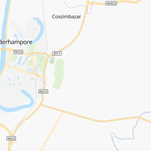
Roadmap (route) to go from Baharampur to Hugli detailed above, you can also see the course layout on the map.
While doing trip Baharampur - Hugli by car, the calculated route ends at a distance , or more straight.
Distance and duration of the route between Baharampur and Hugli
Calculation of distance and route from Hugli to Baharampur :
133.7160.9 km2h26mn
Continue 0h1mn 554 mTurn right onto K N ROAD 0h0mn 368 mTurn left 0h10mn 8.2 kmTurn sharp left onto NH12 0h0mn 156 mTurn right 0h0mn 11 mTurn right onto NH12 1h8mn 80.6 kmKeep left 0h1mn 700 mTurn left onto SH11 0h0mn 481 mContinue onto Ranaghat Bypass 0h22mn 24.7 kmKeep left onto Ranaghat Bypass 0h0mn 88 mTurn slight left onto NH12 0h1mn 998 mKeep right 0h6mn 6.9 kmTurn left 0h2mn 1.9 kmTurn right 0h1mn 1.2 kmTurn right 0h6mn 6.2 kmTurn left 0h1mn 550 mTurn right 0h0mn 327 mTurn left 0h1mn 1.6 kmTurn left 0h3mn 3.6 kmTurn right onto SH1 0h6mn 6.6 kmTurn left onto SH1 0h0mn 70 mTurn right onto SH1 0h1mn 1.2 kmTurn right onto SH1 0h0mn 136 mKeep right onto SH1 0h0mn 304 mTurn right onto SH1 0h0mn 80 mTurn left onto SH1 0h0mn 163 mTurn left onto SH1 0h0mn 128 mTurn right onto SH1 0h0mn 129 mKeep left 0h1mn 1.0 kmTurn left onto Central Park 0h0mn 223 mTurn left onto SH1 0h1mn 1.2 kmTurn left onto SH1 0h0mn 129 mTurn left onto SH1 0h0mn 157 mTurn right onto Kalyani-Barrackpur expressway 0h1mn 775 mTurn left 0h1mn 770 mTurn right 0h0mn 21 mTurn left 0h1mn 1.2 kmTurn sharp right 0h0mn 316 mTurn right 0h7mn 7.1 kmTurn right 0h0mn 137 mTurn left 0h0mn 36 mTurn left 0h0mn 3 mArrive at destination 0h0mn 0 m
Travel from Baharampur (West Bengal) to a selection of major cities.
Distances from Baharampur to biggest cities in West Bengal
- Kultali,187,942 inhabitants.246 km
- Chandannagar,180,623 inhabitants.139 km
- Hugli,177,005 inhabitants.134 km
- Haldia,170,695 inhabitants.228 km
- Raiganj,170,252 inhabitants.168 km
- Ingraj Bazar,170,039 inhabitants.101 km
- Madhyamgram,161,126 inhabitants.159 km
- Jamuria,160,242 inhabitants.127 km
- Jaigaon,158,664 inhabitants.326 km
- Medinipur,153,349 inhabitants.210 km
- Shantipur,149,983 inhabitants.97 km
- Barakpur,148,174 inhabitants.149 km
- Krishnanagar,145,926 inhabitants.82 km
- Balurghat,141,404 inhabitants.135 km
- Habra,139,297 inhabitants.147 km
- Kanchrapara,136,954 inhabitants.129 km
- Bankura,133,966 inhabitants.155 km
- Raniganj,131,261 inhabitants.126 km
- Khardah,128,346 inhabitants.155 km
- Halisahar,128,172 inhabitants.132 km
Other major cities in country :
- Gorakhpur [10], 1,324,570 inhabitants. 1,383 km
- Nashik [16], 1,289,497 inhabitants. 1,559 km
- Pimpri [16], 1,284,606 inhabitants. 1,616 km
- Kalyan [16], 1,262,255 inhabitants. 1,653 km
- Thane [16], 1,261,517 inhabitants. 1,672 km
- Meerut [36], 1,223,184 inhabitants. 1,181 km
- Nowrangapur [21], 1,220,946 inhabitants. 801 km
- Faridabad [10], 1,220,229 inhabitants. 1,192 km
- Ghaziabad [36], 1,199,191 inhabitants. 1,191 km
- Dombivli [16], 1,193,000 inhabitants. 1,660 km
- Rajkot [09], 1,177,362 inhabitants. 1,796 km
- Varanasi [36], 1,164,404 inhabitants. 547 km
- Amritsar [23], 1,092,450 inhabitants. 1,558 km
- Allahabad [36], 1,073,438 inhabitants. 665 km
- Visakhapatnam [02], 1,063,178 inhabitants. 887 km
- Teni [25], 1,034,724 inhabitants. 1,941 km
- Jabalpur [35], 1,030,168 inhabitants. 853 km
- Aurangabad [16], 1,016,441 inhabitants. 1,412 km
- Shivaji Nagar [16], 1,000,000 inhabitants. 1,616 km
- Solapur [16], 997,281 inhabitants. 1,469 km
Route from Hugli to major cities (India).
- Distance Hugli Mumbai1,667 km
- Distance Hugli Delhi1,288 km
- Distance Hugli Bengaluru1,590 km
- Distance Hugli Chennai1,390 km
- Distance Hugli Ahmedabad1,620 km
- Distance Hugli Hyderabad1,207 km
- Distance Hugli Pune1,590 km
- Distance Hugli Surat1,617 km
- Distance Hugli Kanpur905 km
- Distance Hugli Jaipur1,348 km
- Distance Hugli Navi Mumbai1,655 km
- Distance Hugli Lucknow872 km
- Distance Hugli Nagpur981 km
- Distance Hugli Indore1,289 km
- Distance Hugli Patna446 km
- Distance Hugli Bhopal1,126 km
- Distance Hugli Ludhiana1,529 km
- Distance Hugli Tirunelveli1,949 km
- Distance Hugli Agra1,149 km
- Distance Hugli Vadodara1,562 km
Nearest cities to Baharampur :
- Kolkata, 4,631,392 inhabitants. 172 km
- Haora, 1,027,672 inhabitants. 170 km
- Ranchi, 846,454 inhabitants. 312 km
- Jamshedpur, 616,338 inhabitants. 256 km
- Durgapur, 518,872 inhabitants. 116 km
- Shiliguri, 515,574 inhabitants. 291 km
- Asansol, 504,271 inhabitants. 137 km
- Bhatpara, 483,129 inhabitants. 139 km
- Shyamnagar, 441,956 inhabitants. 142 km
- Nangi, 440,894 inhabitants. 178 km
- Bokaro, 418,533 inhabitants. 236 km
- Panihati, 378,705 inhabitants. 158 km
- Bhagalpur, 361,548 inhabitants. 181 km
- Muzaffarpur, 333,200 inhabitants. 366 km
- Kamarhati, 332,965 inhabitants. 160 km
- Kulti, 305,405 inhabitants. 149 km
- Barddhaman, 301,725 inhabitants. 103 km
- Barasat, 298,127 inhabitants. 156 km
- Bali, 296,973 inhabitants. 162 km
- Darbhanga, 287,150 inhabitants. 329 km
- Baranagar, 260,072 inhabitants. 163 km
- Naihati, 253,221 inhabitants. 136 km
- Bihar Sharif, 244,230 inhabitants. 302 km
- Barasat, 237,783 inhabitants. 210 km
- Shrirampur, 226,317 inhabitants. 151 km
- Gosaba, 222,764 inhabitants. 223 km
- Kharagpur, 219,665 inhabitants. 218 km
- Dhanbad, 219,636 inhabitants. 187 km
- Monghyr, 203,163 inhabitants. 229 km
- Purnia, 198,453 inhabitants. 202 km
- Katihar, 192,555 inhabitants. 174 km
- Kultali, 187,942 inhabitants. 246 km
- Chandannagar, 180,623 inhabitants. 139 km
- Baharampur, 180,547 inhabitants. 0 km
- Hugli, 177,005 inhabitants. 134 km
- Haldia, 170,695 inhabitants. 228 km
- Raiganj, 170,252 inhabitants. 168 km
- Ingraj Bazar, 170,039 inhabitants. 101 km
- Madhyamgram, 161,126 inhabitants. 159 km
- Jamuria, 160,242 inhabitants. 127 km
- Jaigaon, 158,664 inhabitants. 326 km
- Medinipur, 153,349 inhabitants. 210 km
- Shantipur, 149,983 inhabitants. 97 km
- Barakpur, 148,174 inhabitants. 149 km
- Krishnanagar, 145,926 inhabitants. 82 km
- Saharsa, 145,764 inhabitants. 258 km
- Balurghat, 141,404 inhabitants. 135 km
- Hazaribagh, 140,063 inhabitants. 294 km
- Habra, 139,297 inhabitants. 147 km
- Kanchrapara, 136,954 inhabitants. 129 km
Location Baharampur (West Bengal) :
| Country flag |  |
| Location | Baharampur |
| State | West Bengal |
| County | Murshidabad |
| Country | India |
| Country code / ISO 2 | IN |
| Latitude | 24.1047300 |
| Longitude | 88.2515500 |
| Altitude | 0 meters |
| Time zone | Asia/Kolkata |
Location Hugli (West Bengal) :
| Country flag | |
| Location | Hugli |
| State | West Bengal |
| County | Hugli |
| Country | India |
| Country code / ISO 2 | IN |
| Latitude | 22.9087700 |
| Longitude | 88.3967400 |
| Altitude | 0 meters |
| Time zone | Asia/Kolkata |


