


How to get from Byculla (Maharashtra) to Nandurbar (Maharashtra)
Calculate route from Byculla (Maharashtra, India) to Nandurbar (Maharashtra, India).
The flight distance (as the crow flies) between Byculla and Nandurbar is 306.1 km.
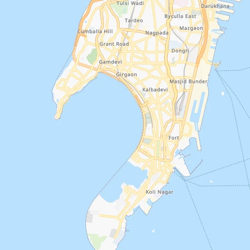
Roadmap (route) to go from Byculla to Nandurbar detailed above, you can also see the course layout on the map.
While doing trip Byculla - Nandurbar by car, the calculated route ends at a distance , or more straight.
Distance and duration of the route between Byculla and Nandurbar
Calculation of distance and route from Nandurbar to Byculla :
306.1377.3 km5h26mn
Continue onto Mumbai Coastal Road - Phase I 0h2mn 3.9 kmKeep left 0h1mn 707 mContinue 0h1mn 710 mTurn left onto Muhammad Ali Road 0h0mn 128 mTurn right onto Bhaji Pala Lane 0h0mn 65 mTurn left 0h0mn 242 mTurn right 0h1mn 695 mTurn left onto P D' Mello Road 0h1mn 560 mKeep right onto Eastern Freeway 0h9mn 15.5 kmKeep left onto Eastern Freeway 0h1mn 1.3 kmTurn right onto NH48 0h16mn 18.1 kmKeep left onto Majiwada-Kapurbawdi Flyover 0h0mn 353 mKeep left 0h0mn 422 mTurn right 0h10mn 11.6 kmContinue onto Agra Road 0h1mn 1.3 kmKeep left 0h1mn 1.7 kmTurn right 0h0mn 353 mKeep left 0h6mn 6.2 kmKeep left 2h29mn 173.5 kmKeep left 0h0mn 68 mTurn slight left 0h7mn 7.2 kmTurn left onto NH752G 0h25mn 29.0 kmTurn slight left onto SH7 1h43mn 47.2 kmKeep left onto SH7 0h11mn 12.3 kmTurn left onto NH53, NH752G 0h0mn 60 mTurn right onto SH7 0h10mn 10.8 kmTurn left onto SH7 0h8mn 9.2 kmTurn sharp left onto NH753B 0h19mn 22.3 kmTurn slight left onto SH5, SH8 0h1mn 1.1 kmTurn slight left onto SH5, SH8 0h0mn 119 mKeep right 0h1mn 660 mTurn right 0h0mn 88 mTurn right 0h0mn 8 mArrive at destination 0h0mn 0 m
Travel from Byculla (Maharashtra) to a selection of major cities.
Distances from Byculla to biggest cities in Maharashtra
- Malegaon,435,362 inhabitants.253 km
- Jalgaon,429,298 inhabitants.368 km
- Akola,428,857 inhabitants.480 km
- Ahmadnagar,367,140 inhabitants.204 km
- Dhulia,366,980 inhabitants.299 km
- Latur,348,967 inhabitants.402 km
- Chanda,328,351 inhabitants.690 km
- Parbhani,289,629 inhabitants.419 km
- Ichalkaranji,274,383 inhabitants.308 km
- Jalna,262,034 inhabitants.338 km
- Amarnath,217,780 inhabitants.47 km
- Bhusaval,183,001 inhabitants.389 km
- Virar,150,357 inhabitants.54 km
- Yavatmal,128,175 inhabitants.581 km
- Panvel,128,046 inhabitants.33 km
- Gondia,124,897 inhabitants.820 km
- Wardha,113,759 inhabitants.638 km
- Satara,112,793 inhabitants.190 km
- Achalpur,111,278 inhabitants.554 km
- Barsi,110,983 inhabitants.316 km
Other major cities in country :
- Faridabad [10], 1,220,229 inhabitants. 1,147 km
- Ghaziabad [36], 1,199,191 inhabitants. 1,178 km
- Rajkot [09], 1,177,362 inhabitants. 425 km
- Varanasi [36], 1,164,404 inhabitants. 1,267 km
- Amritsar [23], 1,092,450 inhabitants. 1,424 km
- Allahabad [36], 1,073,438 inhabitants. 1,178 km
- Visakhapatnam [02], 1,063,178 inhabitants. 1,108 km
- Teni [25], 1,034,724 inhabitants. 1,117 km
- Jabalpur [35], 1,030,168 inhabitants. 877 km
- Haora [28], 1,027,672 inhabitants. 1,663 km
- Srinagar [12], 975,857 inhabitants. 1,695 km
- Chandigarh [05], 960,787 inhabitants. 1,370 km
- Coimbatore [25], 959,823 inhabitants. 993 km
- Jodhpur [24], 921,476 inhabitants. 813 km
- Madurai [25], 909,908 inhabitants. 1,159 km
- Guwahati [03], 899,094 inhabitants. 2,104 km
- Gwalior [35], 882,458 inhabitants. 979 km
- Vijayawada [02], 874,587 inhabitants. 876 km
- Mysore [19], 868,313 inhabitants. 849 km
- Ranchi [38], 846,454 inhabitants. 1,386 km
Route from Nandurbar to major cities (India).
- Distance Nandurbar Delhi865 km
- Distance Nandurbar Bengaluru1,000 km
- Distance Nandurbar Kolkata1,464 km
- Distance Nandurbar Chennai1,123 km
- Distance Nandurbar Ahmedabad251 km
- Distance Nandurbar Hyderabad626 km
- Distance Nandurbar Surat148 km
- Distance Nandurbar Kanpur842 km
- Distance Nandurbar Jaipur638 km
- Distance Nandurbar Lucknow912 km
- Distance Nandurbar Indore223 km
- Distance Nandurbar Patna1,207 km
- Distance Nandurbar Bhopal388 km
- Distance Nandurbar Ludhiana1,075 km
- Distance Nandurbar Tirunelveli1,455 km
- Distance Nandurbar Agra752 km
- Distance Nandurbar Vadodara149 km
- Distance Nandurbar Gorakhpur911 km
- Distance Nandurbar Meerut916 km
- Distance Nandurbar Nowrangapur899 km
Nearest cities to Byculla :
- Mumbai, 12,691,836 inhabitants. 15 km
- Pune, 2,935,744 inhabitants. 122 km
- Surat, 2,894,504 inhabitants. 248 km
- Navi Mumbai, 2,600,000 inhabitants. 24 km
- Nashik, 1,289,497 inhabitants. 155 km
- Pimpri, 1,284,606 inhabitants. 113 km
- Kalyan, 1,262,255 inhabitants. 47 km
- Thane, 1,261,517 inhabitants. 31 km
- Dombivli, 1,193,000 inhabitants. 41 km
- Aurangabad, 1,016,441 inhabitants. 286 km
- Shivaji Nagar, 1,000,000 inhabitants. 121 km
- Bhiwandi, 707,035 inhabitants. 46 km
- Borivli, 609,617 inhabitants. 31 km
- Sangli, 601,214 inhabitants. 300 km
- Bhavnagar, 554,978 inhabitants. 319 km
- Bhayandar, 520,301 inhabitants. 38 km
- Ulhasnagar, 516,584 inhabitants. 46 km
- Kolhapur, 516,142 inhabitants. 295 km
- Bilimora, 510,879 inhabitants. 201 km
- Malegaon, 435,362 inhabitants. 253 km
- Jalgaon, 429,298 inhabitants. 368 km
- Ahmadnagar, 367,140 inhabitants. 204 km
- Dhulia, 366,980 inhabitants. 299 km
- Ichalkaranji, 274,383 inhabitants. 308 km
- Bijapur, 271,064 inhabitants. 390 km
- Amarnath, 217,780 inhabitants. 47 km
- Junagadh, 184,447 inhabitants. 375 km
- Bhusaval, 183,001 inhabitants. 389 km
- Veraval, 163,326 inhabitants. 334 km
- Bharuch, 153,528 inhabitants. 304 km
- Virar, 150,357 inhabitants. 54 km
- Panvel, 128,046 inhabitants. 33 km
- Jetpur, 118,068 inhabitants. 385 km
- Satara, 112,793 inhabitants. 190 km
- Barsi, 110,983 inhabitants. 316 km
- Badlapur, 104,636 inhabitants. 53 km
- Gondal, 101,801 inhabitants. 393 km
- Nandurbar, 100,703 inhabitants. 307 km
- Airoli, 100,000 inhabitants. 29 km
- Amreli, 99,742 inhabitants. 337 km
- Amalner, 97,369 inhabitants. 330 km
- Bagalkot, 97,269 inhabitants. 436 km
- Chalisgaon, 96,381 inhabitants. 285 km
- Pandharpur, 95,665 inhabitants. 303 km
- Khargone, 94,985 inhabitants. 433 km
- Roha, 90,000 inhabitants. 68 km
- Dhoraji, 81,445 inhabitants. 394 km
- Kundla, 76,809 inhabitants. 307 km
- Manmad, 76,722 inhabitants. 224 km
- Ratnagiri, 75,986 inhabitants. 226 km
Location Byculla (Maharashtra) :
| Country flag |  |
| Location | Byculla |
| State | Maharashtra |
| County | |
| Country | India |
| Country code / ISO 2 | IN |
| Latitude | 18.9666700 |
| Longitude | 72.8000000 |
| Altitude | 0 meters |
| Time zone | Asia/Kolkata |
Location Nandurbar (Maharashtra) :
| Country flag | |
| Location | Nandurbar |
| State | Maharashtra |
| County | Nandurbar |
| Country | India |
| Country code / ISO 2 | IN |
| Latitude | 21.3667100 |
| Longitude | 74.2405100 |
| Altitude | 0 meters |
| Time zone | Asia/Kolkata |