


How to get from Kodandarāmankoil (Tamil Nadu) to Ambur (Tamil Nadu)
Calculate route from Kodandarāmankoil (Tamil Nadu, India) to Ambur (Tamil Nadu, India).
The flight distance (as the crow flies) between Kodandarāmankoil and Ambur is 401.9 km.
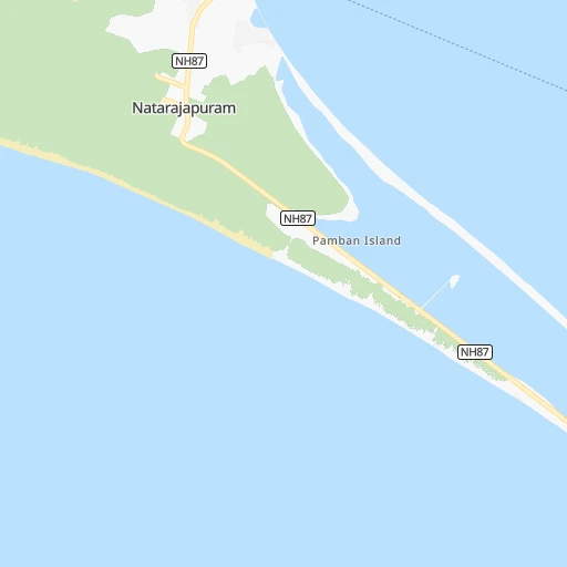
Roadmap (route) to go from Kodandarāmankoil to Ambur detailed above, you can also see the course layout on the map.
While doing trip Kodandarāmankoil - Ambur by car, the calculated route ends at a distance , or more straight.
Distance and duration of the route between Kodandarāmankoil and Ambur
Calculation of distance and route from Ambur to Kodandarāmankoil :
401.9501.2 km8h58mn
Continue onto Dhanushkodi road 0h10mn 8.3 kmTurn left 0h0mn 242 mTurn right 0h0mn 392 mTurn sharp left 0h0mn 177 mTurn right 0h0mn 250 mTurn left onto Madurai-Rameshwaram Road 1h53mn 42.5 kmTurn sharp right 0h3mn 2.6 kmTurn left 0h4mn 3.1 kmTurn right 0h2mn 1.4 kmTurn left 0h13mn 10.6 kmTurn sharp left onto East Coast Road 0h0mn 67 mTurn right 0h0mn 241 mTurn right onto NH536 1h45mn 52.4 kmKeep right 0h15mn 16.8 kmTurn right onto SHU159 0h3mn 2.9 kmTurn left 0h1mn 240 mTurn left onto SHU159 0h1mn 841 mContinue onto Karaikudi - Soorakudi Road 0h5mn 4.8 kmTurn slight right onto NH536 1h31mn 36.7 kmContinue onto Trichy Road 0h0mn 32 mContinue onto Trichy Road 0h29mn 33.4 kmTurn right 0h1mn 251 mTurn left onto NH83 Tiruchi Semicircular Ring Road 0h0mn 183 mContinue onto NH83 Tiruchi Semicircular Ring Road 0h0mn 41 mTurn right onto Pudukottai Road 0h9mn 10.5 kmAt roundabout, take exit 2 onto Pudukottai Road 0h1mn 1.2 kmTurn right 0h1mn 846 mTurn left 0h0mn 64 mContinue 0h0mn 197 mTurn right onto Melapudur Main Road 0h1mn 531 mKeep left onto Madurai Road 0h1mn 732 mContinue onto Chennai - Trichy - Dindigul Road (Old NH45) 0h1mn 1.1 kmKeep right onto Chennai - Trichy - Dindigul Road (Old NH45) 0h0mn 61 mKeep left onto Chennai - Trichy - Dindigul Road (Old NH45) 0h0mn 417 mContinue 0h0mn 437 mKeep right 0h0mn 364 mAt roundabout, take exit 2 onto Chennai - Trichy - Dindigul Road (Old NH45) 0h3mn 3.4 kmContinue onto Chennai - Trichy - Dindigul Road (Old NH45) 0h1mn 1.4 kmAt roundabout, take exit 1 onto Trichy - Namakkal Road 0h2mn 2.1 kmTurn right onto Trichy - Thuraiyur Road 0h3mn 3.4 kmTurn left onto Trichy - Thuraiyur Road 0h26mn 28.8 kmAt roundabout, take exit 2 onto Musiri - Thuraiyur - Attur Road 0h2mn 2.0 kmTurn sharp left onto Musiri - Thuraiyur - Attur Road 1h45mn 49.4 kmTurn left 0h0mn 98 mTurn right 0h3mn 2.4 kmTurn left 0h3mn 2.5 kmTurn left onto Mallikkarai - Rasipuram - Thiruchengode - Erode Road 0h3mn 2.9 kmTurn right onto Valapady - Thimmanaickenpatty Road 0h11mn 10.6 kmTurn right onto Salem Villupuram National Highway NH68 0h0mn 454 mTurn left onto Valapadi - Belur Road 0h6mn 6.4 kmContinue onto Ayothiyapattinam - Belur - Kilakkadu Road 0h15mn 15.4 kmTurn left 0h14mn 14.3 kmTurn left 0h22mn 22.3 kmContinue onto Tiruvannamalai - Thanipadi - Harur Road 0h12mn 14.3 kmKeep right 0h2mn 1.4 kmKeep left 0h8mn 6.4 kmTurn right onto Salem - Thirupathur - Vaniyambadi Road 1h31mn 36.1 kmTurn left onto NH179A 0h0mn 30 mKeep left onto NH179A 0h3mn 3.9 kmAt roundabout, take exit 2 onto Salem - Thirupathur - Vaniyambadi Road 0h14mn 16.4 kmTurn left onto Salem - Thirupathur - Vaniyambadi Road 0h0mn 40 mTurn left 0h0mn 335 mTurn right 0h15mn 18.3 kmTurn left onto Ambur - Sathgur Road 0h1mn 749 mContinue 0h0mn 235 mTurn left 0h0mn 120 mTurn right 0h0mn 23 mTurn left 0h0mn 63 mTurn left 0h0mn 46 mTurn right 0h0mn 45 mTurn right 0h0mn 45 mArrive at destination 0h0mn 0 m
Travel from Kodandarāmankoil (Tamil Nadu) to a selection of major cities.
Distances from Kodandarāmankoil to biggest cities in Tamil Nadu
- Alandur,153,775 inhabitants.431 km
- Erode,147,270 inhabitants.295 km
- Kumbakonam,139,264 inhabitants.193 km
- Tiruvannamalai,138,243 inhabitants.335 km
- Rajapalaiyam,124,168 inhabitants.198 km
- Pudukkottai,112,118 inhabitants.141 km
- Ambur,109,873 inhabitants.403 km
- Hosur,103,724 inhabitants.424 km
- Ooty,98,238 inhabitants.378 km
- Villupuram,97,380 inhabitants.302 km
- Negapatam,94,238 inhabitants.180 km
- Gudiyatham,93,973 inhabitants.417 km
- Karaikkudi,91,908 inhabitants.113 km
- Valparai,90,353 inhabitants.289 km
- Kovilpatti,90,296 inhabitants.162 km
- Vaniyambadi,90,288 inhabitants.393 km
- Pollachi,88,214 inhabitants.301 km
- Tiruchengode,87,123 inhabitants.287 km
- Mayiladuthurai,86,660 inhabitants.212 km
- Paramagudi,85,695 inhabitants.90 km
Other major cities in country :
- Nashik [16], 1,289,497 inhabitants. 1,339 km
- Pimpri [16], 1,284,606 inhabitants. 1,204 km
- Kalyan [16], 1,262,255 inhabitants. 1,300 km
- Thane [16], 1,261,517 inhabitants. 1,305 km
- Meerut [36], 1,223,184 inhabitants. 2,205 km
- Nowrangapur [21], 1,220,946 inhabitants. 1,166 km
- Faridabad [10], 1,220,229 inhabitants. 2,146 km
- Ghaziabad [36], 1,199,191 inhabitants. 2,173 km
- Dombivli [16], 1,193,000 inhabitants. 1,300 km
- Rajkot [09], 1,177,362 inhabitants. 1,717 km
- Varanasi [36], 1,164,404 inhabitants. 1,833 km
- Amritsar [23], 1,092,450 inhabitants. 2,535 km
- Allahabad [36], 1,073,438 inhabitants. 1,825 km
- Visakhapatnam [02], 1,063,178 inhabitants. 1,029 km
- Jabalpur [35], 1,030,168 inhabitants. 1,553 km
- Haora [28], 1,027,672 inhabitants. 1,768 km
- Aurangabad [16], 1,016,441 inhabitants. 1,261 km
- Shivaji Nagar [16], 1,000,000 inhabitants. 1,193 km
- Solapur [16], 997,281 inhabitants. 1,011 km
- Srinagar [12], 975,857 inhabitants. 2,806 km
Route from Ambur to major cities (India).
- Distance Ambur Mumbai937 km
- Distance Ambur Delhi1,772 km
- Distance Ambur Bengaluru123 km
- Distance Ambur Kolkata1,492 km
- Distance Ambur Ahmedabad1,311 km
- Distance Ambur Hyderabad512 km
- Distance Ambur Pune823 km
- Distance Ambur Surat1,126 km
- Distance Ambur Kanpur1,532 km
- Distance Ambur Jaipur1,602 km
- Distance Ambur Navi Mumbai925 km
- Distance Ambur Lucknow1,581 km
- Distance Ambur Nagpur931 km
- Distance Ambur Indore1,146 km
- Distance Ambur Patna1,576 km
- Distance Ambur Bhopal1,173 km
- Distance Ambur Ludhiana2,038 km
- Distance Ambur Agra1,604 km
- Distance Ambur Vadodara1,209 km
- Distance Ambur Gorakhpur1,881 km
Nearest cities to Kodandarāmankoil :
- Tirunelveli, 1,435,844 inhabitants. 191 km
- Teni, 1,034,724 inhabitants. 222 km
- Coimbatore, 959,823 inhabitants. 327 km
- Madurai, 909,908 inhabitants. 155 km
- Thiruvananthapuram, 784,153 inhabitants. 276 km
- Salem, 778,396 inhabitants. 300 km
- Tiruchirappalli, 775,484 inhabitants. 190 km
- Thoothukudi, 410,760 inhabitants. 142 km
- Tiruppur, 397,521 inhabitants. 303 km
- Kollam, 394,163 inhabitants. 306 km
- Puducherry, 227,411 inhabitants. 306 km
- Tanjore, 219,571 inhabitants. 175 km
- Nagercoil, 213,858 inhabitants. 240 km
- Dindigul, 200,797 inhabitants. 196 km
- Cuddalore, 158,569 inhabitants. 285 km
- Erode, 147,270 inhabitants. 295 km
- Kumbakonam, 139,264 inhabitants. 193 km
- Tiruvannamalai, 138,243 inhabitants. 335 km
- Palghat, 132,728 inhabitants. 341 km
- Rajapalaiyam, 124,168 inhabitants. 198 km
- Pudukkottai, 112,118 inhabitants. 141 km
- Ooty, 98,238 inhabitants. 378 km
- Villupuram, 97,380 inhabitants. 302 km
- Negapatam, 94,238 inhabitants. 180 km
- Karaikkudi, 91,908 inhabitants. 113 km
- Valparai, 90,353 inhabitants. 289 km
- Kovilpatti, 90,296 inhabitants. 162 km
- Pollachi, 88,214 inhabitants. 301 km
- Neyyattinkara, 88,104 inhabitants. 265 km
- Tiruchengode, 87,123 inhabitants. 287 km
- Mayiladuthurai, 86,660 inhabitants. 212 km
- Paramagudi, 85,695 inhabitants. 90 km
- Aruppukkottai, 85,369 inhabitants. 140 km
- Karaikal, 79,653 inhabitants. 196 km
- Kadayanallur, 77,772 inhabitants. 221 km
- Karur, 76,915 inhabitants. 237 km
- Bodinayakkanur, 75,680 inhabitants. 236 km
- Srivilliputhur, 74,370 inhabitants. 190 km
- Sivakasi, 74,282 inhabitants. 171 km
- Virudunagar, 73,273 inhabitants. 157 km
- Dharapuram, 72,291 inhabitants. 260 km
- Munnar, 68,000 inhabitants. 268 km
- Chamrajnagar, 67,992 inhabitants. 399 km
- Pattukkottai, 67,982 inhabitants. 133 km
- Mettupalayam, 66,944 inhabitants. 350 km
- Palani, 66,085 inhabitants. 242 km
- Dharmapuri, 66,017 inhabitants. 348 km
- Thenkasi, 65,496 inhabitants. 225 km
- Ramanathapuram, 65,314 inhabitants. 58 km
- Kayankulam, 64,183 inhabitants. 312 km
Location Kodandarāmankoil (Tamil Nadu) :
| Country flag |  |
| Location | Kodandarāmankoil |
| State | Tamil Nadu |
| County | Virudhunagar |
| Country | India |
| Country code / ISO 2 | IN |
| Latitude | 9.2276300 |
| Longitude | 79.3426900 |
| Altitude | 0 meters |
| Time zone | Asia/Kolkata |
Location Ambur (Tamil Nadu) :
| Country flag | |
| Location | Ambur |
| State | Tamil Nadu |
| County | Vellore |
| Country | India |
| Country code / ISO 2 | IN |
| Latitude | 12.7916300 |
| Longitude | 78.7164400 |
| Altitude | 0 meters |
| Time zone | Asia/Kolkata |

