


How to get from Uppulūru (Andhra Pradesh) to Kūkatpalli (Telangana)
Calculate route from Uppulūru (Andhra Pradesh, India) to Kūkatpalli (Telangana, India).
The flight distance (as the crow flies) between Uppulūru and Kūkatpalli is 274.5 km.
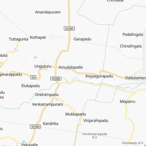
Roadmap (route) to go from Uppulūru to Kūkatpalli detailed above, you can also see the course layout on the map.
While doing trip Uppulūru - Kūkatpalli by car, the calculated route ends at a distance , or more straight.
Distance and duration of the route between Uppulūru and Kūkatpalli
Calculation of distance and route from Kūkatpalli to Uppulūru :
274.5301.6 km5h35mn
Continue 0h0mn 213 mTurn slight left onto Kankipadu - Kesarapalli Road 0h0mn 468 mTurn right onto MDR 0h4mn 4.3 kmTurn right onto MDR 0h0mn 441 mTurn left onto NH16 0h7mn 8.2 kmTurn right onto Karl Marx Road 0h2mn 2.2 kmTurn right onto BRTS 0h0mn 12 mTurn slight left onto BRTS 0h3mn 3.4 kmTurn right 0h0mn 65 mTurn left onto Vijawada Bypass Road 0h3mn 3.0 kmKeep left onto Nehru Inner Ring Road 0h10mn 11.6 kmAt roundabout, take exit 2 onto NH65 0h11mn 13.1 kmKeep left 0h0mn 438 mTurn right 0h0mn 111 mTurn left onto Kanchikacherla Road 0h4mn 4.8 kmContinue onto Chevitikallu - Vatsavai Road 0h1mn 1.0 kmKeep left 0h0mn 138 mTurn right 1h2mn 66.2 kmTurn right 0h0mn 21 mTurn slight left 0h1mn 1.5 kmTurn right onto NH65 0h28mn 32.5 kmKeep left onto Old NH9 0h1mn 1.1 kmTurn left 0h1mn 779 mTurn slight left 0h2mn 2.5 kmTurn left onto NH65 0h20mn 23.0 kmKeep right onto NH65 1h22mn 96.0 kmKeep right onto NH65 0h0mn 435 mTurn left onto Inner Ring Road 0h0mn 16 mTurn right 0h0mn 54 mKeep left onto Saroor Nagar Mini Tank Bund Road 0h1mn 1.3 kmKeep left onto Saroor Nagar Mini Tank Bund Road 0h2mn 1.5 kmTurn left onto Saroor Nagar Mini Tank Bund Road 0h2mn 1.6 kmTurn left onto Mumbai Highway 0h3mn 3.1 kmAt roundabout, take exit 3 onto NH65 0h0mn 388 mKeep left onto NH65 0h1mn 725 mTurn right onto Jambagh Road 0h1mn 1.1 kmContinue 0h2mn 1.9 kmAt roundabout, take exit 1 onto NH44, NH65, NH163 0h0mn 182 mAt roundabout, take exit 1 onto Public Garden Road 0h1mn 329 mKeep left onto Lakdikapul Road 0h1mn 384 mKeep right onto Lakdikapul Road 0h11mn 8.4 kmKeep left 0h1mn 204 mKeep left 0h4mn 2.1 kmMake a U-turn onto Kukkatpally Main Road - Mumbai Highway 0h0mn 191 mTurn left 0h1mn 285 mTurn left 0h0mn 225 mTurn right 0h0mn 16 mTurn left 0h0mn 15 mArrive at destination 0h0mn 0 m
Travel from Uppulūru (Telangana) to a selection of major cities.
Distances from Uppulūru to biggest cities in Andhra Pradesh
- Guntakal Junction,120,964 inhabitants.394 km
- Chicacole,118,299 inhabitants.388 km
- Gudivada,116,161 inhabitants.24 km
- Dharmavaram,114,050 inhabitants.401 km
- Madanapalle,108,593 inhabitants.409 km
- Tadepallegudem,108,167 inhabitants.88 km
- Narasaraopet,97,194 inhabitants.83 km
- Chilakalurupet,94,011 inhabitants.79 km
- Tadpatri,93,044 inhabitants.345 km
- Chirala,87,001 inhabitants.87 km
- Anakapalle,84,357 inhabitants.272 km
- Kavali,83,352 inhabitants.194 km
- Kadiri,81,498 inhabitants.386 km
- Rayachoti,81,433 inhabitants.347 km
- Emmiganur,80,933 inhabitants.361 km
- Gudur,74,851 inhabitants.279 km
- Bapatla,70,117 inhabitants.73 km
- Tanuku,68,290 inhabitants.101 km
- Attili,68,196 inhabitants.91 km
- Palasa,65,833 inhabitants.462 km
Other major cities in country :
- Vadodara [09], 1,409,476 inhabitants. 1,024 km
- Gorakhpur [10], 1,324,570 inhabitants. 1,534 km
- Nashik [16], 1,289,497 inhabitants. 835 km
- Pimpri [16], 1,284,606 inhabitants. 777 km
- Kalyan [16], 1,262,255 inhabitants. 866 km
- Thane [16], 1,261,517 inhabitants. 881 km
- Meerut [36], 1,223,184 inhabitants. 1,425 km
- Nowrangapur [21], 1,220,946 inhabitants. 358 km
- Faridabad [10], 1,220,229 inhabitants. 1,374 km
- Ghaziabad [36], 1,199,191 inhabitants. 1,398 km
- Dombivli [16], 1,193,000 inhabitants. 870 km
- Rajkot [09], 1,177,362 inhabitants. 1,231 km
- Varanasi [36], 1,164,404 inhabitants. 1,010 km
- Amritsar [23], 1,092,450 inhabitants. 1,787 km
- Allahabad [36], 1,073,438 inhabitants. 1,003 km
- Teni [25], 1,034,724 inhabitants. 805 km
- Jabalpur [35], 1,030,168 inhabitants. 748 km
- Haora [28], 1,027,672 inhabitants. 1,041 km
- Aurangabad [16], 1,016,441 inhabitants. 687 km
- Shivaji Nagar [16], 1,000,000 inhabitants. 769 km
Route from Kūkatpalli to major cities (India).
- Distance Kūkatpalli Mumbai611 km
- Distance Kūkatpalli Delhi1,249 km
- Distance Kūkatpalli Bengaluru510 km
- Distance Kūkatpalli Kolkata1,184 km
- Distance Kūkatpalli Chennai529 km
- Distance Kūkatpalli Ahmedabad866 km
- Distance Kūkatpalli Pune496 km
- Distance Kūkatpalli Surat717 km
- Distance Kūkatpalli Kanpur1,019 km
- Distance Kūkatpalli Jaipur1,084 km
- Distance Kūkatpalli Navi Mumbai596 km
- Distance Kūkatpalli Lucknow1,073 km
- Distance Kūkatpalli Nagpur414 km
- Distance Kūkatpalli Indore642 km
- Distance Kūkatpalli Patna1,139 km
- Distance Kūkatpalli Bhopal651 km
- Distance Kūkatpalli Ludhiana1,517 km
- Distance Kūkatpalli Tirunelveli978 km
- Distance Kūkatpalli Agra1,080 km
- Distance Kūkatpalli Vadodara764 km
Nearest cities to Uppulūru :
- Hyderabad, 3,597,816 inhabitants. 266 km
- Nowrangapur, 1,220,946 inhabitants. 358 km
- Visakhapatnam, 1,063,178 inhabitants. 290 km
- Vijayawada, 874,587 inhabitants. 14 km
- Warangal, 557,802 inhabitants. 211 km
- Guntur, 530,577 inhabitants. 40 km
- Kurnool, 460,184 inhabitants. 302 km
- Ramgundam, 452,261 inhabitants. 293 km
- Nellore, 404,158 inhabitants. 242 km
- Kukatpalli, 341,709 inhabitants. 275 km
- Nizamabad, 305,438 inhabitants. 374 km
- Rajahmundry, 304,804 inhabitants. 121 km
- Kakinada, 292,923 inhabitants. 164 km
- Lal Bahadur Nagar, 261,987 inhabitants. 255 km
- Gajuwaka, 258,944 inhabitants. 292 km
- Tirupati, 250,821 inhabitants. 350 km
- Ramagundam, 235,000 inhabitants. 288 km
- Karimnagar, 228,745 inhabitants. 279 km
- Quthbullapur, 225,816 inhabitants. 271 km
- Secunderabad, 204,182 inhabitants. 263 km
- Machilipatnam, 192,827 inhabitants. 51 km
- Ellore, 183,387 inhabitants. 43 km
- Vizianagaram, 179,358 inhabitants. 333 km
- Proddatur, 177,797 inhabitants. 308 km
- Ongole, 172,872 inhabitants. 135 km
- Khammam, 170,503 inhabitants. 108 km
- Nandyal, 165,337 inhabitants. 270 km
- Serilingampalle, 150,525 inhabitants. 286 km
- Malkajgiri, 150,000 inhabitants. 262 km
- Bhimavaram, 142,967 inhabitants. 80 km
- Mahbubnagar, 136,135 inhabitants. 299 km
- Cuddapah, 127,010 inhabitants. 307 km
- Nalgonda, 121,826 inhabitants. 173 km
- Uppal Kalan, 118,259 inhabitants. 257 km
- Gudivada, 116,161 inhabitants. 24 km
- Suriapet, 111,729 inhabitants. 143 km
- Madanapalle, 108,593 inhabitants. 409 km
- Tadepallegudem, 108,167 inhabitants. 88 km
- Mirialguda, 101,234 inhabitants. 136 km
- Jagtial, 99,035 inhabitants. 324 km
- Narasaraopet, 97,194 inhabitants. 83 km
- Chilakalurupet, 94,011 inhabitants. 79 km
- Tadpatri, 93,044 inhabitants. 345 km
- Chirala, 87,001 inhabitants. 87 km
- Anakapalle, 84,357 inhabitants. 272 km
- Kavali, 83,352 inhabitants. 194 km
- Kadiri, 81,498 inhabitants. 386 km
- Rayachoti, 81,433 inhabitants. 347 km
- Nirmal, 80,982 inhabitants. 388 km
- Jeypore, 80,837 inhabitants. 325 km
Location Uppulūru (Andhra Pradesh) :
| Country flag |  |
| Location | Uppulūru |
| State | Andhra Pradesh |
| County | Krishna |
| Country | India |
| Country code / ISO 2 | IN |
| Latitude | 16.4901600 |
| Longitude | 80.7777200 |
| Altitude | 0 meters |
| Time zone | Asia/Kolkata |
Location Kūkatpalli (Telangana) :
| Country flag | |
| Location | Kūkatpalli |
| State | Telangana |
| County | Rangareddi |
| Country | India |
| Country code / ISO 2 | IN |
| Latitude | 17.4848600 |
| Longitude | 78.4137600 |
| Altitude | 0 meters |
| Time zone | Asia/Kolkata |


