
How to get from Darsana Halt Railway Station (Khulna) to Feni (Chittagong)
Calculate route from Darsana Halt Railway Station (Khulna, Bangladesh) to Feni (Chittagong, Bangladesh).
The flight distance (as the crow flies) between Darsana Halt Railway Station and Feni is 271.4 km.
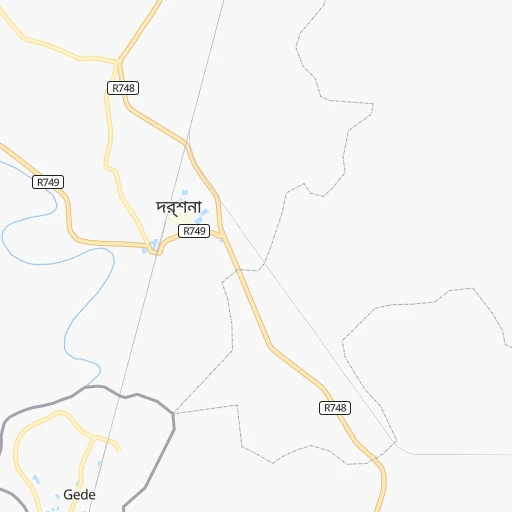
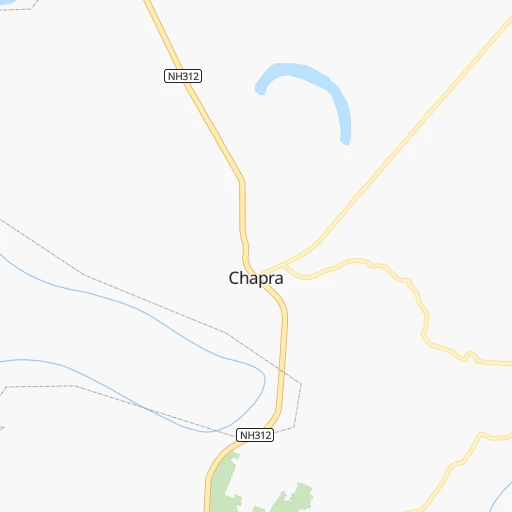
Roadmap (route) to go from Darsana Halt Railway Station to Feni detailed above, you can also see the course layout on the map.
While doing trip Darsana Halt Railway Station - Feni by car, the calculated route ends at a distance , or more straight.
Distance and duration of the route between Darsana Halt Railway Station and Feni
Calculation of distance and route from Feni to Darsana Halt Railway Station :
271.4370.8 km5h53mn
Continue onto Darsana - Mujibnagar Road 0h1mn 1.4 kmContinue 0h3mn 1.4 kmKeep left 0h3mn 1.7 kmTurn right 0h8mn 3.8 kmTurn left 0h2mn 1.2 kmTurn right 0h0mn 138 mTurn left 0h0mn 85 mTurn right 0h1mn 396 mTurn right 0h0mn 93 mTurn sharp left onto makhaldanga - মাখলডাঙ্গা 0h7mn 5.5 kmTurn right onto ঝিনাইদাহ-চুয়াডাঙ্গা সড়ক 0h27mn 30.1 kmAt roundabout, take exit 2 onto R775 0h1mn 776 mAt roundabout, take exit 1 onto H.S.S Road 0h0mn 92 mKeep right onto H.S.S Road 0h2mn 1.8 kmAt roundabout, take exit 2 onto ঝিনাইদহ-মাগুরা মহাসড়ক 0h22mn 25.5 kmAt roundabout, take exit 3 onto Jhenaidah - Magura Highway 1h41mn 48.0 kmAt roundabout, take exit 2 onto N803 0h0mn 119 mTurn right onto Faridpur Bypass Road 0h5mn 5.3 kmKeep right onto N808 0h0mn 62 mTurn right onto Faridpur-Bhanga Highway 0h21mn 24.9 kmKeep left 0h18mn 30.4 kmKeep right onto মাওয়া-ভাঙ্গা এক্সপ্রেসওয়ে 0h6mn 9.6 kmAt roundabout, take exit 2 onto ঢাকা-মাওয়া এক্সপ্রেসওয়ে 0h19mn 32.1 kmKeep left 0h1mn 810 mTurn sharp right onto Shahid Faruk Road 0h0mn 14 mKeep right 0h0mn 36 mAt roundabout, take exit 1 onto ঢাকা-চট্টগ্রাম মহাসড়ক 0h8mn 9.4 kmContinue onto ঢাকা-চট্টগ্রাম মহাসড়ক 0h12mn 13.9 kmKeep right onto ঢাকা-চট্টগ্রাম মহাসড়ক 1h19mn 117.0 kmTurn left onto ট্রাঙ্ক রোড 0h3mn 3.0 kmKeep right onto ট্রাঙ্ক রোড 0h2mn 2.1 kmTurn left onto Sohid Selina Parbin Road 0h1mn 151 mArrive at destination 0h0mn 0 m
Travel from Darsana Halt Railway Station (Chittagong) to a selection of major cities.
Distances from Darsana Halt Railway Station to biggest cities in Khulna
Other major cities in country :
- Paltan [81], 184,492 inhabitants. 167 km
- Tangail [81], 180,144 inhabitants. 140 km
- Jamalpur [H], 167,900 inhabitants. 194 km
- Puthia [83], 159,406 inhabitants. 94 km
- Nawabganj [83], 142,361 inhabitants. 130 km
- Sonargaon [81], 130,000 inhabitants. 186 km
- Sirajganj [83], 127,481 inhabitants. 139 km
- Faridpur [81], 112,187 inhabitants. 107 km
- Sherpur [H], 107,419 inhabitants. 207 km
- Bhairab Bazar [81], 105,457 inhabitants. 230 km
- Shahzadpur [83], 102,420 inhabitants. 109 km
- Bhola [85], 99,079 inhabitants. 211 km
- Azimpur [81], 96,641 inhabitants. 164 km
- Kishorganj [81], 90,690 inhabitants. 226 km
- Bibir Hat [84], 89,030 inhabitants. 321 km
- Habiganj [86], 88,760 inhabitants. 283 km
- Madaripur [81], 84,789 inhabitants. 150 km
- Feni [84], 84,028 inhabitants. 272 km
- Laksham [84], 82,290 inhabitants. 240 km
- Ishurdi [83], 81,995 inhabitants. 73 km
Route from Feni to major cities (Bangladesh).
- Distance Feni Dhaka127 km
- Distance Feni Khulna189 km
- Distance Feni Rajshahi323 km
- Distance Feni Shibganj306 km
- Distance Feni Natore291 km
- Distance Feni Rangpur374 km
- Distance Feni Tungi141 km
- Distance Feni Narsingdi123 km
- Distance Feni Bagerhat169 km
- Distance Feni Jessore224 km
- Distance Feni Nagarpur194 km
- Distance Feni Sylhet215 km
- Distance Feni Mymensingh219 km
- Distance Feni Narayanganj113 km
- Distance Feni Bogra290 km
- Distance Feni Dinajpur404 km
- Distance Feni Barisal111 km
- Distance Feni Saidpur399 km
- Distance Feni Par Naogaon319 km
- Distance Feni Pabna247 km
Nearest cities to Darsana Halt Railway Station :
- Dhaka, 10,356,500 inhabitants. 166 km
- Khulna, 1,342,339 inhabitants. 112 km
- Rajshahi, 700,133 inhabitants. 97 km
- Comilla, 389,411 inhabitants. 244 km
- Shibganj, 378,701 inhabitants. 173 km
- Natore, 369,138 inhabitants. 101 km
- Rangpur, 343,122 inhabitants. 252 km
- Tungi, 337,579 inhabitants. 169 km
- Narsingdi, 281,080 inhabitants. 201 km
- Bagerhat, 266,388 inhabitants. 140 km
- Jessore, 243,987 inhabitants. 58 km
- Nagarpur, 238,422 inhabitants. 125 km
- Mymensingh, 225,126 inhabitants. 213 km
- Narayanganj, 223,622 inhabitants. 174 km
- Bogra, 210,000 inhabitants. 159 km
- Dinajpur, 206,234 inhabitants. 235 km
- Barisal, 202,242 inhabitants. 185 km
- Saidpur, 199,422 inhabitants. 251 km
- Par Naogaon, 192,464 inhabitants. 143 km
- Pabna, 186,781 inhabitants. 70 km
- Paltan, 184,492 inhabitants. 167 km
- Tangail, 180,144 inhabitants. 140 km
- Jamalpur, 167,900 inhabitants. 194 km
- Puthia, 159,406 inhabitants. 94 km
- Nawabganj, 142,361 inhabitants. 130 km
- Kushtia, 135,724 inhabitants. 53 km
- Sonargaon, 130,000 inhabitants. 186 km
- Satkhira, 128,918 inhabitants. 95 km
- Sirajganj, 127,481 inhabitants. 139 km
- Faridpur, 112,187 inhabitants. 107 km
- Sherpur, 107,419 inhabitants. 207 km
- Bhairab Bazar, 105,457 inhabitants. 230 km
- Shahzadpur, 102,420 inhabitants. 109 km
- Bhola, 99,079 inhabitants. 211 km
- Azimpur, 96,641 inhabitants. 164 km
- Kishorganj, 90,690 inhabitants. 226 km
- Bibir Hat, 89,030 inhabitants. 321 km
- Habiganj, 88,760 inhabitants. 283 km
- Madaripur, 84,789 inhabitants. 150 km
- Feni, 84,028 inhabitants. 272 km
- Laksham, 82,290 inhabitants. 240 km
- Ishurdi, 81,995 inhabitants. 73 km
- Sarishabari, 81,325 inhabitants. 172 km
- Netrakona, 79,016 inhabitants. 248 km
- Joypur Hat, 73,068 inhabitants. 177 km
- Thakurgaon, 71,096 inhabitants. 281 km
- Palang, 67,652 inhabitants. 162 km
- Lalmonirhat, 65,127 inhabitants. 274 km
- Raipur, 64,652 inhabitants. 209 km
- Tungipara, 62,210 inhabitants. 133 km
Location Darsana Halt Railway Station (Khulna) :
| Country flag |  |
| Location | Darsana Halt Railway Station |
| State | Khulna |
| County | Chuadanga |
| Country | Bangladesh |
| Country code / ISO 2 | BD |
| Latitude | 23.5241400 |
| Longitude | 88.7961800 |
| Altitude | 0 meters |
| Time zone | Asia/Dhaka |
Location Feni (Chittagong) :
| Country flag | |
| Location | Feni |
| State | Chittagong |
| County | Feni |
| Country | Bangladesh |
| Country code / ISO 2 | BD |
| Latitude | 23.0144000 |
| Longitude | 91.3966000 |
| Altitude | 0 meters |
| Time zone | Asia/Dhaka |
