

How to get from Ciruelos (Los Ríos Region) to Arauco (Biobío)
Calculate route from Ciruelos (Los Ríos Region, Chile) to Arauco (Biobío, Chile).
The flight distance (as the crow flies) between Ciruelos and Arauco is 258.2 km.
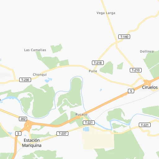
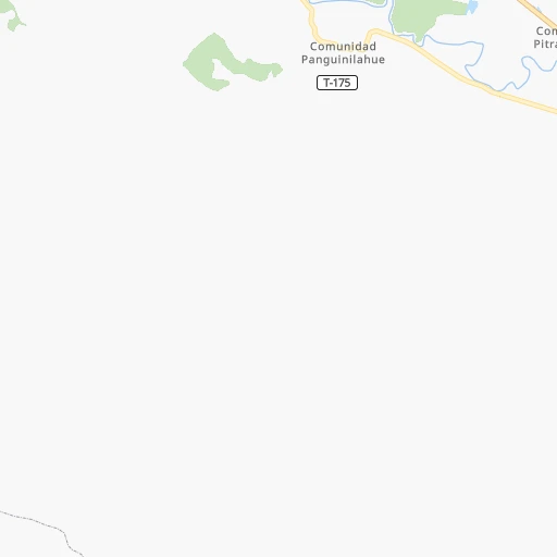
Roadmap (route) to go from Ciruelos to Arauco detailed above, you can also see the course layout on the map.
While doing trip Ciruelos - Arauco by car, the calculated route ends at a distance , or more straight.
Distance and duration of the route between Ciruelos and Arauco
Calculation of distance and route from Arauco to Ciruelos :
258.2349.2 km6h40mn
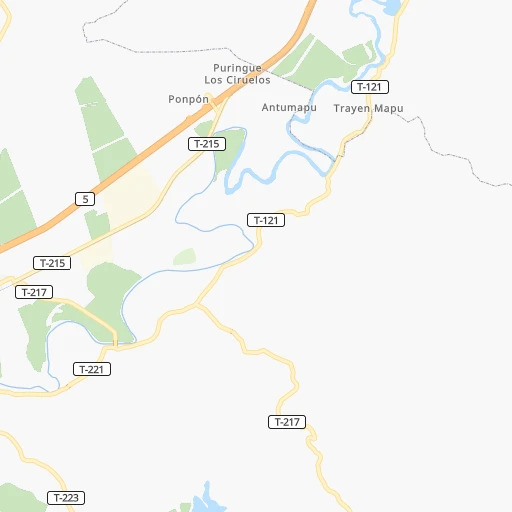
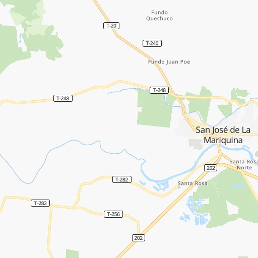
Continue 0h0mn 26 mTurn left onto Ruta T-217 0h2mn 1.3 kmTurn left and take 5 toward Osorno 0h3mn 5.8 kmKeep right and take 202, T-203 toward Valdivia, Estación Mariquina 0h0mn 44 mKeep right and take 202 toward Valdivia 0h1mn 468 mContinue onto Ruta 202 0h1mn 1.8 kmKeep right and take T-20 toward San José de La Mariquina 0h1mn 1.2 kmTurn left onto Godofredo Mera 0h0mn 98 mTurn right onto Los Carrera 0h0mn 240 mTurn left onto Mariquina 0h23mn 27.0 kmContinue onto Ruta T-270-S 0h4mn 4.1 kmKeep left onto Ruta T-270-S 0h3mn 2.7 kmTurn right onto Camino Pichilingue - Queule - Mehuín 0h1mn 1.1 kmTurn left onto Ruta S-790 1h36mn 38.9 kmTurn left onto Arturo Prat 0h1mn 671 mTurn left onto Esperanza 0h0mn 112 mTurn left onto Camino a Puerto Domínguez 0h28mn 30.5 kmTurn right onto Jorge Alessandri 0h12mn 12.9 kmTurn sharp left onto Camino El Alma - Molino El Temo 0h12mn 12.1 kmTurn sharp right 0h3mn 1.7 kmKeep right 0h0mn 214 mTurn left 0h5mn 2.6 kmTurn left onto Camino Reneco 0h2mn 1.1 kmTurn right 0h1mn 379 mTurn left 0h1mn 576 mTurn right onto Ruta S-40 0h2mn 2.1 kmTurn left onto Ruta S-138 1h45mn 46.1 kmTurn left onto Ruta P-760 0h3mn 1.5 kmTurn left onto Ruta P-72-S 0h3mn 3.7 kmTurn left onto Ruta P-756 0h3mn 1.3 kmTurn right onto Ruta P-756 0h0mn 13 mTurn left onto Ruta P-72-S 0h1mn 654 mTurn left onto Ignacio Carrera 0h0mn 93 mTurn right onto Julio Montt 1h58mn 59.9 kmContinue onto Ruta P-60-R 1h34mn 30.0 kmAt roundabout, take exit 1 onto Diego Portales 0h3mn 2.6 kmAt roundabout, take exit 2 onto Ruta 160 1h38mn 46.1 kmKeep right and take P-20 toward Arauco, Carampangue 0h0mn 284 mTurn left onto Ruta P-20 0h8mn 7.2 kmTurn left onto Caupolicán 0h0mn 62 mArrive at destination 0h0mn 0 m
Travel from Ciruelos (Biobío) to a selection of major cities.
Distances from Ciruelos to biggest cities in Los Ríos Region
Other major cities in country :
- Quilpue [01], 130,263 inhabitants. 734 km
- Copiapo [05], 129,280 inhabitants. 1,375 km
- Los Angeles [06], 125,430 inhabitants. 235 km
- Punta Arenas [10], 117,430 inhabitants. 1,523 km
- Lo Prado [12], 104,316 inhabitants. 705 km
- Curico [11], 102,438 inhabitants. 527 km
- Villa Alemana [01], 97,320 inhabitants. 736 km
- Coronel [06], 92,940 inhabitants. 280 km
- San Antonio [01], 85,651 inhabitants. 671 km
- Chiguayante [06], 82,545 inhabitants. 292 km
- Ovalle [07], 77,138 inhabitants. 1,007 km
- Linares [11], 69,535 inhabitants. 426 km
- Quillota [01], 67,779 inhabitants. 755 km
- Penaflor [12], 65,495 inhabitants. 684 km
- Melipilla [12], 63,100 inhabitants. 668 km
- San Felipe [01], 59,294 inhabitants. 780 km
- Los Andes [01], 56,859 inhabitants. 774 km
- Buin [12], 55,441 inhabitants. 674 km
- Talagante [12], 51,764 inhabitants. 677 km
Route from Arauco to major cities (Chile).
- Distance Arauco Santiago486 km
- Distance Arauco Puente Alto475 km
- Distance Arauco Antofagasta1,539 km
- Distance Arauco Vina del Mar497 km
- Distance Arauco Valparaiso493 km
- Distance Arauco San Bernardo471 km
- Distance Arauco Temuco178 km
- Distance Arauco Iquique1,921 km
- Distance Arauco Rancagua414 km
- Distance Arauco La Pintana475 km
- Distance Arauco Talca252 km
- Distance Arauco Arica2,110 km
- Distance Arauco Coquimbo832 km
- Distance Arauco Puerto Montt471 km
- Distance Arauco La Serena839 km
- Distance Arauco Calama1,700 km
- Distance Arauco Osorno371 km
- Distance Arauco Valdivia286 km
- Distance Arauco Quilpue498 km
- Distance Arauco Copiapo1,135 km
Nearest cities to Ciruelos :
- Talcahuano, 252,968 inhabitants. 314 km
- Temuco, 238,129 inhabitants. 92 km
- Concepcion, 215,413 inhabitants. 303 km
- Puerto Montt, 160,054 inhabitants. 215 km
- Chillan, 150,396 inhabitants. 333 km
- Osorno, 135,773 inhabitants. 117 km
- Valdivia, 133,419 inhabitants. 45 km
- Los Angeles, 125,430 inhabitants. 235 km
- Coronel, 92,940 inhabitants. 280 km
- Chiguayante, 82,545 inhabitants. 292 km
- Lota, 49,763 inhabitants. 274 km
- Tome, 46,698 inhabitants. 326 km
- Penco, 46,091 inhabitants. 312 km
- Angol, 44,856 inhabitants. 195 km
- Villarrica, 31,602 inhabitants. 61 km
- Curanilahue, 30,611 inhabitants. 234 km
- Las Animas, 30,000 inhabitants. 43 km
- Castro, 29,926 inhabitants. 335 km
- Ancud, 28,020 inhabitants. 272 km
- Pucon, 26,953 inhabitants. 83 km
- La Union, 26,298 inhabitants. 86 km
- Puerto Varas, 24,958 inhabitants. 198 km
- Arauco, 24,659 inhabitants. 259 km
- Victoria, 24,555 inhabitants. 153 km
- Lebu, 22,345 inhabitants. 226 km
- Mulchen, 22,170 inhabitants. 210 km
- Lautaro, 21,579 inhabitants. 118 km
- Nacimiento, 21,220 inhabitants. 228 km
- Canete, 20,158 inhabitants. 199 km
- Nueva Imperial, 18,777 inhabitants. 89 km
- Cabrero, 18,327 inhabitants. 282 km
- Frutillar, 16,939 inhabitants. 177 km
- La Laja, 16,550 inhabitants. 252 km
- Collipulli, 16,392 inhabitants. 180 km
- Panguipulli, 16,312 inhabitants. 47 km
- Loncoche, 15,590 inhabitants. 28 km
- Rio Bueno, 15,456 inhabitants. 89 km
- Traiguen, 14,481 inhabitants. 145 km
- Pitrufquen, 13,743 inhabitants. 65 km
- Purranque, 13,619 inhabitants. 155 km
- Bulnes, 12,715 inhabitants. 315 km
- Calbuco, 12,490 inhabitants. 249 km
- Carahue, 11,875 inhabitants. 96 km
- Yumbel, 11,111 inhabitants. 273 km
- Vilcun, 9,241 inhabitants. 112 km
- Freire, 7,813 inhabitants. 69 km
- Coihueco, 7,346 inhabitants. 337 km
- Puyehue, 3,932 inhabitants. 126 km
- Corral, 3,500 inhabitants. 62 km
Location Ciruelos (Los Ríos Region) :
| Country flag |  |
| Location | Ciruelos |
| State | Los Ríos Region |
| County | |
| Country | Chile |
| Country code / ISO 2 | CL |
| Latitude | -39.5417200 |
| Longitude | -72.8590500 |
| Altitude | 0 meters |
| Time zone | America/Santiago |
Location Arauco (Biobío) :
| Country flag | |
| Location | Arauco |
| State | Biobío |
| County | Provincia de Arauco |
| Country | Chile |
| Country code / ISO 2 | CL |
| Latitude | -37.2463000 |
| Longitude | -73.3175200 |
| Altitude | 0 meters |
| Time zone | America/Santiago |
