
How to get from Hatia (Jharkhand) to Kulti (West Bengal)
Calculate route from Hatia (Jharkhand, India) to Kulti (West Bengal, India).
The flight distance (as the crow flies) between Hatia and Kulti is 163.3 km.
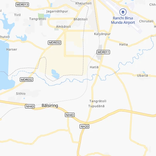
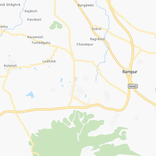
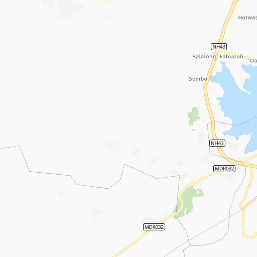
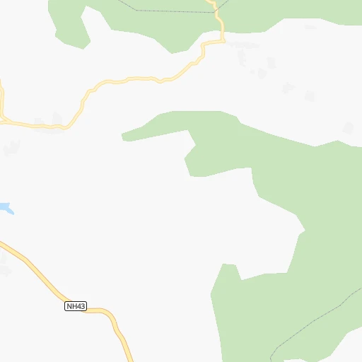
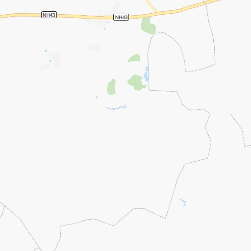
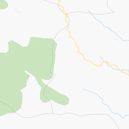
Roadmap (route) to go from Hatia to Kulti detailed above, you can also see the course layout on the map.
While doing trip Hatia - Kulti by car, the calculated route ends at a distance , or more straight.
Distance and duration of the route between Hatia and Kulti
Calculation of distance and route from Kulti to Hatia :
163.3195.5 km3h55mn
Continue 0h2mn 1.3 kmTurn left 0h0mn 114 mKeep right 0h0mn 229 mAt roundabout, take exit 2 onto Birsa Chowk 0h1mn 900 mAt roundabout, take exit 1 onto karpuri thakur chawk 0h2mn 1.8 kmAt roundabout, take exit 1 onto Vivekanand Chowk 0h0mn 411 mTurn right onto MDR003 0h0mn 288 mAt roundabout, take exit 1 onto Mahatma Gandhi Road 0h0mn 53 mContinue onto Mahatma Gandhi Road 0h1mn 1.0 kmAt roundabout, take exit 3 onto Ranchi Club Road 0h1mn 881 mTurn left onto Old Hazaribagh Road 0h2mn 1.7 kmContinue onto NH20 0h5mn 5.3 kmAt roundabout, take exit 2 onto NH33 0h0mn 72 mTurn slight left onto NH33 0h11mn 12.6 kmKeep right onto NH320B 0h11mn 13.2 kmTurn slight left onto MDR101 0h5mn 5.2 kmTurn left onto NH320B, MDR101 0h10mn 12.1 kmTurn right onto NH320 1h37mn 42.9 kmTurn left 0h7mn 8.1 kmTurn left onto Mahatma Gandhi Road 0h1mn 758 mAt roundabout, take exit 1 onto Mahatma Gandhi Road 0h1mn 877 mAt roundabout, take exit 1 onto Gandhi Chouk 0h1mn 782 mTurn sharp right 0h0mn 20 mKeep right 0h0mn 66 mContinue 0h1mn 911 mAt roundabout, take exit 2 onto Ambedkar mod/ chowk 0h2mn 2.3 kmKeep left 0h0mn 69 mAt roundabout, take exit 1 onto Jawahar Lal Nehru Road 0h1mn 1.0 kmTurn right onto Jawahar Lal Nehru Road 0h0mn 252 mTurn sharp left onto Jawahar Lal Nehru Road 0h0mn 235 mTurn right onto Jawahar Lal Nehru Road 0h1mn 591 mTurn left 0h0mn 117 mTurn right 0h4mn 3.6 kmTurn left onto NH18 0h6mn 6.8 kmKeep left onto NH18 0h2mn 1.4 kmTurn sharp right 0h2mn 2.3 kmTurn slight left onto NH18 0h14mn 16.4 kmTurn left onto NH18 0h1mn 879 mTurn slight left onto NH18 0h0mn 149 mAt roundabout, take exit 1 onto NH18 0h0mn 475 mAt roundabout, take exit 2 onto Dhaiya Main Road 0h0mn 379 mTurn left onto NH18 0h1mn 835 mAt roundabout, take exit 2 onto NH18 0h8mn 9.6 kmTurn slight left onto NH18 0h0mn 72 mTurn right onto NH19 0h22mn 26.0 kmTurn right onto Grand Trunk Road 0h5mn 5.7 kmAt roundabout, take exit 1 onto Grand Trunk Road 0h3mn 3.5 kmTurn left 0h0mn 47 mKeep right 0h0mn 110 mTurn right 0h2mn 788 mKeep right 0h0mn 219 mKeep right 0h0mn 49 mKeep left 0h0mn 80 mArrive at destination 0h0mn 0 m
Travel from Hatia (West Bengal) to a selection of major cities.
Distances from Hatia to biggest cities in Jharkhand
- Pakur,45,840 inhabitants.297 km
- Pathardih,45,276 inhabitants.121 km
- Gumla,44,951 inhabitants.84 km
- Godda,43,658 inhabitants.257 km
- Garhwa,40,662 inhabitants.180 km
- Chakradharpur,40,599 inhabitants.78 km
- Ghatsila,40,018 inhabitants.145 km
- Simdega,38,732 inhabitants.113 km
- Jamadoba,34,774 inhabitants.120 km
- Mushabani,32,761 inhabitants.148 km
- Sijua,31,537 inhabitants.116 km
- Gomoh,31,395 inhabitants.106 km
- Khunti,31,366 inhabitants.26 km
- Gobindpur,27,066 inhabitants.109 km
- Husainabad,26,184 inhabitants.190 km
- Jamtara,24,388 inhabitants.169 km
- Barki Saria,24,134 inhabitants.113 km
- Latehar,20,769 inhabitants.96 km
- Dugda,20,400 inhabitants.100 km
Other major cities in country :
- Vadodara [09], 1,409,476 inhabitants. 1,246 km
- Gorakhpur [10], 1,324,570 inhabitants. 1,178 km
- Nashik [16], 1,289,497 inhabitants. 1,247 km
- Pimpri [16], 1,284,606 inhabitants. 1,304 km
- Kalyan [16], 1,262,255 inhabitants. 1,341 km
- Thane [16], 1,261,517 inhabitants. 1,359 km
- Meerut [36], 1,223,184 inhabitants. 987 km
- Nowrangapur [21], 1,220,946 inhabitants. 537 km
- Faridabad [10], 1,220,229 inhabitants. 981 km
- Ghaziabad [36], 1,199,191 inhabitants. 987 km
- Dombivli [16], 1,193,000 inhabitants. 1,347 km
- Rajkot [09], 1,177,362 inhabitants. 1,493 km
- Varanasi [36], 1,164,404 inhabitants. 323 km
- Amritsar [23], 1,092,450 inhabitants. 1,383 km
- Allahabad [36], 1,073,438 inhabitants. 424 km
- Visakhapatnam [02], 1,063,178 inhabitants. 664 km
- Teni [25], 1,034,724 inhabitants. 1,699 km
- Jabalpur [35], 1,030,168 inhabitants. 548 km
- Haora [28], 1,027,672 inhabitants. 319 km
- Aurangabad [16], 1,016,441 inhabitants. 1,100 km
Route from Kulti to major cities (India).
- Distance Kulti Mumbai1,536 km
- Distance Kulti Delhi1,105 km
- Distance Kulti Bengaluru1,545 km
- Distance Kulti Chennai1,372 km
- Distance Kulti Ahmedabad1,458 km
- Distance Kulti Hyderabad1,124 km
- Distance Kulti Pune1,467 km
- Distance Kulti Surat1,468 km
- Distance Kulti Kanpur722 km
- Distance Kulti Jaipur1,167 km
- Distance Kulti Navi Mumbai1,525 km
- Distance Kulti Lucknow689 km
- Distance Kulti Nagpur848 km
- Distance Kulti Indore1,132 km
- Distance Kulti Patna270 km
- Distance Kulti Bhopal965 km
- Distance Kulti Ludhiana1,348 km
- Distance Kulti Tirunelveli1,934 km
- Distance Kulti Agra966 km
- Distance Kulti Vadodara1,406 km
Nearest cities to Hatia :
- Patna, 1,599,920 inhabitants. 255 km
- Varanasi, 1,164,404 inhabitants. 323 km
- Ranchi, 846,454 inhabitants. 4 km
- Jamshedpur, 616,338 inhabitants. 106 km
- Cuttack, 580,000 inhabitants. 322 km
- Raurkela, 536,450 inhabitants. 129 km
- Durgapur, 518,872 inhabitants. 206 km
- Asansol, 504,271 inhabitants. 176 km
- Nangi, 440,894 inhabitants. 311 km
- Gaya, 423,692 inhabitants. 168 km
- Korba, 419,146 inhabitants. 289 km
- Bokaro, 418,533 inhabitants. 85 km
- Bhagalpur, 361,548 inhabitants. 273 km
- Muzaffarpur, 333,200 inhabitants. 313 km
- Kulti, 305,405 inhabitants. 164 km
- Barddhaman, 301,725 inhabitants. 261 km
- Darbhanga, 287,150 inhabitants. 322 km
- Mau, 246,050 inhabitants. 342 km
- Bihar Sharif, 244,230 inhabitants. 211 km
- Arrah, 223,676 inhabitants. 258 km
- Mirzapur, 220,029 inhabitants. 345 km
- Kharagpur, 219,665 inhabitants. 233 km
- Dhanbad, 219,636 inhabitants. 128 km
- Monghyr, 203,163 inhabitants. 258 km
- Chapra, 201,597 inhabitants. 281 km
- Purnia, 198,453 inhabitants. 351 km
- Katihar, 192,555 inhabitants. 338 km
- Singrauli, 185,580 inhabitants. 286 km
- Baharampur, 180,547 inhabitants. 313 km
- Haldia, 170,695 inhabitants. 320 km
- Raiganj, 170,252 inhabitants. 383 km
- Ingraj Bazar, 170,039 inhabitants. 344 km
- Jaunpur, 169,572 inhabitants. 380 km
- Sambalpur, 162,887 inhabitants. 247 km
- Jamuria, 160,242 inhabitants. 186 km
- Medinipur, 153,349 inhabitants. 229 km
- Dinapore, 152,940 inhabitants. 260 km
- Saharsa, 145,764 inhabitants. 314 km
- Hazaribagh, 140,063 inhabitants. 76 km
- Bankura, 133,966 inhabitants. 181 km
- Hajipur, 133,606 inhabitants. 264 km
- Raniganj, 131,261 inhabitants. 189 km
- Dehri, 129,938 inhabitants. 211 km
- Puruliya, 122,533 inhabitants. 108 km
- Raigarh, 121,278 inhabitants. 252 km
- Siwan, 119,181 inhabitants. 338 km
- Azamgarh, 116,644 inhabitants. 375 km
- Balasore, 114,321 inhabitants. 263 km
- Chas, 112,141 inhabitants. 95 km
- Ghazipur, 103,095 inhabitants. 307 km
Location Hatia (Jharkhand) :
| Country flag |  |
| Location | Hatia |
| State | Jharkhand |
| County | Rānchī |
| Country | India |
| Country code / ISO 2 | IN |
| Latitude | 23.3116100 |
| Longitude | 85.3082200 |
| Altitude | 0 meters |
| Time zone | Asia/Kolkata |
Location Kulti (West Bengal) :
| Country flag | |
| Location | Kulti |
| State | West Bengal |
| County | Barddhamān |
| Country | India |
| Country code / ISO 2 | IN |
| Latitude | 23.7316600 |
| Longitude | 86.8437200 |
| Altitude | 0 meters |
| Time zone | Asia/Kolkata |


