


How to get from Perinad (Kerala) to Ottappālam (Kerala)
Calculate route from Perinad (Kerala, India) to Ottappālam (Kerala, India).
The flight distance (as the crow flies) between Perinad and Ottappālam is 204.6 km.
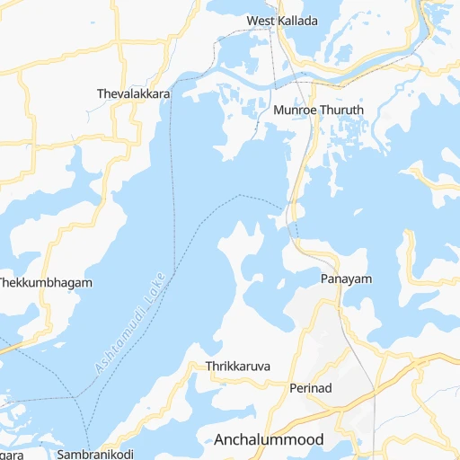
Roadmap (route) to go from Perinad to Ottappālam detailed above, you can also see the course layout on the map.
While doing trip Perinad - Ottappālam by car, the calculated route ends at a distance , or more straight.
Distance and duration of the route between Perinad and Ottappālam
Calculation of distance and route from Ottappālam to Perinad :
204.6258.1 km4h50mn
Continue 0h1mn 631 mKeep right 0h0mn 16 mTurn left 0h1mn 546 mTurn right onto Kollam - Teni Highway 0h4mn 5.5 kmContinue onto Kollam Bypass 0h2mn 2.1 kmContinue onto Salem - Kochi - Kanyakumari Road 0h23mn 24.6 kmKeep left 0h0mn 94 mContinue onto Salem - Kochi - Kanyakumari Road 0h18mn 18.7 kmTurn slight left onto Salem - Kochi - Kanyakumari Road 0h27mn 28.9 kmTurn slight left onto Salem-Kochi-Kanyakumari Road NH66 0h6mn 6.8 kmContinue onto Salem - Kochi - Kanyakumari Road 0h1mn 1.3 kmContinue onto Salem - Kochi - Kanyakumari Road 0h5mn 6.9 kmTurn slight left onto Salem - Kochi - Kanyakumari Road 0h6mn 7.3 kmTurn slight left onto Salem - Kochi - Kanyakumari Road 0h3mn 3.9 kmTurn slight left onto Salem - Kochi - Kanyakumari Road 0h28mn 32.1 kmContinue onto Vytilla Flyover 0h6mn 6.7 kmTurn right onto Salem - Kochi - Kanyakumari Highway 1h50mn 65.4 kmTurn left onto NH-Service-Road 0h0mn 10 mTurn right onto NH-Service-Road 0h2mn 1.1 kmKeep left onto Mannuthi Bazar Road 0h0mn 154 mTurn slight right onto Mannuthi Bazar Road 0h0mn 342 mTurn left onto Chirakkekode - Vellanikkara Road 0h1mn 1.1 kmKeep left onto Madakkathra - Mannuthi rd 0h1mn 1.3 kmTurn right onto Thanikkudam-Mannuthy Road 0h0mn 98 mTurn left onto Thanikkudam-Mannuthy Road 0h1mn 768 mTurn left onto Thanikkudam-Mudikkode Road 0h0mn 55 mTurn right onto Thanikkudam-Mudikkode Road 0h1mn 541 mTurn right onto Thanikkudam-Mudikkode Road 0h1mn 751 mTurn left onto Thanikkudam - Kallayi Road 0h0mn 255 mTurn right onto Thanikkudam-Karumathra Road 0h11mn 9.5 kmTurn left onto Wadakkanchery Vazhani Rd 0h4mn 3.2 kmKeep right 0h0mn 106 mTurn right onto Kodungallur - Shornur Road 0h4mn 4.4 kmKeep left onto Kodungallur - Shornur Road 0h7mn 8.6 kmAt roundabout, take exit 2 onto Shornur - Perinthalmanna Road 0h2mn 2.7 kmTurn right onto Ottappalam-Kulapully-Shornur Road 0h13mn 11.7 kmTurn sharp left onto Ottappalam Cherpulassery Road 0h0mn 104 mArrive at destination 0h0mn 0 m
Travel from Perinad (Kerala) to a selection of major cities.
Distances from Perinad to biggest cities in Kerala
- Kannur,62,836 inhabitants.353 km
- Malappuram,61,743 inhabitants.240 km
- Kottayam,59,437 inhabitants.72 km
- Nedumangad,58,278 inhabitants.57 km
- Tiruvalla,57,223 inhabitants.49 km
- Tirur,54,934 inhabitants.232 km
- Kasaragod,53,309 inhabitants.434 km
- Changanacheri,51,430 inhabitants.56 km
- Mannarakkat,50,921 inhabitants.228 km
- Ottappalam,50,913 inhabitants.205 km
- Kizhake Chalakudi,49,330 inhabitants.154 km
- Punalur,47,263 inhabitants.34 km
- Cherthala,45,827 inhabitants.88 km
- Mattanur,45,521 inhabitants.351 km
- Shertallai,45,474 inhabitants.88 km
- Varkala,43,276 inhabitants.26 km
- Shoranur,42,694 inhabitants.206 km
- Nadapuram,39,512 inhabitants.322 km
- Aroor,39,214 inhabitants.108 km
- Paravur Tekkumbhagam,38,946 inhabitants.18 km
Other major cities in country :
- Vadodara [09], 1,409,476 inhabitants. 1,530 km
- Gorakhpur [10], 1,324,570 inhabitants. 2,284 km
- Nashik [16], 1,289,497 inhabitants. 1,267 km
- Pimpri [16], 1,284,606 inhabitants. 1,119 km
- Kalyan [16], 1,262,255 inhabitants. 1,206 km
- Thane [16], 1,261,517 inhabitants. 1,207 km
- Meerut [36], 1,223,184 inhabitants. 2,233 km
- Nowrangapur [21], 1,220,946 inhabitants. 1,311 km
- Faridabad [10], 1,220,229 inhabitants. 2,168 km
- Ghaziabad [36], 1,199,191 inhabitants. 2,197 km
- Dombivli [16], 1,193,000 inhabitants. 1,205 km
- Rajkot [09], 1,177,362 inhabitants. 1,611 km
- Varanasi [36], 1,164,404 inhabitants. 1,944 km
- Amritsar [23], 1,092,450 inhabitants. 2,531 km
- Allahabad [36], 1,073,438 inhabitants. 1,918 km
- Visakhapatnam [02], 1,063,178 inhabitants. 1,205 km
- Teni [25], 1,034,724 inhabitants. 151 km
- Jabalpur [35], 1,030,168 inhabitants. 1,622 km
- Haora [28], 1,027,672 inhabitants. 1,965 km
- Aurangabad [16], 1,016,441 inhabitants. 1,224 km
Route from Ottappālam to major cities (India).
- Distance Ottappālam Mumbai997 km
- Distance Ottappālam Delhi1,992 km
- Distance Ottappālam Bengaluru278 km
- Distance Ottappālam Kolkata1,830 km
- Distance Ottappālam Chennai497 km
- Distance Ottappālam Ahmedabad1,422 km
- Distance Ottappālam Hyderabad769 km
- Distance Ottappālam Pune904 km
- Distance Ottappālam Surat1,221 km
- Distance Ottappālam Kanpur1,796 km
- Distance Ottappālam Jaipur1,798 km
- Distance Ottappālam Navi Mumbai988 km
- Distance Ottappālam Lucknow1,851 km
- Distance Ottappālam Nagpur1,190 km
- Distance Ottappālam Indore1,331 km
- Distance Ottappālam Patna1,890 km
- Distance Ottappālam Bhopal1,394 km
- Distance Ottappālam Ludhiana2,242 km
- Distance Ottappālam Tirunelveli269 km
- Distance Ottappālam Agra1,835 km
Nearest cities to Perinad :
- Tirunelveli, 1,435,844 inhabitants. 120 km
- Teni, 1,034,724 inhabitants. 151 km
- Coimbatore, 959,823 inhabitants. 232 km
- Madurai, 909,908 inhabitants. 197 km
- Thiruvananthapuram, 784,153 inhabitants. 63 km
- Salem, 778,396 inhabitants. 345 km
- Tiruchirappalli, 775,484 inhabitants. 308 km
- Cochin, 604,696 inhabitants. 117 km
- Kozhikode, 439,922 inhabitants. 272 km
- Thoothukudi, 410,760 inhabitants. 168 km
- Tiruppur, 397,521 inhabitants. 254 km
- Kollam, 394,163 inhabitants. 8 km
- Trichur, 325,110 inhabitants. 180 km
- Tanjore, 219,571 inhabitants. 344 km
- Nagercoil, 213,858 inhabitants. 124 km
- Dindigul, 200,797 inhabitants. 217 km
- Alleppey, 176,783 inhabitants. 68 km
- Erode, 147,270 inhabitants. 293 km
- Kumbakonam, 139,264 inhabitants. 378 km
- Palghat, 132,728 inhabitants. 203 km
- Rajapalaiyam, 124,168 inhabitants. 117 km
- Pudukkottai, 112,118 inhabitants. 289 km
- Ponnani, 105,512 inhabitants. 216 km
- Ooty, 98,238 inhabitants. 275 km
- Villupuram, 97,380 inhabitants. 458 km
- Tellicherry, 97,201 inhabitants. 335 km
- Karaikkudi, 91,908 inhabitants. 267 km
- Valparai, 90,353 inhabitants. 158 km
- Kovilpatti, 90,296 inhabitants. 140 km
- Manjeri, 89,201 inhabitants. 248 km
- Pollachi, 88,214 inhabitants. 195 km
- Neyyattinkara, 88,104 inhabitants. 80 km
- Tiruchengode, 87,123 inhabitants. 305 km
- Paramagudi, 85,695 inhabitants. 227 km
- Aruppukkottai, 85,369 inhabitants. 174 km
- Kadayanallur, 77,772 inhabitants. 80 km
- Karur, 76,915 inhabitants. 275 km
- Badagara, 76,493 inhabitants. 316 km
- Bodinayakkanur, 75,680 inhabitants. 143 km
- Srivilliputhur, 74,370 inhabitants. 128 km
- Sivakasi, 74,282 inhabitants. 141 km
- Virudunagar, 73,273 inhabitants. 163 km
- Dharapuram, 72,291 inhabitants. 223 km
- Beypore, 70,751 inhabitants. 263 km
- Munnar, 68,000 inhabitants. 136 km
- Chamrajnagar, 67,992 inhabitants. 333 km
- Pattukkottai, 67,982 inhabitants. 339 km
- Mettupalayam, 66,944 inhabitants. 264 km
- Palani, 66,085 inhabitants. 194 km
- Thenkasi, 65,496 inhabitants. 76 km
Location Perinad (Kerala) :
| Country flag |  |
| Location | Perinad |
| State | Kerala |
| County | Kollam |
| Country | India |
| Country code / ISO 2 | IN |
| Latitude | 8.9479200 |
| Longitude | 76.6203400 |
| Altitude | 0 meters |
| Time zone | Asia/Kolkata |
Location Ottappālam (Kerala) :
| Country flag | |
| Location | Ottappālam |
| State | Kerala |
| County | Palakkad district |
| Country | India |
| Country code / ISO 2 | IN |
| Latitude | 10.7735000 |
| Longitude | 76.3775800 |
| Altitude | 0 meters |
| Time zone | Asia/Kolkata |


