

How to get from Ettumanur (Kerala) to Nagercoil (Tamil Nadu)
Calculate route from Ettumanur (Kerala, India) to Nagercoil (Tamil Nadu, India).
The flight distance (as the crow flies) between Ettumanur and Nagercoil is 192.8 km.
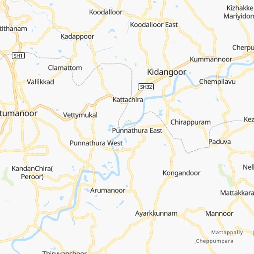
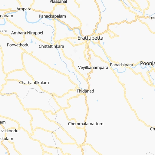
Roadmap (route) to go from Ettumanur to Nagercoil detailed above, you can also see the course layout on the map.
While doing trip Ettumanur - Nagercoil by car, the calculated route ends at a distance , or more straight.
Distance and duration of the route between Ettumanur and Nagercoil
Calculation of distance and route from Nagercoil to Ettumanur :
192.8229.0 km3h30mn
Continue 0h0mn 139 mTurn right 0h1mn 518 mTurn left onto Ettumanoor - Athirampuzha Road 0h1mn 653 mTurn right onto Kodathipady MC Road 0h1mn 636 mTurn right onto MC Road 0h8mn 8.7 kmAt roundabout, take exit 2 onto MC Road 0h0mn 65 mTurn slight left onto MC Road 0h1mn 684 mAt roundabout, take exit 2 onto MC Road 0h2mn 1.2 kmKeep left 0h0mn 205 mTurn left onto MC Road 0h2mn 2.7 kmTurn left onto Chettikunnu - Pakkil Road 0h19mn 23.4 kmTurn right onto Thiruvalla Bypass 0h0mn 10 mContinue onto MC Road 0h10mn 10.5 kmKeep left onto MC Road 0h17mn 20.6 kmContinue onto MC Road 0h0mn 269 mTurn right onto MC Road 0h3mn 2.1 kmAt roundabout, take exit 2 onto Main - Central Road 0h0mn 191 mContinue onto MC Road 1h43mn 51.2 kmContinue onto MC Road 0h11mn 13.0 kmKeep left onto MC Road 0h4mn 4.7 kmKeep right onto MC Road 0h9mn 10.8 kmAt roundabout, take exit 2 onto MC Road 0h3mn 4.0 kmAt roundabout, take exit 1 onto NH 66 0h4mn 3.2 kmTurn right onto LMS-Palayam MAHATHMAGANDHI ROAD 0h0mn 23 mContinue onto Mahatma Gandhi Road 0h0mn 159 mTurn left 0h0mn 217 mKeep left 0h0mn 307 mTurn left 0h0mn 34 mTurn left onto Ganapathy Kovil Road 0h1mn 1.5 kmKeep right 0h0mn 293 mTurn left 0h1mn 298 mTurn sharp left onto Melarannoor-Killipalam Road 0h0mn 17 mTurn sharp right onto Melarannoor Road 0h1mn 1.0 kmTurn right onto Poojapura Karamana Road 0h0mn 41 mTurn left onto Poojapura Karamana Road 0h0mn 31 mTurn left onto Thiruvananthapuram - Nagercoil Highway 0h13mn 11.1 kmTurn slight left onto Salem - Kochi - Kanyakumari Road 0h6mn 6.2 kmTurn right onto Viswabharathy Road, Neyyattinkara 0h1mn 652 mContinue onto Salem - Kochi - Kanyakumari Road 0h9mn 10.2 kmKeep right onto karali Pazhya Road 0h1mn 718 mTurn slight right onto Salem - Kochi - Kanyakumari Road 1h31mn 33.0 kmContinue onto MS Road 0h2mn 1.3 kmKeep right onto WCC Road 0h2mn 1.7 kmTurn right onto Salem - Cochin - Kanniyakumari Road (Old NH47) 0h0mn 463 mTurn sharp right 0h0mn 105 mTurn left 0h0mn 164 mTurn right onto Ganesapuram Road 0h0mn 134 mArrive at destination 0h0mn 0 m
Travel from Ettumanur (Tamil Nadu) to a selection of major cities.
Distances from Ettumanur to biggest cities in Kerala
- Kannur,62,836 inhabitants.276 km
- Malappuram,61,743 inhabitants.160 km
- Kottayam,59,437 inhabitants.10 km
- Nedumangad,58,278 inhabitants.130 km
- Tiruvalla,57,223 inhabitants.33 km
- Tirur,54,934 inhabitants.154 km
- Kasaragod,53,309 inhabitants.357 km
- Changanacheri,51,430 inhabitants.26 km
- Mannarakkat,50,921 inhabitants.147 km
- Ottappalam,50,913 inhabitants.124 km
- Kizhake Chalakudi,49,330 inhabitants.73 km
- Punalur,47,263 inhabitants.84 km
- Cherthala,45,827 inhabitants.23 km
- Mattanur,45,521 inhabitants.273 km
- Shertallai,45,474 inhabitants.23 km
- Varkala,43,276 inhabitants.107 km
- Shoranur,42,694 inhabitants.125 km
- Nadapuram,39,512 inhabitants.244 km
- Aroor,39,214 inhabitants.34 km
- Paravur Tekkumbhagam,38,946 inhabitants.99 km
Other major cities in country :
- Vadodara [09], 1,409,476 inhabitants. 1,450 km
- Gorakhpur [10], 1,324,570 inhabitants. 2,203 km
- Nashik [16], 1,289,497 inhabitants. 1,186 km
- Pimpri [16], 1,284,606 inhabitants. 1,039 km
- Kalyan [16], 1,262,255 inhabitants. 1,127 km
- Thane [16], 1,261,517 inhabitants. 1,128 km
- Meerut [36], 1,223,184 inhabitants. 2,152 km
- Nowrangapur [21], 1,220,946 inhabitants. 1,245 km
- Faridabad [10], 1,220,229 inhabitants. 2,087 km
- Ghaziabad [36], 1,199,191 inhabitants. 2,116 km
- Dombivli [16], 1,193,000 inhabitants. 1,126 km
- Rajkot [09], 1,177,362 inhabitants. 1,533 km
- Varanasi [36], 1,164,404 inhabitants. 1,870 km
- Amritsar [23], 1,092,450 inhabitants. 2,449 km
- Allahabad [36], 1,073,438 inhabitants. 1,843 km
- Visakhapatnam [02], 1,063,178 inhabitants. 1,145 km
- Teni [25], 1,034,724 inhabitants. 109 km
- Jabalpur [35], 1,030,168 inhabitants. 1,545 km
- Haora [28], 1,027,672 inhabitants. 1,908 km
- Aurangabad [16], 1,016,441 inhabitants. 1,143 km
Route from Nagercoil to major cities (India).
- Distance Nagercoil Mumbai1,308 km
- Distance Nagercoil Delhi2,279 km
- Distance Nagercoil Bengaluru534 km
- Distance Nagercoil Kolkata1,983 km
- Distance Nagercoil Ahmedabad1,732 km
- Distance Nagercoil Hyderabad1,031 km
- Distance Nagercoil Pune1,214 km
- Distance Nagercoil Surat1,531 km
- Distance Nagercoil Kanpur2,059 km
- Distance Nagercoil Jaipur2,093 km
- Distance Nagercoil Navi Mumbai1,299 km
- Distance Nagercoil Lucknow2,110 km
- Distance Nagercoil Nagpur1,454 km
- Distance Nagercoil Indore1,627 km
- Distance Nagercoil Patna2,104 km
- Distance Nagercoil Bhopal1,678 km
- Distance Nagercoil Ludhiana2,536 km
- Distance Nagercoil Agra2,116 km
- Distance Nagercoil Vadodara1,636 km
- Distance Nagercoil Gorakhpur2,375 km
Nearest cities to Ettumanur :
- Tirunelveli, 1,435,844 inhabitants. 164 km
- Teni, 1,034,724 inhabitants. 109 km
- Coimbatore, 959,823 inhabitants. 155 km
- Madurai, 909,908 inhabitants. 175 km
- Mysore, 868,313 inhabitants. 292 km
- Thiruvananthapuram, 784,153 inhabitants. 140 km
- Salem, 778,396 inhabitants. 282 km
- Tiruchirappalli, 775,484 inhabitants. 268 km
- Cochin, 604,696 inhabitants. 43 km
- Kozhikode, 439,922 inhabitants. 194 km
- Thoothukudi, 410,760 inhabitants. 202 km
- Tiruppur, 397,521 inhabitants. 183 km
- Kollam, 394,163 inhabitants. 89 km
- Trichur, 325,110 inhabitants. 100 km
- Tanjore, 219,571 inhabitants. 310 km
- Nagercoil, 213,858 inhabitants. 193 km
- Dindigul, 200,797 inhabitants. 175 km
- Alleppey, 176,783 inhabitants. 32 km
- Erode, 147,270 inhabitants. 226 km
- Kumbakonam, 139,264 inhabitants. 343 km
- Tiruvannamalai, 138,243 inhabitants. 396 km
- Mandya, 134,845 inhabitants. 319 km
- Palghat, 132,728 inhabitants. 123 km
- Rajapalaiyam, 124,168 inhabitants. 113 km
- Pudukkottai, 112,118 inhabitants. 262 km
- Ponnani, 105,512 inhabitants. 139 km
- Ooty, 98,238 inhabitants. 194 km
- Villupuram, 97,380 inhabitants. 409 km
- Tellicherry, 97,201 inhabitants. 258 km
- Karaikkudi, 91,908 inhabitants. 248 km
- Valparai, 90,353 inhabitants. 85 km
- Kovilpatti, 90,296 inhabitants. 156 km
- Manjeri, 89,201 inhabitants. 167 km
- Pollachi, 88,214 inhabitants. 121 km
- Neyyattinkara, 88,104 inhabitants. 154 km
- Tiruchengode, 87,123 inhabitants. 240 km
- Paramagudi, 85,695 inhabitants. 225 km
- Aruppukkottai, 85,369 inhabitants. 171 km
- Kadayanallur, 77,772 inhabitants. 110 km
- Karur, 76,915 inhabitants. 221 km
- Badagara, 76,493 inhabitants. 238 km
- Bodinayakkanur, 75,680 inhabitants. 96 km
- Srivilliputhur, 74,370 inhabitants. 121 km
- Sivakasi, 74,282 inhabitants. 140 km
- Virudunagar, 73,273 inhabitants. 155 km
- Dharapuram, 72,291 inhabitants. 160 km
- Beypore, 70,751 inhabitants. 185 km
- Payyannur, 70,069 inhabitants. 307 km
- Talipparamba, 69,878 inhabitants. 293 km
- Kannangad, 68,450 inhabitants. 333 km
Location Ettumanur (Kerala) :
| Country flag |  |
| Location | Ettumanur |
| State | Kerala |
| County | Kottayam |
| Country | India |
| Country code / ISO 2 | IN |
| Latitude | 9.6762000 |
| Longitude | 76.5451500 |
| Altitude | 0 meters |
| Time zone | Asia/Kolkata |
Location Nagercoil (Tamil Nadu) :
| Country flag | |
| Location | Nagercoil |
| State | Tamil Nadu |
| County | Kanniyakumari |
| Country | India |
| Country code / ISO 2 | IN |
| Latitude | 8.1789900 |
| Longitude | 77.4322700 |
| Altitude | 0 meters |
| Time zone | Asia/Kolkata |


