

How to get from Kazipet Jn (Telangana) to Uppal Kalan (Telangana)
Calculate route from Kazipet Jn (Telangana, India) to Uppal Kalan (Telangana, India).
The flight distance (as the crow flies) between Kazipet Jn and Uppal Kalan is 118.9 km.
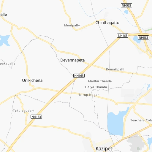
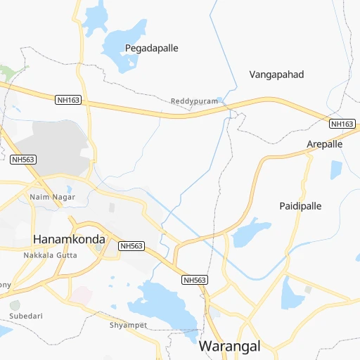
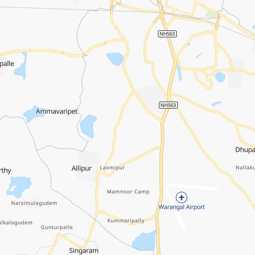
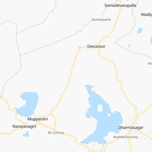
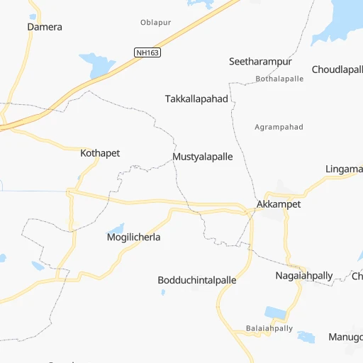
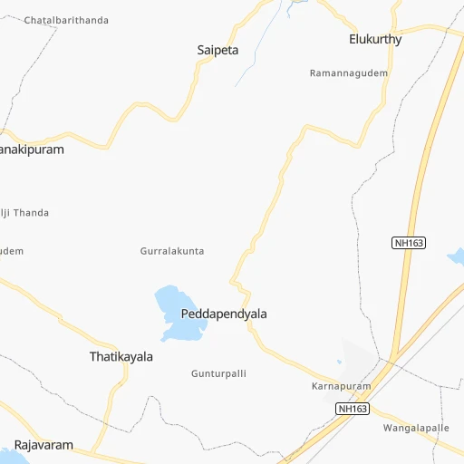
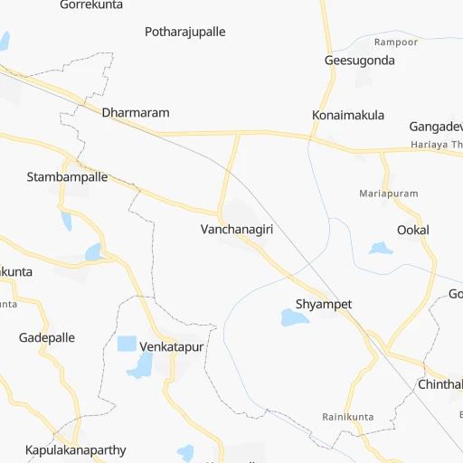
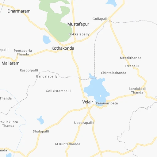
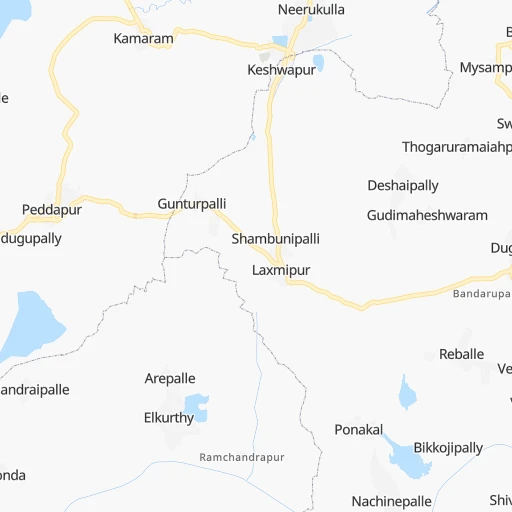
Roadmap (route) to go from Kazipet Jn to Uppal Kalan detailed above, you can also see the course layout on the map.
While doing trip Kazipet Jn - Uppal Kalan by car, the calculated route ends at a distance , or more straight.
Distance and duration of the route between Kazipet Jn and Uppal Kalan
Calculation of distance and route from Uppal Kalan to Kazipet Jn :
118.9126.3 km2h50mn
Continue 0h0mn 72 mTurn sharp left 0h0mn 149 mTurn left 0h9mn 10.4 kmTurn left 0h1mn 517 mKeep right 0h28mn 32.8 kmTurn right 0h7mn 7.8 kmTurn left 0h0mn 98 mTurn right onto NH163 0h7mn 8.1 kmTurn right 0h0mn 109 mTurn slight left 0h3mn 3.3 kmTurn slight left 0h3mn 3.5 kmContinue onto NH163 0h24mn 28.3 kmKeep left 0h26mn 30.3 kmKeep right 0h0mn 54 mTurn right onto NH163 0h0mn 198 mTurn left 0h1mn 578 mTurn right 0h0mn 95 mTurn left 0h0mn 13 mArrive at destination 0h0mn 0 m
Travel from Kazipet Jn (Telangana) to a selection of major cities.
Distances from Kazipet Jn to biggest cities in Telangana
- Nirmal,80,982 inhabitants.175 km
- Kottagudem,79,247 inhabitants.126 km
- Mancheral,77,998 inhabitants.100 km
- Paloncha,75,224 inhabitants.133 km
- Bodhan,73,938 inhabitants.188 km
- Sirsilla,71,499 inhabitants.87 km
- Kamareddi,71,042 inhabitants.130 km
- Palwancha,68,561 inhabitants.131 km
- Bellampalli,66,660 inhabitants.120 km
- Mandamarri,66,176 inhabitants.110 km
- Siddipet,64,562 inhabitants.72 km
- Tandur,63,239 inhabitants.221 km
- Koratla,60,231 inhabitants.127 km
- Sangareddi,59,199 inhabitants.156 km
- Kodar,59,170 inhabitants.119 km
- Gadwal,55,952 inhabitants.266 km
- Wanparti,55,182 inhabitants.236 km
- Gaddi Annaram,53,622 inhabitants.125 km
- Bhongir,50,094 inhabitants.84 km
- Jangaon,47,558 inhabitants.47 km
Other major cities in country :
- Gorakhpur [10], 1,324,570 inhabitants. 1,336 km
- Nashik [16], 1,289,497 inhabitants. 643 km
- Pimpri [16], 1,284,606 inhabitants. 607 km
- Kalyan [16], 1,262,255 inhabitants. 687 km
- Thane [16], 1,261,517 inhabitants. 704 km
- Meerut [36], 1,223,184 inhabitants. 1,239 km
- Nowrangapur [21], 1,220,946 inhabitants. 350 km
- Faridabad [10], 1,220,229 inhabitants. 1,183 km
- Ghaziabad [36], 1,199,191 inhabitants. 1,209 km
- Dombivli [16], 1,193,000 inhabitants. 692 km
- Rajkot [09], 1,177,362 inhabitants. 1,030 km
- Varanasi [36], 1,164,404 inhabitants. 894 km
- Amritsar [23], 1,092,450 inhabitants. 1,589 km
- Allahabad [36], 1,073,438 inhabitants. 866 km
- Visakhapatnam [02], 1,063,178 inhabitants. 392 km
- Teni [25], 1,034,724 inhabitants. 913 km
- Jabalpur [35], 1,030,168 inhabitants. 580 km
- Haora [28], 1,027,672 inhabitants. 1,052 km
- Aurangabad [16], 1,016,441 inhabitants. 487 km
- Shivaji Nagar [16], 1,000,000 inhabitants. 601 km
Route from Uppal Kalan to major cities (India).
- Distance Uppal Kalan Mumbai628 km
- Distance Uppal Kalan Delhi1,259 km
- Distance Uppal Kalan Bengaluru504 km
- Distance Uppal Kalan Kolkata1,175 km
- Distance Uppal Kalan Chennai515 km
- Distance Uppal Kalan Ahmedabad883 km
- Distance Uppal Kalan Pune513 km
- Distance Uppal Kalan Surat735 km
- Distance Uppal Kalan Kanpur1,025 km
- Distance Uppal Kalan Jaipur1,097 km
- Distance Uppal Kalan Navi Mumbai614 km
- Distance Uppal Kalan Lucknow1,078 km
- Distance Uppal Kalan Nagpur420 km
- Distance Uppal Kalan Indore656 km
- Distance Uppal Kalan Patna1,137 km
- Distance Uppal Kalan Bhopal662 km
- Distance Uppal Kalan Ludhiana1,528 km
- Distance Uppal Kalan Tirunelveli971 km
- Distance Uppal Kalan Agra1,090 km
- Distance Uppal Kalan Vadodara781 km
Nearest cities to Kazipet Jn :
- Hyderabad, 3,597,816 inhabitants. 130 km
- Vijayawada, 874,587 inhabitants. 203 km
- Amravati, 603,837 inhabitants. 378 km
- Warangal, 557,802 inhabitants. 8 km
- Nanded, 550,564 inhabitants. 267 km
- Guntur, 530,577 inhabitants. 212 km
- Gulbarga, 483,615 inhabitants. 292 km
- Kurnool, 460,184 inhabitants. 286 km
- Ramgundam, 452,261 inhabitants. 92 km
- Akola, 428,857 inhabitants. 403 km
- Latur, 348,967 inhabitants. 315 km
- Kukatpalli, 341,709 inhabitants. 128 km
- Bellary, 336,681 inhabitants. 419 km
- Chanda, 328,351 inhabitants. 221 km
- Nizamabad, 305,438 inhabitants. 168 km
- Rajahmundry, 304,804 inhabitants. 264 km
- Kakinada, 292,923 inhabitants. 311 km
- Parbhani, 289,629 inhabitants. 323 km
- Lal Bahadur Nagar, 261,987 inhabitants. 123 km
- Ramagundam, 235,000 inhabitants. 87 km
- Karimnagar, 228,745 inhabitants. 66 km
- Raichur, 225,962 inhabitants. 302 km
- Quthbullapur, 225,816 inhabitants. 123 km
- Secunderabad, 204,182 inhabitants. 115 km
- Bidar, 204,071 inhabitants. 210 km
- Machilipatnam, 192,827 inhabitants. 264 km
- Ellore, 183,387 inhabitants. 220 km
- Ongole, 172,872 inhabitants. 281 km
- Khammam, 170,503 inhabitants. 105 km
- Nandyal, 165,337 inhabitants. 299 km
- Adoni, 163,631 inhabitants. 354 km
- Serilingampalle, 150,525 inhabitants. 139 km
- Malkajgiri, 150,000 inhabitants. 120 km
- Bhimavaram, 142,967 inhabitants. 267 km
- Mahbubnagar, 136,135 inhabitants. 212 km
- Yavatmal, 128,175 inhabitants. 306 km
- Nalgonda, 121,826 inhabitants. 106 km
- Guntakal Junction, 120,964 inhabitants. 387 km
- Adilabad, 118,526 inhabitants. 215 km
- Uppal Kalan, 118,259 inhabitants. 119 km
- Gudivada, 116,161 inhabitants. 233 km
- Wardha, 113,759 inhabitants. 322 km
- Suriapet, 111,729 inhabitants. 94 km
- Tadepallegudem, 108,167 inhabitants. 250 km
- Gangawati, 106,250 inhabitants. 426 km
- Mirialguda, 101,234 inhabitants. 123 km
- Udgir, 101,064 inhabitants. 257 km
- Jagtial, 99,035 inhabitants. 111 km
- Hinganghat, 97,568 inhabitants. 295 km
- Narasaraopet, 97,194 inhabitants. 202 km
Location Kazipet Jn (Telangana) :
| Country flag |  |
| Location | Kazipet Jn |
| State | Telangana |
| County | Warangal |
| Country | India |
| Country code / ISO 2 | IN |
| Latitude | 17.9742100 |
| Longitude | 79.5110300 |
| Altitude | 0 meters |
| Time zone | Asia/Kolkata |
Location Uppal Kalan (Telangana) :
| Country flag | |
| Location | Uppal Kalan |
| State | Telangana |
| County | Rangareddi |
| Country | India |
| Country code / ISO 2 | IN |
| Latitude | 17.4057700 |
| Longitude | 78.5591100 |
| Altitude | 0 meters |
| Time zone | Asia/Kolkata |


