
How to get from Rajevadi (Maharashtra) to Badlapur (Maharashtra)
Calculate route from Rajevadi (Maharashtra, India) to Badlapur (Maharashtra, India).
The flight distance (as the crow flies) between Rajevadi and Badlapur is 126.9 km.
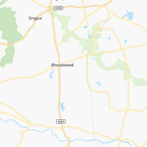
Roadmap (route) to go from Rajevadi to Badlapur detailed above, you can also see the course layout on the map.
While doing trip Rajevadi - Badlapur by car, the calculated route ends at a distance , or more straight.
Distance and duration of the route between Rajevadi and Badlapur
Calculation of distance and route from Badlapur to Rajevadi :
126.9166.5 km3h39mn
Continue 0h1mn 1.2 kmTurn sharp left onto SH63 0h1mn 1.4 kmTurn right 0h4mn 3.2 kmTurn right onto SH61 0h2mn 2.0 kmTurn left 0h2mn 2.0 kmTurn left 0h4mn 3.7 kmTurn left 0h4mn 3.6 kmTurn right 0h1mn 1.2 kmTurn left onto Solapur Road 0h12mn 13.7 kmKeep right onto Solapur Road 0h4mn 4.7 kmKeep right 0h0mn 122 mTurn left onto Prince Of Wales Drive 0h2mn 2.2 kmTurn right 0h1mn 635 mAt roundabout, take exit 2 0h3mn 1.5 kmKeep right 0h0mn 440 mKeep left onto Deccan College Road 0h4mn 4.1 kmAt roundabout, take exit 2 onto Elphinstone Road 0h2mn 2.0 kmTurn right onto Old Pune–Mumbai Highway 0h4mn 3.7 kmContinue onto Old Pune–Mumbai Highway 0h13mn 15.2 kmContinue onto Katraj - Dehu Road Bypass 0h7mn 8.6 kmKeep right onto NH48 0h28mn 32.3 kmTurn slight left onto NH48 0h4mn 4.2 kmContinue onto Old NH4 0h1mn 809 mTurn sharp left 0h0mn 11 mTurn sharp right onto NH48 0h2mn 857 mTurn slight left onto NH48 0h2mn 2.3 kmTurn right 0h0mn 81 mTurn left 0h1mn 1.1 kmTurn slight left 0h0mn 11 mTurn right 0h2mn 2.0 kmTurn left onto NH548A 0h0mn 220 mTurn right onto NH48 0h2mn 2.4 kmTurn right 0h11mn 12.2 kmTurn right onto Chowk - Karjat Road 0h1mn 1.5 kmAt roundabout, take exit 1 onto Karjat Road 0h20mn 22.0 kmTurn right 0h0mn 425 mTurn right 0h0mn 217 mTurn left 0h0mn 114 mKeep left 0h4mn 2.0 kmTurn slight right 0h3mn 1.6 kmTurn right 0h0mn 152 mTurn sharp left 0h2mn 1.9 kmTurn left 0h0mn 36 mTurn right 0h0mn 131 mTurn sharp left 0h3mn 2.7 kmTurn right 0h0mn 17 mArrive at destination 0h0mn 0 m
Travel from Rajevadi (Maharashtra) to a selection of major cities.
Distances from Rajevadi to biggest cities in Maharashtra
- Malegaon,435,362 inhabitants.244 km
- Jalgaon,429,298 inhabitants.327 km
- Akola,428,857 inhabitants.395 km
- Ahmadnagar,367,140 inhabitants.100 km
- Dhulia,366,980 inhabitants.288 km
- Latur,348,967 inhabitants.255 km
- Chanda,328,351 inhabitants.568 km
- Parbhani,289,629 inhabitants.293 km
- Ichalkaranji,274,383 inhabitants.191 km
- Jalna,262,034 inhabitants.244 km
- Amarnath,217,780 inhabitants.138 km
- Bhusaval,183,001 inhabitants.342 km
- Virar,150,357 inhabitants.185 km
- Yavatmal,128,175 inhabitants.474 km
- Panvel,128,046 inhabitants.129 km
- Gondia,124,897 inhabitants.719 km
- Wardha,113,759 inhabitants.535 km
- Satara,112,793 inhabitants.80 km
- Achalpur,111,278 inhabitants.475 km
- Barsi,110,983 inhabitants.163 km
Other major cities in country :
- Faridabad [10], 1,220,229 inhabitants. 1,162 km
- Ghaziabad [36], 1,199,191 inhabitants. 1,192 km
- Rajkot [09], 1,177,362 inhabitants. 559 km
- Varanasi [36], 1,164,404 inhabitants. 1,196 km
- Amritsar [23], 1,092,450 inhabitants. 1,475 km
- Allahabad [36], 1,073,438 inhabitants. 1,117 km
- Visakhapatnam [02], 1,063,178 inhabitants. 961 km
- Teni [25], 1,034,724 inhabitants. 999 km
- Jabalpur [35], 1,030,168 inhabitants. 804 km
- Haora [28], 1,027,672 inhabitants. 1,548 km
- Srinagar [12], 975,857 inhabitants. 1,749 km
- Chandigarh [05], 960,787 inhabitants. 1,400 km
- Coimbatore [25], 959,823 inhabitants. 875 km
- Jodhpur [24], 921,476 inhabitants. 886 km
- Madurai [25], 909,908 inhabitants. 1,035 km
- Guwahati [03], 899,094 inhabitants. 2,006 km
- Gwalior [35], 882,458 inhabitants. 966 km
- Vijayawada [02], 874,587 inhabitants. 720 km
- Mysore [19], 868,313 inhabitants. 728 km
- Ranchi [38], 846,454 inhabitants. 1,284 km
Route from Badlapur to major cities (India).
- Distance Badlapur Delhi1,131 km
- Distance Badlapur Bengaluru829 km
- Distance Badlapur Kolkata1,615 km
- Distance Badlapur Chennai1,009 km
- Distance Badlapur Ahmedabad437 km
- Distance Badlapur Hyderabad583 km
- Distance Badlapur Surat232 km
- Distance Badlapur Kanpur1,091 km
- Distance Badlapur Jaipur902 km
- Distance Badlapur Lucknow1,160 km
- Distance Badlapur Indore478 km
- Distance Badlapur Patna1,416 km
- Distance Badlapur Bhopal627 km
- Distance Badlapur Ludhiana1,334 km
- Distance Badlapur Tirunelveli1,255 km
- Distance Badlapur Agra1,017 km
- Distance Badlapur Vadodara350 km
- Distance Badlapur Gorakhpur1,171 km
- Distance Badlapur Meerut1,183 km
- Distance Badlapur Nowrangapur976 km
Nearest cities to Rajevadi :
- Mumbai, 12,691,836 inhabitants. 155 km
- Pune, 2,935,744 inhabitants. 35 km
- Surat, 2,894,504 inhabitants. 342 km
- Navi Mumbai, 2,600,000 inhabitants. 140 km
- Nashik, 1,289,497 inhabitants. 184 km
- Pimpri, 1,284,606 inhabitants. 45 km
- Kalyan, 1,262,255 inhabitants. 144 km
- Thane, 1,261,517 inhabitants. 155 km
- Dombivli, 1,193,000 inhabitants. 146 km
- Aurangabad, 1,016,441 inhabitants. 208 km
- Shivaji Nagar, 1,000,000 inhabitants. 36 km
- Solapur, 997,281 inhabitants. 202 km
- Bhiwandi, 707,035 inhabitants. 154 km
- Borivli, 609,617 inhabitants. 166 km
- Sangli, 601,214 inhabitants. 176 km
- Bhayandar, 520,301 inhabitants. 171 km
- Ulhasnagar, 516,584 inhabitants. 141 km
- Kolhapur, 516,142 inhabitants. 188 km
- Bilimora, 510,879 inhabitants. 294 km
- Gulbarga, 483,615 inhabitants. 307 km
- Malegaon, 435,362 inhabitants. 244 km
- Jalgaon, 429,298 inhabitants. 327 km
- Akola, 428,857 inhabitants. 395 km
- Belgaum, 428,720 inhabitants. 284 km
- Ahmadnagar, 367,140 inhabitants. 100 km
- Dhulia, 366,980 inhabitants. 288 km
- Latur, 348,967 inhabitants. 255 km
- Parbhani, 289,629 inhabitants. 293 km
- Ichalkaranji, 274,383 inhabitants. 191 km
- Bijapur, 271,064 inhabitants. 240 km
- Jalna, 262,034 inhabitants. 244 km
- Amarnath, 217,780 inhabitants. 138 km
- Burhanpur, 202,695 inhabitants. 391 km
- Bhusaval, 183,001 inhabitants. 342 km
- Gadag-Betageri, 172,813 inhabitants. 365 km
- Gadag, 162,569 inhabitants. 364 km
- Virar, 150,357 inhabitants. 185 km
- Panvel, 128,046 inhabitants. 129 km
- Satara, 112,793 inhabitants. 80 km
- Barsi, 110,983 inhabitants. 163 km
- Gangawati, 106,250 inhabitants. 415 km
- Badlapur, 104,636 inhabitants. 127 km
- Mormugao, 102,345 inhabitants. 335 km
- Udgir, 101,064 inhabitants. 313 km
- Nandurbar, 100,703 inhabitants. 332 km
- Vasco da Gama, 100,485 inhabitants. 335 km
- Airoli, 100,000 inhabitants. 149 km
- Amalner, 97,369 inhabitants. 310 km
- Bagalkot, 97,269 inhabitants. 294 km
- Chalisgaon, 96,381 inhabitants. 248 km
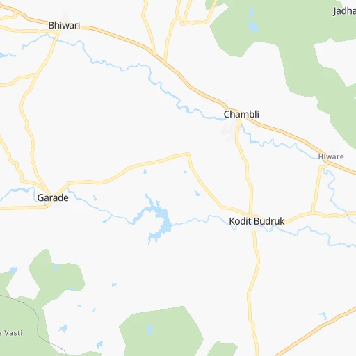
Location Rajevadi (Maharashtra) :
| Country flag |  |
| Location | Rajevadi |
| State | Maharashtra |
| County | Pune Division |
| Country | India |
| Country code / ISO 2 | IN |
| Latitude | 18.3841400 |
| Longitude | 74.1551300 |
| Altitude | 0 meters |
| Time zone | Asia/Kolkata |
Location Badlapur (Maharashtra) :
| Country flag | |
| Location | Badlapur |
| State | Maharashtra |
| County | Thane |
| Country | India |
| Country code / ISO 2 | IN |
| Latitude | 19.1551600 |
| Longitude | 73.2655300 |
| Altitude | 0 meters |
| Time zone | Asia/Kolkata |


