


How to get from Itehar (Madhya Pradesh) to Rāmpur (Uttar Pradesh)
Calculate route from Itehar (Madhya Pradesh, India) to Rāmpur (Uttar Pradesh, India).
The flight distance (as the crow flies) between Itehar and Rāmpur is 252.0 km.
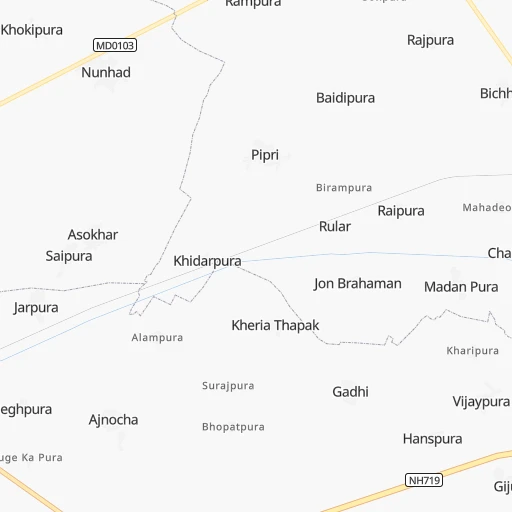
Roadmap (route) to go from Itehar to Rāmpur detailed above, you can also see the course layout on the map.
While doing trip Itehar - Rāmpur by car, the calculated route ends at a distance , or more straight.
Distance and duration of the route between Itehar and Rāmpur
Calculation of distance and route from Rāmpur to Itehar :
252.0332.9 km5h0mn
Continue 0h0mn 86 mTurn right 0h1mn 536 mTurn left 0h1mn 601 mKeep left 0h6mn 3.0 kmTurn right 0h1mn 270 mTurn right 0h0mn 36 mTurn left 0h0mn 43 mTurn right 0h0mn 143 mTurn sharp left 0h0mn 69 mTurn sharp right 0h5mn 2.5 kmTurn slight left onto NH719 0h5mn 5.5 kmAt roundabout, take exit 3 onto NH719 0h24mn 28.0 kmContinue 0h3mn 3.6 kmTurn right 0h2mn 1.6 kmTurn slight left 0h0mn 412 mTurn right 0h0mn 189 mTurn left 0h1mn 443 mTurn left 0h0mn 161 mTurn right 1h50mn 58.1 kmKeep left 0h1mn 661 mTurn right 0h0mn 11 mKeep left 0h0mn 247 mContinue onto NH730C 1h34mn 39.6 kmAt roundabout, take exit 2 onto NH730C 1h4mn 74.9 kmTurn slight left onto NH30 0h19mn 22.6 kmKeep left 0h3mn 2.3 kmKeep right 0h2mn 1.4 kmTurn left onto NH30 0h7mn 7.8 kmKeep left 0h8mn 8.9 kmAt roundabout, take exit 1 0h1mn 1.2 kmKeep right onto Shyamatganj Road 0h1mn 776 mKeep left onto Shyamatganj Road 0h12mn 11.9 kmKeep left 0h3mn 3.9 kmTurn right 0h0mn 92 mTurn slight left 0h2mn 1.9 kmKeep left 0h0mn 73 mTurn right onto NH530 0h17mn 19.3 kmKeep left 0h4mn 4.1 kmKeep left onto NH530 0h15mn 17.1 kmKeep right 0h4mn 4.8 kmTurn right onto NH9 0h1mn 1.4 kmKeep left 0h1mn 935 mKeep right 0h1mn 729 mTurn right 0h1mn 623 mTurn left 0h0mn 99 mTurn right onto Quraysh Street 0h0mn 26 mTurn left 0h0mn 85 mTurn sharp left 0h0mn 39 mArrive at destination 0h0mn 0 m
Travel from Itehar (Uttar Pradesh) to a selection of major cities.
Distances from Itehar to biggest cities in Madhya Pradesh
- Chhindwara,134,847 inhabitants.502 km
- Mandsaur,124,988 inhabitants.457 km
- Damoh,118,776 inhabitants.313 km
- Chhatarpur,111,594 inhabitants.204 km
- Hoshangabad,109,358 inhabitants.436 km
- Nagda,103,501 inhabitants.477 km
- Seoni,101,379 inhabitants.506 km
- Itarsi,100,574 inhabitants.449 km
- Sehore,99,284 inhabitants.408 km
- Khargone,94,985 inhabitants.613 km
- Betul,91,953 inhabitants.525 km
- Datia,90,628 inhabitants.102 km
- Shahdol,89,289 inhabitants.453 km
- Dhar,82,438 inhabitants.559 km
- Balaghat,80,360 inhabitants.550 km
- Tikamgarh,74,724 inhabitants.203 km
- Basoda,69,278 inhabitants.311 km
- Pithampur,68,051 inhabitants.535 km
- Harda Khas,67,387 inhabitants.496 km
- Jaora,67,203 inhabitants.484 km
Other major cities in country :
- Nashik [16], 1,289,497 inhabitants. 885 km
- Pimpri [16], 1,284,606 inhabitants. 1,016 km
- Kalyan [16], 1,262,255 inhabitants. 993 km
- Thane [16], 1,261,517 inhabitants. 1,008 km
- Meerut [36], 1,223,184 inhabitants. 286 km
- Nowrangapur [21], 1,220,946 inhabitants. 907 km
- Faridabad [10], 1,220,229 inhabitants. 246 km
- Ghaziabad [36], 1,199,191 inhabitants. 264 km
- Dombivli [16], 1,193,000 inhabitants. 999 km
- Rajkot [09], 1,177,362 inhabitants. 930 km
- Varanasi [36], 1,164,404 inhabitants. 455 km
- Amritsar [23], 1,092,450 inhabitants. 674 km
- Allahabad [36], 1,073,438 inhabitants. 340 km
- Visakhapatnam [02], 1,063,178 inhabitants. 1,093 km
- Teni [25], 1,034,724 inhabitants. 1,847 km
- Haora [28], 1,027,672 inhabitants. 1,071 km
- Aurangabad [16], 1,016,441 inhabitants. 819 km
- Shivaji Nagar [16], 1,000,000 inhabitants. 1,023 km
- Solapur [16], 997,281 inhabitants. 1,030 km
- Srinagar [12], 975,857 inhabitants. 916 km
Route from Rāmpur to major cities (India).
- Distance Rāmpur Mumbai1,251 km
- Distance Rāmpur Delhi176 km
- Distance Rāmpur Bengaluru1,769 km
- Distance Rāmpur Kolkata1,166 km
- Distance Rāmpur Chennai1,755 km
- Distance Rāmpur Ahmedabad911 km
- Distance Rāmpur Hyderabad1,273 km
- Distance Rāmpur Pune1,261 km
- Distance Rāmpur Surat1,053 km
- Distance Rāmpur Jaipur382 km
- Distance Rāmpur Navi Mumbai1,248 km
- Distance Rāmpur Nagpur853 km
- Distance Rāmpur Indore750 km
- Distance Rāmpur Patna703 km
- Distance Rāmpur Bhopal639 km
- Distance Rāmpur Ludhiana385 km
- Distance Rāmpur Tirunelveli2,240 km
- Distance Rāmpur Vadodara931 km
- Distance Rāmpur Gorakhpur334 km
- Distance Rāmpur Nashik1,115 km
Nearest cities to Itehar :
- Delhi, 10,927,986 inhabitants. 273 km
- Kanpur, 2,823,249 inhabitants. 166 km
- Jaipur, 2,711,758 inhabitants. 291 km
- Lucknow, 2,472,011 inhabitants. 225 km
- Agra, 1,430,055 inhabitants. 96 km
- Meerut, 1,223,184 inhabitants. 286 km
- Faridabad, 1,220,229 inhabitants. 246 km
- Ghaziabad, 1,199,191 inhabitants. 264 km
- Gwalior, 882,458 inhabitants. 63 km
- Kota, 763,088 inhabitants. 324 km
- Aligarh, 753,207 inhabitants. 159 km
- Bareilly, 745,435 inhabitants. 214 km
- Moradabad, 721,139 inhabitants. 254 km
- Karol Bagh, 505,241 inhabitants. 275 km
- Jhansi, 412,927 inhabitants. 123 km
- Muzaffarnagar, 349,706 inhabitants. 338 km
- Mathura, 330,511 inhabitants. 145 km
- Shahjanpur, 320,434 inhabitants. 190 km
- New Delhi, 317,797 inhabitants. 272 km
- Rohtak, 317,245 inhabitants. 332 km
- Firozabad, 306,409 inhabitants. 71 km
- Hisar, 296,436 inhabitants. 410 km
- Rampur, 296,418 inhabitants. 252 km
- Noida, 293,908 inhabitants. 261 km
- Greater Noida, 293,908 inhabitants. 243 km
- Panipat, 292,808 inhabitants. 357 km
- Alwar, 283,228 inhabitants. 232 km
- Satna, 257,778 inhabitants. 308 km
- Etawah, 257,448 inhabitants. 41 km
- Sonipat, 250,521 inhabitants. 316 km
- Saugor, 247,333 inhabitants. 303 km
- Hapur, 242,920 inhabitants. 257 km
- Farrukhabad, 241,152 inhabitants. 128 km
- Bharatpur, 229,384 inhabitants. 139 km
- Rewa, 208,461 inhabitants. 346 km
- Bulandshahr, 198,612 inhabitants. 221 km
- Gurgaon, 197,340 inhabitants. 267 km
- Sambhal, 196,109 inhabitants. 225 km
- Murwara, 195,856 inhabitants. 349 km
- Nangloi Jat, 194,363 inhabitants. 284 km
- Bhiwani, 190,855 inhabitants. 353 km
- Raebareli, 186,433 inhabitants. 257 km
- Bahraigh, 182,218 inhabitants. 310 km
- Amroha, 176,253 inhabitants. 261 km
- Bhind, 174,035 inhabitants. 10 km
- Fatehpur, 166,480 inhabitants. 224 km
- Loni, 164,810 inhabitants. 280 km
- Sitapur, 164,435 inhabitants. 227 km
- Shivpuri, 164,215 inhabitants. 163 km
- Unnao, 161,671 inhabitants. 180 km
Location Itehar (Madhya Pradesh) :
| Country flag |  |
| Location | Itehar |
| State | Madhya Pradesh |
| County | Bhind |
| Country | India |
| Country code / ISO 2 | IN |
| Latitude | 26.5626400 |
| Longitude | 78.6837800 |
| Altitude | 0 meters |
| Time zone | Asia/Kolkata |
Location Rāmpur (Uttar Pradesh) :
| Country flag | |
| Location | Rāmpur |
| State | Uttar Pradesh |
| County | Rāmpur |
| Country | India |
| Country code / ISO 2 | IN |
| Latitude | 28.8101400 |
| Longitude | 79.0269900 |
| Altitude | 0 meters |
| Time zone | Asia/Kolkata |

