

How to get from Jaleswar (Odisha) to Naihāti (West Bengal)
Calculate route from Jaleswar (Odisha, India) to Naihāti (West Bengal, India).
The flight distance (as the crow flies) between Jaleswar and Naihāti is 173.0 km.
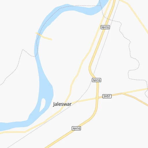
Roadmap (route) to go from Jaleswar to Naihāti detailed above, you can also see the course layout on the map.
While doing trip Jaleswar - Naihāti by car, the calculated route ends at a distance , or more straight.
Distance and duration of the route between Jaleswar and Naihāti
Calculation of distance and route from Naihāti to Jaleswar :
173.0220.6 km3h10mn
Continue 0h29mn 31.8 kmTurn left 0h2mn 2.1 kmTurn slight left onto SH5 0h1mn 562 mContinue 0h1mn 1.1 kmTurn left onto NH16 0h6mn 6.5 kmKeep left 0h5mn 5.2 kmTurn left onto NH16 2h51mn 135.3 kmKeep left onto NH12 0h5mn 6.2 kmKeep right 0h1mn 1.3 kmKeep left onto SH2 0h0mn 390 mTurn left onto Barrackpore Trunk Road 0h11mn 12.3 kmAt roundabout, take exit 1 onto Barrackpore Trunk Road 0h0mn 355 mTurn right 0h0mn 129 mTurn right 0h0mn 22 mTurn left 0h0mn 147 mTurn right onto Shanti Bazar Lane 0h0mn 133 mKeep left 0h0mn 193 mTurn left 0h0mn 30 mTurn slight left onto SH1 0h14mn 15.9 kmTurn left 0h0mn 137 mTurn right 0h0mn 203 mTurn left 0h0mn 139 mTurn right 0h1mn 466 mTurn sharp left 0h0mn 37 mArrive at destination 0h0mn 0 m
Travel from Jaleswar (West Bengal) to a selection of major cities.
Distances from Jaleswar to biggest cities in Odisha
- Angul,44,386 inhabitants.244 km
- Kendraparha,43,843 inhabitants.166 km
- Khurda,42,526 inhabitants.245 km
- Jajpur,42,157 inhabitants.140 km
- Sundargarh,41,705 inhabitants.331 km
- Koraput,41,170 inhabitants.576 km
- Burla,40,816 inhabitants.348 km
- Talcher,38,436 inhabitants.227 km
- Phulbani,36,613 inhabitants.343 km
- Patamundai,34,400 inhabitants.152 km
- Jagatsinghapur,32,945 inhabitants.203 km
- Basudebpur,31,827 inhabitants.91 km
- Remuna,30,319 inhabitants.47 km
- Soro,29,797 inhabitants.80 km
- Titlagarh,28,405 inhabitants.455 km
- Birmitrapur,27,879 inhabitants.262 km
- Hirakud,27,277 inhabitants.348 km
- Malakanagiri,25,054 inhabitants.676 km
- Jaleshwar,23,280 inhabitants.1 km
- Kuchaiburi,23,072 inhabitants.120 km
Other major cities in country :
- Vadodara [09], 1,409,476 inhabitants. 1,446 km
- Gorakhpur [10], 1,324,570 inhabitants. 1,437 km
- Nashik [16], 1,289,497 inhabitants. 1,410 km
- Pimpri [16], 1,284,606 inhabitants. 1,445 km
- Kalyan [16], 1,262,255 inhabitants. 1,495 km
- Thane [16], 1,261,517 inhabitants. 1,514 km
- Meerut [36], 1,223,184 inhabitants. 1,246 km
- Faridabad [10], 1,220,229 inhabitants. 1,240 km
- Ghaziabad [36], 1,199,191 inhabitants. 1,246 km
- Dombivli [16], 1,193,000 inhabitants. 1,501 km
- Rajkot [09], 1,177,362 inhabitants. 1,695 km
- Varanasi [36], 1,164,404 inhabitants. 581 km
- Amritsar [23], 1,092,450 inhabitants. 1,642 km
- Allahabad [36], 1,073,438 inhabitants. 682 km
- Visakhapatnam [02], 1,063,178 inhabitants. 622 km
- Teni [25], 1,034,724 inhabitants. 1,675 km
- Jabalpur [35], 1,030,168 inhabitants. 763 km
- Haora [28], 1,027,672 inhabitants. 143 km
- Aurangabad [16], 1,016,441 inhabitants. 1,254 km
- Shivaji Nagar [16], 1,000,000 inhabitants. 1,443 km
Route from Naihāti to major cities (India).
- Distance Naihāti Mumbai1,668 km
- Distance Naihāti Delhi1,290 km
- Distance Naihāti Bengaluru1,590 km
- Distance Naihāti Chennai1,390 km
- Distance Naihāti Ahmedabad1,622 km
- Distance Naihāti Hyderabad1,207 km
- Distance Naihāti Pune1,591 km
- Distance Naihāti Surat1,618 km
- Distance Naihāti Kanpur907 km
- Distance Naihāti Jaipur1,351 km
- Distance Naihāti Navi Mumbai1,656 km
- Distance Naihāti Lucknow875 km
- Distance Naihāti Nagpur982 km
- Distance Naihāti Indore1,291 km
- Distance Naihāti Patna448 km
- Distance Naihāti Bhopal1,128 km
- Distance Naihāti Ludhiana1,532 km
- Distance Naihāti Tirunelveli1,949 km
- Distance Naihāti Agra1,152 km
- Distance Naihāti Vadodara1,564 km
Nearest cities to Jaleswar :
- Kolkata, 4,631,392 inhabitants. 145 km
- Haora, 1,027,672 inhabitants. 143 km
- Ranchi, 846,454 inhabitants. 261 km
- Bhubaneshwar, 762,243 inhabitants. 223 km
- Jamshedpur, 616,338 inhabitants. 155 km
- Cuttack, 580,000 inhabitants. 203 km
- Raurkela, 536,450 inhabitants. 248 km
- Durgapur, 518,872 inhabitants. 191 km
- Asansol, 504,271 inhabitants. 211 km
- Bhatpara, 483,129 inhabitants. 170 km
- Shyamnagar, 441,956 inhabitants. 165 km
- Nangi, 440,894 inhabitants. 130 km
- Gaya, 423,692 inhabitants. 404 km
- Bokaro, 418,533 inhabitants. 257 km
- Panihati, 378,705 inhabitants. 155 km
- Kamarhati, 332,965 inhabitants. 154 km
- Brahmapur, 324,726 inhabitants. 375 km
- Kulti, 305,405 inhabitants. 219 km
- Barddhaman, 301,725 inhabitants. 175 km
- Barasat, 298,127 inhabitants. 166 km
- Bali, 296,973 inhabitants. 149 km
- Baranagar, 260,072 inhabitants. 152 km
- Naihati, 253,221 inhabitants. 173 km
- Barasat, 237,783 inhabitants. 136 km
- Shrirampur, 226,317 inhabitants. 157 km
- Gosaba, 222,764 inhabitants. 168 km
- Kharagpur, 219,665 inhabitants. 61 km
- Dhanbad, 219,636 inhabitants. 237 km
- Kultali, 187,942 inhabitants. 122 km
- Chandannagar, 180,623 inhabitants. 167 km
- Baharampur, 180,547 inhabitants. 278 km
- Hugli, 177,005 inhabitants. 173 km
- Puri, 170,841 inhabitants. 266 km
- Haldia, 170,695 inhabitants. 96 km
- Madhyamgram, 161,126 inhabitants. 161 km
- Jamuria, 160,242 inhabitants. 213 km
- Medinipur, 153,349 inhabitants. 70 km
- Shantipur, 149,983 inhabitants. 204 km
- Barakpur, 148,174 inhabitants. 160 km
- Krishnanagar, 145,926 inhabitants. 222 km
- Hazaribagh, 140,063 inhabitants. 310 km
- Habra, 139,297 inhabitants. 188 km
- Kanchrapara, 136,954 inhabitants. 179 km
- Bankura, 133,966 inhabitants. 160 km
- Raniganj, 131,261 inhabitants. 203 km
- Khardah, 128,346 inhabitants. 157 km
- Halisahar, 128,172 inhabitants. 177 km
- Titagarh, 127,751 inhabitants. 159 km
- Dam Dam, 122,719 inhabitants. 155 km
- Puruliya, 122,533 inhabitants. 192 km
Location Jaleswar (Odisha) :
| Country flag |  |
| Location | Jaleswar |
| State | Odisha |
| County | Bāleshwar |
| Country | India |
| Country code / ISO 2 | IN |
| Latitude | 21.7974900 |
| Longitude | 87.2204900 |
| Altitude | 0 meters |
| Time zone | Asia/Kolkata |
Location Naihāti (West Bengal) :
| Country flag | |
| Location | Naihāti |
| State | West Bengal |
| County | North 24 Parganas |
| Country | India |
| Country code / ISO 2 | IN |
| Latitude | 22.8939600 |
| Longitude | 88.4152100 |
| Altitude | 0 meters |
| Time zone | Asia/Kolkata |


