
Home
››
Aérodrome De Secours De Berkine
››
Roadmap from Aérodrome De Secours De Berkine to Khemisset
How to get from Aérodrome De Secours De Berkine (Oriental) to Khemisset (Rabat-Salé-Kénitra)
Calculate route from Aérodrome De Secours De Berkine (Oriental, Morocco) to Khemisset (Rabat-Salé-Kénitra, Morocco).
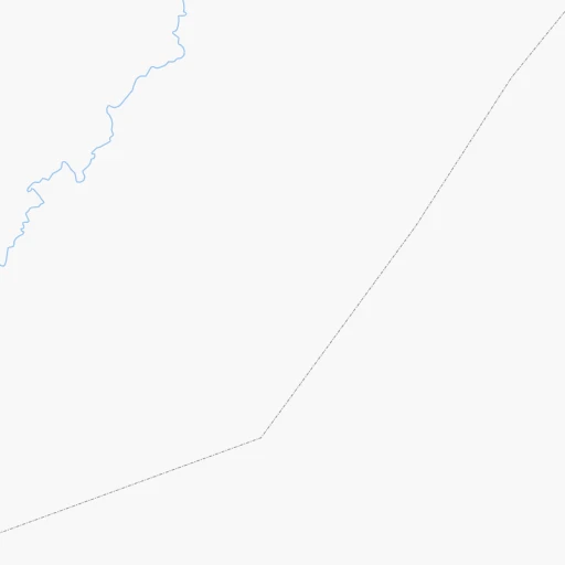
The flight distance (as the crow flies) between Aérodrome De Secours De Berkine and Khemisset is 207.3 km.
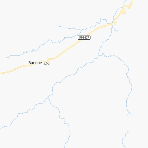
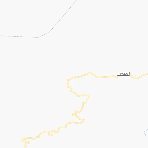
Roadmap (route) to go from Aérodrome De Secours De Berkine to Khemisset detailed above, you can also see the course layout on the map.
While doing trip Aérodrome De Secours De Berkine - Khemisset by car, the calculated route ends at a distance , or more straight.
Distance and duration of the route between Aérodrome De Secours De Berkine and Khemisset
Calculation of distance and route from Khemisset to Aérodrome De Secours De Berkine :
207.3300.9 km4h29mn
Continue onto RP5427 1h0mn 51.0 kmTurn right onto RN29 0h9mn 4.6 kmTurn left 0h18mn 4.8 kmTurn slight left onto RR504 1h52mn 48.9 kmAt roundabout, take exit 3 onto RR504 0h12mn 10.7 kmContinue onto RP5043 0h21mn 18.9 kmTurn left onto RN6 0h5mn 6.4 kmAt roundabout, take exit 1 0h1mn 728 mKeep left and drive toward Fes 1h24mn 149.4 kmKeep right and drive toward الخميسات, سيدي سليمان, اولماس, Khémisset, Sidi Slimane, Oulmès 0h2mn 1.7 kmAt roundabout, take exit 1 onto RR404 0h1mn 536 mAt roundabout, take exit 1 onto RR404 0h1mn 1.3 kmAt roundabout, take exit 2 onto RR404 0h0mn 98 mTurn right onto P4329 0h0mn 89 mTurn left 0h1mn 1.1 kmAt roundabout, take exit 3 0h0mn 384 mTurn sharp left 0h0mn 72 mTurn right onto Zenkat Si Ahmed Boubia 0h0mn 219 mArrive at destination 0h0mn 0 m
Travel from Aérodrome De Secours De Berkine (Rabat-Salé-Kénitra) to a selection of major cities.
Distances from Aérodrome De Secours De Berkine to biggest cities in Oriental
Other major cities in country :
- Larache [01], 109,294 inhabitants. 266 km
- Ksar El Kebir [01], 108,753 inhabitants. 235 km
- Khemisset [04], 106,991 inhabitants. 208 km
- Guelmim [10], 98,229 inhabitants. 796 km
- Berrechid [06], 93,954 inhabitants. 354 km
- Errachidia [08], 92,374 inhabitants. 213 km
- Oued Zem [05], 84,910 inhabitants. 275 km
- Al Fqih Ben Calah [05], 84,072 inhabitants. 302 km
- Sidi Slimane [04], 79,437 inhabitants. 202 km
- Sidi Qacem [04], 74,755 inhabitants. 181 km
- Khenifra [05], 73,906 inhabitants. 195 km
- Ifrane [03], 73,782 inhabitants. 122 km
- Taroudant [09], 71,133 inhabitants. 602 km
- Essaouira [07], 70,634 inhabitants. 612 km
- Tiflet [04], 70,010 inhabitants. 230 km
- Oulad Teima [09], 66,832 inhabitants. 632 km
- Sefrou [03], 65,150 inhabitants. 93 km
- Youssoufia [07], 64,910 inhabitants. 471 km
- Tan-Tan [10], 61,924 inhabitants. 913 km
- Ouezzane [01], 58,684 inhabitants. 198 km
Route from Khemisset to major cities (Morocco).
- Distance Khemisset Casablanca145 km
- Distance Khemisset Fes101 km
- Distance Khemisset Marrakesh304 km
- Distance Khemisset Agadir504 km
- Distance Khemisset Tangier218 km
- Distance Khemisset Meknes49 km
- Distance Khemisset Oujda-Angad394 km
- Distance Khemisset Al Hoceima252 km
- Distance Khemisset Tetouan205 km
- Distance Khemisset Safi341 km
- Distance Khemisset Mohammedia123 km
- Distance Khemisset Khouribga131 km
- Distance Khemisset Beni Mellal168 km
- Distance Khemisset Fes al Bali106 km
- Distance Khemisset El Jadid235 km
- Distance Khemisset Taza195 km
- Distance Khemisset Nador324 km
- Distance Khemisset Settat171 km
- Distance Khemisset Larache153 km
- Distance Khemisset Ksar El Kebir132 km
Nearest cities to Aérodrome De Secours De Berkine :
- Fes, 964,891 inhabitants. 113 km
- Sale, 903,485 inhabitants. 277 km
- Tangier, 688,356 inhabitants. 286 km
- Meknes, 545,705 inhabitants. 160 km
- Oujda-Angad, 405,253 inhabitants. 203 km
- Al Hoceima, 395,644 inhabitants. 165 km
- Kenitra, 366,570 inhabitants. 260 km
- Tetouan, 326,261 inhabitants. 246 km
- Beni Mellal, 166,399 inhabitants. 285 km
- Fes al Bali, 156,000 inhabitants. 110 km
- Taza, 141,890 inhabitants. 52 km
- Nador, 129,260 inhabitants. 175 km
- Larache, 109,294 inhabitants. 266 km
- Ksar El Kebir, 108,753 inhabitants. 235 km
- Khemisset, 106,991 inhabitants. 208 km
- Errachidia, 92,374 inhabitants. 213 km
- Oued Zem, 84,910 inhabitants. 275 km
- Al Fqih Ben Calah, 84,072 inhabitants. 302 km
- Taourirt, 82,518 inhabitants. 111 km
- Berkane, 80,721 inhabitants. 188 km
- Sidi Slimane, 79,437 inhabitants. 202 km
- Sidi Qacem, 74,755 inhabitants. 181 km
- Khenifra, 73,906 inhabitants. 195 km
- Ifrane, 73,782 inhabitants. 122 km
- Tiflet, 70,010 inhabitants. 230 km
- Sefrou, 65,150 inhabitants. 93 km
- Ouezzane, 58,684 inhabitants. 198 km
- Guercif, 57,544 inhabitants. 66 km
- Tirhanimine, 55,827 inhabitants. 163 km
- Fnidek, 53,559 inhabitants. 270 km
- Azrou, 48,249 inhabitants. 135 km
- Midelt, 45,159 inhabitants. 148 km
- Souq Larb'a al Gharb, 44,059 inhabitants. 225 km
- Jerada, 43,696 inhabitants. 165 km
- Kasba Tadla, 41,199 inhabitants. 263 km
- Imzouren, 40,000 inhabitants. 153 km
- Martil, 39,738 inhabitants. 245 km
- Tinghir, 36,795 inhabitants. 298 km
- Chefchaouene, 36,280 inhabitants. 204 km
- Al Aaroui, 36,021 inhabitants. 157 km
- El Aioun, 35,196 inhabitants. 151 km
- Taounate, 32,802 inhabitants. 114 km
- Sidi Yahia El Gharb, 32,202 inhabitants. 236 km
- Zaio, 30,008 inhabitants. 164 km
- Asilah, 28,861 inhabitants. 277 km
- El Hajeb, 28,126 inhabitants. 144 km
- Mechraa Bel Ksiri, 27,802 inhabitants. 216 km
- Tahla, 25,761 inhabitants. 63 km
- Arfoud, 23,637 inhabitants. 263 km
- Recani, 20,469 inhabitants. 280 km
Location Aérodrome De Secours De Berkine (Oriental) :
| Country flag |  |
| Location | Aérodrome De Secours De Berkine |
| State | Oriental |
| County | |
| Country | Morocco |
| Country code / ISO 2 | MA |
| Latitude | 33.7723800 |
| Longitude | -3.8223500 |
| Altitude | 0 meters |
| Time zone | Africa/Casablanca |
Location Khemisset (Rabat-Salé-Kénitra) :
| Country flag | |
| Location | Khemisset |
| State | Rabat-Salé-Kénitra |
| County | Khemisset |
| Country | Morocco |
| Country code / ISO 2 | MA |
| Latitude | 33.8240400 |
| Longitude | -6.0662700 |
| Altitude | 0 meters |
| Time zone | Africa/Casablanca |