


How to get from Naokot (Sindh) to Battagram (Khyber Pakhtunkhwa)
Calculate route from Naokot (Sindh, Pakistan) to Battagram (Khyber Pakhtunkhwa, Pakistan).
The flight distance (as the crow flies) between Naokot and Battagram is 1,144.1 km.
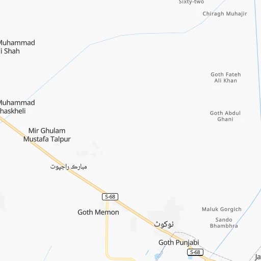
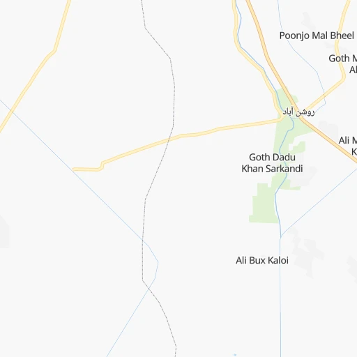
Roadmap (route) to go from Naokot to Battagram detailed above, you can also see the course layout on the map.
While doing trip Naokot - Battagram by car, the calculated route ends at a distance , or more straight.
Distance and duration of the route between Naokot and Battagram
Calculation of distance and route from Battagram to Naokot :
1,144.11,399.0 km18h10mn
Continue 0h0mn 22 mTurn left 0h2mn 1.1 kmTurn left 0h0mn 35 mTurn right 0h1mn 561 mTurn left 0h0mn 245 mTurn right 0h1mn 312 mTurn right onto Mirwah-Digri-Mithi Provincial Highway 0h14mn 15.1 kmContinue onto Mirwah-Digri-Mithi Provincial Highway 0h13mn 14.3 kmKeep right onto Mirwah-Digri-Mithi Provincial Highway 0h15mn 16.7 kmTurn right onto Mirwah-Digri-Mithi Provincial Highway 1h37mn 41.1 kmAt roundabout, take exit 2 onto Jarwari Chowk 0h1mn 894 mAt roundabout, take exit 2 0h1mn 1.0 kmTurn left 0h0mn 133 mTurn right 0h0mn 63 mTurn right 0h0mn 331 mTurn right 0h0mn 446 mTurn left 0h0mn 183 mTurn right 0h0mn 17 mTurn left 0h0mn 320 mTurn right 0h22mn 24.0 kmTurn left onto نوشاہ - سانگھڑ - میرپورخاص صوبائی شاہراہ 1h39mn 43.2 kmTurn slight left onto نوشاہ - سانگھڑ - میرپورخاص صوبائی شاہراہ 0h0mn 65 mTurn right 0h0mn 148 mTurn right onto محمد علی جناح روڈ 0h1mn 1.2 kmTurn left onto Kot Diji -Tajal -Sanghar Provincial Highway 1h39mn 46.5 kmTurn left onto Kot Diji -Tajal -Sanghar Provincial Highway 0h1mn 1.1 kmTurn right onto Kot Diji -Tajal -Sanghar Provincial Highway 1h5mn 77.5 kmTurn left onto Kot Diji -Tajal -Sanghar Provincial Highway 0h6mn 6.6 kmTurn left onto Kot Diji -Tajal -Sanghar Provincial Highway 0h3mn 3.8 kmTurn right 0h0mn 410 mTurn left 0h1mn 611 mTurn slight right onto Kadanwari Road 0h6mn 6.2 kmTurn left 0h1mn 1.2 kmTurn right 1h6mn 55.0 kmTurn left 0h0mn 55 mKeep right 3h36mn 280.1 kmKeep left 0h1mn 975 mKeep left 0h0mn 78 mTurn slight left 0h15mn 18.3 kmTurn right 0h8mn 6.3 kmTurn left 0h1mn 496 mTurn sharp right onto Rohilanwali-ByPass Road 1h1mn 73.3 kmContinue onto Alipur Road 0h3mn 3.9 kmKeep left 0h0mn 56 mTurn left onto Multan Road 0h0mn 27 mTurn right 0h1mn 823 mTurn right onto Jhang Road 0h3mn 3.8 kmTurn slight left onto Mianwali-Muzaffargarh Road 1h21mn 97.0 kmAt roundabout, take exit 2 onto میانوالی - مظفر گڑھ سڑک 1h50mn 60.3 kmContinue onto میانوالی - مظفر گڑھ سڑک 0h16mn 19.2 kmKeep left onto میانوالی - مظفر گڑھ سڑک 1h45mn 54.5 kmTurn left 0h0mn 27 mTurn left onto میانوالی - مظفر گڑھ سڑک 1h40mn 47.5 kmKeep left onto N-135 0h0mn 60 mKeep left onto میانوالی - مظفر گڑھ سڑک 0h4mn 5.2 kmAt roundabout, take exit 3 onto KalaBagh-Banu Road 1h30mn 36.5 kmTurn right 2h43mn 154.5 kmKeep left toward M-1 0h1mn 2.1 kmKeep left 0h0mn 458 mTurn left 0h2mn 1.5 kmTurn left onto Paswal Road 0h3mn 2.5 kmTurn right 0h0mn 279 mTurn left onto گرینڈ ٹرنک روڈ 0h8mn 8.9 kmTurn sharp right onto HMC Road 0h10mn 11.3 kmKeep right onto Farooqia Road 0h6mn 6.9 kmContinue onto Hattar Industrial Road 0h5mn 5.2 kmTurn sharp right 1h40mn 71.4 kmKeep right onto ہزارہ موٹروے 0h3mn 6.2 kmTurn right 0h0mn 46 mTurn left 0h0mn 228 mTurn left onto oghi road 1h50mn 55.4 kmContinue onto شاہراہ قراقرم 0h3mn 3.2 kmArrive at destination 0h0mn 0 m
Travel from Naokot (Khyber Pakhtunkhwa) to a selection of major cities.
Distances from Naokot to biggest cities in Sindh
- Tando Muhammad Khan,72,659 inhabitants.93 km
- Shahdadpur,67,249 inhabitants.142 km
- Ghotki,64,295 inhabitants.349 km
- Sanghar,62,033 inhabitants.140 km
- Rohri,50,649 inhabitants.319 km
- Matli,50,398 inhabitants.79 km
- Mirpur Mathelo,49,311 inhabitants.351 km
- Hala,47,915 inhabitants.145 km
- Ratodero,47,819 inhabitants.346 km
- Thatta,44,302 inhabitants.151 km
- Umarkot,42,074 inhabitants.64 km
- Sehwan,41,150 inhabitants.233 km
- Khairpur,40,083 inhabitants.357 km
- New Badah,38,855 inhabitants.308 km
- Pir Jo Goth,35,537 inhabitants.314 km
- Thul,34,472 inhabitants.381 km
- Gambat,34,005 inhabitants.291 km
- Kashmor,33,732 inhabitants.397 km
- Naudero,33,455 inhabitants.329 km
- Setharja Old,32,651 inhabitants.278 km
Other major cities in country :
- Kasur [04], 290,643 inhabitants. 854 km
- Mingora [03], 279,914 inhabitants. 1,139 km
- Dera Ghazi Khan [04], 236,093 inhabitants. 589 km
- Sahiwal [04], 235,695 inhabitants. 740 km
- Okara [04], 223,648 inhabitants. 772 km
- Chiniot [04], 201,781 inhabitants. 839 km
- Shahkot [04], 200,000 inhabitants. 846 km
- Kamoke [04], 199,531 inhabitants. 920 km
- Saddiqabad [04], 189,876 inhabitants. 390 km
- Burewala [04], 183,915 inhabitants. 671 km
- Muzaffargarh [04], 165,192 inhabitants. 605 km
- Muridke [04], 164,246 inhabitants. 906 km
- Jhelum [04], 164,080 inhabitants. 991 km
- Hafizabad [04], 153,656 inhabitants. 904 km
- Kohat [03], 151,427 inhabitants. 990 km
- Khanpur [04], 142,426 inhabitants. 439 km
- Khuzdar [02], 141,227 inhabitants. 431 km
- Gojra [04], 139,726 inhabitants. 769 km
- Mandi Bahauddin [04], 129,733 inhabitants. 947 km
- Daska Kalan [04], 126,924 inhabitants. 960 km
Route from Battagram to major cities (Pakistan).
- Distance Battagram Karachi1,237 km
- Distance Battagram Lahore369 km
- Distance Battagram Faisalabad363 km
- Distance Battagram Rawalpindi120 km
- Distance Battagram Multan519 km
- Distance Battagram Hyderabad1,126 km
- Distance Battagram Gujranwala301 km
- Distance Battagram Rahim Yar Khan743 km
- Distance Battagram Quetta755 km
- Distance Battagram Muzaffarabad53 km
- Distance Battagram Kotli152 km
- Distance Battagram Islamabad106 km
- Distance Battagram Bahawalpur601 km
- Distance Battagram Sargodha290 km
- Distance Battagram Sialkot281 km
- Distance Battagram Sukkur872 km
- Distance Battagram Larkana915 km
- Distance Battagram Shekhupura342 km
- Distance Battagram Bhimbar213 km
- Distance Battagram Jhang Sadr385 km
Nearest cities to Naokot :
- Karachi, 11,624,219 inhabitants. 243 km
- Hyderabad, 1,386,330 inhabitants. 120 km
- Sukkur, 417,767 inhabitants. 321 km
- Larkana, 364,033 inhabitants. 323 km
- Malir Cantonment, 300,000 inhabitants. 223 km
- Nawabshah, 229,504 inhabitants. 184 km
- Mirpur Khas, 215,657 inhabitants. 84 km
- Khuzdar, 141,227 inhabitants. 431 km
- Dadu, 139,784 inhabitants. 265 km
- Tando Allahyar, 127,202 inhabitants. 97 km
- Tando Adam, 125,598 inhabitants. 126 km
- Khairpur Mir's, 124,602 inhabitants. 304 km
- Kambar, 77,481 inhabitants. 334 km
- Moro, 76,765 inhabitants. 245 km
- Shahdad Kot, 75,411 inhabitants. 364 km
- Badin, 73,569 inhabitants. 63 km
- Pano Aqil, 72,881 inhabitants. 334 km
- Kotri, 72,672 inhabitants. 125 km
- Tando Muhammad Khan, 72,659 inhabitants. 93 km
- Shahdadpur, 67,249 inhabitants. 142 km
- Sanghar, 62,033 inhabitants. 140 km
- Rohri, 50,649 inhabitants. 319 km
- Matli, 50,398 inhabitants. 79 km
- Hala, 47,915 inhabitants. 145 km
- Ratodero, 47,819 inhabitants. 346 km
- Thatta, 44,302 inhabitants. 151 km
- Umarkot, 42,074 inhabitants. 64 km
- Sehwan, 41,150 inhabitants. 233 km
- New Badah, 38,855 inhabitants. 308 km
- Pir Jo Goth, 35,537 inhabitants. 314 km
- Gambat, 34,005 inhabitants. 291 km
- Naudero, 33,455 inhabitants. 329 km
- Setharja Old, 32,651 inhabitants. 278 km
- Digri, 31,842 inhabitants. 45 km
- Sakrand, 31,630 inhabitants. 182 km
- Tando Jam, 31,612 inhabitants. 109 km
- Mehar, 30,429 inhabitants. 303 km
- Khairpur Nathan Shah, 30,286 inhabitants. 299 km
- Nasirabad, 27,809 inhabitants. 318 km
- Sita Road, 27,587 inhabitants. 288 km
- Kandiaro, 26,807 inhabitants. 272 km
- Kunri, 26,773 inhabitants. 38 km
- Kot Diji, 25,616 inhabitants. 284 km
- Mithi, 23,431 inhabitants. 41 km
- Ranipur, 22,495 inhabitants. 284 km
- Khanpur Mahar, 22,273 inhabitants. 331 km
- Hingorja, 22,263 inhabitants. 279 km
- Naukot, 22,081 inhabitants. 2 km
- Shahpur Chakar, 21,446 inhabitants. 163 km
- Talhar, 21,154 inhabitants. 61 km
Location Naokot (Sindh) :
| Country flag |  |
| Location | Naokot |
| State | Sindh |
| County | |
| Country | Pakistan |
| Country code / ISO 2 | PK |
| Latitude | 24.8666700 |
| Longitude | 69.4166700 |
| Altitude | 0 meters |
| Time zone | Asia/Karachi |
Location Battagram (Khyber Pakhtunkhwa) :
| Country flag | |
| Location | Battagram |
| State | Khyber Pakhtunkhwa |
| County | Battagram District |
| Country | Pakistan |
| Country code / ISO 2 | PK |
| Latitude | 34.6771900 |
| Longitude | 73.0232900 |
| Altitude | 0 meters |
| Time zone | Asia/Karachi |