


How to get from Dongghal Stansasy (Karaganda) to Kokshetau (Aqmola)
Calculate route from Dongghal Stansasy (Karaganda, Kazakhstan) to Kokshetau (Aqmola, Kazakhstan).
The flight distance (as the crow flies) between Dongghal Stansasy and Kokshetau is 631.0 km.
Roadmap (route) to go from Dongghal Stansasy to Kokshetau detailed above, you can also see the course layout on the map.
While doing trip Dongghal Stansasy - Kokshetau by car, the calculated route ends at a distance , or more straight.
Distance and duration of the route between Dongghal Stansasy and Kokshetau
Calculation of distance and route from Kokshetau to Dongghal Stansasy :
631.0775.4 km8h25mn
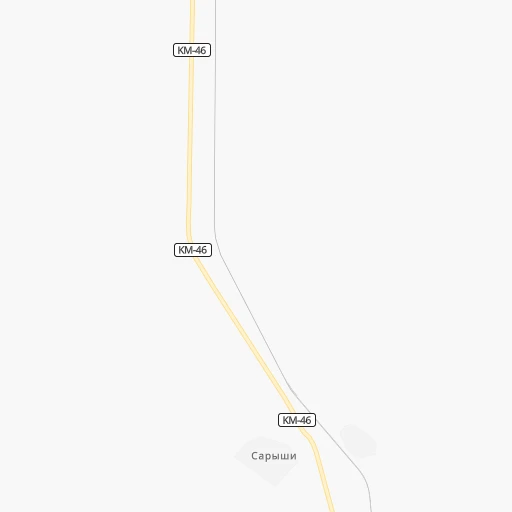
Continue onto KM-46 0h27mn 22.8 kmAt roundabout, take exit 1 0h3mn 3.2 kmAt roundabout, take exit 2 1h35mn 35.1 kmTurn left onto KM-46 1h50mn 49.7 kmTurn right onto Жапакова улица 0h2mn 2.0 kmTurn sharp right 0h5mn 7.3 kmTurn left 0h0mn 48 mTurn left onto M-36 1h45mn 62.4 kmTurn right onto M-36 0h0mn 55 mTurn left onto M-36 0h1mn 1.6 kmTurn right onto M-36 1h47mn 66.2 kmContinue onto Республики проспект 0h3mn 3.1 kmTurn slight right onto улица Гоголя 0h7mn 6.4 kmKeep right 2h48mn 195.7 kmKeep right onto M-36 0h23mn 27.5 kmKeep right 2h17mn 274.8 kmKeep left 0h7mn 12.3 kmKeep right 0h4mn 3.3 kmTurn right onto Ыбырай Алтынсарин көшесі 0h1mn 766 mTurn left onto Ақан сері көшесі 0h1mn 825 mTurn right onto Мәлік Ғабдуллин көшесі 0h0mn 132 mTurn right onto улица Алимжана Баймуканова 0h0mn 147 mArrive at destination 0h0mn 0 m
Travel from Dongghal Stansasy (Aqmola) to a selection of major cities.
Distances from Dongghal Stansasy to biggest cities in Karaganda
Other major cities in country :
Route from Kokshetau to major cities (Kazakhstan).
- Distance Kokshetau Almaty1,246 km
- Distance Kokshetau Karagandy465 km
- Distance Kokshetau Shymkent1,223 km
- Distance Kokshetau Taraz1,165 km
- Distance Kokshetau Astana273 km
- Distance Kokshetau Pavlodar521 km
- Distance Kokshetau Ust-Kamenogorsk982 km
- Distance Kokshetau Kyzyl-Orda981 km
- Distance Kokshetau Kyzylorda980 km
- Distance Kokshetau Semey811 km
- Distance Kokshetau Aktobe902 km
- Distance Kokshetau Kostanay385 km
- Distance Kokshetau Petropavl177 km
- Distance Kokshetau Oral1,246 km
- Distance Kokshetau Atyrau1,419 km
- Distance Kokshetau Temirtau435 km
- Distance Kokshetau Aktau1,712 km
- Distance Kokshetau Rudnyy421 km
- Distance Kokshetau Ekibastuz437 km
- Distance Kokshetau Taldykorgan1,127 km
Nearest cities to Dongghal Stansasy :
- Karagandy, 451,800 inhabitants. 195 km
- Temirtau, 170,600 inhabitants. 222 km
- Balqash, 81,364 inhabitants. 206 km
- Soran, 42,552 inhabitants. 193 km
- Shakhtinsk, 41,602 inhabitants. 185 km
- Abay, 35,454 inhabitants. 176 km
- Qarazhal, 13,807 inhabitants. 158 km
- Priozersk, 13,457 inhabitants. 233 km
- Shakhan, 13,273 inhabitants. 197 km
- Atasu, 13,184 inhabitants. 117 km
- Aktau, 9,977 inhabitants. 7 km
- Aktas, 9,888 inhabitants. 192 km
- Aqadyr, 9,710 inhabitants. 23 km
- Aktau, 9,500 inhabitants. 243 km
- Qarqaraly, 8,195 inhabitants. 241 km
- Osakarovka, 7,305 inhabitants. 280 km
- Kievka, 7,037 inhabitants. 265 km
- Bayanaul, 5,700 inhabitants. 365 km
- Novodolinskiy, 5,167 inhabitants. 184 km
- Aqshatau, 4,899 inhabitants. 85 km
- Aksu-Ayuly, 4,721 inhabitants. 97 km
- Dolinka, 4,543 inhabitants. 181 km
- Saryshaghan, 4,365 inhabitants. 222 km
- Tokarevka, 4,098 inhabitants. 230 km
- Kushoky, 3,920 inhabitants. 244 km
- Aktogay, 3,741 inhabitants. 178 km
- Ulken, 3,735 inhabitants. 327 km
- Prigorodnoye, 3,563 inhabitants. 267 km
- Shashubay, 3,563 inhabitants. 211 km
Location Dongghal Stansasy (Karaganda) :
| Country flag |  |
| Location | Dongghal Stansasy |
| State | Karaganda |
| County | |
| Country | Kazakhstan |
| Country code / ISO 2 | KZ |
| Latitude | 48.0584300 |
| Longitude | 72.9169400 |
| Altitude | 0 meters |
| Time zone | Asia/Almaty |
Location Kokshetau (Aqmola) :
| Country flag | |
| Location | Kokshetau |
| State | Aqmola |
| County | |
| Country | Kazakhstan |
| Country code / ISO 2 | KZ |
| Latitude | 53.2833300 |
| Longitude | 69.4000000 |
| Altitude | 0 meters |
| Time zone | Asia/Almaty |
