


Home
››
Villiyambākkam Railway Station
››
Roadmap from Villiyambākkam Railway Station to Marathi, Maharashtra
How to get from Villiyambākkam Railway Station (Tamil Nadu) to Marathi, Maharashtra (Maharashtra)
Calculate route from Villiyambākkam Railway Station (Tamil Nadu, India) to Marathi, Maharashtra (Maharashtra, India).
The flight distance (as the crow flies) between Villiyambākkam Railway Station and Marathi, Maharashtra is 1,013.5 km.
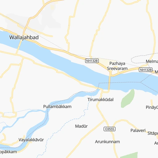
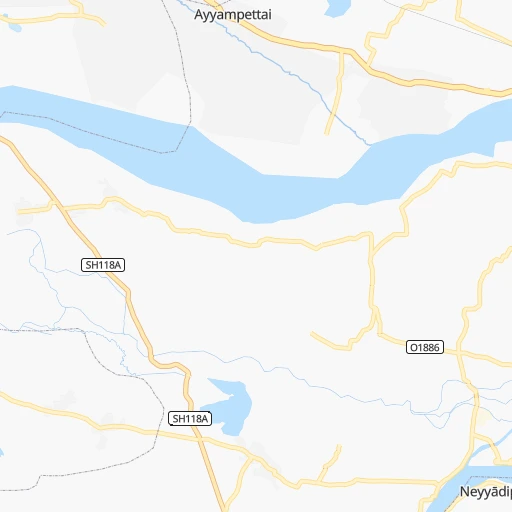
Roadmap (route) to go from Villiyambākkam Railway Station to Marathi, Maharashtra detailed above, you can also see the course layout on the map.
While doing trip Villiyambākkam Railway Station - Marathi, Maharashtra by car, the calculated route ends at a distance , or more straight.
Distance and duration of the route between Villiyambākkam Railway Station and Marathi, Maharashtra
Calculation of distance and route from Marathi, Maharashtra to Villiyambākkam Railway Station :
1,013.51,170.6 km17h9mn
Continue 0h0mn 94 mTurn left onto Chengalpattu - Kancheepuram Highway 0h0mn 19 mTurn right 0h0mn 9 mTurn right onto Kanchipuram - Chengalpattu Rd 0h3mn 3.9 kmTurn slight left onto Chengalpattu - Kancheepuram Highway 0h6mn 6.7 kmAt roundabout, take exit 2 onto Chengalpattu - Kancheepuram Highway 0h13mn 14.6 kmAt roundabout, take exit 1 0h1mn 864 mTurn sharp left onto Chengalpattu - Kancheepuram Highway 0h1mn 1.2 kmTurn slight left onto Chengalpattu - Kancheepuram Highway 0h0mn 9 mContinue onto Kancheepuram - Surappan Road 0h5mn 5.3 kmKeep left 0h7mn 7.7 kmContinue onto Chennai - Bengaluru Trunk Road 0h19mn 21.6 kmKeep left onto Chennai - Bengaluru Trunk Road 0h0mn 546 mTurn right onto NH40 0h2mn 1.9 kmTurn slight left onto Madras Bangalore Trunk Road 0h4mn 4.5 kmTurn sharp left onto Post Office Street 0h0mn 126 mTurn right 0h1mn 279 mTurn left 0h0mn 70 mTurn sharp right onto Kelly’s Road 0h1mn 686 mKeep right onto Madras Bangalore Trunk Road 0h1mn 1.3 kmTurn slight left onto Madras Bangalore Trunk Road 0h0mn 191 mKeep right onto Ranipet - Ponnai Road 0h19mn 21.2 kmTurn left onto Chittoor - Tiruttani Road 0h15mn 16.7 kmKeep left 0h2mn 2.2 kmTurn right 0h2mn 2.1 kmTurn sharp right 0h0mn 153 mTurn right onto NH40 0h4mn 4.9 kmKeep right onto NH40 1h23mn 96.7 kmTurn left 0h4mn 3.7 kmTurn left 0h14mn 14.0 kmTurn sharp left onto Rayachoti-Kadiri road 1h48mn 53.1 kmTurn right onto Anantapur - Krishnagiri Road 1h13mn 84.6 kmContinue onto Anantapur - Krishnagiri Road 0h1mn 1.4 kmTurn left onto Anantapur - Krishnagiri Road 0h0mn 39 mTurn sharp right onto NH544F 0h4mn 4.6 kmTurn left onto kadiri road 0h1mn 732 mTurn left onto kadiri road 0h1mn 1.0 kmAt roundabout, take exit 2 onto Anantapur - Krishnagiri Road 0h1mn 1.0 kmContinue onto Anantapur - Krishnagiri Road 0h6mn 6.7 kmTurn slight left onto Ballari - Badepalli Road 1h38mn 44.7 kmTurn left 1h37mn 41.0 kmKeep left onto Kalamma Street 0h1mn 460 mTurn right onto Bangalore Road 0h0mn 50 mTurn left 0h1mn 372 mTurn right onto Kalamma Street 0h0mn 377 mTurn left onto Station Road 0h0mn 64 mAt roundabout, take exit 4 onto Hosapete Road 0h0mn 314 mKeep left 0h2mn 2.4 kmAt roundabout, take exit 1 onto Hosapete Road 0h0mn 19 mTurn slight left onto Hosapete Road 0h0mn 439 mTurn right onto Hosapete Road 0h12mn 14.3 kmTurn right 0h1mn 1.6 kmKeep right onto NH67 0h1mn 600 mTurn right onto SH29 0h28mn 31.3 kmAt roundabout, take exit 1 onto SH29 0h9mn 9.4 kmAt roundabout, take exit 3 onto SH29 0h0mn 451 mKeep left 0h0mn 87 mTurn slight left onto SH23 0h1mn 1.2 kmTurn right 0h18mn 19.7 kmTurn left 0h0mn 97 mTurn slight right 0h0mn 380 mTurn left onto SH130 0h8mn 8.9 kmTurn right onto SH130 0h0mn 276 mTurn right onto SH130 0h0mn 181 mTurn left onto SH130 0h3mn 2.9 kmTurn sharp left onto SH130 0h9mn 9.9 kmTurn right onto SH130 0h1mn 1.5 kmTurn sharp right 0h16mn 13.1 kmTurn left onto SH30 0h0mn 429 mTurn right onto Bijapur Road 2h53mn 131.8 kmContinue onto Bijapur Bypass 0h8mn 9.7 kmKeep left onto NH561A 1h8mn 78.8 kmContinue 0h4mn 4.0 kmContinue onto NH561A 0h17mn 20.0 kmTurn sharp left onto Shivaji Chowk 0h0mn 45 mTurn left onto NH561A 0h0mn 466 mTurn left onto NH965, NH561A 0h1mn 610 mTurn right onto NH561A 0h2mn 2.7 kmTurn left onto NH561A 1h31mn 36.4 kmTurn left onto NH561A 0h3mn 3.1 kmTurn left 0h2mn 2.0 kmContinue onto Nh548C 0h1mn 1.0 kmContinue 0h2mn 2.0 kmTurn left onto NH65 0h13mn 14.7 kmKeep right onto NH65 0h2mn 1.8 kmKeep right 0h0mn 14 mContinue 0h4mn 4.9 kmKeep right 0h0mn 115 mTurn right onto NH65 1h54mn 62.6 kmKeep right onto NH65 0h1mn 1.6 kmKeep right onto NH65 0h1mn 936 mKeep right onto NH65 0h1mn 1.2 kmKeep right onto NH65 1h52mn 60.7 kmKeep right onto Solapur Road 0h4mn 4.7 kmKeep right 0h0mn 122 mTurn left onto Prince Of Wales Drive 0h2mn 2.2 kmTurn right 0h1mn 635 mAt roundabout, take exit 2 0h3mn 1.5 kmKeep right 0h0mn 440 mKeep left onto Deccan College Road 0h4mn 4.1 kmAt roundabout, take exit 2 onto Elphinstone Road 0h2mn 2.0 kmTurn right onto Old Pune–Mumbai Highway 0h4mn 3.7 kmContinue onto Old Pune–Mumbai Highway 0h13mn 15.2 kmContinue onto Katraj - Dehu Road Bypass 0h7mn 8.6 kmKeep right onto NH48 0h28mn 32.3 kmTurn slight left onto NH48 0h4mn 4.2 kmContinue onto Old NH4 0h1mn 966 mTurn sharp left onto Mumbai - Pune Expressway 0h2mn 2.3 kmContinue onto Mumbai - Pune Expressway 1h41mn 50.8 kmKeep left 0h0mn 313 mKeep left 0h0mn 20 mTurn left onto Ahilya Gokul Patil Marg 0h0mn 424 mKeep right onto Shivaji Chowk 0h0mn 40 mTurn left onto Ahilya Gokul Patil Marg 0h1mn 776 mTurn left onto Shivajirao Annasaheb Patil Marg 0h1mn 886 mArrive at destination 0h0mn 0 m
Travel from Villiyambākkam Railway Station (Maharashtra) to a selection of major cities.
Distances from Villiyambākkam Railway Station to biggest cities in Tamil Nadu
- Alandur,153,775 inhabitants.42 km
- Erode,147,270 inhabitants.285 km
- Kumbakonam,139,264 inhabitants.209 km
- Tiruvannamalai,138,243 inhabitants.109 km
- Rajapalaiyam,124,168 inhabitants.450 km
- Pudukkottai,112,118 inhabitants.291 km
- Ambur,109,873 inhabitants.129 km
- Hosur,103,724 inhabitants.225 km
- Ooty,98,238 inhabitants.381 km
- Villupuram,97,380 inhabitants.102 km
- Negapatam,94,238 inhabitants.223 km
- Gudiyatham,93,973 inhabitants.114 km
- Karaikkudi,91,908 inhabitants.325 km
- Valparai,90,353 inhabitants.421 km
- Kovilpatti,90,296 inhabitants.458 km
- Vaniyambadi,90,288 inhabitants.140 km
- Pollachi,88,214 inhabitants.394 km
- Tiruchengode,87,123 inhabitants.268 km
- Mayiladuthurai,86,660 inhabitants.187 km
- Paramagudi,85,695 inhabitants.386 km
Other major cities in country :
- Nashik [16], 1,289,497 inhabitants. 1,036 km
- Pimpri [16], 1,284,606 inhabitants. 923 km
- Kalyan [16], 1,262,255 inhabitants. 1,022 km
- Thane [16], 1,261,517 inhabitants. 1,031 km
- Meerut [36], 1,223,184 inhabitants. 1,819 km
- Nowrangapur [21], 1,220,946 inhabitants. 773 km
- Faridabad [10], 1,220,229 inhabitants. 1,762 km
- Ghaziabad [36], 1,199,191 inhabitants. 1,788 km
- Dombivli [16], 1,193,000 inhabitants. 1,024 km
- Rajkot [09], 1,177,362 inhabitants. 1,434 km
- Varanasi [36], 1,164,404 inhabitants. 1,435 km
- Amritsar [23], 1,092,450 inhabitants. 2,161 km
- Allahabad [36], 1,073,438 inhabitants. 1,426 km
- Visakhapatnam [02], 1,063,178 inhabitants. 651 km
- Jabalpur [35], 1,030,168 inhabitants. 1,158 km
- Haora [28], 1,027,672 inhabitants. 1,409 km
- Aurangabad [16], 1,016,441 inhabitants. 930 km
- Shivaji Nagar [16], 1,000,000 inhabitants. 912 km
- Solapur [16], 997,281 inhabitants. 694 km
- Srinagar [12], 975,857 inhabitants. 2,429 km
Route from Marathi, Maharashtra to major cities (India).
- Distance Marathi, Maharashtra Delhi1,153 km
- Distance Marathi, Maharashtra Bengaluru834 km
- Distance Marathi, Maharashtra Kolkata1,644 km
- Distance Marathi, Maharashtra Chennai1,020 km
- Distance Marathi, Maharashtra Ahmedabad446 km
- Distance Marathi, Maharashtra Hyderabad604 km
- Distance Marathi, Maharashtra Surat241 km
- Distance Marathi, Maharashtra Kanpur1,118 km
- Distance Marathi, Maharashtra Jaipur922 km
- Distance Marathi, Maharashtra Lucknow1,187 km
- Distance Marathi, Maharashtra Indore504 km
- Distance Marathi, Maharashtra Patna1,445 km
- Distance Marathi, Maharashtra Bhopal654 km
- Distance Marathi, Maharashtra Ludhiana1,352 km
- Distance Marathi, Maharashtra Tirunelveli1,253 km
- Distance Marathi, Maharashtra Agra1,041 km
- Distance Marathi, Maharashtra Vadodara364 km
- Distance Marathi, Maharashtra Gorakhpur1,190 km
- Distance Marathi, Maharashtra Meerut1,205 km
- Distance Marathi, Maharashtra Nowrangapur1,003 km
Nearest cities to Villiyambākkam Railway Station :
- Bengaluru, 5,104,047 inhabitants. 252 km
- Chennai, 4,328,063 inhabitants. 54 km
- Teni, 1,034,724 inhabitants. 405 km
- Coimbatore, 959,823 inhabitants. 376 km
- Madurai, 909,908 inhabitants. 372 km
- Salem, 778,396 inhabitants. 227 km
- Tiruchirappalli, 775,484 inhabitants. 254 km
- Nellore, 404,158 inhabitants. 188 km
- Tiruppur, 397,521 inhabitants. 333 km
- Ambattur, 341,049 inhabitants. 46 km
- Bellary, 336,681 inhabitants. 417 km
- Tumkur, 307,359 inhabitants. 311 km
- Tirupati, 250,821 inhabitants. 110 km
- Avadi, 250,044 inhabitants. 45 km
- Tiruvottiyur, 248,059 inhabitants. 61 km
- Anantapur, 240,442 inhabitants. 327 km
- Puducherry, 227,411 inhabitants. 93 km
- Tanjore, 219,571 inhabitants. 236 km
- Dindigul, 200,797 inhabitants. 340 km
- Proddatur, 177,797 inhabitants. 265 km
- Vellore, 177,081 inhabitants. 86 km
- Tambaram, 174,787 inhabitants. 30 km
- Ongole, 172,872 inhabitants. 305 km
- Nandyal, 165,337 inhabitants. 339 km
- Adoni, 163,631 inhabitants. 427 km
- Cuddalore, 158,569 inhabitants. 113 km
- Pallavaram, 157,145 inhabitants. 35 km
- Kanchipuram, 155,029 inhabitants. 24 km
- Alandur, 153,775 inhabitants. 42 km
- Erode, 147,270 inhabitants. 285 km
- Kumbakonam, 139,264 inhabitants. 209 km
- Tiruvannamalai, 138,243 inhabitants. 109 km
- Robertsonpet, 135,218 inhabitants. 178 km
- Hindupur, 133,298 inhabitants. 287 km
- Cuddapah, 127,010 inhabitants. 224 km
- Kolar, 126,441 inhabitants. 197 km
- Guntakal Junction, 120,964 inhabitants. 384 km
- Yelahanka, 116,447 inhabitants. 253 km
- Dharmavaram, 114,050 inhabitants. 299 km
- Pudukkottai, 112,118 inhabitants. 291 km
- Ambur, 109,873 inhabitants. 129 km
- Madanapalle, 108,593 inhabitants. 175 km
- Hosur, 103,724 inhabitants. 225 km
- Villupuram, 97,380 inhabitants. 102 km
- Negapatam, 94,238 inhabitants. 223 km
- Gudiyatham, 93,973 inhabitants. 114 km
- Closepet, 93,528 inhabitants. 285 km
- Tadpatri, 93,044 inhabitants. 314 km
- Karaikkudi, 91,908 inhabitants. 325 km
- Valparai, 90,353 inhabitants. 421 km
Location Villiyambākkam Railway Station (Tamil Nadu) :
| Country flag |  |
| Location | Villiyambākkam Railway Station |
| State | Tamil Nadu |
| County | Kancheepuram |
| Country | India |
| Country code / ISO 2 | IN |
| Latitude | 12.7663400 |
| Longitude | 79.9068900 |
| Altitude | 0 meters |
| Time zone | Asia/Kolkata |
Location Marathi, Maharashtra (Maharashtra) :
| Country flag | |
| Location | Marathi, Maharashtra |
| State | Maharashtra |
| County | Thane |
| Country | India |
| Country code / ISO 2 | IN |
| Latitude | 19.0368100 |
| Longitude | 73.0158200 |
| Altitude | 0 meters |
| Time zone | Asia/Kolkata |


