
How to get from Culley Acres (airport) (Indiana) to Smyrna (Tennessee)
Calculate route from Culley Acres (airport) (Indiana, United States) to Smyrna (Tennessee, United States).
The flight distance (as the crow flies) between Culley Acres (airport) and Smyrna is 262.4 km.
Roadmap (route) to go from Culley Acres Airport to Smyrna detailed above, you can also see the course layout on the map.
While doing trip Culley Acres (airport) - Smyrna by car, the calculated route ends at a distance , or more straight.
Distance and duration of the route between Culley Acres (airport) and Smyrna
Calculation of distance and route from Smyrna to Culley Acres (airport) :
262.4314.8 km4h42mn
Continue onto Greathouse Road 0h1mn 339 mContinue onto Savah Road 0h17mn 13.9 kmTurn left onto West Grant Street 0h0mn 405 mTurn right onto Main Street 0h1mn 888 mTurn left onto East 4th Street 0h24mn 28.7 kmKeep right 0h0mn 308 mTurn right onto South Fulton Avenue 0h1mn 1.7 kmContinue onto Veterans Memorial Parkway 0h2mn 2.8 kmKeep right and take US 41 toward Henderson, Kentucky, Vincennes 0h0mn 289 mKeep right and take US 41 South toward Henderson, Kentucky 1h53mn 84.3 kmKeep left onto Pennyrile Parkway and take I 169 South toward Hopkinsville 0h25mn 43.0 kmKeep right toward US 41 0h0mn 369 mKeep left 0h0mn 50 mTurn left onto East 9th Street 0h1mn 703 mTurn right onto Bradshaw Road 0h13mn 17.6 kmTurn right onto Pembroke Oak Grove Road 0h2mn 2.2 kmTurn left and drive toward Nashville 1h47mn 78.6 kmKeep right onto I 24 and take I 24 East, I 65 South toward Nashville 0h6mn 8.2 kmKeep left onto I 24 and take I 40 East, I 24 East toward Knoxville, Chattanooga 0h1mn 1.7 kmKeep right and drive toward Fesslers Lane 0h0mn 354 mTurn right onto Fesslers Lane 0h0mn 442 mTurn left onto Murfreesboro Pike 0h25mn 27.7 kmTurn left onto Sam Hager Street 0h0mn 76 mTurn right onto 2nd Street 0h0mn 97 mArrive at destination 0h0mn 0 m
Travel from Culley Acres (airport) (Tennessee) to a selection of major cities.
Distances from Culley Acres Airport to biggest cities in Indiana
- Columbus,46,690 inhabitants.222 km
- West Lafayette,45,550 inhabitants.282 km
- Portage,36,738 inhabitants.400 km
- Westfield,36,738 inhabitants.275 km
- New Albany,36,732 inhabitants.191 km
- Richmond,35,854 inhabitants.334 km
- Merrillville,35,224 inhabitants.388 km
- Goshen,32,983 inhabitants.436 km
- Valparaiso,32,626 inhabitants.391 km
- Michigan City,31,459 inhabitants.419 km
- Plainfield,30,590 inhabitants.231 km
- Granger,30,465 inhabitants.444 km
- Marion,29,081 inhabitants.345 km
- Crown Point,28,879 inhabitants.380 km
- Schererville,28,791 inhabitants.386 km
- East Chicago,28,699 inhabitants.404 km
- Hobart,28,404 inhabitants.394 km
- Zionsville,26,296 inhabitants.260 km
- Brownsburg,24,996 inhabitants.244 km
- Franklin,24,598 inhabitants.232 km
Other major cities in country :
- Seattle [WA], 684,451 inhabitants. 2,971 km
- Denver [CO], 682,545 inhabitants. 1,483 km
- El Paso [TX], 681,124 inhabitants. 1,824 km
- Detroit [MI], 677,116 inhabitants. 636 km
- Boston [MA], 667,137 inhabitants. 1,514 km
- Memphis [TN], 655,770 inhabitants. 370 km
- New South Memphis [TN], 641,608 inhabitants. 377 km
- Portland [OR], 632,309 inhabitants. 2,972 km
- Oklahoma City [OK], 631,346 inhabitants. 896 km
- Las Vegas [NV], 623,747 inhabitants. 2,411 km
- Baltimore [MD], 621,849 inhabitants. 998 km
- Washington, D.C. [DC], 601,723 inhabitants. 959 km
- Milwaukee [WI], 600,155 inhabitants. 557 km
- South Boston [MA], 571,281 inhabitants. 1,515 km
- Albuquerque [NM], 559,121 inhabitants. 1,698 km
- Tucson [AZ], 531,641 inhabitants. 2,180 km
- Nashville [TN], 530,852 inhabitants. 234 km
- Fresno [CA], 520,052 inhabitants. 2,801 km
- Sacramento [CA], 490,712 inhabitants. 2,911 km
- Kansas City [MO], 475,378 inhabitants. 586 km
Route from Smyrna to major cities (United States).
- Distance Smyrna New York City1,211 km
- Distance Smyrna Los Angeles2,888 km
- Distance Smyrna Chicago660 km
- Distance Smyrna Brooklyn1,213 km
- Distance Smyrna Houston1,078 km
- Distance Smyrna Queens1,223 km
- Distance Smyrna Philadelphia1,089 km
- Distance Smyrna Phoenix2,349 km
- Distance Smyrna Manhattan1,217 km
- Distance Smyrna San Antonio1,337 km
- Distance Smyrna San Diego2,828 km
- Distance Smyrna The Bronx1,228 km
- Distance Smyrna Dallas1,009 km
- Distance Smyrna San Jose3,144 km
- Distance Smyrna Austin1,223 km
- Distance Smyrna Jacksonville775 km
- Distance Smyrna San Francisco3,183 km
- Distance Smyrna Columbus540 km
- Distance Smyrna Fort Worth1,056 km
- Distance Smyrna Indianapolis423 km
Nearest cities to Culley Acres (airport) :
- Indianapolis, 829,718 inhabitants. 250 km
- Memphis, 655,770 inhabitants. 370 km
- New South Memphis, 641,608 inhabitants. 377 km
- Nashville, 530,852 inhabitants. 234 km
- St. Louis, 315,685 inhabitants. 204 km
- Louisville, 243,639 inhabitants. 196 km
- Chattanooga, 176,588 inhabitants. 410 km
- East Chattanooga, 154,024 inhabitants. 411 km
- Clarksville, 149,176 inhabitants. 176 km
- Murfreesboro, 126,118 inhabitants. 282 km
- Evansville, 119,943 inhabitants. 38 km
- Springfield, 116,565 inhabitants. 244 km
- Peoria, 115,070 inhabitants. 327 km
- North Peoria, 113,004 inhabitants. 329 km
- Carmel, 88,713 inhabitants. 270 km
- Champaign, 86,096 inhabitants. 233 km
- O'Fallon, 85,040 inhabitants. 252 km
- Bloomington, 84,067 inhabitants. 179 km
- Bloomington, 78,292 inhabitants. 286 km
- Fishers, 76,794 inhabitants. 274 km
- Jonesboro, 73,907 inhabitants. 344 km
- Decatur, 73,254 inhabitants. 218 km
- Franklin, 72,639 inhabitants. 255 km
- Lafayette, 71,111 inhabitants. 282 km
- Muncie, 70,087 inhabitants. 329 km
- Jackson, 66,975 inhabitants. 279 km
- Saint Charles, 65,794 inhabitants. 233 km
- Bowling Green, 63,616 inhabitants. 179 km
- Terre Haute, 60,825 inhabitants. 167 km
- Noblesville, 59,093 inhabitants. 282 km
- Owensboro, 59,042 inhabitants. 82 km
- Bartlett, 58,579 inhabitants. 357 km
- Kokomo, 57,995 inhabitants. 316 km
- Hendersonville, 56,018 inhabitants. 227 km
- Greenwood, 55,586 inhabitants. 240 km
- Anderson, 55,305 inhabitants. 305 km
- Normal, 54,373 inhabitants. 289 km
- Saint Peters, 52,575 inhabitants. 246 km
- Florissant, 52,268 inhabitants. 221 km
- Collierville, 48,863 inhabitants. 365 km
- Chesterfield, 47,864 inhabitants. 237 km
- Lawrence, 47,809 inhabitants. 263 km
- Jeffersonville, 46,960 inhabitants. 199 km
- Columbus, 46,690 inhabitants. 222 km
- Smyrna, 46,607 inhabitants. 263 km
- West Lafayette, 45,550 inhabitants. 282 km
- Urbana, 42,311 inhabitants. 232 km
- Belleville, 42,034 inhabitants. 183 km
- Brentwood, 41,763 inhabitants. 247 km
- Cape Girardeau, 39,462 inhabitants. 158 km
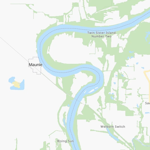
Location Culley Acres (airport) (Indiana) :
| Country flag |  |
| Location | Culley Acres (airport) |
| State | Indiana |
| County | Posey County |
| Country | United States |
| Country code / ISO 2 | US |
| Latitude | 38.0338800 |
| Longitude | -87.9850500 |
| Altitude | 138 meters |
| Time zone | America/Chicago |
Location Smyrna (Tennessee) :
| Country flag | |
| Location | Smyrna |
| State | Tennessee |
| County | Rutherford County |
| Country | United States |
| Country code / ISO 2 | US |
| Latitude | 35.9828400 |
| Longitude | -86.5186000 |
| Altitude | 166 meters |
| Time zone | America/Chicago |


