

How to get from Kursela Railroad Station (Bihar) to Aurangabad (Maharashtra)
Calculate route from Kursela Railroad Station (Bihar, India) to Aurangabad (Maharashtra, India).
The flight distance (as the crow flies) between Kursela Railroad Station and Aurangabad is 1,367.8 km.
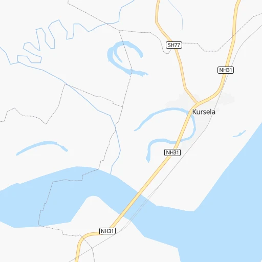
Roadmap (route) to go from Kursela Railroad Station to Aurangabad detailed above, you can also see the course layout on the map.
While doing trip Kursela Railroad Station - Aurangabad by car, the calculated route ends at a distance , or more straight.
Distance and duration of the route between Kursela Railroad Station and Aurangabad
Calculation of distance and route from Aurangabad to Kursela Railroad Station :
1,367.81,639.3 km22h7mn
Continue 0h0mn 245 mTurn right 0h1mn 559 mTurn left 0h1mn 470 mTurn left onto NH31 2h51mn 129.0 kmTurn sharp left onto MDR 0h0mn 100 mTurn right 0h1mn 593 mTurn right 0h1mn 334 mTurn right 0h0mn 390 mTurn right 0h10mn 10.3 kmTurn left onto NH31 0h7mn 8.5 kmKeep left onto NH31 0h8mn 9.2 kmKeep left 0h21mn 24.5 kmTurn sharp right 0h2mn 2.1 kmContinue 0h1mn 540 mTurn left onto NH31 0h11mn 13.1 kmKeep right 0h0mn 148 mContinue 0h29mn 31.5 kmTurn slight left onto Ashok Raj Path 0h2mn 2.2 kmKeep left 0h1mn 1.0 kmTurn slight left 0h5mn 6.0 kmKeep left onto NH31 0h9mn 10.2 kmAt roundabout, take exit 1 onto NH139 0h3mn 3.0 kmAt roundabout, take exit 3 0h3mn 3.1 kmKeep left 0h12mn 13.3 kmKeep right 0h4mn 4.6 kmContinue onto NH922 0h14mn 16.4 kmKeep left 0h0mn 94 mKeep left 0h3mn 3.3 kmTurn left 2h45mn 122.1 kmKeep right onto NH319 0h0mn 46 mTurn right onto NH19 1h53mn 61.5 kmKeep left 0h0mn 286 mTurn sharp left 0h1mn 610 mTurn right onto SH97 0h0mn 530 mTurn sharp left onto NH35 1h43mn 47.2 kmContinue onto Mirzapur Bypass 1h7mn 77.8 kmKeep left 1h15mn 86.8 kmKeep left 0h0mn 320 mKeep right 0h0mn 69 mTurn sharp left 0h0mn 3 mTurn sharp right 0h0mn 206 mTurn left 0h0mn 9 mTurn right 0h3mn 2.7 kmContinue 0h2mn 2.1 kmAt roundabout, take exit 2 0h1mn 564 mAt roundabout, take exit 2 0h1mn 1.3 kmTurn right 0h0mn 32 mTurn left 0h6mn 7.2 kmTurn left onto Rewa Bypass 0h3mn 4.0 kmKeep left 0h0mn 503 mTurn right onto NH39 0h2mn 2.2 kmTurn left 0h0mn 183 mTurn right 2h5mn 145.8 kmTurn left 0h4mn 3.6 kmKeep left 0h16mn 19.0 kmKeep left 0h4mn 3.7 kmContinue 0h0mn 219 mTurn left onto NH30 0h17mn 19.7 kmKeep left 0h1mn 716 mKeep left 0h9mn 10.4 kmKeep left 0h5mn 5.8 kmAt roundabout, take exit 1 0h2mn 1.8 kmKeep right 0h1mn 1.1 kmAt roundabout, take exit 2 onto Ambedkar Chowk 0h0mn 370 mAt roundabout, take exit 2 onto NH45 0h0mn 288 mTurn left 0h1mn 722 mTurn right 0h0mn 520 mAt roundabout, take exit 2 0h6mn 6.1 kmTurn right 0h0mn 411 mTurn slight left onto NH30 0h5mn 6.1 kmKeep left 0h0mn 35 mTurn slight left 0h4mn 2.0 kmKeep right 1h58mn 67.8 kmKeep right onto NH44 0h18mn 21.0 kmTurn right 0h0mn 39 mTurn left 0h5mn 4.9 kmTurn right onto NH44 0h12mn 13.8 kmTurn right 0h3mn 2.6 kmTurn right onto NH44 2h30mn 105.1 kmKeep right onto NH44 0h11mn 12.8 kmKeep left onto NH7 0h4mn 4.7 kmTurn right 0h3mn 3.4 kmTurn left 0h0mn 141 mTurn right onto Dragon Palace Temple Road 0h0mn 109 mContinue onto Dragon Palace Temple Road 0h2mn 1.1 kmTurn left 0h0mn 138 mTurn right 0h1mn 296 mTurn left 0h2mn 1.7 kmTurn slight left 0h0mn 318 mTurn right 0h5mn 3.9 kmTurn right onto Outer Ring Road 0h25mn 29.1 kmAt roundabout, take exit 1 onto Mumbai - Nagpur Expressway 4h32mn 369.1 kmKeep left 0h1mn 939 mKeep right 0h0mn 38 mTurn right 0h2mn 3.0 kmTurn right onto NH753A, NH752I 1h43mn 50.7 kmKeep left onto Jalna Road 0h0mn 223 mTurn right onto New Mondha Road 0h0mn 337 mTurn sharp right onto Smashan Maruti Road 0h0mn 178 mContinue onto Kailash Nagar Road 0h0mn 137 mTurn right 0h0mn 108 mTurn left 0h0mn 11 mTurn right 0h0mn 93 mArrive at destination 0h0mn 0 m
Travel from Kursela Railroad Station (Maharashtra) to a selection of major cities.
Distances from Kursela Railroad Station to biggest cities in Bihar
- Jamalpur,100,780 inhabitants.78 km
- Nawada,96,730 inhabitants.183 km
- Jahanabad,96,387 inhabitants.229 km
- Buxar,96,120 inhabitants.329 km
- Aurangabad,95,929 inhabitants.300 km
- Kishanganj,94,807 inhabitants.102 km
- Bagaha,91,383 inhabitants.243 km
- Luckeesarai,89,500 inhabitants.120 km
- Baruni,84,888 inhabitants.129 km
- Jamui,78,181 inhabitants.118 km
- Madhubani,71,582 inhabitants.156 km
- Araria,67,474 inhabitants.83 km
- Gopalganj,63,725 inhabitants.304 km
- Supaul,60,020 inhabitants.100 km
- Bangaon,60,000 inhabitants.88 km
- Samastipur,57,575 inhabitants.155 km
- Sitamarhi,57,095 inhabitants.218 km
- Mokameh,55,203 inhabitants.134 km
- Masaurhi Buzurg,53,440 inhabitants.223 km
- Khagaul,51,577 inhabitants.222 km
Other major cities in country :
- Gorakhpur [10], 1,324,570 inhabitants. 1,227 km
- Nashik [16], 1,289,497 inhabitants. 1,508 km
- Pimpri [16], 1,284,606 inhabitants. 1,580 km
- Kalyan [16], 1,262,255 inhabitants. 1,607 km
- Thane [16], 1,261,517 inhabitants. 1,626 km
- Meerut [36], 1,223,184 inhabitants. 1,023 km
- Nowrangapur [21], 1,220,946 inhabitants. 844 km
- Faridabad [10], 1,220,229 inhabitants. 1,040 km
- Ghaziabad [36], 1,199,191 inhabitants. 1,037 km
- Dombivli [16], 1,193,000 inhabitants. 1,614 km
- Rajkot [09], 1,177,362 inhabitants. 1,711 km
- Varanasi [36], 1,164,404 inhabitants. 427 km
- Amritsar [23], 1,092,450 inhabitants. 1,391 km
- Allahabad [36], 1,073,438 inhabitants. 544 km
- Visakhapatnam [02], 1,063,178 inhabitants. 960 km
- Teni [25], 1,034,724 inhabitants. 2,004 km
- Jabalpur [35], 1,030,168 inhabitants. 783 km
- Haora [28], 1,027,672 inhabitants. 337 km
- Aurangabad [16], 1,016,441 inhabitants. 1,370 km
- Shivaji Nagar [16], 1,000,000 inhabitants. 1,581 km
Route from Aurangabad to major cities (India).
- Distance Aurangabad Delhi995 km
- Distance Aurangabad Bengaluru805 km
- Distance Aurangabad Kolkata1,383 km
- Distance Aurangabad Chennai921 km
- Distance Aurangabad Ahmedabad452 km
- Distance Aurangabad Hyderabad430 km
- Distance Aurangabad Surat300 km
- Distance Aurangabad Kanpur894 km
- Distance Aurangabad Jaipur785 km
- Distance Aurangabad Lucknow962 km
- Distance Aurangabad Indore320 km
- Distance Aurangabad Patna1,189 km
- Distance Aurangabad Bhopal432 km
- Distance Aurangabad Ludhiana1,229 km
- Distance Aurangabad Tirunelveli1,267 km
- Distance Aurangabad Agra858 km
- Distance Aurangabad Vadodara349 km
- Distance Aurangabad Gorakhpur1,066 km
- Distance Aurangabad Meerut1,041 km
- Distance Aurangabad Nowrangapur759 km
Nearest cities to Kursela Railroad Station :
- Kolkata, 4,631,392 inhabitants. 340 km
- Patna, 1,599,920 inhabitants. 213 km
- Haora, 1,027,672 inhabitants. 337 km
- Ranchi, 846,454 inhabitants. 305 km
- Jamshedpur, 616,338 inhabitants. 313 km
- Durgapur, 518,872 inhabitants. 214 km
- Shiliguri, 515,574 inhabitants. 184 km
- Asansol, 504,271 inhabitants. 197 km
- Bhatpara, 483,129 inhabitants. 309 km
- Shyamnagar, 441,956 inhabitants. 311 km
- Nangi, 440,894 inhabitants. 341 km
- Gaya, 423,692 inhabitants. 238 km
- Bokaro, 418,533 inhabitants. 226 km
- Panihati, 378,705 inhabitants. 326 km
- Bhagalpur, 361,548 inhabitants. 36 km
- Muzaffarpur, 333,200 inhabitants. 202 km
- Kamarhati, 332,965 inhabitants. 329 km
- Kulti, 305,405 inhabitants. 195 km
- Barddhaman, 301,725 inhabitants. 251 km
- Barasat, 298,127 inhabitants. 327 km
- Bali, 296,973 inhabitants. 330 km
- Darbhanga, 287,150 inhabitants. 157 km
- Baranagar, 260,072 inhabitants. 332 km
- Naihati, 253,221 inhabitants. 307 km
- Bihar Sharif, 244,230 inhabitants. 176 km
- Shrirampur, 226,317 inhabitants. 319 km
- Arrah, 223,676 inhabitants. 260 km
- Dhanbad, 219,636 inhabitants. 200 km
- Monghyr, 203,163 inhabitants. 79 km
- Chapra, 201,597 inhabitants. 254 km
- Purnia, 198,453 inhabitants. 44 km
- Katihar, 192,555 inhabitants. 34 km
- Chandannagar, 180,623 inhabitants. 308 km
- Baharampur, 180,547 inhabitants. 180 km
- Hugli, 177,005 inhabitants. 305 km
- Raiganj, 170,252 inhabitants. 90 km
- Ingraj Bazar, 170,039 inhabitants. 102 km
- Madhyamgram, 161,126 inhabitants. 329 km
- Jamuria, 160,242 inhabitants. 194 km
- Jaigaon, 158,664 inhabitants. 264 km
- Dinapore, 152,940 inhabitants. 222 km
- Shantipur, 149,983 inhabitants. 272 km
- Barakpur, 148,174 inhabitants. 318 km
- Krishnanagar, 145,926 inhabitants. 259 km
- Saharsa, 145,764 inhabitants. 82 km
- Balurghat, 141,404 inhabitants. 155 km
- Hazaribagh, 140,063 inhabitants. 250 km
- Habra, 139,297 inhabitants. 322 km
- Kanchrapara, 136,954 inhabitants. 301 km
- Bankura, 133,966 inhabitants. 246 km
Location Kursela Railroad Station (Bihar) :
| Country flag |  |
| Location | Kursela Railroad Station |
| State | Bihar |
| County | Katihar |
| Country | India |
| Country code / ISO 2 | IN |
| Latitude | 25.4390300 |
| Longitude | 87.2521300 |
| Altitude | 0 meters |
| Time zone | Asia/Kolkata |
Location Aurangabad (Maharashtra) :
| Country flag | |
| Location | Aurangabad |
| State | Maharashtra |
| County | Aurangabad |
| Country | India |
| Country code / ISO 2 | IN |
| Latitude | 19.8775700 |
| Longitude | 75.3422600 |
| Altitude | 0 meters |
| Time zone | Asia/Kolkata |


