

How to get from Handiā Khās Railroad Station (Uttar Pradesh) to Ahmedabad (Gujarat)
Calculate route from Handiā Khās Railroad Station (Uttar Pradesh, India) to Ahmedabad (Gujarat, India).
The flight distance (as the crow flies) between Handiā Khās Railroad Station and Ahmedabad is 1,007.1 km.
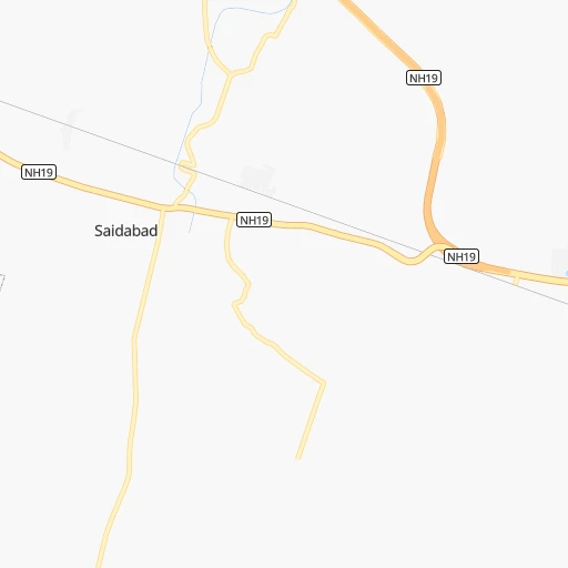
Roadmap (route) to go from Handiā Khās Railroad Station to Ahmedabad detailed above, you can also see the course layout on the map.
While doing trip Handiā Khās Railroad Station - Ahmedabad by car, the calculated route ends at a distance , or more straight.
Distance and duration of the route between Handiā Khās Railroad Station and Ahmedabad
Calculation of distance and route from Ahmedabad to Handiā Khās Railroad Station :
1,007.11,203.0 km17h28mn
Continue 0h0mn 51 mTurn left 0h1mn 568 mTurn right 0h1mn 452 mTurn left 0h23mn 27.0 kmAt roundabout, take exit 2 onto NH19 0h0mn 342 mAt roundabout, take exit 1 onto NH19 0h1mn 898 mAt roundabout, take exit 2 onto NH19 0h1mn 993 mKeep left onto NH19 0h5mn 5.4 kmAt roundabout, take exit 3 0h0mn 242 mAt roundabout, take exit 2 0h1mn 929 mKeep left 0h3mn 3.0 kmAt roundabout, take exit 2 onto Grand Trunk Road 0h1mn 1.5 kmTurn left onto Grand Trunk Road 0h0mn 30 mTurn left onto Grand Trunk Road 0h1mn 1.2 kmContinue onto Grand Trunk Road 0h25mn 29.2 kmTurn left onto SH94 0h5mn 5.6 kmTurn left onto SH94 1h35mn 40.6 kmTurn right onto SH92 1h19mn 86.9 kmTurn left onto NH335 1h44mn 51.4 kmKeep left onto NH34 0h19mn 22.2 kmTurn right onto NH339 0h29mn 33.5 kmTurn right 0h2mn 1.8 kmTurn left onto SH12 1h36mn 40.1 kmTurn left onto SH12 0h1mn 826 mKeep right onto SH12 1h37mn 36.7 kmContinue onto SH54B 0h7mn 8.2 kmKeep left 0h1mn 562 mContinue 0h0mn 112 mTurn left onto Lalitpur mahrauni marg 0h0mn 240 mAt roundabout, take exit 1 onto Lalitpur mahrauni marg 0h0mn 294 mTurn right 0h0mn 129 mTurn left onto NH539 0h0mn 466 mTurn slight right onto SH54B 0h1mn 1.5 kmContinue onto MDR30B 0h19mn 19.5 kmTurn left onto MDR35B 0h0mn 58 mKeep right 1h34mn 28.0 kmTurn sharp right 0h3mn 2.4 kmTurn left onto NH44 0h10mn 11.4 kmKeep left 0h0mn 241 mTurn right onto SH61 0h19mn 20.6 kmKeep right onto SH61 0h17mn 18.3 kmTurn right onto SH61 1h52mn 56.9 kmTurn left onto SH10 0h1mn 997 mTurn right onto SH10 0h0mn 42 mTurn left onto SH10 0h2mn 2.7 kmContinue onto NH752B 1h38mn 44.7 kmTurn left 0h2mn 2.3 kmContinue onto NH752B 1h32mn 37.4 kmContinue 0h2mn 1.5 kmTurn sharp right onto MD2805 0h0mn 122 mTurn left 0h2mn 1.5 kmKeep right onto NH52 1h31mn 36.0 kmKeep left onto NH752B 1h48mn 55.9 kmTurn right onto NH752B 0h25mn 28.8 kmTurn slight left onto SH19A 0h23mn 24.9 kmTurn left onto SH19C, 19E 0h1mn 830 mTurn right onto SH19E 0h2mn 2.2 kmTurn left onto SH19E 0h20mn 21.5 kmAt roundabout, take exit 1 2h32mn 137.7 kmTurn left onto SH26A 0h1mn 571 mTurn sharp right 0h6mn 5.2 kmTurn sharp right 0h1mn 750 mTurn right onto SH64 1h37mn 42.1 kmTurn left onto NH147D 0h0mn 268 mTurn right onto NH147D 0h25mn 29.4 kmTurn right onto NH147D 0h2mn 2.3 kmTurn left 0h0mn 79 mTurn right 0h4mn 4.5 kmTurn right onto SH62 0h3mn 3.5 kmTurn left 0h0mn 76 mTurn right 0h20mn 23.0 kmKeep left onto NH47 0h1mn 980 mContinue onto SH12 0h5mn 5.2 kmKeep left onto SH12 0h0mn 185 mKeep right onto SH12 0h6mn 6.3 kmKeep left 1h1mn 71.7 kmTurn right onto SH2 0h1mn 925 mAt roundabout, take exit 3 onto SH2 0h1mn 1.5 kmTurn right onto NH47 0h24mn 28.0 kmTurn right 0h2mn 2.5 kmTurn right onto NH47 0h9mn 10.4 kmAt roundabout, take exit 2 onto Rakhial Road 0h0mn 465 mKeep left onto Rakhial Road 0h2mn 2.2 kmTurn left 0h0mn 77 mKeep left 0h0mn 254 mTurn left onto Gandhi Road 0h0mn 242 mTurn right 0h0mn 333 mTurn left onto Relief Road 0h1mn 847 mTurn left 0h0mn 196 mArrive at destination 0h0mn 0 m
Travel from Handiā Khās Railroad Station (Gujarat) to a selection of major cities.
Distances from Handiā Khās Railroad Station to biggest cities in Uttar Pradesh
- Etawah,257,448 inhabitants.354 km
- Mau,246,050 inhabitants.152 km
- Hapur,242,920 inhabitants.576 km
- Farrukhabad,241,152 inhabitants.345 km
- Mirzapur,220,029 inhabitants.44 km
- Bulandshahr,198,612 inhabitants.548 km
- Sambhal,196,109 inhabitants.508 km
- Raebareli,186,433 inhabitants.137 km
- Bahraigh,182,218 inhabitants.254 km
- Amroha,176,253 inhabitants.540 km
- Jaunpur,169,572 inhabitants.67 km
- Fatehpur,166,480 inhabitants.152 km
- Loni,164,810 inhabitants.615 km
- Sitapur,164,435 inhabitants.288 km
- Unnao,161,671 inhabitants.216 km
- Budaun,161,555 inhabitants.427 km
- Orai,158,265 inhabitants.284 km
- Fyzabad,153,047 inhabitants.158 km
- Banda,152,218 inhabitants.187 km
- Lakhimpur,140,223 inhabitants.321 km
Other major cities in country :
- Pimpri [16], 1,284,606 inhabitants. 1,144 km
- Kalyan [16], 1,262,255 inhabitants. 1,154 km
- Thane [16], 1,261,517 inhabitants. 1,171 km
- Nowrangapur [21], 1,220,946 inhabitants. 683 km
- Faridabad [10], 1,220,229 inhabitants. 592 km
- Dombivli [16], 1,193,000 inhabitants. 1,160 km
- Rajkot [09], 1,177,362 inhabitants. 1,209 km
- Amritsar [23], 1,092,450 inhabitants. 999 km
- Visakhapatnam [02], 1,063,178 inhabitants. 861 km
- Teni [25], 1,034,724 inhabitants. 1,779 km
- Jabalpur [35], 1,030,168 inhabitants. 333 km
- Haora [28], 1,027,672 inhabitants. 696 km
- Aurangabad [16], 1,016,441 inhabitants. 931 km
- Shivaji Nagar [16], 1,000,000 inhabitants. 1,148 km
- Solapur [16], 997,281 inhabitants. 1,074 km
- Srinagar [12], 975,857 inhabitants. 1,205 km
- Chandigarh [05], 960,787 inhabitants. 800 km
- Coimbatore [25], 959,823 inhabitants. 1,690 km
- Jodhpur [24], 921,476 inhabitants. 926 km
- Madurai [25], 909,908 inhabitants. 1,772 km
Route from Ahmedabad to major cities (India).
- Distance Ahmedabad Mumbai441 km
- Distance Ahmedabad Delhi780 km
- Distance Ahmedabad Bengaluru1,238 km
- Distance Ahmedabad Kolkata1,619 km
- Distance Ahmedabad Chennai1,373 km
- Distance Ahmedabad Hyderabad877 km
- Distance Ahmedabad Pune519 km
- Distance Ahmedabad Kanpur873 km
- Distance Ahmedabad Jaipur540 km
- Distance Ahmedabad Navi Mumbai446 km
- Distance Ahmedabad Lucknow942 km
- Distance Ahmedabad Nagpur702 km
- Distance Ahmedabad Indore335 km
- Distance Ahmedabad Patna1,304 km
- Distance Ahmedabad Bhopal494 km
- Distance Ahmedabad Ludhiana936 km
- Distance Ahmedabad Tirunelveli1,682 km
- Distance Ahmedabad Agra717 km
- Distance Ahmedabad Gorakhpur778 km
- Distance Ahmedabad Nashik359 km
Nearest cities to Handiā Khās Railroad Station :
- Kanpur, 2,823,249 inhabitants. 222 km
- Lucknow, 2,472,011 inhabitants. 208 km
- Patna, 1,599,920 inhabitants. 297 km
- Varanasi, 1,164,404 inhabitants. 83 km
- Allahabad, 1,073,438 inhabitants. 36 km
- Jabalpur, 1,030,168 inhabitants. 333 km
- Gorakhpur, 674,246 inhabitants. 196 km
- Gaya, 423,692 inhabitants. 290 km
- Shahjanpur, 320,434 inhabitants. 361 km
- Satna, 257,778 inhabitants. 163 km
- Mau, 246,050 inhabitants. 152 km
- Farrukhabad, 241,152 inhabitants. 345 km
- Arrah, 223,676 inhabitants. 249 km
- Mirzapur, 220,029 inhabitants. 44 km
- Rewa, 208,461 inhabitants. 129 km
- Chapra, 201,597 inhabitants. 261 km
- Murwara, 195,856 inhabitants. 248 km
- Raebareli, 186,433 inhabitants. 137 km
- Singrauli, 185,580 inhabitants. 138 km
- Bahraigh, 182,218 inhabitants. 254 km
- Jaunpur, 169,572 inhabitants. 67 km
- Fatehpur, 166,480 inhabitants. 152 km
- Sitapur, 164,435 inhabitants. 288 km
- Unnao, 161,671 inhabitants. 216 km
- Orai, 158,265 inhabitants. 284 km
- Fyzabad, 153,047 inhabitants. 158 km
- Dinapore, 152,940 inhabitants. 289 km
- Banda, 152,218 inhabitants. 187 km
- Lakhimpur, 140,223 inhabitants. 321 km
- Gonda City, 133,583 inhabitants. 199 km
- Dehri, 129,938 inhabitants. 207 km
- Deoria, 129,570 inhabitants. 204 km
- Bettiah, 127,008 inhabitants. 282 km
- Hardoi, 122,635 inhabitants. 306 km
- Siwan, 119,181 inhabitants. 237 km
- Damoh, 118,776 inhabitants. 326 km
- Azamgarh, 116,644 inhabitants. 127 km
- Basti, 115,115 inhabitants. 168 km
- Mothihari, 112,144 inhabitants. 308 km
- Chhatarpur, 111,594 inhabitants. 267 km
- Sultanpur, 110,368 inhabitants. 101 km
- Bagaha, 103,855 inhabitants. 271 km
- Ghazipur, 103,095 inhabitants. 142 km
- Mughal Sarai, 98,043 inhabitants. 94 km
- Jahanabad, 96,387 inhabitants. 282 km
- Buxar, 96,120 inhabitants. 181 km
- Aurangabad, 95,929 inhabitants. 230 km
- Bagaha, 91,383 inhabitants. 304 km
- Shahdol, 89,289 inhabitants. 245 km
- Mahoba, 89,170 inhabitants. 233 km
Location Handiā Khās Railroad Station (Uttar Pradesh) :
| Country flag |  |
| Location | Handiā Khās Railroad Station |
| State | Uttar Pradesh |
| County | Allahābād |
| Country | India |
| Country code / ISO 2 | IN |
| Latitude | 25.3569000 |
| Longitude | 82.1913500 |
| Altitude | 0 meters |
| Time zone | Asia/Kolkata |
Location Ahmedabad (Gujarat) :
| Country flag | |
| Location | Ahmedabad |
| State | Gujarat |
| County | Ahmadābād |
| Country | India |
| Country code / ISO 2 | IN |
| Latitude | 23.0257900 |
| Longitude | 72.5872700 |
| Altitude | 0 meters |
| Time zone | Asia/Kolkata |


