
How to get from Bagnoli Stazione (Campania) to Manfredonia (Apulia)
Calculate route from Bagnoli Stazione (Campania, Italy) to Manfredonia (Apulia, Italy).
The flight distance (as the crow flies) between Bagnoli Stazione and Manfredonia is 172.2 km.
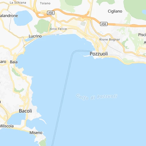
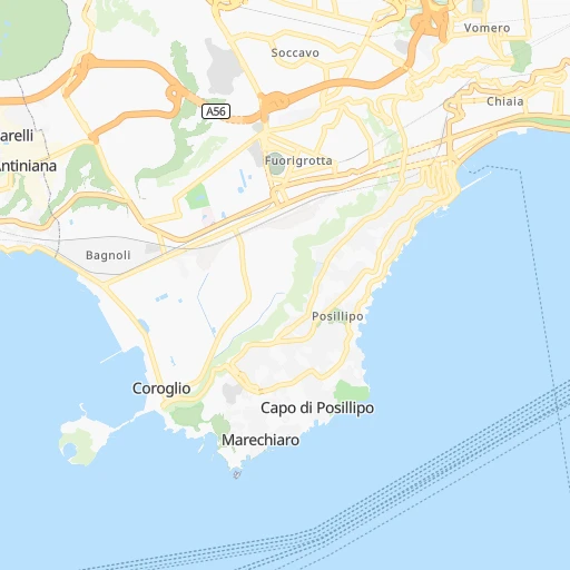
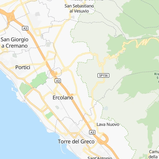
Roadmap (route) to go from Bagnoli Stazione to Manfredonia detailed above, you can also see the course layout on the map.
While doing trip Bagnoli Stazione - Manfredonia by car, the calculated route ends at a distance , or more straight.
Distance and duration of the route between Bagnoli Stazione and Manfredonia
Calculation of distance and route from Manfredonia to Bagnoli Stazione :
172.2208.9 km3h13mn
Continue onto Via Amedeo Maiuri 0h0mn 170 mTurn left onto Via Salvatore Ferrara 0h0mn 194 mAt roundabout, take exit 2 onto Via Girolamo Cerbone 0h1mn 416 mKeep right 0h0mn 52 mKeep left 0h0mn 37 mTurn slight right onto Viale della Liberazione 0h0mn 157 mTurn right 0h4mn 4.5 kmTurn sharp left onto Via Francesco Caracciolo 0h1mn 661 mAt roundabout, take exit 1 onto Viale Anton Dohrn 0h2mn 1.3 kmAt roundabout, take exit 1 0h0mn 167 mContinue onto Via Giorgio Arcoleo 0h2mn 1.3 kmKeep left 0h0mn 374 mKeep left 0h0mn 211 mAt roundabout, take exit 1 onto Piazza Giovanni Bovio 0h1mn 1.4 kmKeep left onto Piazza Giuseppe Garibaldi 0h0mn 45 mContinue onto Piazza Giuseppe Garibaldi 0h0mn 84 mKeep right 0h0mn 423 mAt roundabout, take exit 2 onto Corso Meridionale 0h1mn 921 mAt roundabout, take exit 1 onto Via Taddeo Da Sessa 0h1mn 515 mKeep left 0h0mn 34 mKeep right onto Via Emanuele Gianturco 0h0mn 264 mTurn right onto Traversa di Via Emanuele Gianturco 0h0mn 440 mTurn slight right onto Traversa di Via Vesuvio 0h0mn 179 mTurn left onto Via dei Bonifaci 0h0mn 198 mTurn right onto Piazza Francesco Saverio Arabia 0h0mn 267 mTurn right 0h1mn 274 mKeep right 0h8mn 8.9 kmContinue onto Strada statale 162 dir del Centro Direzionale 0h1mn 1.2 kmKeep right onto A16 0h1mn 580 mKeep right onto SP330 0h0mn 95 mKeep left 0h29mn 42.0 kmKeep right 0h1mn 661 mKeep right 0h4mn 4.6 kmKeep left onto Strada Statale 371 della Valle del Sabato 0h3mn 2.5 kmAt roundabout, take exit 1 onto SP243 0h1mn 891 mContinue onto Via Provinciale Serra 0h1mn 509 mKeep right 0h1mn 578 mTurn right onto Via Provinciale Serra 0h3mn 2.9 kmTurn right onto SP243 0h0mn 2 mKeep left onto SP243 0h0mn 14 mKeep right onto SP243 0h0mn 15 mTurn right onto Strada Provinciale 243 Bivio Serra 0h3mn 2.2 kmTurn sharp right 0h0mn 139 mTurn left 0h0mn 18 mTurn left onto Via Appia 0h4mn 4.8 kmKeep right onto Strada statale delle Puglie 0h0mn 412 mTurn slight left onto Frazione Calore 0h1mn 441 mContinue onto Strada statale delle Puglie 0h7mn 7.2 kmAt roundabout, take exit 2 onto Strada Statale delle Puglie 0h10mn 9.8 kmAt roundabout, take exit 3 onto SS90 0h3mn 2.9 kmAt roundabout, take exit 1 onto Strada Statale 90 delle Puglie 0h4mn 3.9 kmAt roundabout, take exit 1 onto Via Martiri 1h35mn 38.0 kmKeep left onto Vecchio tracciato Statale 90 0h2mn 1.8 kmContinue onto Vecchio tracciato Statale 90 0h2mn 1.8 kmTurn left onto Strada Statale 90 delle Puglie 0h12mn 12.8 kmKeep left 0h0mn 47 mTurn slight left onto Via Napoli 0h4mn 2.8 kmAt roundabout, take exit 2 onto Via Napoli 0h1mn 650 mAt roundabout, take exit 2 onto Via Vittime Civili 0h1mn 525 mTurn left onto Via Pasquale Fuiani 0h0mn 35 mTurn right onto Via Nunziata Sulmona 0h0mn 83 mTurn left onto Via Orfane 0h0mn 40 mTurn right onto Via Calvello 0h0mn 6 mTurn left onto Via Orfane 0h0mn 47 mTurn right onto Via Arpi 0h1mn 498 mContinue onto Via San Lazzaro 0h0mn 259 mTurn slight right onto Via Manfredonia 0h5mn 3.8 kmTurn slight right onto Garganica 0h20mn 26.8 kmKeep right and drive toward Manfredonia Sud 0h1mn 696 mContinue onto SP141 0h7mn 5.3 kmTurn right 0h0mn 37 mTurn left onto Viale John Fitzgerald Kennedy 0h0mn 215 mTurn left onto Piazza Guglielmo Marconi 0h0mn 68 mTurn right onto Corso Roma 0h0mn 93 mTurn left onto Via del Seminario 0h0mn 90 mTurn right onto Via Tribuna 0h0mn 467 mTurn right onto Via delle Cisterne 0h0mn 16 mArrive at destination 0h0mn 0 m
Travel from Bagnoli Stazione (Apulia) to a selection of major cities.
Distances from Bagnoli Stazione to biggest cities in Campania
- San Giorgio a Cremano,45,463 inhabitants.15 km
- Nocera Inferiore,45,086 inhabitants.41 km
- Torre Annunziata,43,521 inhabitants.25 km
- Marcianise,40,239 inhabitants.26 km
- Pomigliano d'Arco,38,921 inhabitants.21 km
- Quarto,37,683 inhabitants.7 km
- Melito di Napoli,36,933 inhabitants.13 km
- Arzano,34,933 inhabitants.13 km
- Caivano,34,604 inhabitants.20 km
- Maddaloni,34,546 inhabitants.31 km
- Mugnano di Napoli,34,231 inhabitants.11 km
- Sant'Antimo,33,561 inhabitants.15 km
- Pagani,32,835 inhabitants.39 km
- Somma Vesuviana,32,484 inhabitants.24 km
- Santa Maria Capua Vetere,31,743 inhabitants.31 km
- Angri,31,632 inhabitants.35 km
- Marigliano,29,901 inhabitants.27 km
- Frattamaggiore,29,822 inhabitants.17 km
- Monterusciello,29,125 inhabitants.9 km
- Gragnano,29,082 inhabitants.33 km
Other major cities in country :
- Mestre [20], 147,662 inhabitants. 543 km
- Parma [05], 146,299 inhabitants. 543 km
- Foggia [13], 137,032 inhabitants. 136 km
- Reggio nell'Emilia [05], 133,296 inhabitants. 520 km
- Acilia-Castel Fusano-Ostia Antica [07], 129,362 inhabitants. 186 km
- Perugia [18], 120,137 inhabitants. 295 km
- Monza [09], 119,618 inhabitants. 662 km
- Rimini [05], 118,673 inhabitants. 384 km
- Pescara [01], 116,596 inhabitants. 183 km
- Bergamo [09], 114,162 inhabitants. 654 km
- Vicenza [20], 107,129 inhabitants. 568 km
- Bolzano [17], 99,049 inhabitants. 671 km
- Andria [13], 98,342 inhabitants. 185 km
- Udine [06], 97,761 inhabitants. 590 km
- Siracusa [15], 97,472 inhabitants. 427 km
- Terni [18], 97,050 inhabitants. 232 km
- Forli [05], 93,638 inhabitants. 417 km
- Novara [12], 93,295 inhabitants. 684 km
- Barletta [13], 93,279 inhabitants. 186 km
- Piacenza [05], 93,228 inhabitants. 596 km
Route from Manfredonia to major cities (Italy).
- Distance Manfredonia Rome284 km
- Distance Manfredonia Milan690 km
- Distance Manfredonia Naples163 km
- Distance Manfredonia Turin768 km
- Distance Manfredonia Palermo448 km
- Distance Manfredonia Genoa646 km
- Distance Manfredonia Bologna490 km
- Distance Manfredonia Florence451 km
- Distance Manfredonia Catania466 km
- Distance Manfredonia Messina384 km
- Distance Manfredonia Verona581 km
- Distance Manfredonia Padova532 km
- Distance Manfredonia Trieste479 km
- Distance Manfredonia Brescia633 km
- Distance Manfredonia Prato467 km
- Distance Manfredonia Reggio Calabria392 km
- Distance Manfredonia Modena526 km
- Distance Manfredonia Livorno505 km
- Distance Manfredonia Cagliari635 km
- Distance Manfredonia Mestre522 km
Nearest cities to Bagnoli Stazione :
- Rome, 2,318,895 inhabitants. 183 km
- Naples, 959,470 inhabitants. 9 km
- Palermo, 648,260 inhabitants. 307 km
- Florence, 349,296 inhabitants. 408 km
- Bari, 277,387 inhabitants. 228 km
- Messina, 219,948 inhabitants. 315 km
- Reggio Calabria, 169,140 inhabitants. 327 km
- Foggia, 137,032 inhabitants. 136 km
- Acilia-Castel Fusano-Ostia Antica, 129,362 inhabitants. 186 km
- Salerno, 125,797 inhabitants. 55 km
- Perugia, 120,137 inhabitants. 295 km
- Pescara, 116,596 inhabitants. 183 km
- Andria, 98,342 inhabitants. 185 km
- Terni, 97,050 inhabitants. 232 km
- Barletta, 93,279 inhabitants. 186 km
- Ancona, 89,994 inhabitants. 314 km
- Torre del Greco, 85,897 inhabitants. 17 km
- Giugliano in Campania, 80,269 inhabitants. 13 km
- Lido di Ostia, 79,400 inhabitants. 188 km
- Catanzaro, 78,970 inhabitants. 299 km
- Arezzo, 76,346 inhabitants. 350 km
- Latina, 76,305 inhabitants. 128 km
- Caserta, 72,844 inhabitants. 32 km
- Lamezia Terme, 70,501 inhabitants. 276 km
- Altamura, 67,821 inhabitants. 201 km
- Guidonia Montecelio, 67,516 inhabitants. 178 km
- Castellammare di Stabia, 65,730 inhabitants. 30 km
- Cosenza, 63,852 inhabitants. 245 km
- Afragola, 62,775 inhabitants. 17 km
- Molfetta, 59,557 inhabitants. 209 km
- Trapani, 58,681 inhabitants. 342 km
- Casoria, 58,456 inhabitants. 15 km
- Potenza, 56,433 inhabitants. 140 km
- Portici, 55,765 inhabitants. 14 km
- Nicastro-Sambiase, 55,687 inhabitants. 275 km
- Matera, 54,891 inhabitants. 206 km
- San Severo, 54,880 inhabitants. 140 km
- Cerignola, 54,056 inhabitants. 154 km
- Trani, 53,981 inhabitants. 195 km
- Bisceglie, 53,648 inhabitants. 202 km
- Acerra, 53,578 inhabitants. 22 km
- Ercolano, 53,576 inhabitants. 15 km
- Bagheria, 52,952 inhabitants. 310 km
- Manfredonia, 52,911 inhabitants. 173 km
- Aversa, 52,830 inhabitants. 18 km
- Bitonto, 51,661 inhabitants. 215 km
- Marano di Napoli, 49,920 inhabitants. 9 km
- Scafati, 49,264 inhabitants. 32 km
- Benevento, 48,931 inhabitants. 62 km
- Crotone, 48,704 inhabitants. 318 km
Location Bagnoli Stazione (Campania) :
| Country flag |  |
| Location | Bagnoli Stazione |
| State | Campania |
| County | Provincia di Napoli |
| Country | Italy |
| Country code / ISO 2 | IT |
| Latitude | 40.8151300 |
| Longitude | 14.1668200 |
| Altitude | 0 meters |
| Time zone | Europe/Rome |
Location Manfredonia (Apulia) :
| Country flag | |
| Location | Manfredonia |
| State | Apulia |
| County | Provincia di Foggia |
| Country | Italy |
| Country code / ISO 2 | IT |
| Latitude | 41.6306500 |
| Longitude | 15.9187600 |
| Altitude | 5 meters |
| Time zone | Europe/Rome |


